Skip to content

Random Connections

A collection of photography and exploration focusing on Upstate South Carolina and beyond.

  • Home
  • About Us
  • Photos
  • Resources
  • Other Voices
  • Post Archives
  • Podcast
  • Home
  • Geocaching and Maps
  • Page 3

Category: Geocaching and Maps

0

Chasing the Swamp Rabbit – Part 4, Lost in Lexington

Posted on May 22, 2016 By Tom 7 Comments on Chasing the Swamp Rabbit – Part 4, Lost in Lexington
Geocaching and Maps, History and Genealogy, Photography, Rambling

Samaria Store

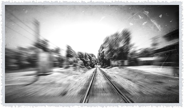
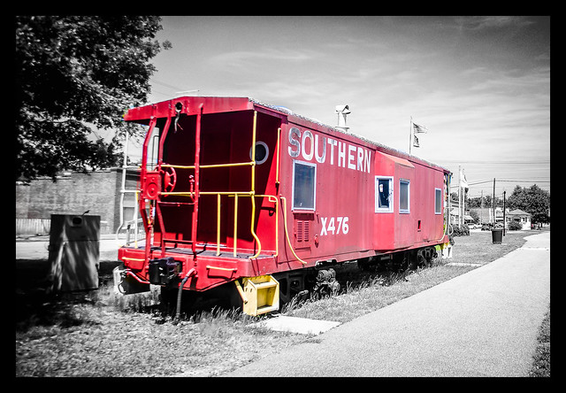
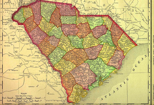
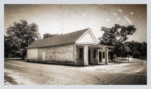
I was on a quest to find traces of the old Swamp Rabbit Railroad. This isn’t the one that runs through Northern Greenville with which most are familiar, but was a train that ran across Barnwell, Aiken, and Lexington Counties. So far I already traveled the original route from Blackville to Sievern. Now I was going to deeper into the swamps of the Edisto, and losing my way in the process.

Read More “Chasing the Swamp Rabbit – Part 4, Lost in Lexington” »

Chasing the Swamp Rabbit – Part 3, Sievern and Edisto Academy

Posted on May 21, 2016May 21, 2016 By Tom 9 Comments on Chasing the Swamp Rabbit – Part 3, Sievern and Edisto Academy
Geocaching and Maps, History and Genealogy, Photography, Rambling

Swamp Rabbit RR

I was on a quest to find traces of the “other” Swamp Rabbit Railroad, a passenger service on the Blackville, Alston & Newberry (BA&N) line that ran from Blackville in Barnwell County to Seivern in Lexington County. So far the task had been easy. There were clear tracks and right-of-ways between and through the towns of Blackville, Springfield, Salley, Perry, and Wagener. The last four towns came into existence because of the BA&N, and these towns celebrated their railroad heritage. The Swamp Rabbit was about to get more elusive, though, as its route traversed the environment for which it was named – the swamps of the Edisto River.

Read More “Chasing the Swamp Rabbit – Part 3, Sievern and Edisto Academy” »

Chasing the Swamp Rabbit – Part 2, From Salley to Wagener

Posted on May 20, 2016May 20, 2016 By Tom 8 Comments on Chasing the Swamp Rabbit – Part 2, From Salley to Wagener
Geocaching and Maps, History and Genealogy, Photography, Rambling

Salley Cargo Depot

I had been on an excursion to track down the Swamp Rabbit Railroad – not the well-known one in Greenville County, but a lesser-known railroad that ran from Blackville in Barnwell County to the ghost town of Sievern in Lexington County. I was following a map developed by Mitch Bailey of Lexington, with data points form the map loaded into my GPS. So far I’d traced the railroad from Blackville to Springfield, but I still had a ways to go.

Read More “Chasing the Swamp Rabbit – Part 2, From Salley to Wagener” »

Chasing the Swamp Rabbit (No, Not That One)

Posted on May 20, 2016May 20, 2016 By Tom 2 Comments on Chasing the Swamp Rabbit (No, Not That One)
Geocaching and Maps, History and Genealogy, Photography, Rambling

Springfield Caboose

When folks in this area hear the phrase “Swamp Rabbit Railroad”, they probably think of the Swamp Rabbit Trail, which has garnered so many accolades. Use of the name has been growing as the moniker “Swamp Rabbit” has been taken by many new businesses, usually those located along the trail on the old railway. The trail has gotten so popular that even the local pro hockey team changed their name from Road Warriors to the Greenville Swamp Rabbits.

As most Greenvillians know, the trail was named for the former Greenville and Northern Railroad, nicknamed the Swamp Rabbit because its route took it through the wetlands of the upper Reedy River. However, the lowly sylvilagus aquaticus lent its name to not one, but two railroads in South Carolina. The former Blackville, Alston, and Newberry line was also known as the Swamp Rabbit, and ran through the wetlands of the North Edisto River from Blackville in Barnwell County to the ghost town of Seivern in Lexington County. The first Sunday in May I set out to see what I could find of this other Swamp Rabbit Railroad.

Read More “Chasing the Swamp Rabbit (No, Not That One)” »

The Athens of Greenville

Posted on February 26, 2016February 28, 2016 By Tom 8 Comments on The Athens of Greenville
Geocaching and Maps, History and Genealogy

TR Sign

Usually, when someone utters the phrase, “The Athens of ….” whatever region, they mean that the region is a center of enlightenment and learning. While this particular saga does end with a school, the story begins with civic jealousy.

Greenville County did, in fact, have its own town named Athens for a short while. I first heard about the town from Dot Bishop at the Travelers Rest History Museum. I made a note to add it to my list of ghost towns until I could do a bit more research on it, and see if I could find any remnants of the old town. That time has finally come, and here’s what I found…

Read More “The Athens of Greenville” »

The Lost Counties of South Carolina

Posted on February 23, 2016February 23, 2016 By Tom 2 Comments on The Lost Counties of South Carolina
Geocaching and Maps, History and Genealogy
1895 Map of South Carolina

I grew up in the southwestern part of Enoree County, South Carolina…

At least, that’s how my biography might have started, if the people of Woodruff had their way back in 1913. Enoree County would have been created from parts of Greenville, Spartanburg, and Laurens Counties, with the county seat in the town of Woodruff. I came across a reference to this mythical county while doing research on another topic on the Library of Congress’s Chronicling America site.

Woodruff Wants to Be County Seat

I haven’t been able to relocate the original article (should have bookmarked it right then and there) but it gave more specific boundaries for the new county. At first I thought it might be cool to find these boundaries in Google Earth and see which areas would be encompassed by the new county. As I dug deeper, I found that this wasn’t an isolated proposal, and was part of a much larger story, leading me to the discovery of “new county fever” that broke out around the turn of the 20th Century.

Read More “The Lost Counties of South Carolina” »

Pathfinders and Map Makers – Part One

Posted on October 28, 2015October 28, 2015 By Tom 3 Comments on Pathfinders and Map Makers – Part One
Geocaching and Maps, History and Genealogy

Pathfinder with Trailer

It was early 20th Century and cars were just coming into their own. However, the roads weren’t keeping up. Most were still dirt tracks at the best of times, and terrible mud pits at others. A cross-country trek was an adventure, and only for those with the means to obtain and maintain an automobile. Greater buy-in was needed from the general public so that bond initiatives and legislation could be passed. Thus was born the age of the Pathfinders, adventurous souls who sought out the best routes, laid out the paths for early highway systems, and brought to the public awareness of the need for good roads.

Read More “Pathfinders and Map Makers – Part One” »

In Search of Good Roads for South Carolina

Posted on October 27, 2015October 27, 2015 By Tom No Comments on In Search of Good Roads for South Carolina
Geocaching and Maps, History and Genealogy

NC Good Roads, Johnson County, circa 1909

The recent flooding in the mid-state has pointed out some of the glaring problems with South Carolina’s infrastructure. Even before the floods, the issue of deteriorating roads has been foremost, with discussion about how to fund road repairs. This isn’t a new problem, though. The question about how to develop and maintain adequate infrastructure is not a “one and done” proposition. First there was the King’s Road and Great Wagon Road, then in the 1820s it was the development of the Santee Canal and the State Road. The development, maintenance, and funding of an adequate means of transportation was, and always will continue to be an issue.

In the last post I made a few comments about the roads around Greenville – basically trails that connected town to town. The condition of those roads was often appalling. This was true for the entire country around the turn of 20th century. The automobile was just taking off, but getting anywhere proved to be a challenge. Thus, the Good Roads Movement was born.

Read More “In Search of Good Roads for South Carolina” »

The Streets of Greenville

Posted on October 22, 2015April 26, 2023 By Tom 3 Comments on The Streets of Greenville
Geocaching and Maps, History and Genealogy, Local

Greenville Map 1948

My late father-in-law had a problem with Greenville. He grew up in the wilds of Idaho along the Salmon River. However, he spent most of his adult life in large western cities, namely Los Angeles, where the streets are laid out in neat, tidy grids. Greenville’s streets always left him bewildered.

Whenever he gave me trouble about my hometown, I would reply that it makes perfect sense – Laurens Road goes to Laurens, Augusta Road goes to Augusta, etc. While that’s true, there are lots of other…questionable routes, and I could see how someone not from here would be very confused. Greenville’s streets are based on an early 19th Century design, and that pattern STILL influences our traffic.

Read More “The Streets of Greenville” »

Spirit of 45 Military Vehicles on the Bankhead Highway

Posted on September 27, 2015 By Tom No Comments on Spirit of 45 Military Vehicles on the Bankhead Highway
Geocaching and Maps, History and Genealogy, Local, Photography

MVPA Convoy Desaturated

There’s a reason I named this blog RandomConnections. The URL RandomThoughts was taken…but that’s beside the point. Time and time again the idea of “random connections” has proved itself to be the more appropriate title, as tenuous threads appear that seem to bind disparate ideas together. Such was the case this past week.

I got a forwarded e-mail from my brother, Stephen, with a note that a historical convoy would be passing through our area. The convoy would feature vintage military vehicles, and I thought it would be a cool photo opportunity. Little did I realize how closely this event would tie right into my recent research and explorations.

Read More “Spirit of 45 Military Vehicles on the Bankhead Highway” »

Posts pagination

Previous 1 2 3 4 … 21 Next

Categories

  • EdTech (197)
  • Entertainment (201)
  • Family (123)
  • Gear (114)
  • General Technology (98)
  • Geocaching and Maps (208)
  • History and Genealogy (275)
  • Internet (141)
  • Local (458)
  • Miscellaneous (557)
  • Music (202)
  • Paddling (265)
  • Photography (781)
  • Podcast (16)
  • Rambling (233)
  • Rants (161)
  • Recipes (36)
  • Religion (48)
  • Restaurants (165)
  • Science (48)
  • Things Overheard (29)
  • Travel (413)
  • Uncategorized (143)
  • Washington Sabbatical (113)
  • Weirdness (59)

Recent Posts

  • Carolina Ghost Towns – Paper Towns
  • Kayaking on Wolf Creek Lake
  • Carolina Ghost Towns – Colonial Dorchester
  • Six Layer Bourbon Grits Bowl
  • How’s the House? Part 2

Recent Comments

  • Eric Kincaid on Kayaking and Coffee
  • Daniel S Mawn on Remembering the Walke
  • Judy Hall on The Clock on Wade Hampton
  • Charles Johnson on In Search of the Road Builder
  • Anthony h hannig on From Kingsbury to Stoneboro – Rambling in Lancaster County

Tags

blogging cemetery Christmas Columbia Edisto River edtech Entertainment family Flickr Florida Furman Furman University gear Georgia geotagging Ghost Town Ghost Towns Google Earth Google Maps GPS Greenville Greenville Chorale history Instructional Technology kayaking Lake Jocassee LCU Lowcountry Unfiltered maps Music North Carolina Paddling Photography rambling restaurant Restaurants review singing social networking South Carolina time-lapse Travel video Washington Washington State
June 2025
S M T W T F S
1234567
891011121314
15161718192021
22232425262728
2930  
« May    

Copyright © 2025 Random Connections.

Theme: Oceanly by ScriptsTown