Skip to content

Random Connections

A collection of photography and exploration focusing on Upstate South Carolina and beyond.

  • Home
  • About Us
  • Photos
  • Resources
  • Other Voices
  • Post Archives
  • Home
  • Geocaching and Maps

Category: Geocaching and Maps

0

Exploring Berry Shoals Pond from Tygerberry

Posted on September 28, 2019September 28, 2019 By Tom 2 Comments on Exploring Berry Shoals Pond from Tygerberry
Geocaching and Maps, History and Genealogy, Local, Paddling

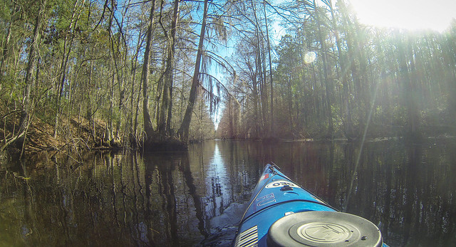
For many years I drove over the bridge over the South Tyger River at Berry Shoals, looking longingly at the old steel trestle bridge downstream and the twin lakes of Berry Shoals Pond and Silver Lake. I wanted to explore the area. However, I was always in route to one of my schools or on some other school district business, so I never got a chance to explore…until now. Sadly, my explorations were cut short, all for want of a hat.
Cypress Adventures – Part 2, Ebenezer Creek

Posted on May 28, 2019May 28, 2019 By Tom 2 Comments on Cypress Adventures – Part 2, Ebenezer Creek
Geocaching and Maps, History and Genealogy, Paddling, Photography

Thursday was Sparkleberry Swamp with the Tri-County Blueway Paddlers. Since this was a Second Saturday, it also meant that it was time for a trek with Lowcountry Unfiltered. We would be doing a trip through yet another cypress swamp, this time along Ebenezer Creek in Georgia. I drove down Friday night so that I wouldn’t … Read More “Cypress Adventures – Part 2, Ebenezer Creek” »

Cypress Adventures – Part 1, Sparkleberry

Posted on May 16, 2019May 16, 2019 By Tom No Comments on Cypress Adventures – Part 1, Sparkleberry
Geocaching and Maps, History and Genealogy, Paddling, Photography

The past several days have been a marathon of kayaking trips. I’ve done three paddles in five days for a total of 21 miles. Each of these trips had some similarities, but there were some significant differences. The first trip was on Thursday of last week to Sparkleberry Swamp with the Tri-County Blueway Paddlers.

Lost Communities – Sessions 4, 5 &6

Posted on May 3, 2019May 3, 2019 By Tom No Comments on Lost Communities – Sessions 4, 5 &6
Geocaching and Maps, History and Genealogy, Photography, Rambling

We only have two more sessions left in our Lost Communities course, and I have been remiss in posting the information for the last several sessions. In these past sessions we’ve traveled along the Broad River, looked at what’s under the state’s lakes, examined some railroad towns, and explored some Native American sites. Session 4 … Read More “Lost Communities – Sessions 4, 5 &6” »

Lost Communities – Sessions Two and Three

Posted on April 12, 2019April 12, 2019 By Tom No Comments on Lost Communities – Sessions Two and Three
Geocaching and Maps, History and Genealogy

I’ve been remiss in my blogging lately. I’ve had a series of technical glitches (to be elaborated upon in a future post) and I’ve gotten completely wrapped up in my new endeavors. That means I’ve also missed one of our Lost Communities classes, so we’re up to Session Three. I’ve promised to post links to the class materials on this website, so here we go…

Buried in the Tall Pines

Posted on March 1, 2019March 2, 2019 By Tom 17 Comments on Buried in the Tall Pines
Geocaching and Maps, History and Genealogy, Local, Photography, Rambling

Last week it was announced that a new preserve has been established under control of SC Department of Natural Resources. The new public space, called the Tall Pines Wildlife Management Area, will be open to hunting, fishing, and hiking. Located in Northern Greenville County along the banks of of the South Saluda River, the property … Read More “Buried in the Tall Pines” »

The Tale of a Map

Posted on July 25, 2017 By Tom 1 Comment on The Tale of a Map
Geocaching and Maps, History and Genealogy

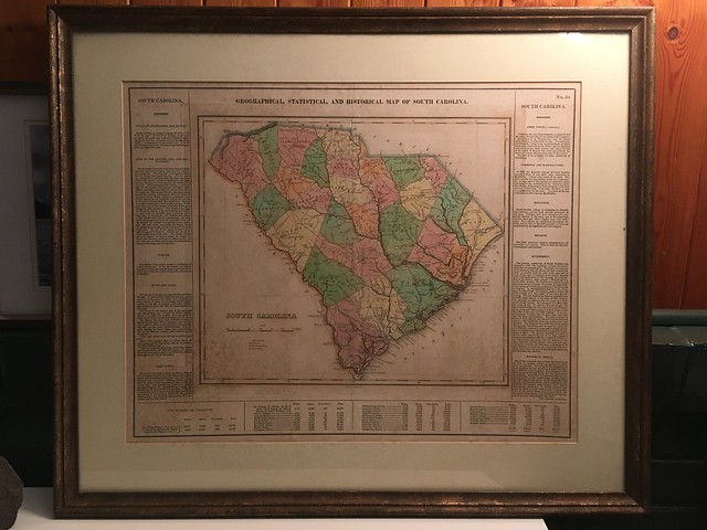
1822 Carey and Lea Map of South Carolina

I recently acquired a map from my Aunt Grace’s estate. While she was in Paris she found an old map of South Carolina in an antique store. The map had lots of interesting information, including the slave population for each county. The information and history intrigued her, and since it was from her home state, she bought it. Aunt Grace knew that I was a map geek and was especially interested in the history of the state. Before she died she expressed her desire that I get the map. I won’t go into the long and sordid details of how it did eventually end up in my possession, but rather delve into the history of the map itself and the cartographers that created this work of art.

Read More “The Tale of a Map” »

Exploring the Old Santee Canal – Part Four, Paddling the Canal

Posted on February 16, 2017February 16, 2017 By Tom 1 Comment on Exploring the Old Santee Canal – Part Four, Paddling the Canal
Geocaching and Maps, History and Genealogy, Paddling, Photography

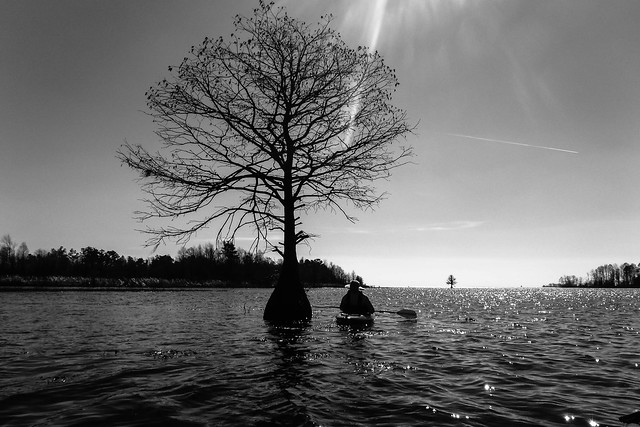
Lake Moultrie and Santee Canal with LCU-71

Second Saturday had finally arrived. I’d spent Friday exploring Berkeley County, specifically the Old Santee Canal Park. Now I’d be joined by my fellow kayakers from Lowcountry Unfiltered to explore the upper end of the old canal from where it enters Lake Moultrie. It was time to get on the water.

Read More “Exploring the Old Santee Canal – Part Four, Paddling the Canal” »

Exploring the Old Santee Canal – Part Three, Moncks Corner to Santee

Posted on February 15, 2017 By Tom 2 Comments on Exploring the Old Santee Canal – Part Three, Moncks Corner to Santee
Geocaching and Maps, History and Genealogy, Photography, Rambling

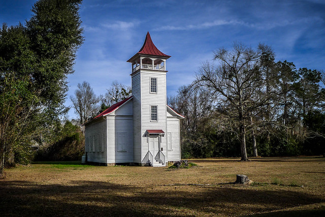
Pineville Chapel

So far I’d had a great day out exploring. I had an interesting visit at the Old Santee Canal Park, and the next day I’d be paddling part of the canal from Lake Moultrie. Now, however, the afternoon sun was sinking and I had to get to my night’s lodgings. Along that route I found some more cool bits of history.

Read More “Exploring the Old Santee Canal – Part Three, Moncks Corner to Santee” »

Exploring the Old Santee Canal – Part One, History

Posted on February 14, 2017February 14, 2017 By Tom No Comments on Exploring the Old Santee Canal – Part One, History
Geocaching and Maps, History and Genealogy

Lake Moultrie and Santee Canal with LCU-31

It was time to plan a second Saturday paddling trip for our Lowcountry Unfiltered gang. After looking at several options on the Berkeley Blueways website, we decided on a section of northern Lake Moultrie where we could paddle part of the old Santee Canal.

Read More “Exploring the Old Santee Canal – Part One, History” »

Posts navigation

1 2 … 21 Next

Categories

  • EdTech (200)
  • Entertainment (202)
  • Family (121)
  • Gear (115)
  • General Technology (99)
  • Geocaching and Maps (208)
  • History and Genealogy (266)
  • Internet (144)
  • Local (451)
  • Miscellaneous (550)
  • Music (196)
  • Paddling (248)
  • Photography (779)
  • Podcast (6)
  • Rambling (227)
  • Rants (161)
  • Recipes (34)
  • Religion (48)
  • Restaurants (165)
  • Science (48)
  • Things Overheard (29)
  • Travel (411)
  • Uncategorized (129)
  • Washington Sabbatical (113)
  • Weirdness (60)

Recent Posts

  • In Search of the Road Builder
  • The Phoenix Riots and Dr. Benjamin Mays – An MLK Day Ramble
  • An Obsession with Steak Knives
  • An Epiphany on Patriotism
  • Kayaking Bates Old River and Running Creek

Recent Comments

  • Tom on The Children’s Graveyard
  • Jani Trusty on The Children’s Graveyard
  • Shanel on Exploring Underground Anderson
  • Kris Chappell on The Sad Fate of Chappells
  • Joel Nagy on Old Pickens Court House

Tags

blogging cemetery Christmas Columbia Edisto River edtech Entertainment family Flickr Florida Furman Furman University gear Georgia geotagging Ghost Town Ghost Towns Google Earth Google Maps GPS Greenville Greenville Chorale history Instructional Technology kayaking Lake Jocassee LCU Lowcountry Unfiltered maps Music North Carolina Paddling Photography rambling restaurant Restaurants review singing social networking South Carolina time-lapse Travel video Washington Washington State
February 2023
S M T W T F S
 1234
567891011
12131415161718
19202122232425
262728  
« Jan    

Copyright © 2023 Random Connections.

Theme: Oceanly by ScriptsTown