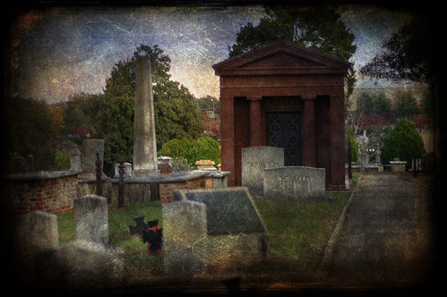
Skip to content

Random Connections

A collection of photography and exploration focusing on Upstate South Carolina and beyond.

  • Home
  • About Us
  • Photos
  • Resources
  • Other Voices
  • Post Archives
  • Podcast
  • Home
  • History and Genealogy
  • Page 23

Category: History and Genealogy

Union County Photo Trek

Posted on September 11, 2011 By Tom 3 Comments on Union County Photo Trek
History and Genealogy, Local, Photography

Pinckneyville Panorama

It started with a cryptic e-mail which began as follows:

Hello Tom,
I don’t know you and you don’t know me, but I do know about your fascination with ghost towns.

Mark Elbrecht had contacted me through this website, and he had a proposal. Mark is a fellow Flickr photographer, and it seems that he and I have similar interests as far as subject matter is concerned. He had arranged to meet with a representative of the Union Historical Society and get access to the Pinckneyville site, a ghost town I’ve been wanting to visit for quite some time, and he invited me to come along. There was absolutely no way I was going to pass up this opportunity.

Union

My brother Houston joined me, and this past Saturday we made the trek from Greenville to Union to join up with the group. We arrived a bit early, so we wandered the main street of Union and took a few photos of the architecture, including the spectacular court house…

Read More “Union County Photo Trek” »

A Matter of Maps

Posted on August 21, 2011 By Tom 3 Comments on A Matter of Maps
Geocaching and Maps, History and Genealogy

Fairfield District

I have been enjoying going through the old maps in the Robert Mills 1825 Atlas of South Carolina. However, last weekend’s photo trek to Old Pickens Court House brought out some problems with relying solely on Mills’ maps to find ghost towns. The maps are too early to catch many towns that developed after 1825, only to fade away by the time of the Great Depression. Never fear, though. There are other online resources that can cover later time periods.

Topographical Maps of South Carolina, 1888 - 1975 - Digital Collections - Thomas Cooper Map Library - USC.png by RndConnections on Aviary

The University of South Carolina’s online digital library has an extensive collection of historic topographic maps of the state. The maps cover from 1888 to 1975, but not all quadrangles are available for this time period. For example, the collection contains three maps for the Abbeville quadrangle – 1900, 1918, 1943. The 236 maps in the collection include a mix of 30 minute, 15 minute, and 7.5 minute projections. I haven’t checked to see how extensive the state coverage is, but I’m sure there are parts of the state that are not covered.

Read More “A Matter of Maps” »

Old Pickens Court House

Posted on August 16, 2011 By Tom 2 Comments on Old Pickens Court House
History and Genealogy

Old Pickens Presbyterian-23

During our photo trek on Sunday, Ed and I visited Old Pickens Presbyterian Church, which was once in Old Pickens Courthouse. The “Old” designation is official, as a way of distinguishing it from the “New” town and church to the east. This location fits our working definition of a “ghost town”, so I thought I would write it up as such.

Ed and I first visited the church early in the morning. The church itself was closed, but there was a sign saying that it would be open at 2:30 that afternoon. After our trek I had dropped Ed off at his house, and was actually on my way home when I noticed the the time – the church would now be open. Since I hadn’t gotten very far down the road, and since I had no idea when I would have another opportunity, I turned around and headed back to the church.

I found the church open and manned by Joyce Brickett, who is on the Board of Directors of the Historic Old Pickens Foundation. She had several tables set up with a wealth of information about the church and the town. I spent some time photographing the interior and talking with her about the area.

Old Pickens Presbyterian Interior

Read More “Old Pickens Court House” »

A Photo Trek with a Duck Hunter

Posted on August 15, 2011 By Tom 1 Comment on A Photo Trek with a Duck Hunter
History and Genealogy, Local, Photography

Newry-10

Saturday I met Marc50. Sunday I met another long-time Flickr friend – Ed Clem, the Duck Hunter.

Ed and I have been online friends for several years now.  We started commenting on each other’s photos first on Flickr, then started following and commenting on each other’s blogs, and have both been active on Facebook and Google+.  I feel like I know Ed fairly well, but there’s just one catch – we had never met in person.  That is, until Sunday.  Ed loves history and rambling about as much as I do.  So we decided to get together and see what we could find in the Pickens-Oconee areas.

I picked up Ed at his home, then we headed for our first stop, Cateechee.  This is an old mill village that has suffered the fate of so many in the upstate.  The mill has closed, and has now been torn down.  The little community has long been in decline.  There are still two churches with active congregations, but any form of commerce is long gone.

Cateechee is an isolated village where the mill is the only real employer, similar to Slater, Newry or Startex.  As one enters the main village loop, the old Cateechee School can be seen off to the right.

Read More “A Photo Trek with a Duck Hunter” »

Millstone Mystery

Posted on August 8, 2011 By Tom No Comments on Millstone Mystery
History and Genealogy, Local

Last Friday afternoon I was copied on an e-mail from my boss regarding a discovery. This summer they are doing some sewer work at Reidville Elementary School, and according to the e-mail the construction workers had dug up an old mill stone behind the school. The e-mail was addressed to the principal of the school, … Read More “Millstone Mystery” »

Robert Mills’ Atlas of South Carolina

Posted on August 4, 2011 By Tom 8 Comments on Robert Mills’ Atlas of South Carolina
Geocaching and Maps, History and Genealogy

State District

I was talking with my brother Houston sometime back about my Ghost Towns project, and he suggested that in addition to using the GNIS historical data, we should look at old maps of the state to see what towns might have been listed. I agreed that it was an excellent idea, so I set off in search of the one resource I knew would have everything we wanted – Robert Mills‘ 1825 Atlas of South Carolina.

A native of Charleston, Robert Mills was the quintessential Renaissance Man, along the same lines Thomas Jefferson. Mills studied architecture first in Charleston, then later in Philadelphia. Anyone familiar with South Carolina history is aware of Mill’s contributions to South Carolina – the many court houses and civic buildings designed by him. Perhaps, though, he is most famous for his designs for buildings in Washington, D. C., including the Washington Monument.

In 1818…

“…the General Assembly adopted resolutions looking to the preparation of a map of the state, showing a separate map of each district thereof. In 1818 an appropriation of $9,000.00 was made toward procuring such a map, and in 1819 a like amount was appropriated for the same cause.”

-from the Introduction to the 1839 reprint of the Mills Atlas.

In 1820 Mills was appointed commissioner for the Board of Public Works for South Carolina, and was tasked with creating the atlas. He commissioned surveyors to create the separate maps for the then 27 districts in the state. He then personally rescaled the surveyors’ work for inclusion in the atlas, and added a legend reflecting the new scale. He also edited place names, adding or omitting as needed. The legend of each map bears the original surveyor’s name and notes the map was “improved for Mills’ Atlas, 1825.”

Greenville District

Read More “Robert Mills’ Atlas of South Carolina” »

More Obsessions and New Tools

Posted on June 20, 2011 By Tom No Comments on More Obsessions and New Tools
Geocaching and Maps, History and Genealogy

Chick Springs Springhouse and Gazebo

Photo by Flickr photographer markemark4

I have yet another location-based obsession, possibly even several more. First it was fire towers, then old schools, and lately it’s been ghost towns. You would think I’d have enough abandoned historic stuff to go traipsing about the countryside to photograph and document. But wait! There’s still more!

While visiting Laurens County recently we stopped by Stomp Springs, and this past weekend we found the Shivar Springs bottling cisterns near Shelton in Fairfield County. That got me thinking about mineral springs, and where these might be located.

A 2004 Department of Natural Resources report by H. Lee Mitchell (PDF) gives some of the background of the springs and their locations. The report mentions the historical significance of springs, as well as the development of resorts and bottling facilities. These dot the state, but most are located inland of the Fall Line, as indicated by the map in the report (which I’ve imported into Google Earth as an overlay.)

Mineral Springs GE

Read More “More Obsessions and New Tools” »

Revisiting Eastern Fairfield County

Posted on June 18, 2011 By Tom 3 Comments on Revisiting Eastern Fairfield County
Geocaching and Maps, History and Genealogy, Photography

Blair General Merchandise

A couple of weeks ago Glynda and I had been down to see the parents, and had stopped back by Renno and Stomp Springs. On Friday we had made another trip to Prosperity, and decided we would catch a couple more locations on the way back this time. We passed through some truly remote areas and visited a few towns that could just about qualify as ghost towns.

Back in January we had taken the parents on a right through the southwestern corner of Fairfield County, and along the eastern shore of Lake Monticello. This time we extended that earlier trip, with stops in Jenkinsville and points further north on Highway 215.

Shiloh Methodist

Read More “Revisiting Eastern Fairfield County” »

Ghost Towns of Calhoun County

Posted on June 13, 2011 By Tom 3 Comments on Ghost Towns of Calhoun County
History and Genealogy, Travel

Lone Star, SC

This past week was the first of our four-day weeks on our summer schedule. That meant that I had Friday off, so I decided to take advantage of it. This was also a Lowcountry Unfiltered paddling weekend, so I decided to head down early and check out a couple of places. My trek led me to some true ghost towns in a very remote part of the state.

Since I hit so many places on this trip I’m abandoning my format for ghost town posts, but may go back and revisit those locations. We’ll have to see how closely I stick to this.

The first part of the trip was the non-descript I-26 trek down to Columbia. As soon as I got past the city, though, I was ready to leave the interstate. I took the Highway 176 exit, which parallels the interstate to the east. This led me to the little community of Sandy Run. I paused to take a few shots of the old red general store building on the side of the highway, now long abandoned.

Read More “Ghost Towns of Calhoun County” »

Renno and Stomp Springs

Posted on June 13, 2011 By Tom 15 Comments on Renno and Stomp Springs
History and Genealogy

Renno Store

Last weekend Glynda and I headed down to Prosperity to visit our parents, and on the way back we stopped by a couple of remote places in Laurens County. These spots are places our family has visited long, long ago. Back then they were already abandoned, but there was still lots to see. Today, however, the communities of Stomp Springs and Renno are almost completely gone.

Both Renno and Stomp Springs are part of the Jacks Township. This area was one of the first settled in Laurens County, sometime in the mid 1700’s. Nearby Duncan Creek Presbyterian Church is the oldest in the county.

Our first stop was Stomp Springs. This was one of the old mineral springs resorts popular in the early 1900’s. Folks would come to these springs for the purported healing properties of the water from the springs. The water was even bottled and sold around the state. Unfortunately, I’ve not been able to find much on the history of the springs, other than a random reference to acknowledge that it once existed.  There is one brief reference in the 1909 Newberry Observer that a teacher from Bush River had just “returned from vacationing at Stomp Springs.” I also came across a couple of references from bottle collectors seeking the rare bottles from the springs.

Read More “Renno and Stomp Springs” »

Posts pagination

Previous 1 … 22 23 24 … 28 Next

Categories

  • EdTech (197)
  • Entertainment (202)
  • Family (124)
  • Gear (114)
  • General Technology (98)
  • Geocaching and Maps (208)
  • History and Genealogy (275)
  • Internet (142)
  • Local (459)
  • Miscellaneous (561)
  • Music (202)
  • Paddling (268)
  • Photography (781)
  • Podcast (19)
  • Rambling (233)
  • Rants (162)
  • Recipes (37)
  • Religion (48)
  • Restaurants (165)
  • Science (48)
  • Things Overheard (29)
  • Travel (413)
  • Uncategorized (144)
  • Washington Sabbatical (113)
  • Weirdness (61)

Recent Posts

  • Thanksgiving at Home
  • Home!
  • Helene One Year Later
  • Once Again, Up the Long Nose
  • Upstate Renaissance Faire

Recent Comments

  • James D. Bell on Exploring Jacks Township
  • Tripp Clement on Thanksgiving at Home
  • James Lewis on Remembering the Walke
  • James Lewis on Remembering the Walke
  • Kim on Carolina Ghost Towns – Kingville

Tags

blogging cemetery Christmas Columbia Edisto River edtech Entertainment family Flickr Florida Furman Furman University gear Georgia geotagging Ghost Town Ghost Towns Google Earth Google Maps GPS Greenville Greenville Chorale history Instructional Technology kayaking Lake Jocassee LCU Lowcountry Unfiltered maps Music North Carolina Paddling Photography rambling restaurant Restaurants review singing social networking South Carolina time-lapse Travel video Washington Washington State
December 2025
S M T W T F S
 123456
78910111213
14151617181920
21222324252627
28293031  
« Nov    

Copyright © 2025 Random Connections.

Theme: Oceanly by ScriptsTown