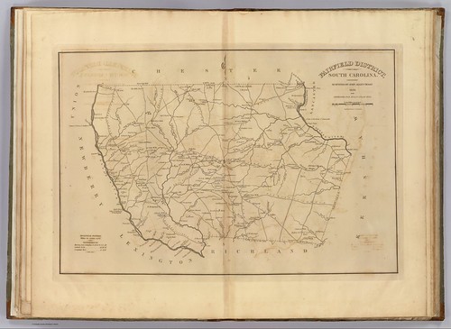
I have been enjoying going through the old maps in the Robert Mills 1825 Atlas of South Carolina. However, last weekend’s photo trek to Old Pickens Court House brought out some problems with relying solely on Mills’ maps to find ghost towns. The maps are too early to catch many towns that developed after 1825, only to fade away by the time of the Great Depression. Never fear, though. There are other online resources that can cover later time periods.
The University of South Carolina’s online digital library has an extensive collection of historic topographic maps of the state. The maps cover from 1888 to 1975, but not all quadrangles are available for this time period. For example, the collection contains three maps for the Abbeville quadrangle – 1900, 1918, 1943. The 236 maps in the collection include a mix of 30 minute, 15 minute, and 7.5 minute projections. I haven’t checked to see how extensive the state coverage is, but I’m sure there are parts of the state that are not covered.
These maps provide an excellent filler between the Mills Atlas and today’s maps. Unfortunately, this collection suffers the same problem as the state’s online collection of Mills maps – the viewing real estate is very limited. You can zoom in for closer detail, but there is no way to view the map as a whole. Fortunate, I’ve got a Mac with a large screen so it’s not as much of a problem, but on a netbook or other smaller device, it’s unusable. USC also does not provide a link to download the map so that it can be printed out or viewed with another tool.
The Perry-Castañeda Library Map Collection at the University of Texas also has an extensive collection of South Carolina Topo Maps.
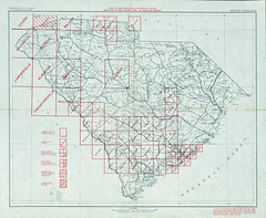
The maps are by no means exhaustive, but what maps they do carry are available for download as JPG files. This overview map shows the quadrangles and sizes that are available:
If it’s complete coverage of the state that you’re after, the Libre Map Project is the place to go. Every state quadrangle is available for download as a high-resolution TIFF file. They also have the ability to search by place name and feature. The results return a link to the proper quadrangle. Unfortunately, you have to download the large TIFF file in order to view it – there are no low-res options for easy online view. It’s almost the opposite problem of the USC collection.
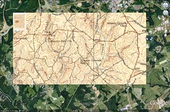
The beauty of these topographic resources is that the maps are much, much more accurate, and can be used as overlays in Google Earth. Here’s an example of a map segment for eastern Spartanburg County showing the old Abner Creek School. I’ve used this to locate the historic school in relation to present-day Abner Creek Elementary. The roads and map features line up nicely, making it much easier to match the overlay with the Google Earth data.
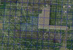
However, there are easier ways to get topographic map overlays. A company called 3D Solar has produced a Google Earth network link (KMZ file) that displays topo maps at various zoom levels. While this works OK, I found it to be a bit slow and unwieldy. Much more useful is the Google Earth Library’s network file. Rather than load all of the topo maps at once, the user is shown a grid with the quadrangles. You can click on a button to load that specific quadrangle.
Matt at GELIB is also working on a historic topographic map network link. Right now this is limited to areas in the Northeast US.
One other collection worth mentioning is Pam Rietsch’s 1895 U. S. Atlas project. This collection is based on an 1895 Rand McNalley atlas of the US, which Rietsch has scanned and enhanced. The maps themselves don’t provide much detail. Much more useful are the charts with listings of city and town names. These also indicate population, where available, and whether or not the town had a post office or railroad.
I’ve captured the chart data from Rietsch’s website and made it a bit more user-friendly in the form of a Google Spreadsheet. I’ve posted that below, and the CSV data can be downloaded here.
At this point the availability of online resources is almost overwhelming. As far as my own project is concerned, I think I’m going to start with known ghost towns, then do a county-by-county survey to see what other hidden gems might be waiting.


Cool!
I wonder regarding downloads: how concerned are these entities to prevent downloads in order to protect their work? No, they didn’t create the originals. But they did process and host. I noticed that the Furman digital library seems to have restrictions on imagery download on rather old photos. I wonder if this is to protect their efforts at hosting.
It’s possible. Downloading a large TIFF is going to take more bandwidth than serving up a smaller image via CONTENTdm. I’d just be happy to download a reasonably large JPG.
The lady who does the 1895 Atlas claims copyright because she has cleaned up and altered the images somewhat. I don’t know how well that would hold up in court, though. From what I could see, the images were not substantially altered. The rest of those images are in the public domain.
When I redid that site for the Geology people, we had some study sites that had thumbnail, moderate size, and higher res images. All were jpegs. The higher res topos were pretty big, but everything could be downloaded.
The USC library images for Greenville and Spartanburg were cool. Didn’t see anything for Columbia there. The “Columbia Quadrangle” had part of the city at the SE corner, but not quite what I was looking for. Some cool detail on the Broad River, though. I can spend HOURS looking at this stuff – fascinating. I did see what may be an error, though, on some of the Greenville County images. Looks like there are 2 ferry crossings down in PK. I don’t know that this was the case at any time, though it’s possible one is supposed to be Cooley Bridge. I’ve seen what looks like two crossings on some old maps.