A couple of weeks ago Glynda and I had been down to see the parents, and had stopped back by Renno and Stomp Springs. On Friday we had made another trip to Prosperity, and decided we would catch a couple more locations on the way back this time. We passed through some truly remote areas and visited a few towns that could just about qualify as ghost towns.
Back in January we had taken the parents on a right through the southwestern corner of Fairfield County, and along the eastern shore of Lake Monticello. This time we extended that earlier trip, with stops in Jenkinsville and points further north on Highway 215.
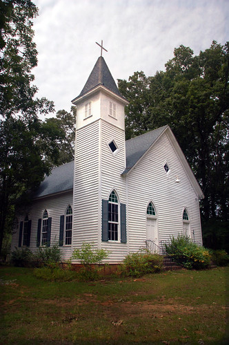
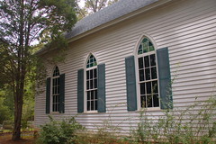
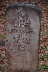
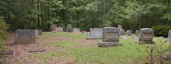
Just south of Jenkinsville is Shiloh Methodist Church. This small white frame church was built in the early 1900’s, but the congregation goes back much further. Buried in the graveyard are several Revolutionary War soldiers.
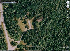
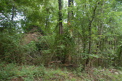
About half a mile north of Shiloh Church we glanced to the right and saw what looked like large brick ruins off in the woods. We had to explore. We found a semi-paved road that would through some brush down to a large brick structure. It turns out that these are the ruins of the old Jenkinsville School Auditorium. The roof was gone and the walls were crumbling.
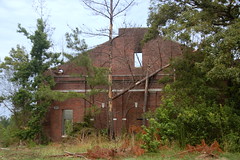
There was an abandoned white frame house nearby, but it was really hard to tell what this had been from the remains. I was able to find a photograph of the auditorium in the South Carolina School Archives collection of school insurance photos.

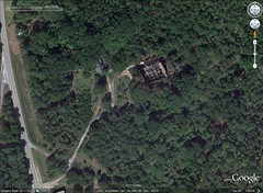
The house next door apparently was the superintendent’s residence. It looked just like the insurance photo…

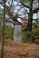
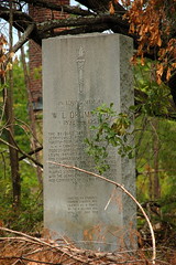
At one time there was a high school, grammar school, and teacherage here, but they are now long gone. Near where the teacherage must have stood is an old chimney. In front of the chimney is a large granite monument to W. L. Dummond, former superintendent of the Jenkinsville Schools, who apparently died in 1953, the year this monument was erected.
In Google Earth I could see that as late as 2006 the auditorium still had a roof. However, going as far back as 1994 in the Google Earth historical imagery I could see no trace of the other buildings.
Here’s what the current, 2010 imagery looks like…
We continued north along Highway 215. It was tempting to stop and take even more photos of the quaint village of Monticello, but since I had already done that, and we had a couple more targets, we continued on.
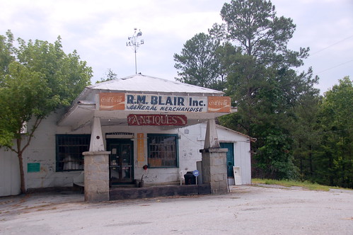
Glynda had never been to Blair, SC. I had visited a couple of times, and thought it might be a town to add to our collection of ghost towns. We drove through countryside of Winnesboro Blue Granite boulders strewn through fields, turned westward on Highway 34 from 215, then headed north on the Old Blair Road.
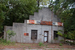
I’m not sure if Blair would qualify as a ghost town or not. There is a collection of about six old commercial buildings. While most of these are disused, there is still an active antique store in the old general store and there is still an active post office. By the strictest definition, it probably isn’t a ghost town, but it certainly qualifies for the “near” ghost town label.
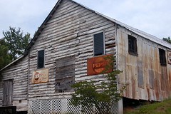
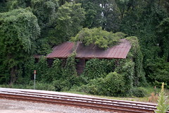
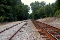
Blair was another one of those whistle stops on the railroad. This close to the Broad River it served as a hub of transportation until interstates and other major highways bypassed it.
We drove down to the tracks and toward the old depot. This must have been a major deal at one time. There was a side so that trains could pull off the main line at the depot. I wanted to continue on down to the river, but there were No Trespassing signs.
We continued north through some fairly desolate landscape, and eventually made our way back to Highway 215. Continuing north, we saw a historical marker, and pulled over to investigate. We had found the Feasterville Academy, a school for boys and girls. We could see the old white frame buildings beyond a gate, but there were signs indicating that it was now the property of a hunt club and was posted. We didn’t get close enough to get any good shots.
Across the road from the marker was a sign for the Liberty Universalist Church. Later research showed that Feasterville, the church and the academy are all on the National Register of Historic Places, but right then we didn’t know it. We turned down what we thought to be the correct road to the church, but we were far off the mark. We came to one dead end and had to backtrack, then turned down another that led to a paved road. By this time we were far from the church, and decided to just continue on.
Our meanderings led us to the community of Shelton. At this point I had another destination in mind. Instead of turning right to take us back to the highway and toward home, I turned left. After one more bad turn and backtrack, I finally reached Clayton Depot Road and a loop that wound down near the railroad. There we found several unusual large stone structures.
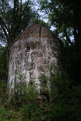
I had seen these before, and was just as puzzled then. However, a commenter on one of my earlier Flickr photos of the area led me to the answer. These were cisterns, and were part of the old Shivar Mineral Springs Bottle Plant, which was in operation until 1950. Like Feasterville, this area was also on the National Register.
By this time it was getting late and it was a rush to get home to Laura in time for dinner. There is much more to explore along this stretch, and I didn’t really spot just how much I’d missed and how close we were to some really cool things until I got home. This will definitely be a repeat trip.
As far as ghost towns go, here’s the tally…
- Jenkinsville – no, there is still an active community, post office and commerce.
- Monticello – maybe. If anything, it would have near ghost town status because of the active church and number of homes in the community.
- Blair – possibly. It’s closer to being a ghost town than Monticello is.
- Feasterville – definitely. There is nothing there.
- Shelton – definitely.
- Clayton Depot (and Shivar Springs) – definitely.
And finally, here is a map of these locations…
View Fairfield County Trek June 16, 2011 in a larger map
Dru Blair, who graduated a year or two ahead of us at Furman, has his art school in Blair. I think that is historically where his family is from. 🙂 Here’s a link to the facilities page:
http://airbrushworkshops.com/facilities.php
Interesting. I saw a photo in Panoramio of the “Blair School of Art Dormitory” (http://www.panoramio.com/photo/28481632) It also appears that the photo was posted by “airartiste”, and may be Dru himself.
The name sounds like one he’d use. He is an amazing talent.