This past week was the first of our four-day weeks on our summer schedule. That meant that I had Friday off, so I decided to take advantage of it. This was also a Lowcountry Unfiltered paddling weekend, so I decided to head down early and check out a couple of places. My trek led me to some true ghost towns in a very remote part of the state.
Since I hit so many places on this trip I’m abandoning my format for ghost town posts, but may go back and revisit those locations. We’ll have to see how closely I stick to this.
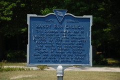
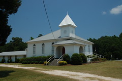
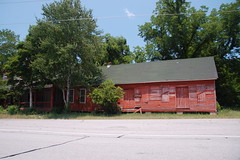
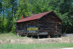
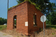
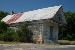
The first part of the trip was the non-descript I-26 trek down to Columbia. As soon as I got past the city, though, I was ready to leave the interstate. I took the Highway 176 exit, which parallels the interstate to the east. This led me to the little community of Sandy Run. I paused to take a few shots of the old red general store building on the side of the highway, now long abandoned.
I continued to weave through the countryside, occasionally leaving Highway 176, but returning to it. Finally I reached Fort Motte Road, and headed east on it.
Eventually I came to the community of Belleville (I looked for triplets, but didn’t see any.) At one time there was a large plantation in the area. I was only able to spot a few dilapidated buildings.
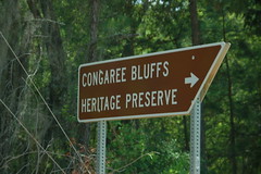
I took a brief detour down a dirt road to the Congaree Bluffs Heritage Preserve. I’ve been wanting to visit, but this definitely wasn’t the day for it. A trail leads down to the Congaree River, but it was just too hot. I continued on my way, vowing to come back in the fall when it’s a bit cooler.
The road finally reached one of my major targets for the day – Fort Motte. The name was originally given to a nearby plantation owned by Rebecca Motte, a heroine of the Revolutionary War. The plantation, originally named Mount Joseph, was located a few miles away from the present town on the banks of the Congaree River. It was commandeered by the British and renamed Fort Motte.
In 1781 Francis Marion and Henry Lee laid siege to the fort, with Mrs. Motte and the British inside. Motte was a Patriot, and even offered to burn down her own house. The British surrendered, and Mrs Motte insisted that both the British officers and Patriots sit together for an evening meal at the end of the siege.
As for the current town, I couldn’t find much info. As with many early towns it grew up along transportation lines, in this case the nearby Congaree River and as a railroad station. With the construction of Highway 176, and later the Interstate, traffic patterns shifted west, leaving Fort Motte behind.
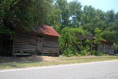
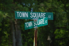
I’m always hesitant to label a town a “ghost town” if it still has town limit signs, but this one certainly fits the description. Town Square Street does as its name suggests, and forms a square. There are a couple of remaining commercial buildings facing the railroad, including an old post office and the old jail (which I mistook to be a bank when I first saw it.) The rest of the square is lined with a few aging country homes. There is no viable commerce left in the town.
I cross the railroad and continued along Fort Motte Road until it crossed Highway 601. I continued south heading toward my next target, Lone Star. However, I had a detour to make. I decided to check out Low Falls Landing on Lake Marion, which is a place I’ve wanted to paddle for awhile.
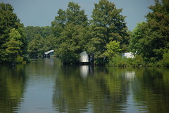
My route led me through farms and agricultural areas until I reached the landing. There were lots of fishing boats and other activity. From the landing I could see some of the old abandoned river shanties that the state Department of Natural Resources is planning to remove.
I was tempted to pull my kayak off of the car right then and there and get in a quick paddle, but decided against it. I knew I had a long kayaking day ahead of me tomorrow. As I left a sign on the Low Falls Bait and Tackle caught my eye. I decided I needed to explore. Perhaps they might even have a cold drink. I found much, much more.
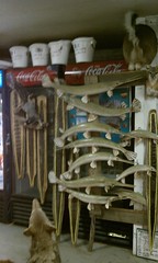
Inside I met Danny Daniels, taxidermist extraordinaire. Dan was full of stories about the area, and was proud to show off his collection. He also shared with me several of the publications that featured his store over the years. He showed me a bobcat he had just gotten that morning, and it was amazing how far along he was with it. He was quite the character. I was even able to find that cold drink I was after.
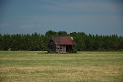
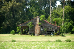
It was now time to find Lone Star. I made a couple of missteps, driving through even more farms. Several of these had old home places out in the middle of the fields. Rather than tear them down, they just plowed around them, no matter how overgrown they were.
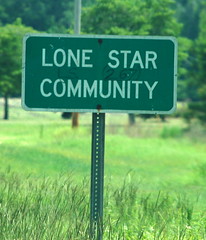
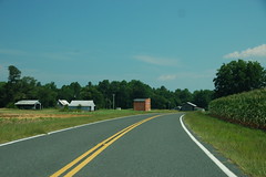
Soon I found the right path, and found myself approaching Lone Star from the rear of the town.
Like Fort Motte, this was another railroad town left high and dry by new lines of transportation. All that was left was a depot…
…a two story store that more recently served as a community center…
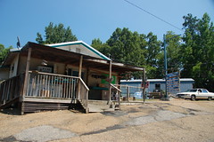
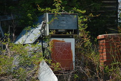
…and two competing service stations.
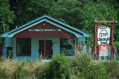
Apparently that last store with the overhang sported an antique Texaco sign and antique pumps until just a few years ago when they were sold. Across the railroad track was a convenience store, still trying to make a go of it.
Even that place didn’t look too terribly open, so I decided not to stop.
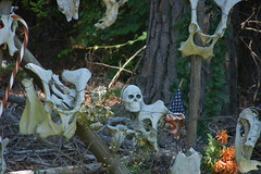
By this time I was ready to head on down to my destination of Santee. Along the way I checked out a couple more of the lake landings for future paddling reference, and I encountered this rather inviting driveway along the highway…
Of course, No Trespassing signs accompanied the bones.
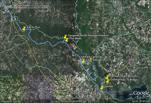
Finally in Santee I found cheap accommodations and got settled in quicker than I anticipated. There was still plenty of sunlight, and I still wanted to explore. I crossed Lake Marion on I-95 and turned north toward the Santee National Wildlife Refuge. The visitors center had already closed, but I continued on around the refuge road until I reached the Santee Indian Mound and location of Fort Watson.
Fort Watson was another British outpost captured by Francis Marion. The Indian mound was a ceremonial and burial place for the Santee tribe.
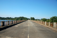
I headed back southward, taking one last detour. The old highway 15 bridge is no longer in use, but parallels the Interstate. It’s now used as a fishing bridge.
The geocaching app on my phone indicated that there were several geocaches along the old bridge. It was still too hot to walk the entire length, but I was able to find a couple of them.
By this time I was pretty tired, and ready to get settled in. It had been an interesting day of travel, with a couple of ghost towns and historic communities thrown in for good measure.
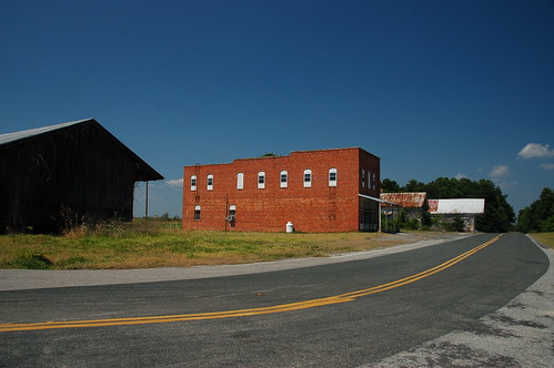



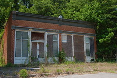







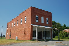




Hello. I saw this and saw the comments of the town of Lone Star. I’ve lived in Lone Star my whole life. I know this article was written around 2011 but I wanted to clear up some stuff and mistakes written in the article. The two story brick building was never used as a community center, that is about a mile from downtown located next to a church. The two story brick building served as a grocery store and up until the 2000s served as a magistrates court. It still serves as a Masonic lodge. Also the two old white general stores that are pictured were never sold. To this day they still remain in the family’s that built them in the 1890s. I believe what you are referring to when it comes to the selling of the buildings was the old post office and another store that was moved to Santee to form the Lone Star BBQ Restaurant. I’m not mad about these mistakes, in fact I enjoyed seeing my town featured in an article. It’s pretty cool to live in this kind of setting. I just wanted to take the time to clear some of these mistakes up!
Jeremey, updates and corrections are always welcome. When I had visited I saw that the brick building was set up with tables for meetings, and there was a polling place sign on the door. It looked like the building functions as a center of the community, regardless of whether or not it is called a “community center.” I hadn’t spotted the other building to which you refer.
My information about the buildings that were sold comes from news articles posted about Lone Star BBQ. As you said, this was the old post office and a couple of other buildings. It’s fascinating to hear that the remaining structures are still owned by the same families. The whole community is an intriguing place, full of history.
Indigenous peoples always lived around there it’s just other races do us wrong so we live in peace we have tribes in fort motte and it wasn’t always called fort motte , Gullah tribe and creek and Cherokees out there but they misclassified us as Indian or native Americans or black.