Skip to content

Random Connections

A collection of photography and exploration focusing on Upstate South Carolina and beyond.

  • Home
  • About Us
  • Photos
  • Resources
  • Other Voices
  • Post Archives
  • Home
  • Ghost Town

Tag: Ghost Town

Return to Andersonville Island

Posted on December 8, 2016December 11, 2016 By Tom 3 Comments on Return to Andersonville Island
Geocaching and Maps, History and Genealogy, Paddling, Photography, Rambling

Return to Andersonville Island-109

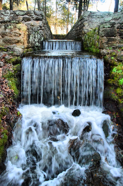
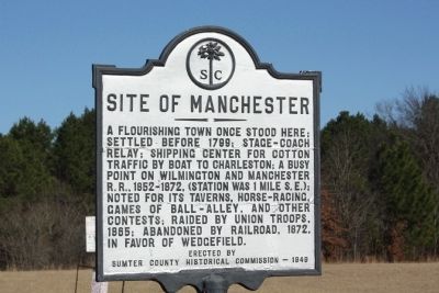
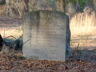
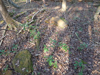
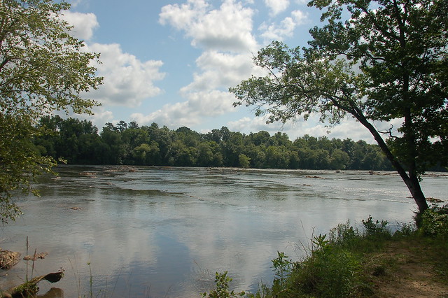
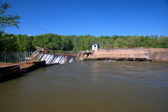
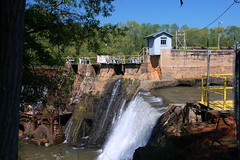
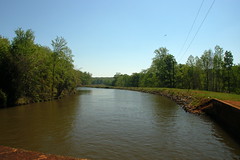
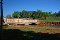
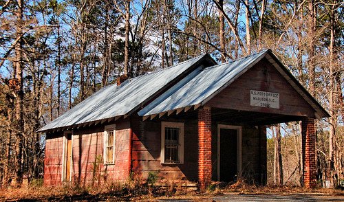
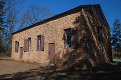
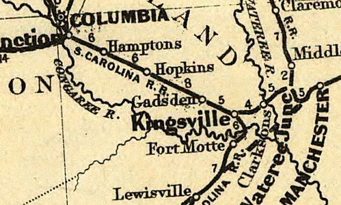
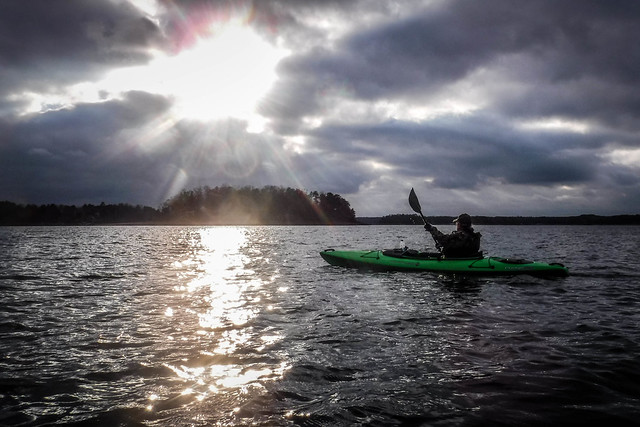
Just because it’s December doesn’t mean that we stop paddling. Heck, for this particular trip we even went swimming, but that’s getting ahead of things a bit. Fellow explorer, and now fellow paddler Mark Elbrecht proposed a trip out to Andersonville Island to see if we could spot the ruins that everyone says are there. Bennie Waddell had just gotten a new kayak, and I lacked only 6 miles to push me over the 200 mark for the year. Of course, agreed to come along. Turned out to be a great trip with unexpected finds and unexpected excitement. But, I guess the word “unexpected” is redundant. Regardless…

Read More “Return to Andersonville Island” »

More on Chappells

Posted on February 20, 2013 By Tom 5 Comments on More on Chappells
History and Genealogy, Rambling

Chappells Ruins

My how time flies. Hard to believe that it’s been two years since Alan and I first explored the ghost town of Chappells, SC. We made our exploration after a paddling trip on the Saluda River, and I did a follow-up post on the history of the town.

Last year fellow explorer Mark Elbrecht visited the town during winter, and was able to get some clearer photographs of the ruins.

One other item Mark found was a photograph of the old Chappells Depot from an article in the Newberry Observer…

Chappells Depot

As we walked down the old main street and looked at the ruins on our visit, I wondered if any other photographs existed of the town in its heyday. Apart from Mark’s discovery of the depot photo, I had not seen any other photos of the old town. That all changed this past week.

Read More “More on Chappells” »

LCU vs Manchester, Part 3

Posted on January 19, 2013 By Tom No Comments on LCU vs Manchester, Part 3
Geocaching and Maps, History and Genealogy, Photography

Poinsett Park Millrace 2

So far our crew from Lowcountry Unfiltered had breakfast at Battens in Wedgefield, visited the cemetery of a deranged governor, hiked part of the Palmetto trail and discovered an old railroad junction, and we were just getting started.

Manchester and Melrose

We got back to our vehicles and headed to the location of the ghost town of Manchester. The town died out with the demise of the Wilmington and Manchester railroad. All that remains are a few rural houses. We paused briefly, and left in search of a more interesting section of Manchester.

Nearby is a marking indicating the location of Melrose Plantation. Built in the late 1700s, the plantation was owned by Matthew Singleton, whose cemetery we had visited earlier in the day. We stopped at the marker and took a look around. There were a few foundation stones, and the twisted remains of a metal bed. Unfortunately the bed appeared to be more of modern than pre-Civil War origin.

Melrose Plantation Marker
Melrose Plantation Remains

Read More “LCU vs Manchester, Part 3” »

Searching for Coopersville

Posted on June 17, 2012 By Tom 3 Comments on Searching for Coopersville
History and Genealogy, Local, Photography, Rambling

Cherokee Ford on the Broad River

About a month ago SCETV was airing an episode of Palmetto Places on Gaffney, South Carolina. I caught the tail end of a segment about the Coopersville Iron Works. I didn’t catch much of the segment, but heard enough to know that it should be a target for one of my ghost town hunts. It sounded like it would be a perfect rambling trip for this week’s Friday off.

Coopersville was one of a series of Civil War era iron furnace operations in Cherokee County. In addition to this complex, there were furnaces near Cowpens and Thicketty Mountain. Coopersville was the largest, with several factories, a post office and some stores. All of these historic iron works are on private property, and finding information about the actual location proved to be a challenge. The National Register nomination form for Coopersville was severely redacted so that no addresses were visible. Even beyond that, the name “Coopersville” didn’t show up on any GNIS listings, or on any other lists of towns that I had, historic or otherwise.

After several conversations on Google+ with my history exploring friends, Mark Elbrecht pointed me in the direction of an archeological survey done in the 1980s prior to the construction of electrical transmission lines. It contained several maps which were not redacted. I used that map as basis for my ramblings.

Predictive Modeling: An Archeolgical Assessment of Duke Power Company's Proposed Cherokee Transmission Lines

Read More “Searching for Coopersville” »

Searching for Shoals Junction

Posted on April 4, 2012 By Tom 4 Comments on Searching for Shoals Junction
History and Genealogy, Local, Photography

Shoals Junction Ramble-027

It’s spring break for most of the Upstate school districts, and I wanted to search for a few ghost towns. Mark Elbrecht and I had bounced around some possible targets, and after looking through the South Carolina section of the Abandoned Rails website, we decided to try to find Shoals Junction, at the end of the abandoned Ware Shoals line. We would also hit a couple of other smaller communities and see what we could find.  Turns out we could hit lots of communities – eight of them in all.  I’ll try to summarize them here.

Ware Shoals

We set out down Augusta Road eventually reaching the eastern terminus of the railroad in Ware Shoals. We took a turn through the town, then headed down to the river. We drove through the riverside park, then circled past the power generation station. There were several workers, and we felt awkward stopping for photos. We retraced our steps upstream and headed beyond the bridge crossing the Saluda River. We soon reached the Ware Shoals Dam.

Ware Shoals Dam-002

Ware Shoals Dam

At the top of the dam water is diverted into a canal so that it can be routed through the power turbines below. With the recent rain lots of water was flowing over the dam.

Ware Shoals Dam-004

Ware Shoals Dam-006

An old masonry staircase led down to the river. As sign pointed to the “Fishing Trail” and “Canoe Portage.” I guess the portage was around the dam, but I couldn’t see where one would take out a canoe at the top of the dam. I guess it would be more obvious if I were on the river.

Read More “Searching for Shoals Junction” »

A Trip to Madison

Posted on February 26, 2012 By Tom 4 Comments on A Trip to Madison
Photography, Travel

New Madison Post Office

Saturday morning we wanted to get out of the house for a bit. So, we had a big breakfast, loaded everyone into the car, and headed west.

Laura’s mother had never seen Clemson, so that was going to be one of our stops. I also had a potential ghost town I wanted to check out. Laura’s desires were simple – she wanted a hamburger somewhere. The only problem was that we had a time limit. Laura and I had to be back for a dinner party that evening.

We pretty much stuck to our plan. We drove straight to Clemson and drove around the campus. We also drove through the state botanical garden. There didn’t appear to be much in bloom, so we didn’t stop and get out.

After touring Clemson, we headed south on Highway 76 until we got to the Old Stone Church. Last time I was here there was a maintenance man on duty and he let me into the church. No such luck this time. The place was locked up and I could only take photos from the outside.

Old Stone Church

Old Stone Church

Read More “A Trip to Madison” »

Kingville, Kingsville

Posted on February 12, 2012 By Tom 22 Comments on Kingville, Kingsville
Geocaching and Maps, History and Genealogy

Kingville Station

I came upon Kingville quite by accident. I was looking for information on another ghost town in Google Earth when I spotted this name near the confluence of the Congaree and Wateree Rivers. When I zoomed in a bit further I saw that the the place indicated by the name was all wooded – there was no town there. Street View also showed just a wooded area, and not enough buildings to even justify keeping this as a place name. This intrigued me, so I did a bit of research, and it turned out to be an interesting ghost town location itself.

Kingville Google Earth

According to information on the Kingville Historical Foundation’s website, the town got it’s start in 1842 when a spur railroad line from Aiken was completed to Columbia. I checked Robert Mill’s 1825 atlas of the area, and the name Kingville does not appear. In 1850 a branch line was completed to Camden, and the town began to grow because it was now located at the juncture of two major railroad lines.

Research on the town was initially confusing. According to the historical marker for the site…

Kingville is thought to be named for its status as “king” of the railroad line between Charleston and Columbia and between Columbia and Camden.

However, the town was first called “Kingsville” with an “s”. For awhile I wasn’t sure if I was finding information on the same town. For example, this is an excerpt from an 1870 map of the Port Royal railroad in the southern states. It clearly shows the spelling with an “s”. The town’s name on this map makes it look almost as big as Columbia, but this is deceptive. Since this was a railroad map, the emphasis was on major junctions, rather than the actual towns.

Kingville_1870

Read More “Kingville, Kingsville” »

More on New Bordeaux

Posted on January 19, 2012 By Tom 1 Comment on More on New Bordeaux
Geocaching and Maps, History and Genealogy

While we were on our McCormick County Photo Trek we had trouble locating the old town of New Bordeaux. I had it on my list as a potential ghost town target, but finding the actual town was elusive. Since we’ve returned from the trip I’ve been able to find out a bit more information, but … Read More “More on New Bordeaux” »

Old Pickens Court House

Posted on August 16, 2011 By Tom 1 Comment on Old Pickens Court House
History and Genealogy

Old Pickens Presbyterian-23

During our photo trek on Sunday, Ed and I visited Old Pickens Presbyterian Church, which was once in Old Pickens Courthouse. The “Old” designation is official, as a way of distinguishing it from the “New” town and church to the east. This location fits our working definition of a “ghost town”, so I thought I would write it up as such.

Ed and I first visited the church early in the morning. The church itself was closed, but there was a sign saying that it would be open at 2:30 that afternoon. After our trek I had dropped Ed off at his house, and was actually on my way home when I noticed the the time – the church would now be open. Since I hadn’t gotten very far down the road, and since I had no idea when I would have another opportunity, I turned around and headed back to the church.

I found the church open and manned by Joyce Brickett, who is on the Board of Directors of the Historic Old Pickens Foundation. She had several tables set up with a wealth of information about the church and the town. I spent some time photographing the interior and talking with her about the area.

Old Pickens Presbyterian Interior

Read More “Old Pickens Court House” »

Revisiting Eastern Fairfield County

Posted on June 18, 2011 By Tom 3 Comments on Revisiting Eastern Fairfield County
Geocaching and Maps, History and Genealogy, Photography

Blair General Merchandise

A couple of weeks ago Glynda and I had been down to see the parents, and had stopped back by Renno and Stomp Springs. On Friday we had made another trip to Prosperity, and decided we would catch a couple more locations on the way back this time. We passed through some truly remote areas and visited a few towns that could just about qualify as ghost towns.

Back in January we had taken the parents on a right through the southwestern corner of Fairfield County, and along the eastern shore of Lake Monticello. This time we extended that earlier trip, with stops in Jenkinsville and points further north on Highway 215.

Shiloh Methodist

Read More “Revisiting Eastern Fairfield County” »

Posts navigation

1 2 Next

Categories

  • EdTech (200)
  • Entertainment (202)
  • Family (121)
  • Gear (115)
  • General Technology (99)
  • Geocaching and Maps (208)
  • History and Genealogy (266)
  • Internet (144)
  • Local (451)
  • Miscellaneous (550)
  • Music (196)
  • Paddling (248)
  • Photography (779)
  • Podcast (6)
  • Rambling (227)
  • Rants (161)
  • Recipes (34)
  • Religion (48)
  • Restaurants (165)
  • Science (48)
  • Things Overheard (29)
  • Travel (411)
  • Uncategorized (129)
  • Washington Sabbatical (113)
  • Weirdness (60)

Recent Posts

  • In Search of the Road Builder
  • The Phoenix Riots and Dr. Benjamin Mays – An MLK Day Ramble
  • An Obsession with Steak Knives
  • An Epiphany on Patriotism
  • Kayaking Bates Old River and Running Creek

Recent Comments

  • Walter Kokoszka on Mysterious Mayucha and The Wolf Pit
  • Elizabeth on The Temple of Health: Ground-Truthing in Antreville
  • The Bay Area Basketball Fan’s Guide to March Madness on FU All the Time!
  • Why You Should Root For This March Madness Underdog on FU All the Time!
  • Gregory Davis on Ghost Towns of the Pee Dee – Part 2, Centenary

Tags

blogging cemetery Christmas Columbia Edisto River edtech Entertainment family Flickr Florida Furman Furman University gear Georgia geotagging Ghost Town Ghost Towns Google Earth Google Maps GPS Greenville Greenville Chorale history Instructional Technology kayaking Lake Jocassee LCU Lowcountry Unfiltered maps Music North Carolina Paddling Photography rambling restaurant Restaurants review singing social networking South Carolina time-lapse Travel video Washington Washington State
March 2023
S M T W T F S
 1234
567891011
12131415161718
19202122232425
262728293031  
« Jan    

Copyright © 2023 Random Connections.

Theme: Oceanly by ScriptsTown