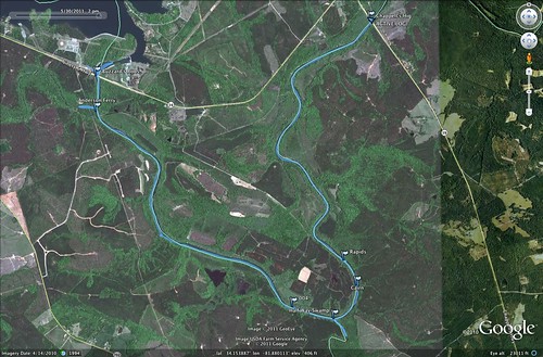
With the long weekend I felt the need to hit the water. The challenge was to find a paddling venue that was relatively close, doable without killing the entire day, and not over-run by Memorial Day crowds. We found the perfect location on the Saluda River, below the Lake Greenwood Dam.
Our plans were for an 8-mile stretch of the river from Buzzards Roost at Highway 34 to the Highway 39 bridge at Chappells. I was a bit concerned about river access. I knew there was parking and river access at Buzzard’s Roost, but I couldn’t find any info about Chappells. All my resources indicated that it would be a throw-in, at best. Fortunately, Dave was able to do some advanced scouting, and concluded that it would be a challenge, but doable. We decided to go for it.
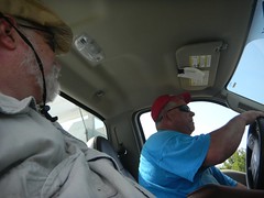
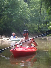
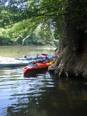
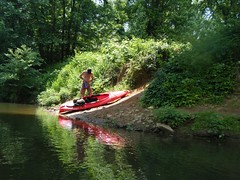
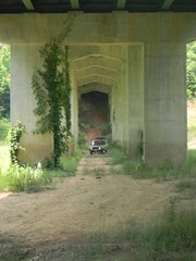
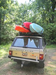
Dave, Alan, and I rendezvoused at Alan’s house early Monday morning and we headed on down. Our first stop was at the take-out at Chappells. A steep, rutted dirt road lead down to the river, and it looked like there was adequate parking, assuming one had four-wheel drive and could get down the initial hill. The bank down to the river did look steep, but not insurmountable. We decided to put all of the kayaks in my truck and leave Dave’s Land Rover at the take-out.
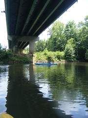
The shuttle for the trip was only about 3 miles. While the road goes east-west, the river takes a deep dip southward. Before we knew it we had arrived at the Highway 34 bridge and the area known as Buzzards Roost. The dam forming Lake Greenwood was completed in 1940 and was referred to as the Buzzards Roost Project. The name has been around much longer than the lake, but I haven’t been able to find any history on it.
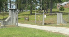
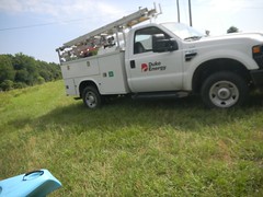
On the north side of Highway 34 there are two parking areas, one on either side of the river. Unfortunately, there is a 200-300 yard hike to get down to the river. However, we had connections. Dave works for Duke Power and one of his colleagues, George, was on call. He opened the gates onto Duke property, allowing us to drive right down to the river and offload the boats. Once unloaded, I drove the truck on back to the public parking area.
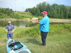
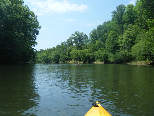
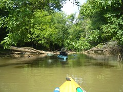
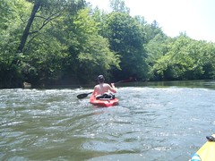
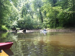
By 10:30 we were under way. We paddled upstream toward the dam first. There were lots of fishermen in the area, and the eponymous buzzards were all over the place.
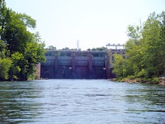
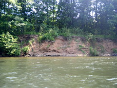
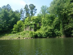
Water levels were quite good. The dam has 3 power tubines, and according to George one was running today. Apparently this stretch can get quite rocky if the turbines aren’t running. Along with decent water levels there was a decent current – not too fast, but you could float along without paddling if you wanted. The river was fairly wide, and high tree-lined bluffs ran along the banks. Dave and I both figured that with more turbines running, less of the bluffs would be visible.
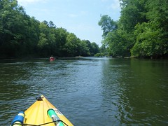
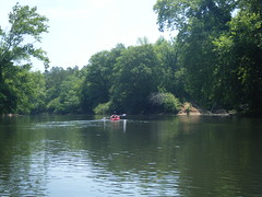
In addition to the fisherman at the put-in, two more guys fishing in kayaks were hovering near the bridge. Another kayaking group launched about the same time we did with to men and three boys that looked to be between 10 and 13. The were taking a leisurely trip, as well, and were stopping to fish all along the way. We encountered them several times downstream, but other than that we had the river to ourselves.
Not far below Highway 34 Ninety-Six Creek enters on the right side of the river. I have jokingly referred to the Lowcountry Unfiltered group as ADD paddlers, but in truth Alan and I are just as bad. So, of course, we had to explore. We paddled past a large island in the middle of the Creek and continued until our path was blocked by deadfalls. At one point we looked up to see two bald eagles soaring overhead, one being chased by an osprey. Pretty amazing.
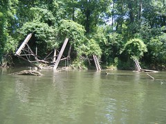
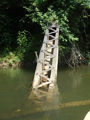
Back on the main river our next landmark was an old bridge abutment. At first I thought it must be an old highway. This area was historically known as Anderson’s Ferry, and I thought it might have something to do with that. However, in looking at topo maps when I got home I found out that it was an abandoned line of the Southern Railway Line that ran from Newberry to Greenwood and beyond.
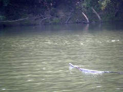
In addition to the eagles we had other wildlife keeping us company. Blue herons and kingfishers kept us company as we paddled along. Of course, there lots of turtles – yellow sliders of various sizes. And we saw a couple of snakes.
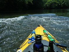
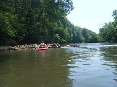
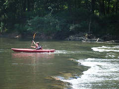
George had warned us about some shoals on the river, and said we might want to scout or portage them. I had seen a couple of photos on Panoramio, but they didn’t look like anything that should worry us. We encountered a couple of ripples, but nothing that would even qualify as a Class I rapid in my book.
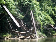
The minor rapids were fun little diversions. However, there was even more stuff to hold our interested. We soon encountered the remains of an old steel trestle bridge. On Google Earth and topo maps it looks like an old road approached from the west, but there was no indication as to where it went on the other side of the river. There was also no indication of the road’s name.
Just past the ruined bridge Lucy’s Point came into view. This is on the south side of Halfway Swamp Creek, which, as the name implies, marks the halfway point of our trip. This was the southernmost point of the deep bend that characterizes this stretch of river. From here, the river turns north-northeast toward Chappells.
Of course, since this was a major tributary, we had to explore it. We paddled back quite a ways, and could have continued further if we had wanted.

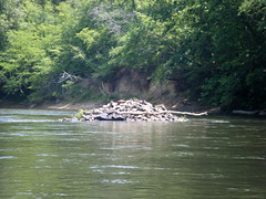
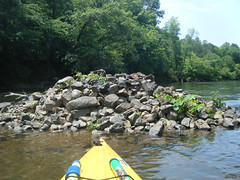
Back on the main part of the Saluda we came to a rock cairn on the middle-right of the river. As much as I’ve looked, I’ve not found any information about the cairn. I don’t know it’s age, why it’s there, or anything about it.
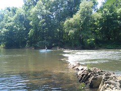
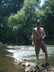
Soon we reached the place I had marked on my GPS as “rapids” based on the Panoramio photos. There were some interesting ripples, but not much to it. We decided it would be as good a place as any for lunch, so we pulled our kayaks into the pool that had formed about the rocks on river right and took a break.
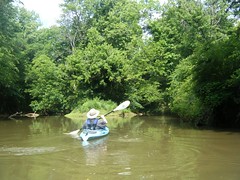
Our fellow paddlers soon caught back up with us. I was pleased to see how well the boys were doing handling the kayaks. They made it through the rocks with no problem at all.
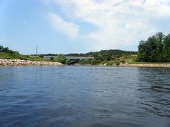
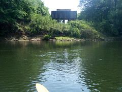
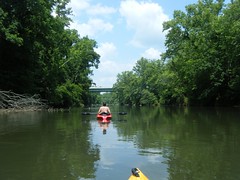
After lunch we continued on. We were still looking for the big rapid George had mentioned, but it never came. Before we knew it we were already at the Highway 39 bridge and the end of our trip.
As we feared, the take-out was a challenge. We used a rope to pull the boats up the steep embankment and up to level land. Dave then went and retrieved his Rover and we loaded the boats on top for the journey back to retrieve my truck.

Despite the tough river access, this section is definitely a keeper. The scenery was interesting, there was plenty of wildlife, and enough current to keep things interesting. Water quality was so-so, but there were still some potential swimming holes and places for rope swings along the rocky banks. It was a near-perfect day out on the water.
It looked like there were rapids down through there (Google Earth), but i guess that either the water level was different in the photos v when you were there, or those “ripples” show up really well on satellite. Sounded like a cool trip and great stretch of wild river.
I prefer to think us of as EDP–easily distracted paddlers. It was a really great trip, though.
I like that term! I think I’ll suggest it to the group!
Thanks for information that you provide on your paddling trips. My wife and I recently started kayaking and it is very helpful.
I have paddled that stretch twice and I truly love it!! Last trip we saw 3 bald eagles. I was kayaking the other stretch the day y’all went. From chappels to 121. I belive I saw that land rover! Are you guys part of a local club? anyways glad to see more people kayaking up in this neck of the woods.
Happy paddling
I have paddled that stretch twice and I truly love it!! Last trip we saw 3 bald eagles. I was kayaking the other stretch the day y’all went. From chappels to 121. I belive I saw that land rover! Are you guys part of a local club? anyways glad to see more people kayaking up in this neck of the woods. Oh yea that is a steep hill under the bridge huh!!
Happy paddling
Money was approved by state(SC) in late 2012 to construct a takeout area at the SC Hwy 39 bridge…Cannot wait to see construction begin, as it is certainly a challenge to get the kayaks out…Paddled it twice last year and hope to again when wx gets warmer…
Get Wet and Paddle
That’s great news!
Tom, As Thomas above said, there is now a asphalt road, large paved parking area, and concrete boat ramp under Highway 39 bridge. This is as of September 2015 with entrance on southern or Saluda (town) side of 39. Very nice.
The ramp is now complete.
How long did trip take ?
Thanks!
We tend to paddle very leisurely. We got on the water by about 10:30 and were done by about 2:30, so 4 hours with side trips and a stop for lunch.
I will be part of a small group that will be geokayaching along this section of the river. We are going tomorrow, 4/17/21. We are looking forward to it. I sent a message to your geocaching account earlier this week, but I was not sure how often you check there.
Oh, man! I missed that. I’ve already got a trip on the Edisto this weekend, otherwise I’d love to go.
Just went this weekend. Took our group 5 hours. Water still not too cold in Oct. Our mist experienced paddles flipped on biggest drop. I suggest paddling to the right of it to unload your stuff, then paddling over.