About a month ago SCETV was airing an episode of Palmetto Places on Gaffney, South Carolina. I caught the tail end of a segment about the Coopersville Iron Works. I didn’t catch much of the segment, but heard enough to know that it should be a target for one of my ghost town hunts. It sounded like it would be a perfect rambling trip for this week’s Friday off.
Coopersville was one of a series of Civil War era iron furnace operations in Cherokee County. In addition to this complex, there were furnaces near Cowpens and Thicketty Mountain. Coopersville was the largest, with several factories, a post office and some stores. All of these historic iron works are on private property, and finding information about the actual location proved to be a challenge. The National Register nomination form for Coopersville was severely redacted so that no addresses were visible. Even beyond that, the name “Coopersville” didn’t show up on any GNIS listings, or on any other lists of towns that I had, historic or otherwise.
After several conversations on Google+ with my history exploring friends, Mark Elbrecht pointed me in the direction of an archeological survey done in the 1980s prior to the construction of electrical transmission lines. It contained several maps which were not redacted. I used that map as basis for my ramblings.

Since we weren’t sure of the exact location, this was more of a quick “ground-truthing” expedition than a real survey of the area. I wanted to see if we actually could get access to the area. There appeared to be a recreational area and river access, but I wasn’t sure how close that was to the actual town location. I was also interested in exploring Cherokee Falls on the other side of the river, and the area in general.
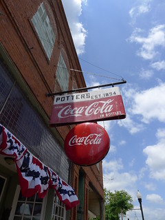
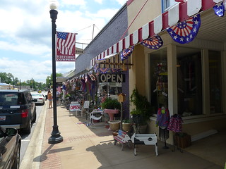
I was joined on this trek by my sister, Glynda. We headed straight toward Gaffney, taking I-85 rather than some of the more appealing indirect routes. We decided to drive through the center of the town, and were pleasantly surprised at the amount of activity and revitalization going on in the town. It looked liked there would be several nice eateries to try if we were in the area at the right time.
We took Highway 29 eastward out of town, then turned south on Highway 329. Signs along the way indicated that this was part of the Overmountain Victory Trail (OVT), a historic route followed by patriots from Virginia to the Battle of Kings Mountain, not far from Gaffney. We turned off of 329 onto Ford Road, which led to our target location.
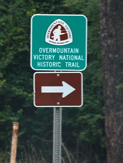
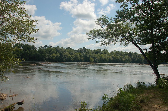
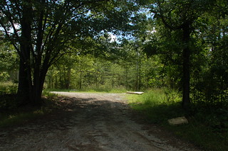
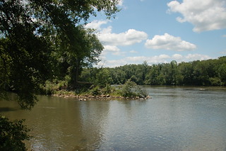
A sign pointed down a dirt road, indicating that the OVT continued that way. The dirt road corresponded with locations on my maps, so we headed that way. The road led down to the Broad River, and appeared to be a public access point.
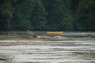
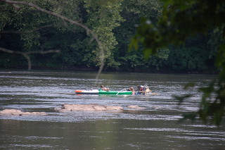
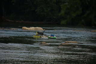
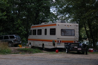
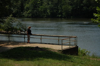
However, there seemed to be weirdness afoot. There were two campsites, one with a large RV that appeared to have set up permanent residence. Stranger still, there were several flotillas out on the shoals in the river. These consisted of a canoe or kayak, and a small round floating dredge rig. All four dredges appeared to be in operation, but only one was attended by a woman and what looked like a teenaged daughter.
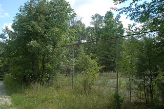
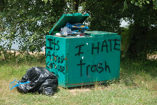
It looked like there was more to explore in the area, but with the weirdness going on, we decided see what else we could find. Back at the intersection of the dirt road and Ford Road was a fenced area that caught our eye. This turned out to be a long-abandoned set of tennis courts. I wondered if this was part of the Cherokee Ford Recreation Area I had seen on Google Earth. It looked like it was now little more than a dump, with trash and several mattresses in the area.
There were several other areas that looked like they could have been old homesites, but nothing to indicate the ghost town.
We continued on Ford Road until it joined back up with 329. Along the way we saw one more dirt road headed straight down to the Coopersville area, but it was clearly marked “Private Property: No Trespassing.” In addition there were several mobile homes along the dirt road. We wouldn’t be accessing the site that way. Coopersville was in between the first dirt road we had traveled, and this one, but between weirdness on the river and posted signs we wouldn’t be visiting it today.
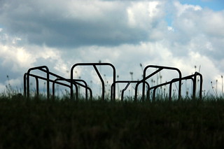
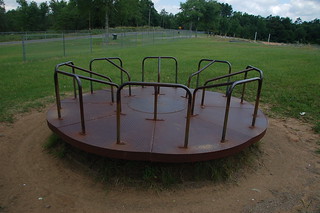
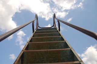
We retraced our steps back to the first dirt road, but continued north on Ford Road. There we found several ball fields and a small playground. We turned in, hoping that it also led down to the river. Unfortunately, access was only to the fields. The playground equipment itself was ancient, just like the old playground equipment we had when I was a student at Gray Court School. I stopped to take photos.
A groundskeeper came by to see what we were up to. I asked him about Coopersville, and he had never heard of it. He did say that this area was the old Cherokee Ford across the Broad River. As part of the OVT, this was where the Patriot army crossed the Broad on its way to Kings Mountain. He said that he thought there was a marker just downstream from where we were on the river. I asked about the dredging, and he said he thought it was someone looking for historical artifacts in the river. These artifacts would probably be more associated with the Revolutionary War era Cherokee Ford, rather than the Civil War era Coopersville, but who knows?
Glynda and I decided to check out the other side of the river and see if we could see anything. We drove back to Highway 29 and crossed the river, then took River Road, another dirt road just on the other side of the bridge. We got some good views of the river from powerline and gas clearings, but nothing to really give us a view of the shoals and Cooperville.
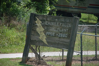
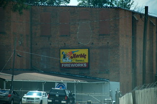
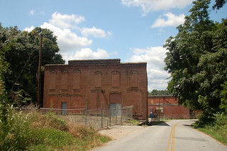
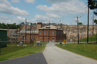
The road eventually led us down to the old mill village of Cherokee Falls. The former textile mill is now a distribution center for Herbie’s Fireworks. A sign indicated that there was still a power plant at the dam.
We stopped at a boat ramp just above the dam. There was a small pull-off area with parking for the ramp, but the rest of the road was blocked by a gate with concertina wire.

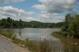
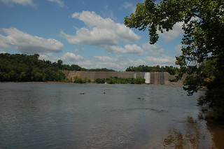
I had viewed the dam in Google Earth, and it looked unusual. This visit just bore out those initial feelings. Most of the dam is concrete, but it’s topped with a series of wooden panels with beam braces, giving it a somewhat less than sturdy appearance. This photo by Panoramio user Bearden82 gives a clearer view of the dam from the other side of the river.

It looked like we could explore the area by kayak. We could put in either here or at the Cherokee Falls access, and probably reach the Coopersville location by water.
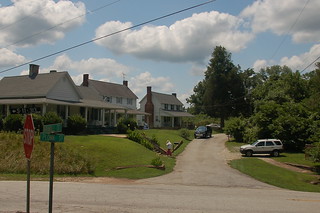
Glynda and I decided to explore the little village itself. Narrow, twisting roads wound through houses that clung to the steep hillsides. It was like a step back in time. There didn’t appear to be any stores or commerce. I guess there had probably been a company store at one time, but there was no indication of it.
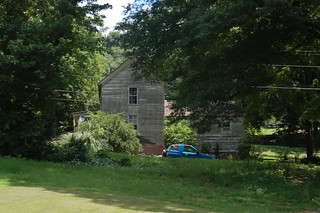
A road sign indicating “Old Factory Road” caught our eye, and we decided to explore. This took us by a very nice estate with the following handwritten sign nailed to a tree on the road.
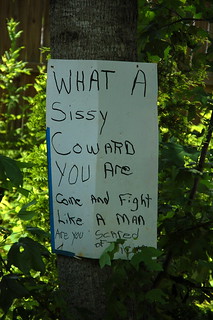
There was no explanation. We kept going. Along the way we also encountered a camel…
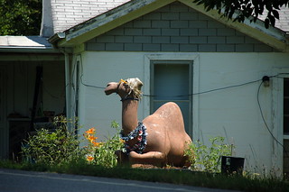
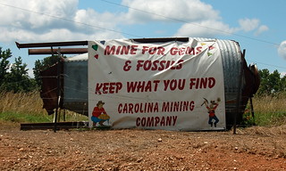
…and a gem and fossil mine.
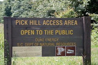
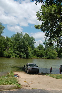
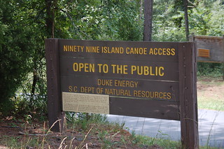
Eventually Old Factory Road took us to Ninety-Nine Islands Road, which we took southward. We stopped for a moment at the Pick Hill Boat Ramp. There was a family swimming in the river, and someone pulling a boat out of the river. It looks like this area would also have potential as a paddling venue.
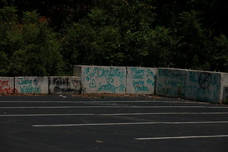
Continuing on Ninety-Nine Islands Road, the road suddenly narrowed to a single lane, then twisted down to the Ninety-Nine Islands Dam and Power Plant. Just below the dam was another river access area. The parking area was covered with graffiti, but the access itself looked well maintained.
It wasn’t until I got back and was looking at our travels in Google Earth that I realized that we were just on the other side of the river from the abandoned Cherokee Nuclear Plant. The power plant was never finished, and was used as a set for the movie The Abyss. Here is an image from Google Earth…

I may have to explore this are further when I get a chance.
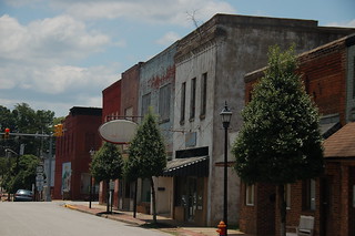
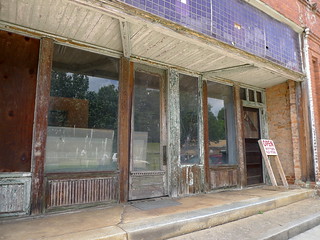
By this time Glynda and I were getting hungry. We decided to head to Blacksburg to find lunch. As a total contrast to Gaffney, the downtown part of Blacksburg was a series of abandoned storefronts. The architecture was neat, but nothing was open. There was potential, but no realization of that potential.
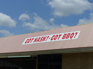
We took Highway 29 westward toward Gaffney, hoping to find something to eat along the way. A sign proclaiming hash and BBQ caught our eye, so we turned into Danny’s Cafe, hoping to get a bit of local flavor. We got more than we asked for (and just about enough material for an entire blog post.)

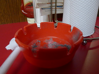
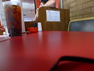
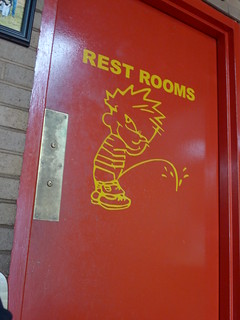
The bright red decor should have served as a warning. There was a sticker proclaiming “Smokers have rights, too”, and ashtrays everywhere. One kitchen worker even came in, plopped down right next to us and lit up. The restroom doors had the cartoon Calvin peeing on something.
Since the sign had advertised hash, that’s what we ordered. What we got was so totally unlike our experience with hash as to be completely baffling to us. The food was the most unappetizing mush we had ever encountered. The cole slaw was nasty cabbage covered in mayonnaise, and no amount of seasoning seemed to help. We didn’t finish all of our meal. In fact, after we left we drove through a Hardees on down the highway and got milkshakes to help settle our stomachs.

We decided to take Highway 29 back toward home. Our route took us past a couple of interesting places, such as Beaverdam school, and a couple of other places.
When we got to Cowpens, we stopped at a row of antique stores to explore. Turns out that this was the weekend for the Mighty Moo Festival in town, and the shop owners were busy decorating. The historic architecture had also caught our eye. We popped into a couple of the stores for a few minutes.
We continued on our way, driving through downtown Spartanburg. Our last stop was the Hubbub Book Store, located in the old Masonic Temple in Spartanburg. It was a nice cap to a good day of exploration.
View Cherokee County Ramble in a larger map
You can still find it if you want to! I’m convinced the two sites, Ellen furnace and Susan furnace, are sitting in the bends of Peolpes creek and the fork for Furnace creek. I have a link to a book on-line about the area and it has a map showing the locations. Putting two and two together, it’s not hard to figure out where they probably are.
My great great great grandfather was the manager of Nesbitt Iron Manufacturing Co. All I know about it, was that it sat at the bend of Broad River and People’s Creek. A village sprang up which they named Cooperville. Another nearby area to spring up was Limestone Springs, home of the Up Country Resort. The company changed hands and became the Swedish Iron Manuf Co, preWar, and sold to Magnetic Iron Co, receiving huge War contracts. After the War was lost, the company was broke and forced to dissolve.
I really enjoyed your pictures. I’ve never been to the area, so it was nice to get an idea of where my people lived.
I own the iron furnace on people creek in Gaffney SC and I have a hard time finding out anything about it myself . It is a rock building with 4 openings a sits about 50 to 60 feet off people creek.