Skip to content

Random Connections

A collection of photography and exploration focusing on Upstate South Carolina and beyond.

  • Home
  • About Us
  • Photos
  • Resources
  • Other Voices
  • Post Archives
  • Podcast
  • Home
  • rambling
  • Page 5

Tag: rambling

North Carolina with the New Camera

Posted on July 23, 2012 By Tom 3 Comments on North Carolina with the New Camera
Gear, Photography, Rambling

Madison County Courthouse

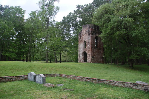
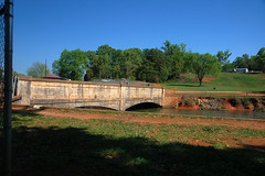
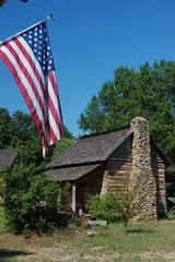
Laura is out of town for awhile traveling with her mother. Saturday morning I dropped her off at GSP for an early flight, then headed out to try out the new camera. My plan was to head up into the North Carolina mountains for a bit and see what I could see. I have to confess, it was quite a bit of a learning curve.

Friday night I charged up the batteries and got familiar with the menu and controls. The temptation is to start with an absolutely perfect shot – something worthy of such a fine instrument. Didn’t happen. I shot one of the cats, and shot him poorly. So much for breaking the ice.

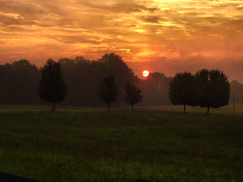
When the time came the next morning I felt ready for a cursory outing. From the airport I drove north on Highway 14, pausing in Landrum to get some shots of the sunrise through the fog. Here’s the shot I was after…

Landrum Sunrise 2

Read More “North Carolina with the New Camera” »

Rambling through Greenwood

Posted on June 26, 2012 By Tom 1 Comment on Rambling through Greenwood
Photography, Rambling

Dino Cafe Sign

I got a note from fellow explorer Mark Elbrecht the other day mentioning that they were offering tours of Cokesbury College as part of Greenwood’s Festival of Flowers. Mark was able to do the tour on Saturday, but I was off paddling Parr Shoals. My brother Houston was in town, so we stopped by to pick up my sister Glynda and headed down toward Greenwood.

The route from Gray Court to Greenwood cuts across the Laurens County countryside. Southwest of Hickory Tavern we found ourselves at Boyds Mill Pond, an impoundment on the Reed River with a small hydroelectric plant. We stopped to take a few photos.

Boyds Mill Pond Jun 24, 2012 11-039Boyds Mill Pond Jun 24, 2012 11-036

The river below the dam has several fishing access spots. One point looked like it would be an excellent place to launch a kayak, but it was very trashy. There were several folks fly-fishing downstream.

Read More “Rambling through Greenwood” »

Searching for Coopersville

Posted on June 17, 2012 By Tom 3 Comments on Searching for Coopersville
History and Genealogy, Local, Photography, Rambling

Cherokee Ford on the Broad River

About a month ago SCETV was airing an episode of Palmetto Places on Gaffney, South Carolina. I caught the tail end of a segment about the Coopersville Iron Works. I didn’t catch much of the segment, but heard enough to know that it should be a target for one of my ghost town hunts. It sounded like it would be a perfect rambling trip for this week’s Friday off.

Coopersville was one of a series of Civil War era iron furnace operations in Cherokee County. In addition to this complex, there were furnaces near Cowpens and Thicketty Mountain. Coopersville was the largest, with several factories, a post office and some stores. All of these historic iron works are on private property, and finding information about the actual location proved to be a challenge. The National Register nomination form for Coopersville was severely redacted so that no addresses were visible. Even beyond that, the name “Coopersville” didn’t show up on any GNIS listings, or on any other lists of towns that I had, historic or otherwise.

After several conversations on Google+ with my history exploring friends, Mark Elbrecht pointed me in the direction of an archeological survey done in the 1980s prior to the construction of electrical transmission lines. It contained several maps which were not redacted. I used that map as basis for my ramblings.

Predictive Modeling: An Archeolgical Assessment of Duke Power Company's Proposed Cherokee Transmission Lines

Read More “Searching for Coopersville” »

Old Dorchester and ACE Basin

Posted on April 8, 2012 By Tom 1 Comment on Old Dorchester and ACE Basin
Photography, Travel

Old Dorchester-037

I’ve been able to take off on a few excursions over the last couple of months, but Laura really hasn’t had a chance to get away. With her mom in Florida, and since we had at least one day in common for this spring break, we decided to escape down to the Charleston area. However, we weren’t interested in the city itself, but the outlying areas to do a bit of bird watching. Our goal for the first day was the ACE Basin, and Beidler Forest for the second day.

Driving no the interstate was pure madness. It seems that everyone was out for a weekend away. We decided to get off of the interstate and explore some of the side roads. Laura’s comment was that “South Carolina is much prettier once you get off the interstate.”

We drove into Orangeburg, then headed south. On Highway 61 we saw a sign for the community of Sixty-Six. I’d never heard of it before, so we decided to check it out. It was an old railroad community that didn’t turn out to be much. I may have to do some further research. We did drive through Branchville, which has “the oldest railroad junction in the world.” Laura wasn’t sure about that claim, though, so I filled her in on the history of “The Best Friend” of Charleston, one of the first railroads in the US.

Read More “Old Dorchester and ACE Basin” »

Searching for Shoals Junction

Posted on April 4, 2012 By Tom 4 Comments on Searching for Shoals Junction
History and Genealogy, Local, Photography

Shoals Junction Ramble-027

It’s spring break for most of the Upstate school districts, and I wanted to search for a few ghost towns. Mark Elbrecht and I had bounced around some possible targets, and after looking through the South Carolina section of the Abandoned Rails website, we decided to try to find Shoals Junction, at the end of the abandoned Ware Shoals line. We would also hit a couple of other smaller communities and see what we could find.  Turns out we could hit lots of communities – eight of them in all.  I’ll try to summarize them here.

Ware Shoals

We set out down Augusta Road eventually reaching the eastern terminus of the railroad in Ware Shoals. We took a turn through the town, then headed down to the river. We drove through the riverside park, then circled past the power generation station. There were several workers, and we felt awkward stopping for photos. We retraced our steps upstream and headed beyond the bridge crossing the Saluda River. We soon reached the Ware Shoals Dam.

Ware Shoals Dam-002

Ware Shoals Dam

At the top of the dam water is diverted into a canal so that it can be routed through the power turbines below. With the recent rain lots of water was flowing over the dam.

Ware Shoals Dam-004

Ware Shoals Dam-006

An old masonry staircase led down to the river. As sign pointed to the “Fishing Trail” and “Canoe Portage.” I guess the portage was around the dam, but I couldn’t see where one would take out a canoe at the top of the dam. I guess it would be more obvious if I were on the river.

Read More “Searching for Shoals Junction” »

The Curse of Boynton House

Posted on March 11, 2012 By Tom 44 Comments on The Curse of Boynton House
Photography, Travel

The Curse of Boynton House

Boynton House sits abandoned and forlorn in a remote corner of the Donnelley Wildlife Management Area, part of the ACE Basin. It was once the main house for a vast rice plantation. Now the wooden filigree is falling apart, and bat guano fills several of the rooms. On this particular trip, we also found out that it is cursed.

Normally we do a paddling trip the second Saturday of each month with the Lowcountry Unfiltered group. This time we decided to do something different. One of our members, Rob Dewig, has a new job with the Colleton County Museum. We wanted to check out his new digs. We also planned to do a bit of bike riding in the ACE Basin.

I got up far too early on Saturday morning and drove on down to the Lowcountry. Five other hearty souls joined me at the main kiosk for Donelley. It sounded like a disciples convention – Thomas (me), Matthew, James, John, James, and a young guy whose name starts out C-h-r-i-s-t. (Christian, Jimmy’s son). Yeah, we were in for trouble of Biblical proportions.

Read More “The Curse of Boynton House” »

A Trip to Madison

Posted on February 26, 2012 By Tom 4 Comments on A Trip to Madison
Photography, Travel

New Madison Post Office

Saturday morning we wanted to get out of the house for a bit. So, we had a big breakfast, loaded everyone into the car, and headed west.

Laura’s mother had never seen Clemson, so that was going to be one of our stops. I also had a potential ghost town I wanted to check out. Laura’s desires were simple – she wanted a hamburger somewhere. The only problem was that we had a time limit. Laura and I had to be back for a dinner party that evening.

We pretty much stuck to our plan. We drove straight to Clemson and drove around the campus. We also drove through the state botanical garden. There didn’t appear to be much in bloom, so we didn’t stop and get out.

After touring Clemson, we headed south on Highway 76 until we got to the Old Stone Church. Last time I was here there was a maintenance man on duty and he let me into the church. No such luck this time. The place was locked up and I could only take photos from the outside.

Old Stone Church

Old Stone Church

Read More “A Trip to Madison” »

Congaree and Lower Richland

Posted on February 12, 2012 By Tom No Comments on Congaree and Lower Richland
Geocaching and Maps, History and Genealogy, Local, Travel

Starting out on the Congaree Boardwalk

Normally on a second Saturday I’d be off with the guys from Lowcountry Unfiltered. They had a great trip planned for today, but due to various reasons I wasn’t going to be able to join them. Instead, I teamed up with Dwight, his wife Sue, and son Adam to explore Congaree National Park and a bit of Lower Richland County.

Lower Richland County is located in a wedge formed by the Congaree and Wateree Rivers up to their confluence, where they become the Santee River. The area is also known as the “Cowasee” Basin, a name created by combining names of those rivers. Congaree National Park makes up most of the Cowasee Basin, but there are also lots of historical locations, including one interesting ghost town.

I headed down to Congaree on this clear, cool Saturday morning. I arrived at the park early to find an already packed parking lot. There were groups of Boy Scouts, as well as other tour groups gathering. I have to admit – I tend to be selfish with my wilderness experiences. I don’t mind others around, but lots of loud people make it hard to see wildlife. I was a bit worried.

Congaree Crowds Gather

Dwight, Sue, and Adam arrived, and soon we were off, headed down the high boardwalk. The plan was fairly simple. We would stick to the trails and boardwalks for the most part, but we wanted to do a little bushwhacking. We also wanted to find at least one champion tree.

Read More “Congaree and Lower Richland” »

McCormick County Photo Trek

Posted on January 17, 2012 By Tom 14 Comments on McCormick County Photo Trek
Family, History and Genealogy, Photography

Mount Carmel Presbyterian Lomo

Houston and I had a day off in common, so it was time for one of our mid-winter photo treks. I really like exploring the area south of Abbeville, McCormick, and Edgefield. That part of the state is rather remote and rich in history, including our family history. Even though we’ve been down that way several times, I never seem to cover all of it, so it was ripe as another target.

Our exploration group was larger than usual. In addition to the two of us, Houston’s wife, Lynda, was coming along, as was our sister Glynda. The plan was to meet Houston and Lynda Sunday morning in the parking lot of Calhoun Falls Pentecostal Holiness Church. From there we would head south and see what we would find. Our route would take us past paddling venues, ghost towns, fire towers, and several important genealogy spots. It had the makings of a perfect day.

Read More “McCormick County Photo Trek” »

Laurens County Photo Trek

Posted on July 7, 2010 By Tom 2 Comments on Laurens County Photo Trek
Local, Photography

I had Monday off as part of the 4th of July weekend. My brother, Houston, and my sister, Glynda, also had the day available, so we decided to go on another photo exploration. This time our target was our old stomping grounds around Laurens, South Carolina.

Houston had some specific locations he wanted to see if we could find. Most of these were in the old Long Branch area, but we knew we would get sidetracked in route. I picked up Glynda and Houston at the family home in Gray Court. Armed with GPS, maps, and more cameras than we had passengers, we set out.

We actually didn’t get very far. At the south end of Gray Court is the historic farm area that the Gray Court-Owings Historical Society has put together. Glynda and Houston weren’t aware of this place, so we spent a good bit of time looking at the old cabins and farm implements and taking pictures of these.

Read More “Laurens County Photo Trek” »

Posts pagination

Previous 1 … 4 5 6 Next

Categories

  • EdTech (197)
  • Entertainment (202)
  • Family (123)
  • Gear (114)
  • General Technology (98)
  • Geocaching and Maps (208)
  • History and Genealogy (275)
  • Internet (142)
  • Local (459)
  • Miscellaneous (560)
  • Music (202)
  • Paddling (268)
  • Photography (781)
  • Podcast (19)
  • Rambling (233)
  • Rants (162)
  • Recipes (37)
  • Religion (48)
  • Restaurants (165)
  • Science (48)
  • Things Overheard (29)
  • Travel (413)
  • Uncategorized (143)
  • Washington Sabbatical (113)
  • Weirdness (61)

Recent Posts

  • Helene One Year Later
  • Once Again, Up the Long Nose
  • Upstate Renaissance Faire
  • Exploring Lake Summit
  • The End of Days

Recent Comments

  • Gay on In Search of the Road Builder
  • Virgil Howell on The Ghost Towns of Lake Marion
  • Virgil Howell on Return to Ferguson
  • Mary Copeland Myers on Renno and Stomp Springs
  • Virginia Pepper on Helene One Year Later

Tags

blogging cemetery Christmas Columbia Edisto River edtech Entertainment family Flickr Florida Furman Furman University gear Georgia geotagging Ghost Town Ghost Towns Google Earth Google Maps GPS Greenville Greenville Chorale history Instructional Technology kayaking Lake Jocassee LCU Lowcountry Unfiltered maps Music North Carolina Paddling Photography rambling restaurant Restaurants review singing social networking South Carolina time-lapse Travel video Washington Washington State
October 2025
S M T W T F S
 1234
567891011
12131415161718
19202122232425
262728293031  
« Sep    

Copyright © 2025 Random Connections.

Theme: Oceanly by ScriptsTown