Normally on a second Saturday I’d be off with the guys from Lowcountry Unfiltered. They had a great trip planned for today, but due to various reasons I wasn’t going to be able to join them. Instead, I teamed up with Dwight, his wife Sue, and son Adam to explore Congaree National Park and a bit of Lower Richland County.
Lower Richland County is located in a wedge formed by the Congaree and Wateree Rivers up to their confluence, where they become the Santee River. The area is also known as the “Cowasee” Basin, a name created by combining names of those rivers. Congaree National Park makes up most of the Cowasee Basin, but there are also lots of historical locations, including one interesting ghost town.
I headed down to Congaree on this clear, cool Saturday morning. I arrived at the park early to find an already packed parking lot. There were groups of Boy Scouts, as well as other tour groups gathering. I have to admit – I tend to be selfish with my wilderness experiences. I don’t mind others around, but lots of loud people make it hard to see wildlife. I was a bit worried.
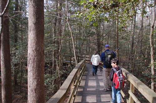
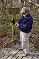
Dwight, Sue, and Adam arrived, and soon we were off, headed down the high boardwalk. The plan was fairly simple. We would stick to the trails and boardwalks for the most part, but we wanted to do a little bushwhacking. We also wanted to find at least one champion tree.
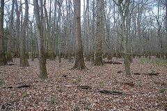
The swamp was much drier than I’ve seen at other times. The first time I came through here with LCU things were wet, but got worse, with the boardwalks flooded by the time we were hiking out. This time it looked like there would be no such problem.
The only drawback was gathering clouds. Rain had not been in the forecast, and I didn’t have a poncho or other rain gear with me. The clouds kept us company most of the day, but nothing came of it.
The hike went fairly quickly, and I was surprise we I found out that we were already 1.2 miles from the visitor’s center. At Wise Lake we left the boardwalk and followed the River Trail. I had the coordinates for several champion trees in my GPS, and our favorite Cherrybark Oak was just off of this path. Eventually we left the trail in search of the large tree. Instead of geocaching, we were “tree”-ocaching.
We did about another mile of off-trail hiking, following my GPS coordinates. I knew this section was fairly safe because we would be keeping the trail mostly on our left and not straying too far afield.
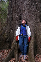
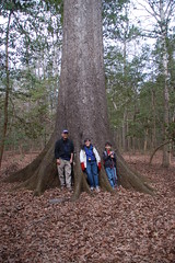
My coordinates were fairly accurate, and at about lunch time we had found our tree. This particular Cherrybark Oak is a state champion, meaning that it’s the largest of its species, based on several parameters, in teh state of South Carolina. We paused for photos, then started unpacking sandwiches.
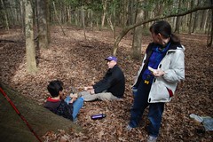
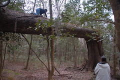
The hike back to the visitors center was a bit more direct. The sun did come out, bathing the swamp with light. We also paused to let Adam try climbing a fallen tree, much to his mother’s dismay.
As the crow flies it’s about 1.75 miles from the visitors center to the cherrybark oak. All told, we probably walked about 4.5 miles on this trek. Normally on these treks I’m using my upper body and arms to paddle, so my legs were really starting to feel it this time.
However, we weren’t done with our explorations. Our next stop was about eight miles to the southeast. We were going to visit the ghost town of Kingville.
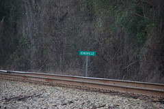
Kingville, also listed as Kingsville on some maps, was an important railroad junction during the Civil War. Many troops passed through the area, and a small town built up around the junction. Sherman’s army marched through here destroying the town and large portions of the railroad. The town was rebuilt, but eventually faded away. More details about Kingville will be included in another post.
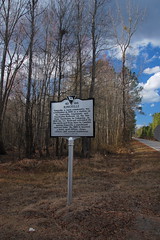
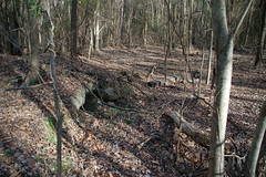
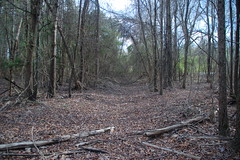
We found the area fairly easy. A historical marker indicates the location of the town at the end of Kingville Road. No structures remain in the town, but we did find several foundations and the ruins of several structures. We also found indications of at least two streets.
The best was yet to come, though. As we were exploring the area an old Buick pulled up and the African American gentleman driver asked if we were interested in the history of the area. We answered that we certainly were. Mr. Joe Wilson turned out to be a wealth of information about the area.
Mr. Wilson pointed across the railroad tracks to where he grew up. His father owned a service station in the area at one time, and had delved into other commerce. Born in 1926, Mr. Wilson remembered many of the old buildings and described their locations to us. He also told us about his time in an all-black Army Air Corps battalion, and his travels to Europe during World War II.
While listening to Mr. Wilson’s stories I was mentally kicking myself for not having my audio recorder in my pocket. I did remember that I had my little Nikon S70 camera with me which would record video. I figured that would have to do, and pulled it out and started recording. Between the wind, my hand covering the microphone accidentally, and hitting the Stop button at the wrong time, I missed most of the conversation. However, I was about to pull a little bit of audio from the file. Here’s a small segment of that conversation…
We could have listened to Mr. Wilson all day. He even invited us up to his house to look at some historical records. Unfortunately, it was getting later in the day. We were invited to come back to the Kingville Reunion held annually in October. Dwight and I said we would have to do that.
As we drove back we stopped at Mt. Olive Baptist Church. On the way to Kingville we had noticed a hand-lettered sign below the church sign pointing to the “Kingville Community Burial Park” and want to know what that was all about. At the church there was some activity going on, and we didn’t want to disturb them, so we continued on our way.
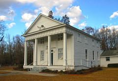
I had noticed one more point of interested that I wanted to go back and check, though. We had passed Congaree Baptist Church out on Highway 48. Since it was on our way back, we decided to stop.
Congaree Baptist had class Greek Revival architecture. However, what had caught my eye was the row of shuttered windows along an upper story, indicating the presence of an old slave gallery.
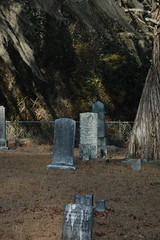
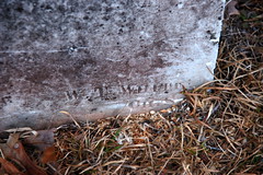
The adjoining cemetery had lots of historic grave stones. I looked at one slab stone and noticed that the stonemason’s name was carved into the headstone. The artist’s name looked familiar, so I checked when I got back home. Sure enough, the same W. T. White from Charleston that carved this headstone also carved several found in the Cedar Springs A. R. P. Church in Abbeville County.
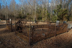
There was one fenced area for the Scott family, obviously a prominent family in the church. The fence had some of the most unusual designs I’d seen anywhere.
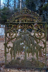
First, the gate had an elaborate willow motif. The cast iron willow was flanked by two lambs.
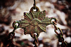
The fence had chains connecting to center points that almost looked like the symbol for the Eye of Ra, then these connected back to the corner posts. At the corner posts the chains appeared to be held in the beaks of some stylized bird. It was all quite intricate and fascinating.
By this time it really was getting late in the afternoon. Also, a cold wind was starting to pick up, and I didn’t think we would enjoy much more outside exploration. I said my goodbyes to Dwight and family, and we headed on back to our homes.
Here’s a slideshow of all of the photos I took…
…and here is a map showing those locations…
View 2-11-2012 Lower Richland County in a larger map
