After spending a Night on Bald Mountain (watching the Geminid meteor shower, not listening to Mussorgsky), Keith and I were off to find a couple of ghost towns in Oconee County. We had two locations in mind – Mayucha and Tunnel Hill.
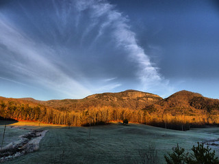
It was still early morning when we left Bald Rock. Our path took us along Highway 11 past Table Rock. There was frost on the fields, and a mist was rising off of Lake Oolenoy.
Mysterious Mayucha
Mayucha is a complete puzzle. It shows up on several lists of ghost towns of South Carolina. However, this is all Wikipedia has on it…
Mayucha was a town that existed in what is now Oconee County, South Carolina, USA from 1850 to the early 1900s.
That’s it – no coordinates like they give for other towns, and no other description. The most information I’ve been able to find was on several treasure hunting websites. Most of this was was posted in online discussion forums years ago by a guy named Kenny Sams, who lists himself as the curator of the South Carolina Gold Museum, a private endeavor that now seems defunct. According to Sams, Mayucha was settled around 1858 by a group of German settlers who were interested in gold mining. There are several mines in the area. Sams described the town as having “many homes and a post office and many stores. This was by no means a small town.” Sams contends that the location of the town has been kept secret for fear of a new gold rush.
Apart from these comments, there is little other information. One reference from the Keowee Courier from July 24, 1903 mentions the establishment of a post office in Mayucha.

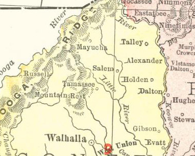
The “Mayucha Falls” mentioned in the paper is now spelled Maiuka, giving a hint that the “ch” is pronounced as a “k”. It does show up on a 1905 map, but no roads are indicated. However, in 1910 it is no longer listed.
Research and inquiries got me no closer to the location. I took the above map and overlaid it onto Google Earth to get an approximate location. As far as I could tell, it was somewhere in the Cheohee Valley, so that was our destination.
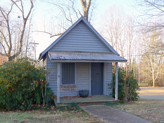
First though, we made a quick detour. One of the comments by Sams indicated that the old post office had been moved to the Tamassee-DAR School campus. Keith and I drove onto the campus and were able to locate the old post office. However, it has a hand-painted sign identifying it as the Tamassee Post Office. At this point, I don’t know what to believe.
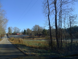
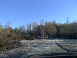
Back out on Highway 11, we turned on to Dynamite Road, then onto the Cheohee Valley Road. It was a beautiful drive through rolling farmland, but there was no indication of the remains of a town. I figured that any town fitting Sams’ description would have to be in relatively flat bottomland, so I paid attention to those areas. He had also indicated that it was on National Forest land, so we drove at least a couple of miles past the Sumter National Forest boundary line.
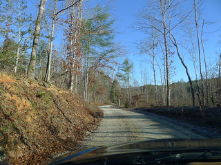
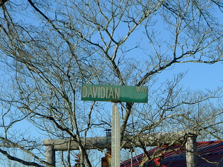
Eventually the pavement gave out. We were hesitant to continue on, especially since the terrain suitable for a town was giving out. One other possibility was up a road called Davidian Way. However, I wasn’t quite sure I wanted to explore that route.
We retraced our route back down Cheohee Valley Road. I had one more stop before we left this area, though. While doing my research on Mayucha I saw that one of my professors from Furman, Dr. Tom Cloer, had spoken at the dedication of a memorial for his great-great-great-grandfather, Daniel Moody. Moody was buried at Wolf Pit Cemetery, which was fairly close to where we were. I had even contacted Dr. Cloer to see if he had any information in Mayucha, but he had never heard of it. It turns out that the Wolf Pit was even more interesting than our futile search for Mayucha.
Wolf Pit School and Cemetery
To be honest, I had been concentrating all of my research on Mayucha, and hadn’t really looked at Wolf Pit. I was first alerted to its existence by the Cloer article. However, once I knew that there was a historic school involved and that it was right within our target area, I had to check it out.
The earliest reference I have to Wolf Pit is as a landmark. An 1890 edition of the Keowee Courier describes new school district boundaries, and references “Wolf Pit”, in quotations.
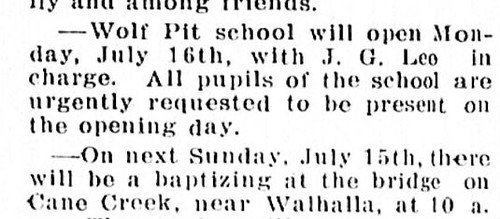
There is one later 1917 reference to the school itself…
…but most of the references in the newspaper are for notices about election precincts. The Wolf Pit Cemetery pops up numerous times on genealogy websites and ancestry registries. However, I can’t find any church associated with the cemetery.
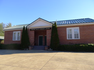
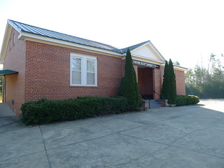
When Keith and I arrived it was still early morning. The school itself was a surprising brick structure, more modern looking than we might have expected. We think the brickwork might have been added later because the overall architecture looks right. It now serves as the Cheohee Community Center, and that sign hangs prominently over the entryway.
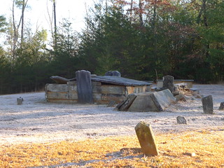
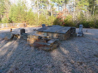
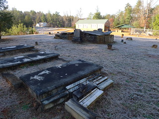
The cemetery is behind the school. Most striking are the unusual above-ground crypts, many of which are in very bad shape.
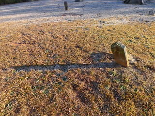
The ground was still frosty, and the shadows of the headstones cast long frost paths across the ground.
I was able to find Tom Cloer’s ancestor, Daniel Moody. Several of the crypts and headstones belonged to members of the Lay family. Jessie Lay was a prominent miner in the area, and his name has popped up in association with Mayucha.
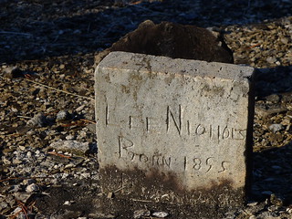
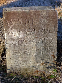
Some of the headstones were hand etched…
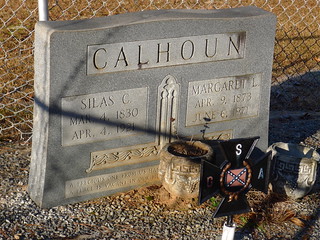
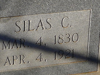
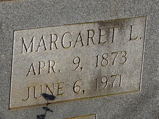
Keith pointed out a classic example of a “Confederate Widow” – a young woman who married an elder Confederate veteran with the expectation that he would die soon and leave her his pension.
In this case the husband was 43 years older than his wife. She was born AFTER the Civil War, and lived until 1971 – 98 years, 50 of those as a widow.
Wolf pit turned out to be a fascinating stop. Even though we hadn’t found Mayucha, the day was already starting out with a bang. Now, though, it was time for breakfast, and to go search for Tunnel Hill.
View Mayucha and Wolf Pit in a larger map



Hey, how’s it going? Nice to finally see someone else on here interested in this mysterious place. I live in East Tennessee, and I moved to the Six Mile area back in about 2004. My brother n law had lived there his whole life, and told me the story about this place. So we decided to go an hunt it out. He had gotten an area map from a guy his wife was friends with who was a land surveyor and he said he actually surveyed in Mayucha. We went to a place called Moody Cove, right off of Cheohee Valley Road if I can remember correctly. There was this large white farm house when you first go in, and we had to sneak our way past it and get behind it. There are two creeks that come off of the mountain back there and merge to flow into the cove. We decided to follow those creeks thinking that the town (being a gold mining town) would more than likely be located on those creeks. Well I think we went the wrong direction because we never found it, and ended up in the National Forest. I feel we were in the general vacinity but we ran outta daylight to go back the other way. I tried like hell for years to get him to go back up there but never could get him to go back. I would really like to find this place sometime. Good luck, and I hope that you find it, and maybe this info might help that is if we were at the right place. Take care… David Busick.
I looked for Tunnel Hill and all I found was open field. I had the GPS coordinates but found zip.
Dennis
Oh, by the way. We found the grave of Samuel L. Moody the postmaster of the town. He told me that legend has it that he went by the nickname black bag Moody cause he always carried a black leather bag on him… Not sure what was in the bag exactly but I am assuming it was probably a large gold nugget from Mayucha!!
Check maps for this waterfall, could be a clue:
Cheohee Or Miuka Falls
This 75 foot waterfall on Townes Creek can be easily viewed with a 45 minute hike. Drive north from Walhalla on SC 28 and bear right on Highway 107. Drive 8.7 miles and park on right. Follow the Winding Stairs Trail beginning at yellow posts on right. Trail turns right after .2 miles, joining Cherry Hill Recreation Area path. Take a sharp left at 1 mile. Continue .3 miles to clearing and hear the falls. Hike through the foliage to the creek.
**Not far from Moody Creek and Lake Cheohee
I know where the gold town Mayucha was located. There is very little left of it. The forest service got rid of most of it so not to keep it up.
Do you have the coordinates of the old town?
Where is it? How to find it from walhalla?
Is it near Moody Cove Rd?
Where is it?
Send coordinates
Where is it
Hello,
i am kenny sams that has the info about the town of mayucha.
anyone may call me and i wil be glad to help you locate it…its very easy to get to.
kenny sams
864-607-0104
kennysams123@gmail.com
posted jan 20 2015
How do I find mayucha
Looking for any signs of my family would have been slaves last name Johnson great great grandfather Thomas Johnson raised family in wolfpit South Carolina.
From the descriptions, it sounds like Mayucha was located on the present day Winding Stairs Road close to its intersection with Jumping Branch Road.
Kenny or Danny, is this correct?
Yes not much left of town you need to know what to look for. I still pan for gold there.
Danny,
I have an interest in finding this town also. I know this is a very longshot as your reply is years old. Would you mind sharing your information about this town.
I’d love to go panning there sometime! Is there a cave somewhere they used to mine gold from? Always heard a legend that it was cursed and whoever tried to take gold from it would die. Never found the place to check it out.
This is all very interesting. Does anyone have the GPS coordinates to Mayucha?
There is a very wide road near yellow branch that leads down towards winding stairs and jumping branch. You can locate a large cliff face that was obviously quarried for stone. We guessed that there was possibly a hammer mill somewhere and we were able to find one of the hammers. The three of us could barely manage to lift it up. Back then they would not have went to such laborious work unless it was for something important. My guess that the town was located in this area.
I had heard there was a post office, at one point, maybe just a foundation left now if that. Also heard about a cursed cave that they used to mine gold out of? Never have had this accurately confirmed by anyone. I would appreciate it if someone could though.
Most all of the ones that had knowledge of all this are diseased . I married into this Alexander family in the 70’s and I’ve herd of all the tales that were told and passed down through the generations . We owned some pasture (bottoms) land near WOLF PIT Cemetery where my husband was cleaning up an old log building up on a hillside that had fell in when he discovered a grave site of a STAR GENERAL ; there is no history of this that we could find but the stone is in the ground …
Hey! Great write up Sir. I would like to add that the small building on campus TDAR school is in fact the first Tamassee PO. The school itself was founded in 1919. I was on staff from 1987 till 1995,wonderful area and folks. I am also interested in this lost town for I believe my 3rd great grandfather had land nearby,I’m trying to make a family tree and he is a mystery.
Jeff
Hello, to you Mr. Sam’s,,have not seen you last time was 2000,,, I’m Tim Green,anybody interested in hiking them hills let me know …
was in the area last week(May 2022)….dvex@bellsouth.net
my name is Steve Rushton
Just a bit of information: Please keep in mind that if you are on Forest Service land, you are not able to dig for anything. Also, if you want to pan for gold go to the FS office near Mountain Rest and get a panning permit (they are no cost). If you find any equipment or artifacts also leave them there and alone so that you don’t end up getting into trouble with the FS. Hate to see anyone who is out trying to have fun end up going to court in Greenville with a ticket. Have a great day!
Have been up an over them there hills,x infantry here,,lots of places I still want to hike,use to belong to the LDMA,,,MR.SAMS WAS FIRST CARETAKER …GREAT GUY….
So Mr. Sam’s has passed away. I just found all this information about the town. I would love to find it. I have driven all through the area, looking at its beauty. I would appreciate any information in finding it. Thanks Craig
Some one has fed you some wrong information as usual.
I am still very much alive and well living in the Pickens area.
Mr Sam’s, is your phone number still the same listed in this thread?
random connections is quite the appropriate name. I stumbled onto this site following the death of my grandfather. his wife, my grandmother, is a fowler, descendents of orr, descendents of lay, which is how i found this site. I have traced my lineage back to James M Lay (b. 1798?) so far and am humbled to have been brought here. my grandparents lived not a mile past the 28/107 split, down the road from yellow branch/stumphouse. i recall my grandfather taking me to Moody Spring on the side of 107 as a child, perhaps named after the moodys mentioned here! they had to move closer to family here in charleston in 2020 due to aging. fascinating stuff!
Mr Seth
Would you possibly be available for a phone call conversation on your family history.
Please feel free to reach out to me by email and we will certainly set up a call.
kimbleseth62@gmail.com
Please tag “Wolf Pit” in the subject.
Thanks!
I think that the cave is in a different place my mother. Jodean Alexander could tell you a lot she went to school at the Wolf Pit school I think.i was an Alexander and I was raised up in the Cheohee Valley area
i have been looking for this for years could anyone lead me in the right direction