I had Monday off as part of the 4th of July weekend. My brother, Houston, and my sister, Glynda, also had the day available, so we decided to go on another photo exploration. This time our target was our old stomping grounds around Laurens, South Carolina.
Houston had some specific locations he wanted to see if we could find. Most of these were in the old Long Branch area, but we knew we would get sidetracked in route. I picked up Glynda and Houston at the family home in Gray Court. Armed with GPS, maps, and more cameras than we had passengers, we set out.
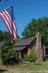
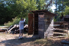
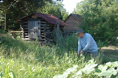
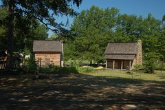
We actually didn’t get very far. At the south end of Gray Court is the historic farm area that the Gray Court-Owings Historical Society has put together. Glynda and Houston weren’t aware of this place, so we spent a good bit of time looking at the old cabins and farm implements and taking pictures of these.
We headed south along Highway 14, but took the old Laurens Road when we came to the community of Narnee. We were headed for a couple of macabre locations in Laurens History.
First up was Ghost Creek Road. There are several tales of hauntings in the area and how the road got its name. Most involve some sort of accident at the bridge across the little creek, and most of these are very inconsistent. One tells of an engaged couple that wrecked, killing the young man. His ghost supposedly haunts the area. Another says that a young mother and child wrecked. The child was saved, but the mother died. She roams the area looking for her child. I haven’t been able to find any other references, but most likely the name of the road is historic, and these tales were invented later simply because of that name.
Ghost Creek Road connects to the Ranch Road, which is another road with a tragic past. The bend where the road crosses Little River was once known as “Dead Man’s Curve.” According to my cousin, Melba, three of her Ford High School classmates had been drinking at the Ranch Restaurant, about a mile away. They lost control on the curve. Two of the boys were killed. This would have been in the 1960s, and I’m looking for documentation of this accident, or any others that might have taken place here.
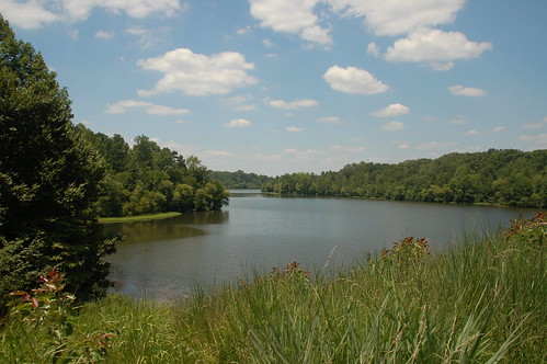
Our route took us on into Wattsville. We stopped at the little business district and looked at the old mill that is being torn down. Glynda wanted to find a place where there had been some springs, but we weren’t able to locate them. We didn’t stay long, but headed on into downtown Laurens after winding through several of the narrow side streets.
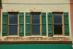
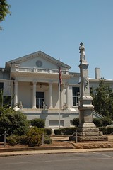
The Laurens Square was quiet, with most of the businesses closed for the holidays. We walked around and took a few photos.
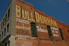
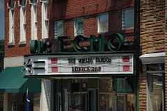
We talked reminisced about what stores had been open when we were young, and how the town has changed.
Lunch was a hot dog plate at Whitefords, then we set off in search of Houston’s targets. He remembered a wooden bridge in the area near the old Laurens Reservoir and wanted to see if we could find it. I could find the Old Clinton Reservoir on my maps, but not one with the name “Laurens.”
From Laurens we cut across the country and more family history as we headed toward the Long Branch Community. Of course, we had to drive up to the old church, and hit a couple of other locations, such as the presumed location of our great-grandparents home.
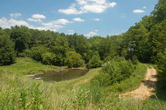
At Goodwin’s Crossroads we turned off of 308 onto Bethany Church Road. From there I found a tiny little road called “Reservoir Road”. It was the one that Houston remembered. The road ended below the reservoir dam. The bridge was no longer there, but the concrete and stone abutments were still visible.
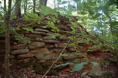
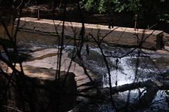
We could tell from the placement of the supports that this had been one very tall, scary wooden bridge, and Houston remembered it as such. Duncan Creek now flowed peacefully over the exposed rocks below the earthen reservoir dam.
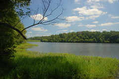
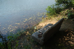
I climbed the dam so I could get a good view of the lake and the area below. There were no visible houses or any development. I did see a couple of folks fishing.

Both Houston and Glynda said that they had been baptized in this lake, and remembered other trips to the lake. There was supposed to be access on the other side. Since the bridge was no longer there, we had to find another route.
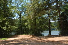
I turned onto Langston Church Road, and found another “Reservoir Road”. This one was dirt, but it looked like it would have continued on to the old bridge. Another dirt road turned off of it, and led down to an access point for the lake.
This area looked like it was heavily used by fishermen. Unfortunately, it also looked like it had been trashed mercilessly. There were multiple fire rings and camp areas, beer bottles, and even a tarp set up as a privy with human waste in it.
Houston was interested in the lake as a possible kayaking venue. I found the place depressing because of the trash. Some other undefinable something made Glynda very uneasy about where we were – something about the woods themselves. She was more than ready to leave.
I did find out later that the entire area is owned by the city of Clinton, and leased to SC Department of Natural Resources. The lake and surrounding areas are open to fishing and hunting in season. I just wish that they wouldn’t trash the place so much.
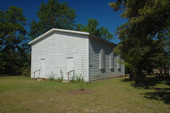
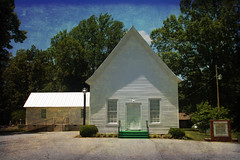
We made our way back along dirt roads that really put my Subaru’s all-wheel drive to its test. It performed admirably. We paused briefly at the historic Langston Baptist Church for a couple of photos.
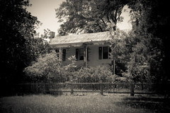
Eventually we made it back to Highway 308 and wound up in the community of Ora. Just off of the main highway stands the old Blakely House. This house, built around 1860, has been nominated for the National Register of Historic Places. We were very tempted to go on in and explore, but we limited ourselves to a few shots of the exterior.
There was one more place Houston was bound and determined to find. Somewhere back in the Ghost Creek Road area was a spring and natural amphitheater where political rallies were once held. We did finally find it, but it was off of Bramlett Road instead of Ghost Creek. The area was overgrown, so Houston was the only one to get out an explore. He was able to find the spring, as well as old beech trees with names carved into them. I remember visiting here as a child and seeing remains of old benches that were used in the rallies. Try as I might, though, I’ve not been able to find any other information about the area.
By this time we were getting pretty tired so we headed back to Gray Court. It had been another successful photo trek, this time through our own immediate family history and old stomping grounds. It gave me ideas for other areas I would like to explore when I get a chance.
Ah Tom…the only thing you left out was the glorious brownies (made by Laura) and Cafe du Monde we ended with back at the Gray Court house! Thanks for a great day!
Great post and photos! Love hearing tidbits about lesser know Upstate areas! Mind sharing the location of the natural amphitheatre on Bramlett Road?