Skip to content

Random Connections

A collection of photography and exploration focusing on Upstate South Carolina and beyond.

  • Home
  • About Us
  • Photos
  • Resources
  • Other Voices
  • Post Archives
  • Podcast
  • Home
  • Google Earth
  • Page 3

Tag: Google Earth

Adding Google Earth to PowerPoint

Posted on May 6, 2009 By Tom 4 Comments on Adding Google Earth to PowerPoint
EdTech, Geocaching and Maps, Internet

I occasionally check to see what leads people to this website – what search terms they are using to find me, or what sites link to this one. Lately I’ve gotten lots of hits from search engines with people trying to find out how to embed Google Earth into Powerpoint. I had posted something a … Read More “Adding Google Earth to PowerPoint” »

South Carolina Heritage Corridor

Posted on March 29, 2009 By Tom 2 Comments on South Carolina Heritage Corridor
Geocaching and Maps, Local, Travel

While out driving the rural highways of South Carolina you may have come across a road sign with this symbol… Seeing a road sign like this lets you know that you are on either the South Carolina Discovery Route, or the South Carolina Nature Route, both parts of the South Carolina Heritage Corridor. On the … Read More “South Carolina Heritage Corridor” »

SCETV Technology Workshops

Posted on March 19, 2009 By Tom No Comments on SCETV Technology Workshops
EdTech

For the past three days I’ve been in Columbia doing workshops SCETV. As I’ve done for the past three years, I’ve offered training at various levels in Google Earth. It was a busy three days, and I didn’t have much time to blog during that time. Still, it was a good experience. SCETV always puts … Read More “SCETV Technology Workshops” »

Searching for the Towers

Posted on February 17, 2009 By Tom 2 Comments on Searching for the Towers
Geocaching and Maps, Local, Miscellaneous

You would think that something that stands 100′ high would be easy to find.  Certainly, when you’re close enough they are very visible.  However, locating lookout tower sites on maps turns out to be harder than I had thought. I knew of several definite locations such as the Duncan Tower, Glassy Mountain, Paris Mountain, and … Read More “Searching for the Towers” »

Google Releases Google Earth version 5

Posted on February 2, 2009 By Tom 1 Comment on Google Releases Google Earth version 5
Geocaching and Maps

Today I found out from Frank Taylor’s Google Earth Blog that Google has released version 5 of Google Earth.  I had to run out and update my copies of the program right away.

At first glance there doesn’t appear to be much different.  The buttons are altered slightly but the overall user interface hasn’t changed.  However, there’s quite a bit new in this release, most of it under the surface (literally.)

The brand-new flashier bits in this version are as follows:

Google Ocean – greater details of the ocean floor had already worked their way into the last release of version 4.  However, now users can plunge beneath the water’s surface to explore.  A new folder of points of interest has been added to accompany the new feature.

Google Mars – Now users can switch between Earth, Sky, and Mars.  The imagery is quite impressive.  However, make sure that you de-select any of your terrestrial layers.  It was a bit disconcerting to see earth-bound geotagged Flickr images on Mars.

Historical Images – To me, this is one of the coolest new features.  When activated from a button on the tool bar, a slider appears.  If there are any historical images of that location, slide the bar to the left to view them.  It’s great for tracking changes over time.  For example, here’s a view of the Reedy Falls Park area from 1994, prior to construction of the Liberty Bridge and Falls Place…
Read More “Google Releases Google Earth version 5” »

A Geeky New President

Posted on January 21, 2009 By Tom No Comments on A Geeky New President
General Technology, Geocaching and Maps

There were ample opportunities for someone like me to really get their Geek on while watching the inauguration.  First there was the Hive Mind experience of sharing the inauguration in real time with friends (and strangers) separated by thousands of miles on Twitter and Facebook.  Then there was the ability to get multiple perspectives from … Read More “A Geeky New President” »

Google Earth Censorship for DC

Posted on January 19, 2009 By Tom 1 Comment on Google Earth Censorship for DC
Geocaching and Maps

Frank Taylor’s Google Earth Blog had an interesting post this morning about updated imagery for Washington D. C., what with the inauguration upon us and all. Frank’s focus was on the realistic 3D imagery now available for the Capitol Building and other locations. I was more interested in what he had discovered about censorship of … Read More “Google Earth Censorship for DC” »

Secrets Revealed in ArcGIS Explorer

Posted on October 2, 2008 By Tom 8 Comments on Secrets Revealed in ArcGIS Explorer
Geocaching and Maps

ArcGIS-Explore-Screen-Captu

LongArcGIS-Explore-Screen-Captu

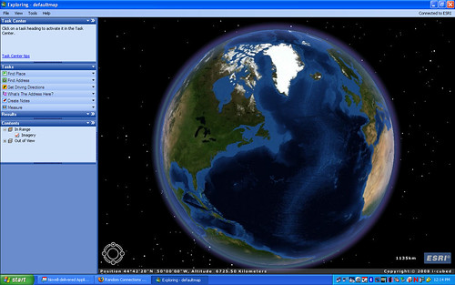
Long before Google Earth came on the scene there was ArcGIS from ESRI. There are two (actually, multiple) flavors of this. There were the professional GIS versions consisting of ArcMAP and ArcServer, and a free viewer, ArcExplorer. I attended a couple of workshops on ArcExplorer, was impressed by its potential for the classroom, but never really got into it. Along came Terraserver making free satellite imagery available, then Google Earth took the world by storm, somewhat obscuring these previous free mapping services.

While working on another project I needed to check out ArcGIS Explorer once again, and was surprised to find that it now looks very much like Google Earth with a similar user interface. Navigation is essentially the same – you can zoom in, tilt, and pan just like in GE. There are search functions and you and create placemarks. While Explorer will open KML files, it’s designed to be more compatible with ArcGIS data.

Google Earth has a much larger user-contributed base. However, there is much more accurate GIS data available for Explorer from various GIS organizations around the world. When comparing the free versions of these programs, you could think of Google Earth as being more populist, and ArcGIS Explorer as more professional.

Read More “Secrets Revealed in ArcGIS Explorer” »

Two Quick Earthly Diversions

Posted on July 1, 2008 By Tom No Comments on Two Quick Earthly Diversions
Geocaching and Maps

Here are two quick video links that I found while browsing my RSS feeds this morning. Oddly enough, both are hosted on Vimeo.com, but I found them linked from different sources. First is the video “Where the Hell is Matt?” found link in an article on BoingBoing.net. Matt is a 31 year old slacker who … Read More “Two Quick Earthly Diversions” »

Greenville in Street View!

Posted on June 11, 2008 By Tom 1 Comment on Greenville in Street View!
Geocaching and Maps

Much of the Upstate, including Greenville, is now available in Google Street View. Last night I discovered that Columbia and Charlotte had been added, and this morning Greenville was also on the list. The blue areas in the map below show the current coverage: In Google Earth, the coverage is a bit deceptive. There are … Read More “Greenville in Street View!” »

Posts pagination

Previous 1 2 3 4 5 Next

Categories

  • EdTech (197)
  • Entertainment (202)
  • Family (123)
  • Gear (114)
  • General Technology (98)
  • Geocaching and Maps (208)
  • History and Genealogy (275)
  • Internet (142)
  • Local (459)
  • Miscellaneous (560)
  • Music (202)
  • Paddling (268)
  • Photography (781)
  • Podcast (19)
  • Rambling (233)
  • Rants (162)
  • Recipes (37)
  • Religion (48)
  • Restaurants (165)
  • Science (48)
  • Things Overheard (29)
  • Travel (413)
  • Uncategorized (143)
  • Washington Sabbatical (113)
  • Weirdness (61)

Recent Posts

  • Helene One Year Later
  • Once Again, Up the Long Nose
  • Upstate Renaissance Faire
  • Exploring Lake Summit
  • The End of Days

Recent Comments

  • Gay on In Search of the Road Builder
  • Virgil Howell on The Ghost Towns of Lake Marion
  • Virgil Howell on Return to Ferguson
  • Mary Copeland Myers on Renno and Stomp Springs
  • Virginia Pepper on Helene One Year Later

Tags

blogging cemetery Christmas Columbia Edisto River edtech Entertainment family Flickr Florida Furman Furman University gear Georgia geotagging Ghost Town Ghost Towns Google Earth Google Maps GPS Greenville Greenville Chorale history Instructional Technology kayaking Lake Jocassee LCU Lowcountry Unfiltered maps Music North Carolina Paddling Photography rambling restaurant Restaurants review singing social networking South Carolina time-lapse Travel video Washington Washington State
October 2025
S M T W T F S
 1234
567891011
12131415161718
19202122232425
262728293031  
« Sep    

Copyright © 2025 Random Connections.

Theme: Oceanly by ScriptsTown