Skip to content

Random Connections

A collection of photography and exploration focusing on Upstate South Carolina and beyond.

  • Home
  • About Us
  • Photos
  • Resources
  • Other Voices
  • Post Archives
  • Podcast
  • Home
  • Google Earth
  • Page 2

Tag: Google Earth

Creating Effective Google Earth Tours

Posted on May 26, 2010 By Tom 3 Comments on Creating Effective Google Earth Tours
Geocaching and Maps, Internet

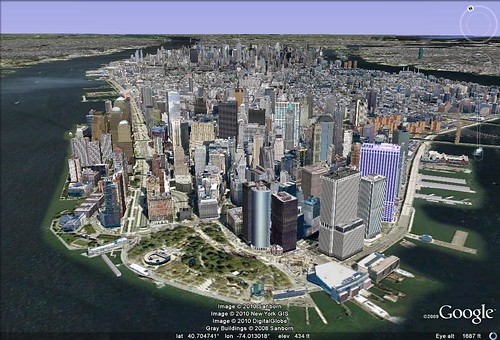
Manhattan GE 3D

The folks over at the Google Earth Design blog have been running a series on creating Google Earth tours.  They have had some excellent suggestions for creating effective tours. (Part 1, Part 2).  It was enough to get me to try creating a tour or two.

For some reason I haven’t done much with GE Tours.  To me they seem passive in a constructivist classroom.  If I’m doing a presentation, I prefer to use a series of placemarks that I access as needed, rather than a fixed tour.  In fact, the GE Design Blog states the following:

If changes of scale and location are not important your narrative it is quicker and just as effective to use presentation software such as PowerPoint.

However, their blog posts inspired me to at least give it a shot.  I won’t repeat all of their suggestions, but here are a few things I learned…
Read More “Creating Effective Google Earth Tours” »

Telling Time in Google Earth, Part 2

Posted on May 6, 2010 By Tom 1 Comment on Telling Time in Google Earth, Part 2
Geocaching and Maps, Science

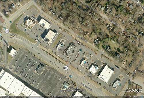
North Pleasantburg

Yesterday I presented readers with a problem – Can you tell the approximate time of day an image was created in Google Earth? Using the image above of Cherrydale Shopping Center in Greenville, I pointed out some clues and some strategies for making a guess. Here’s another, sure-fire way of figuring out the problem…

Read More “Telling Time in Google Earth, Part 2” »

Does Anyone Really Know What Time It Is?

Posted on May 5, 2010 By Tom 2 Comments on Does Anyone Really Know What Time It Is?
EdTech, Geocaching and Maps

Here’s an interesting activity you can do with students using Google Earth. It helps if you use the actual program (or the satellite view in Google Maps) instead of a static image so that students can zoom in and out…


View Larger Map

The above Google Earth image is of the Cherrydale Shopping Center in Greenville. Using only clues from the image, can you tell me the following:

  1. About what time of day was the image captured?
  2. What month was the image captured?

Good luck!

Read More “Does Anyone Really Know What Time It Is?” »

Google Earth Meets Google Maps

Posted on April 28, 2010 By Tom No Comments on Google Earth Meets Google Maps
Geocaching and Maps

Google Earth is now accessible through a browser via the Google Maps page.  The plug-in for Google Earth has been available for quite some time now, so this is only a natural progression.  On the Maps page there is now an “Earth” view in addition to Map and Satellite.  Terrain has been relegated to the … Read More “Google Earth Meets Google Maps” »

Adding Google Earth to PowerPoint – Another Method

Posted on April 26, 2010 By Tom 3 Comments on Adding Google Earth to PowerPoint – Another Method
Geocaching and Maps

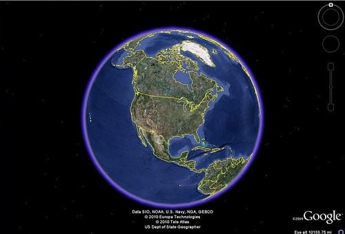
Google Earth

I recently received a request for help from one of my readers regarding Google Earth and PowerPoint.  The reader wanted to know how to put a Google Earth tour into PowerPoint.  This website gets lots of hits from folks wanting to learn how to embed Google Earth into their presentations, but Google hasn’t made it easy.  Therefore, I’ve put together a tutorial for one method, but first it might be helpful to clear up a few things.

  1. Google Earth Tours – Yes, you can create and save tours.  However, the files that are created are KMZ files that can only be opened in Google Earth.  These are NOT video files, and they cannot be easily imported into another program.
  2. Embedding Google Earth – Right now there is no good way to get Google Earth to play in a PowerPoint slide.  You could create a link on your slide that opens a KMZ file outside of PowerPoint in Google Earth itself.  You could also embed a web page that has the Google Earth plug-in for web enabled, but that get’s to be more complicated than it’s worth.

I’ve already demonstrated how it’s possible to add PowerPoint slides to Google Earth.  However, I still get inquiries for the other way around – adding Google Earth to PowerPoint, even though the two points above make it difficult, if not impossible.   Well, there are a couple of ways, but they’re not perfect.  The first involves just exporting static images from Google Earth and putting those images into your slides.  The other involves video screen capture.  Here’s how it’s done…

Read More “Adding Google Earth to PowerPoint – Another Method” »

iFrame Is Your Friend (in Google Earth)

Posted on March 27, 2010 By Tom 2 Comments on iFrame Is Your Friend (in Google Earth)
EdTech, Geocaching and Maps

It’s funny how things work out sometimes.  I was putting together that last post and stumbled upon a whole world of new possibilities for embedding content into Google Earth.  I noticed that several of the embed codes used the <iframe> code and just referenced a URL for the embeddable media.  I began to wonder if … Read More “iFrame Is Your Friend (in Google Earth)” »

Three Collaborative Google Earth Projects

Posted on March 26, 2010 By Tom No Comments on Three Collaborative Google Earth Projects
EdTech, Geocaching and Maps

Google Earth

I had wanted to entitle this post “Cool Google Earth Lesson Plans That Don’t Really Use Google Earth”, but I figure that would be a bit wordy. The idea was taken from my “Creating Media Rich Lessons with Google Earth” presentations that I’ve been doing lately. One of the strategies in that presentation is to embed content from other sources into Google Earth. As I was giving some examples to the workshop participants, it occurred to me that you could do a collaborative project in Google Earth where kids do most of their work in some other application, bringing these together at the last minute in Google Earth. Here are a few of those ideas, and the applications needed.

Read More “Three Collaborative Google Earth Projects” »

SCETV Workshops Spring 2010

Posted on March 18, 2010 By Tom No Comments on SCETV Workshops Spring 2010
EdTech

The time-lapse video above gives some indication of the frenetic pace I’ve been hitting this week. Several months ago I agree to once again do my Google Earth workshops for the SCETV Technology Conference. Had I known how hectic these past two weeks were going to be even without the conference, I might have reconsidered. However, despite PASS testing, 135th day counts, and other pressing needs in Spartanburg Five, I headed on down for the Wednesday – Friday sessions.

As I had done last year, I’m presenting two different sessions. The first is a basic introduction to Google Earth. The teachers get some time just to become familiar with the program’s controls and navigation, and I give them some suggestions for using it in their classrooms. The second session is more in-depth. I cover ways that Google Earth can be used to create highly interactive lessons buy using embedded media. I tend to get lots of oohs and ahs with that session because there is some really cool stuff you can do.

Wednesday we had a luncheon and were joined by several representatives from Discovery Education. Phillipe Cousteau, grandson of Jaques Cousteau, was our keynote speaker. In the evening the Discovery Educators Network (DEN) STAR members had a dinner at the SCETV studios, and we were again joined by Phillipe Cousteau. He spoke about some of his current environmental education endeavors.

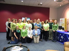
DEN Star Educators DinnerPhillipe Cousteau addresses the DEN groupDEN Star Educators at SCETV

Read More “SCETV Workshops Spring 2010” »

Paddling South Carolina’s Rivers

Posted on October 28, 2009 By Tom 22 Comments on Paddling South Carolina’s Rivers
Geocaching and Maps, Paddling

South Carolina Rivers

File – Paddling South Carolina Rivers (KMZ, 1.5 MB)

Google Earth has been one of the best resources for planning river kayaking trips, especially on new routes with which I’m not familiar. I’ll scan the route, locate put-in and take-out points, and put placemarks for certain landmarks such as rapids, powerlines, bridges, tributaries, or other interesting locations along the way. I would then use GPS Babel to convert my Google Earth files to GPX files then upload the data to my GPS so I would have it with me on the paddling trip.

Pretty soon I had a nice little collection of river trips in Google Earth. I began to wonder if anyone else was doing this. It seemed like it would be an excellent resource. There are some excellent books out there, such as Able and Horman’s Paddling South Carolina, and while the maps in these resources are fine for giving driving directions, there is no GPS information. SCTrails.net has started putting Lat/Long coordinates for some of their paddling trails, but not for all of them. So, I decided to make my own collection.

Read More “Paddling South Carolina’s Rivers” »

SCETV Summer Workshops

Posted on July 30, 2009 By Tom No Comments on SCETV Summer Workshops
EdTech

DSC_2090

This week SCETV is holding its summer technology workshops. Normally I’m so busy building new schools and putting in computers that I can’t take part in the summer workshops. This summer, however, I decided I would try to make it. I figured that during summer there would be better participation than there might during the school year.

Last spring I did three sessions each day, which meant that I had no down time nor opportunity to visit any other sessions. This time I cut one of my presentations, so I would only be doing two workshops each day – Basic Google Earth and Creating Interactive Lessons with Google Earth. I had also been asked to conduct a geocaching activity one of the afternoons.

Read More “SCETV Summer Workshops” »

Posts pagination

Previous 1 2 3 … 5 Next

Categories

  • EdTech (197)
  • Entertainment (201)
  • Family (123)
  • Gear (114)
  • General Technology (98)
  • Geocaching and Maps (208)
  • History and Genealogy (275)
  • Internet (141)
  • Local (458)
  • Miscellaneous (557)
  • Music (202)
  • Paddling (265)
  • Photography (781)
  • Podcast (17)
  • Rambling (233)
  • Rants (161)
  • Recipes (36)
  • Religion (48)
  • Restaurants (165)
  • Science (48)
  • Things Overheard (29)
  • Travel (413)
  • Uncategorized (143)
  • Washington Sabbatical (113)
  • Weirdness (59)

Recent Posts

  • Carolina Ghost Towns – Mitchellville
  • Carolina Ghost Towns – Paper Towns
  • Kayaking on Wolf Creek Lake
  • Carolina Ghost Towns – Colonial Dorchester
  • Six Layer Bourbon Grits Bowl

Recent Comments

  • Eric Kincaid on Kayaking and Coffee
  • Daniel S Mawn on Remembering the Walke
  • Judy Hall on The Clock on Wade Hampton
  • Charles Johnson on In Search of the Road Builder
  • Anthony h hannig on From Kingsbury to Stoneboro – Rambling in Lancaster County

Tags

blogging cemetery Christmas Columbia Edisto River edtech Entertainment family Flickr Florida Furman Furman University gear Georgia geotagging Ghost Town Ghost Towns Google Earth Google Maps GPS Greenville Greenville Chorale history Instructional Technology kayaking Lake Jocassee LCU Lowcountry Unfiltered maps Music North Carolina Paddling Photography rambling restaurant Restaurants review singing social networking South Carolina time-lapse Travel video Washington Washington State
June 2025
S M T W T F S
1234567
891011121314
15161718192021
22232425262728
2930  
« May    

Copyright © 2025 Random Connections.

Theme: Oceanly by ScriptsTown