Skip to content

Random Connections

A collection of photography and exploration focusing on Upstate South Carolina and beyond.

  • Home
  • About Us
  • Photos
  • Resources
  • Other Voices
  • Post Archives
  • Podcast
  • Home
  • Geocaching and Maps
  • Page 9

Category: Geocaching and Maps

0

iFrame Is Your Friend (in Google Earth)

Posted on March 27, 2010 By Tom 2 Comments on iFrame Is Your Friend (in Google Earth)
EdTech, Geocaching and Maps

It’s funny how things work out sometimes.  I was putting together that last post and stumbled upon a whole world of new possibilities for embedding content into Google Earth.  I noticed that several of the embed codes used the <iframe> code and just referenced a URL for the embeddable media.  I began to wonder if … Read More “iFrame Is Your Friend (in Google Earth)” »

Three Collaborative Google Earth Projects

Posted on March 26, 2010 By Tom No Comments on Three Collaborative Google Earth Projects
EdTech, Geocaching and Maps

Google Earth

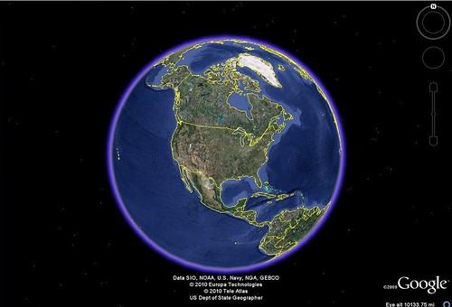
I had wanted to entitle this post “Cool Google Earth Lesson Plans That Don’t Really Use Google Earth”, but I figure that would be a bit wordy. The idea was taken from my “Creating Media Rich Lessons with Google Earth” presentations that I’ve been doing lately. One of the strategies in that presentation is to embed content from other sources into Google Earth. As I was giving some examples to the workshop participants, it occurred to me that you could do a collaborative project in Google Earth where kids do most of their work in some other application, bringing these together at the last minute in Google Earth. Here are a few of those ideas, and the applications needed.

Read More “Three Collaborative Google Earth Projects” »

US 1

Posted on March 23, 2010 By Tom 10 Comments on US 1
Geocaching and Maps

When I was about 12 years old my brother-in-law gave me a Rand McNally Road Atlas. I had already been collecting maps for some time, so having an atlas with a map of every state in the US was a dream come true. I pored over every state, plotting out extended road trips.

One road that especially caught my attention was US 1. First, there was its primacy in the numerical highway system. It must be important if it’s number 1. Then, there was the route. It runs all the way from Key West, Florida, to the northernmost point in Fort Kent, Maine. And finally, there were all of the interesting cities that it connected – places I’d never been, such as Washington, D. C., Philadelphia, New York, and Boston. It seemed like the perfect highway to me.

Recently I’ve had the occasion to drive different segments of US 1 – in Columbia last week, in Florida two weeks ago, and in Maine over this past summer. The recent jaunts on this highway rekindled my interest, so I started exploring the route in Google Earth, and trying to find out what I could about its history.

Read More “US 1” »

Test-Driving the Eye-Fi Explore

Posted on March 8, 2010 By Tom 2 Comments on Test-Driving the Eye-Fi Explore
Gear, Geocaching and Maps, Photography

Eye-Fi

I’ve been interested in these little gizmos for some time now. The Eye-Fi Explore is an SD card that will automagically upload your photos to your online photo service of choice whenever it comes within range of an open wireless network. Not only that, it uses some strange alchemy to geotag your photos each time you click the shutter. It sounded like the perfect photographic tool, but also the promises seemed too good to be true. I was hesitant to make the investment until I saw that Woot.com had one for a dirt-cheap price. I decided to give it a shot. I found it both to be about as amazing as I expected, and about as frustrating as I imagined.

Eye-FiThe Eye-Fi comes with the SD card (2 GB in my case, but available up to 8 GB) and a USB card reader, as shown above. The management software comes on the card itself, and automatically launches when the device is first plugged into the computer. The first thing I discovered is that you must have wireless access to configure the device. Just being connected to a computer with Internet access isn’t enough.

There are lots of parameters that can be set with the device. You can choose your photo hosting service (Flickr, in my case) and even set up separate routing for videos, so your photos may go to Flickr, but your videos to YouTube. You can set the device to connect and upload automatically to any wifi hotspot, or only when it comes within range of specified hotspots. I always like to edit my photos before they go public, so I set the privacy settings so that I would be the only one to see them on Flickr. You can also enable/disable geotagging.

Eye-Fi-Screen-Two

The most amazing thing is that this device actually works. I tried it in both my Fuji WP33 and my Nikon S70. It took photos, and when I turned the camera on in the presence of a wireless network, it uploaded the photos to my Flickr account without any interaction from me.

Read More “Test-Driving the Eye-Fi Explore” »

Please Rob Me

Posted on February 24, 2010 By Tom No Comments on Please Rob Me
Geocaching and Maps, Internet

There’s a new website that’s been getting quite a bit of press lately. It’s called “Please Rob Me,” and it scans Twitter updates for people who have indicated that they are somewhere other than at home. The idea isn’t to enable thieves, but to highlight the carelessness of letting everyone know where you are every … Read More “Please Rob Me” »

DARPA Challenge Update

Posted on December 6, 2009 By Tom 1 Comment on DARPA Challenge Update
Geocaching and Maps, Internet

Well, that didn’t take long. By 5:00 PM DARPA had already announced a winner in their 2009 Challenge. The challenge was supposed to last through December 14, but it was obvious from early on that it wouldn’t take that much time. As shown on the map above, the balloons were located in places where it would have been hard to miss them (although there is a large wedge of the Midwest with no ballooons.) The winner was the team from MIT.

I didn’t participate in the challenge as I thought I might. However, I did check in on the progress from time-to-time on Twitter. It was interesting to watch the competition progress. Most of the Twitter traffic seemed to be from those involved in the hunt, and I saw only one from someone that seemed to have honestly stumbled upon one (…sort of, but more on that in a bit.)

As I saw reports of balloons I wondered if I shouldn’t try to find the location and report them as my own. However, I figured that if the reports were THAT public, then others would have reported them. I just decided to watch the spectacle.

Read More “DARPA Challenge Update” »

Geocaching at Paris Mountain State Park

Posted on November 22, 2009 By Tom 4 Comments on Geocaching at Paris Mountain State Park
Geocaching and Maps

Several weeks ago Bill Bradshaw from the Roper Mountain Science Center asked if I would be willing to do a workshop on geocaching at Paris Mountain State Park.  I agreed, planning to do a repeat of the Discovery Educator’s Network workshop I did this past summer at the SCETV studios.  I began coordinating the activity … Read More “Geocaching at Paris Mountain State Park” »

Paddling South Carolina’s Rivers

Posted on October 28, 2009 By Tom 22 Comments on Paddling South Carolina’s Rivers
Geocaching and Maps, Paddling

South Carolina Rivers

File – Paddling South Carolina Rivers (KMZ, 1.5 MB)

Google Earth has been one of the best resources for planning river kayaking trips, especially on new routes with which I’m not familiar. I’ll scan the route, locate put-in and take-out points, and put placemarks for certain landmarks such as rapids, powerlines, bridges, tributaries, or other interesting locations along the way. I would then use GPS Babel to convert my Google Earth files to GPX files then upload the data to my GPS so I would have it with me on the paddling trip.

Pretty soon I had a nice little collection of river trips in Google Earth. I began to wonder if anyone else was doing this. It seemed like it would be an excellent resource. There are some excellent books out there, such as Able and Horman’s Paddling South Carolina, and while the maps in these resources are fine for giving driving directions, there is no GPS information. SCTrails.net has started putting Lat/Long coordinates for some of their paddling trails, but not for all of them. So, I decided to make my own collection.

Read More “Paddling South Carolina’s Rivers” »

New Geocaching Restrictions

Posted on August 30, 2009 By Tom 2 Comments on New Geocaching Restrictions
Geocaching and Maps

No Geocaching

A new law was passed by the state of South Carolina and signed by the governor on June 2 that places significant restrictions on geocaching activities in Department of Natural Resources lands, including wildlife management areas and heritage preserve areas. This law seems to have passed under the radar of local geocaching organizations, and hasn’t gotten much discussion – until now.

The new law states the following (and I’m copying this directly from the USCG website as edited):

Section 50 11 2200 (C)

(C) The following acts or conduct are prohibited and shall be unlawful on all wildlife management areas, heritage preserves, and all other lands owned by the department; provided, however, the department may promulgate regulations allowing any of the acts or conduct by prescribing acceptable times, locations, means, and other appropriate restrictions not inconsistent with the protection, preservation, operation, maintenance, and use of such lands:
…
(30) geocaching;
…

(E) A person violating this section is guilty of a misdemeanor and, upon conviction, must be fined not less than twenty five dollars nor more than two hundred dollars or be imprisoned for not more than thirty days, or both.

In addition to the posting on the Upstate Geocacher’s website there have been several discussions on Facebook. So far most of the discussions have been level-headed and not reactionary. Most are recognizing it for what it is – an attempt to regulate all manner of activities on DNR lands. Notice the number (30) next to the word “geocaching”. This is just one activity in a long list that includes hiking, trapping, target shooting, and a variety of other things. If anything, it’s a recognition of geocaching as a possible activity that might take place on DNR lands. The phrase that tends to get over looked in that passage is the following:

provided, however, the department may promulgate regulations allowing any of the acts or conduct by prescribing acceptable times, locations, means, and other appropriate restrictions not inconsistent with the protection, preservation, operation, maintenance, and use of such lands:

This simply means that DNR would like to regulate these activities, and not ban them outright.

Read More “New Geocaching Restrictions” »

Peak Experience

Posted on May 30, 2009 By Tom 1 Comment on Peak Experience
Geocaching and Maps, History and Genealogy, Local, Photography, Travel

Peak Trestle

Conditions were ideal for a photo trek. I had a day of vacation I needed to use before the madness of summer system installations started up. Laura had left town for a conference, so I was on my own. And I had gotten new information about an interesting place to visit. My main target for the day would be the old railroad trestle that crosses the Broad River near Peak, SC.

Jay Hope had e-mailed me earlier in the week with a link to a story in The State newspaper about completion of the aforementioned bridge and opening of a new section of the Palmetto Trail. Jay’s family has been working to restore the nearby Hope School, which is one of the historic Rosenwald schools. The trail passes through Jay’s family land and close to the school, and he knew that I had an in the area, so he tries to keep me informed. I followed up on his suggestion, and after getting Laura off to the airport, headed south.

Read More “Peak Experience” »

Posts pagination

Previous 1 … 8 9 10 … 21 Next

Categories

  • EdTech (197)
  • Entertainment (202)
  • Family (124)
  • Gear (114)
  • General Technology (98)
  • Geocaching and Maps (208)
  • History and Genealogy (276)
  • Internet (142)
  • Local (459)
  • Miscellaneous (561)
  • Music (202)
  • Paddling (268)
  • Photography (782)
  • Podcast (21)
  • Rambling (234)
  • Rants (162)
  • Recipes (37)
  • Religion (48)
  • Restaurants (165)
  • Science (48)
  • Things Overheard (29)
  • Travel (413)
  • Uncategorized (144)
  • Washington Sabbatical (113)
  • Weirdness (61)

Recent Posts

  • A Trip to Lando
  • Carolina Ghost Towns – Fort Motte, South Carolina
  • Carolina Ghost Towns Season 3 Trailer
  • Thanksgiving at Home
  • Home!

Recent Comments

  • Virginia Pepper on A Trip to Lando
  • julie niemeyer on Perryville Pickin’ and Grinnin’
  • Heath H Cowart on The Haunting of Farr’s Bridge
  • Sheryl Gunter Bingham on Chasing the Swamp Rabbit – Part 3, Sievern and Edisto Academy
  • Jerome A Mann on Update on Ghost Town Research

Tags

blogging cemetery Christmas Columbia Edisto River edtech Entertainment family Flickr Florida Furman Furman University gear Georgia geotagging Ghost Town Ghost Towns Google Earth Google Maps GPS Greenville Greenville Chorale history Instructional Technology kayaking Lake Jocassee LCU Lowcountry Unfiltered maps Music North Carolina Paddling Photography rambling restaurant Restaurants review singing social networking South Carolina time-lapse Travel video Washington Washington State
January 2026
S M T W T F S
 123
45678910
11121314151617
18192021222324
25262728293031
« Dec    

Copyright © 2026 Random Connections.

Theme: Oceanly by ScriptsTown