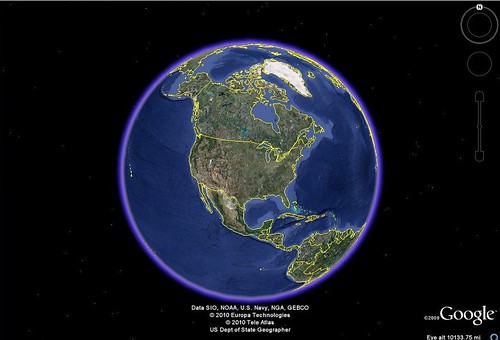
I had wanted to entitle this post “Cool Google Earth Lesson Plans That Don’t Really Use Google Earth”, but I figure that would be a bit wordy. The idea was taken from my “Creating Media Rich Lessons with Google Earth” presentations that I’ve been doing lately. One of the strategies in that presentation is to embed content from other sources into Google Earth. As I was giving some examples to the workshop participants, it occurred to me that you could do a collaborative project in Google Earth where kids do most of their work in some other application, bringing these together at the last minute in Google Earth. Here are a few of those ideas, and the applications needed.
1. PowerPoint
Use a program that, for better or for worse, has found its way into just about every classroom. Students can create presentations about a specific location for later inclusion in Google Earth.
For example, students may be assigned a Civil War battlefield and asked to gather information about that location, then create the presentations. The files could then be uploaded to SlideShare.net where an embed code is available.
Unfortunately, some districts block SlideShare (for whatever reason), so a better method is to upload the files to the teacher’s (or the students’) Google Docs account. An embed code is also available for these presentations.
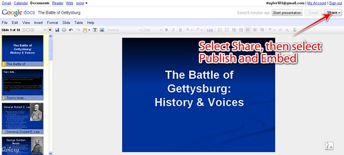
Here’s a Powerpoint presentation on Gettysburg created by a teacher at the University of Omaha. I’ve uploaded it to my Google Docs. I click on the Share button to make it available for embedding…
Once I’ve done that, I can copy the embed code…
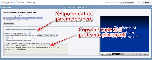
I can then paste the code into a placemark. This process is repeated for each of my students’ presentations. The presentations can be saved as a single Google Earth KML or KMZ file.
2. Glogster
Glogster is great for creating interactive posters. Assign the students a city or location and have them create a promotional travel poster for that location. This can include text, links, and just about any media links.
Once the Glog is done, it can be embedded into Google Earth by copying the code below…
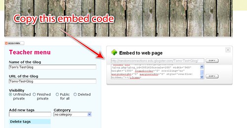
…and pasting into a Google Earth placemark.
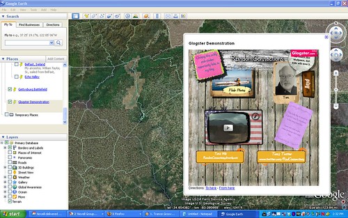
You’ll need to tweak some of the settings in the embed code to make it look right, though. For the figure shown above I set the scale to 50% and the size to 500X500.
3. Voicethread
I think by now you’re getting the idea of how this is done. Voicethread would work just as well as PowerPoint or Glogster for creating content for Google Earth. Students can create their location-based presentations, then bring them together for a single Google Earth file.
One advantage of using Voicethread is that it retains all of its capabilities when embedded in Google Earth placemarks. Video and audio work fine, as well as the commenting functions.
There are lots more applications that will work like this with Google Earth, but these three were ones that seemed to catch teachers’ imaginations more as I was doing my presentations. For a brief list of other applications that can be embedded into Google Earth, check out the table on this page of my GeoPackrat website.