Skip to content

Random Connections

A collection of photography and exploration focusing on Upstate South Carolina and beyond.

  • Home
  • About Us
  • Photos
  • Resources
  • Other Voices
  • Post Archives
  • Podcast
  • Home
  • Geocaching and Maps
  • Page 6

Category: Geocaching and Maps

0

If you build a dam here…

Posted on June 26, 2012 By Tom 5 Comments on If you build a dam here…
EdTech, Geocaching and Maps

Lake Union 1

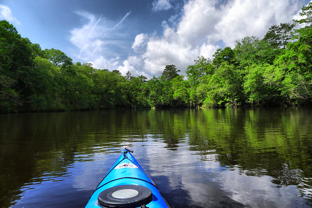
While kayaking on Parr Shoals Reservoir last Saturday, Alan and I started discussing lakes in general. Specifically we were talking about the placement of dams and the hydrology of water backing up to fill in the space. We laughed at one of the last scenes of “O Brother, Where Art Thou“, where the lake comes flooding in as a torrent, rather than rising gently as it should. As far as movies go, “Deliverance” was a more realistic view of how lakes are created.

As the conversation proceeded, I reminisced about the time I participated in the SC-MAPS project when I was a teacher. This was a three-day workshop where we learned how to use topographic maps and satellite imagery in the classroom. This was long before the days of Google Earth, so the ability to look at overhead images of where you live was still a novelty.

One of the activities they had us do was to draw a line across a river connecting contour lines at the same height. This line would represent a dam. Then we were to trace the contour line at that level all the way around, outlining the area that would be inundated by the new lake. It was a tedious process, but the results were fascinating. The lakes always turned out much larger than we expected.

As Alan and I talked, we wondered if there was some automated way to do this using Google Earth, so when I got home I started searching for a method. The automated systems I found were complex, requiring advanced knowledge of ArcGIS, hydrology, and GIS techniques in general. Even so, I think I’ve found a simple way in Google Earth. Here’s how…

Read More “If you build a dam here…” »

Edisto River – The Jacksonboro Passage

Posted on April 22, 2012 By Tom 2 Comments on Edisto River – The Jacksonboro Passage
Geocaching and Maps, Paddling, Photography

Edisto River 11

This trip was supposed to have been last week. The second Saturday of the month is when our Lowcountry Unfiltered group normally hits the trail. However, an event last weekend involving most of our group caused us to postpone the trip. That freed me up to participate in the Tame the Tyger Race last weekend.

So, this weekend rolled around, and our group headed down to the Edisto River. This time we were headed to a new stretch that ended just shy of the ACE Basin. We were going to do a thirteen mile stretch from Martin’s Landing to West Bank Landing through the historic district of Jacksonboro.

I loaded up the boat and gear Thursday night and headed down as far as St. George after work Friday. The weather wasn’t looking promising, but I decided to take the chance. When I got up Saturday to head down to the river a thick fog covered the area. However, it looked like it was going to burn off later. Driving through this historic area I wanted to just stop and photograph everything, but knew I’d need to get on down to our rendezvous at the take-out. I drove on through Jacksonboro, and turned at the old Wesley United Methodist Church onto Hope Plantation Lane.

Wesley United Methodist ChurchHope Plantation Lane

Read More “Edisto River – The Jacksonboro Passage” »

Google Earth and Google Plus

Posted on February 15, 2012 By Tom 1 Comment on Google Earth and Google Plus
Geocaching and Maps, Internet

I hadn’t realized how far behind the times I’ve been with Google Earth until I ready on Frank Taylor’s blog that there is an update out for a version beyond the one I’m using. That means I’m two versions behind. Version 6.2 makes some changes to the overall appearance of the map, with a “pretty … Read More “Google Earth and Google Plus” »

Kingville, Kingsville

Posted on February 12, 2012 By Tom 23 Comments on Kingville, Kingsville
Geocaching and Maps, History and Genealogy

Kingville Station

I came upon Kingville quite by accident. I was looking for information on another ghost town in Google Earth when I spotted this name near the confluence of the Congaree and Wateree Rivers. When I zoomed in a bit further I saw that the the place indicated by the name was all wooded – there was no town there. Street View also showed just a wooded area, and not enough buildings to even justify keeping this as a place name. This intrigued me, so I did a bit of research, and it turned out to be an interesting ghost town location itself.

Kingville Google Earth

According to information on the Kingville Historical Foundation’s website, the town got it’s start in 1842 when a spur railroad line from Aiken was completed to Columbia. I checked Robert Mill’s 1825 atlas of the area, and the name Kingville does not appear. In 1850 a branch line was completed to Camden, and the town began to grow because it was now located at the juncture of two major railroad lines.

Research on the town was initially confusing. According to the historical marker for the site…

Kingville is thought to be named for its status as “king” of the railroad line between Charleston and Columbia and between Columbia and Camden.

However, the town was first called “Kingsville” with an “s”. For awhile I wasn’t sure if I was finding information on the same town. For example, this is an excerpt from an 1870 map of the Port Royal railroad in the southern states. It clearly shows the spelling with an “s”. The town’s name on this map makes it look almost as big as Columbia, but this is deceptive. Since this was a railroad map, the emphasis was on major junctions, rather than the actual towns.

Kingville_1870

Read More “Kingville, Kingsville” »

Congaree and Lower Richland

Posted on February 12, 2012 By Tom No Comments on Congaree and Lower Richland
Geocaching and Maps, History and Genealogy, Local, Travel

Starting out on the Congaree Boardwalk

Normally on a second Saturday I’d be off with the guys from Lowcountry Unfiltered. They had a great trip planned for today, but due to various reasons I wasn’t going to be able to join them. Instead, I teamed up with Dwight, his wife Sue, and son Adam to explore Congaree National Park and a bit of Lower Richland County.

Lower Richland County is located in a wedge formed by the Congaree and Wateree Rivers up to their confluence, where they become the Santee River. The area is also known as the “Cowasee” Basin, a name created by combining names of those rivers. Congaree National Park makes up most of the Cowasee Basin, but there are also lots of historical locations, including one interesting ghost town.

I headed down to Congaree on this clear, cool Saturday morning. I arrived at the park early to find an already packed parking lot. There were groups of Boy Scouts, as well as other tour groups gathering. I have to admit – I tend to be selfish with my wilderness experiences. I don’t mind others around, but lots of loud people make it hard to see wildlife. I was a bit worried.

Congaree Crowds Gather

Dwight, Sue, and Adam arrived, and soon we were off, headed down the high boardwalk. The plan was fairly simple. We would stick to the trails and boardwalks for the most part, but we wanted to do a little bushwhacking. We also wanted to find at least one champion tree.

Read More “Congaree and Lower Richland” »

Rugby Caching

Posted on January 29, 2012 By Tom No Comments on Rugby Caching
Entertainment, Geocaching and Maps

Paris Mountain Geocaching Workshop

Several months ago John Kaup asked if I would do a geocaching workshop for Paris Mountain State Park’s Fourth Saturday program.  The appointed Saturday came around, so I headed up to the park with all of my GPSs, laptops, etc, in tow for the workshop.

I planned to do a repeat of the workshop I’d done for the park back in 2009.  We had secured eight Garmin eTrex GPSs for the participants to use, and I had set up ten dummy geocaches within sight of the building where we were holding the workshop.  The plan was to go over the basics and show them the website, then send the participants out to find the dummy caches.  I had the coordinates for the caches in my netbook, and had several different types of cables for different models of GPSs, in case someone had brought their own and wanted to participate.

Last time I did this I only had two participants.  This time I did more advertising.  I posted on the Upstate Geocacher’s Facebook page, and I also got it added as an event cache on geocaching.com.  That way, anyone who attended to add the workshop itself as one of their finds.  Ranger Cathy Taylor also posted announcements in the Greenville News.

Paris Mountain Geocaching Workshop

It worked.  We had nearly 20 participants.  Also attending were experienced geocachers Patrick Peden and his wife, who have over 6000 finds (compared to my measly 135).  Patrick took the photos here, since for just about the first time ever I got so wrapped up in the program that I forgot to take ANY photographs. What I really like were that there were families with lots of kids there. It was almost like teaching fourth grade again.

Read More “Rugby Caching” »

More on New Bordeaux

Posted on January 19, 2012 By Tom 1 Comment on More on New Bordeaux
Geocaching and Maps, History and Genealogy

While we were on our McCormick County Photo Trek we had trouble locating the old town of New Bordeaux. I had it on my list as a potential ghost town target, but finding the actual town was elusive. Since we’ve returned from the trip I’ve been able to find out a bit more information, but … Read More “More on New Bordeaux” »

A Matter of Maps

Posted on August 21, 2011 By Tom 3 Comments on A Matter of Maps
Geocaching and Maps, History and Genealogy

Fairfield District

I have been enjoying going through the old maps in the Robert Mills 1825 Atlas of South Carolina. However, last weekend’s photo trek to Old Pickens Court House brought out some problems with relying solely on Mills’ maps to find ghost towns. The maps are too early to catch many towns that developed after 1825, only to fade away by the time of the Great Depression. Never fear, though. There are other online resources that can cover later time periods.

Topographical Maps of South Carolina, 1888 - 1975 - Digital Collections - Thomas Cooper Map Library - USC.png by RndConnections on Aviary

The University of South Carolina’s online digital library has an extensive collection of historic topographic maps of the state. The maps cover from 1888 to 1975, but not all quadrangles are available for this time period. For example, the collection contains three maps for the Abbeville quadrangle – 1900, 1918, 1943. The 236 maps in the collection include a mix of 30 minute, 15 minute, and 7.5 minute projections. I haven’t checked to see how extensive the state coverage is, but I’m sure there are parts of the state that are not covered.

Read More “A Matter of Maps” »

Robert Mills’ Atlas of South Carolina

Posted on August 4, 2011 By Tom 8 Comments on Robert Mills’ Atlas of South Carolina
Geocaching and Maps, History and Genealogy

State District

I was talking with my brother Houston sometime back about my Ghost Towns project, and he suggested that in addition to using the GNIS historical data, we should look at old maps of the state to see what towns might have been listed. I agreed that it was an excellent idea, so I set off in search of the one resource I knew would have everything we wanted – Robert Mills‘ 1825 Atlas of South Carolina.

A native of Charleston, Robert Mills was the quintessential Renaissance Man, along the same lines Thomas Jefferson. Mills studied architecture first in Charleston, then later in Philadelphia. Anyone familiar with South Carolina history is aware of Mill’s contributions to South Carolina – the many court houses and civic buildings designed by him. Perhaps, though, he is most famous for his designs for buildings in Washington, D. C., including the Washington Monument.

In 1818…

“…the General Assembly adopted resolutions looking to the preparation of a map of the state, showing a separate map of each district thereof. In 1818 an appropriation of $9,000.00 was made toward procuring such a map, and in 1819 a like amount was appropriated for the same cause.”

-from the Introduction to the 1839 reprint of the Mills Atlas.

In 1820 Mills was appointed commissioner for the Board of Public Works for South Carolina, and was tasked with creating the atlas. He commissioned surveyors to create the separate maps for the then 27 districts in the state. He then personally rescaled the surveyors’ work for inclusion in the atlas, and added a legend reflecting the new scale. He also edited place names, adding or omitting as needed. The legend of each map bears the original surveyor’s name and notes the map was “improved for Mills’ Atlas, 1825.”

Greenville District

Read More “Robert Mills’ Atlas of South Carolina” »

Matching Reality to Google Earth

Posted on August 3, 2011 By Tom No Comments on Matching Reality to Google Earth
Geocaching and Maps

In Flight Photos-2

No matter how many times I’ve flown, the concept of this massive machine lifting into the air still strikes me as weird. I’m still fascinated. And unlike those jaded fliers who prefer the aisle seats, I still like to look out the windows at both the ground below and at unique cloud formations.

This summer I took a couple of trips across country, so I’ve had plenty of opportunity to look out windows. On the past several trips it’s struck me how similar the view is to Google Earth, and I began to wonder if I could match up locations with the same spots in Google Earth.

So, I grabbed my camera and started snapping out the window, trying to see if this could be done. Turns out it’s much, much harder than you might think.

Read More “Matching Reality to Google Earth” »

Posts pagination

Previous 1 … 5 6 7 … 21 Next

Categories

  • EdTech (197)
  • Entertainment (201)
  • Family (123)
  • Gear (114)
  • General Technology (98)
  • Geocaching and Maps (208)
  • History and Genealogy (275)
  • Internet (142)
  • Local (458)
  • Miscellaneous (559)
  • Music (202)
  • Paddling (267)
  • Photography (781)
  • Podcast (19)
  • Rambling (233)
  • Rants (162)
  • Recipes (37)
  • Religion (48)
  • Restaurants (165)
  • Science (48)
  • Things Overheard (29)
  • Travel (413)
  • Uncategorized (143)
  • Washington Sabbatical (113)
  • Weirdness (60)

Recent Posts

  • Exploring Lake Summit
  • The End of Days
  • Double-Dipping on the Edisto
  • Jerk Chicken a la Farehouse
  • How’s the House, Part 3

Recent Comments

  • Kathleen on A Stonecutter’s Tale
  • Karl Plenge on Exploring Lake Summit
  • Virginia Pepper on Exploring Lake Summit
  • John Guerrant on Carolina Ghost Towns – Merrittsville
  • Laura A Davenport on Brandon Mill Cemetery Clean-up

Tags

blogging cemetery Christmas Columbia Edisto River edtech Entertainment family Flickr Florida Furman Furman University gear Georgia geotagging Ghost Town Ghost Towns Google Earth Google Maps GPS Greenville Greenville Chorale history Instructional Technology kayaking Lake Jocassee LCU Lowcountry Unfiltered maps Music North Carolina Paddling Photography rambling restaurant Restaurants review singing social networking South Carolina time-lapse Travel video Washington Washington State
September 2025
S M T W T F S
 123456
78910111213
14151617181920
21222324252627
282930  
« Aug    

Copyright © 2025 Random Connections.

Theme: Oceanly by ScriptsTown