While kayaking on Parr Shoals Reservoir last Saturday, Alan and I started discussing lakes in general. Specifically we were talking about the placement of dams and the hydrology of water backing up to fill in the space. We laughed at one of the last scenes of “O Brother, Where Art Thou“, where the lake comes flooding in as a torrent, rather than rising gently as it should. As far as movies go, “Deliverance” was a more realistic view of how lakes are created.
As the conversation proceeded, I reminisced about the time I participated in the SC-MAPS project when I was a teacher. This was a three-day workshop where we learned how to use topographic maps and satellite imagery in the classroom. This was long before the days of Google Earth, so the ability to look at overhead images of where you live was still a novelty.
One of the activities they had us do was to draw a line across a river connecting contour lines at the same height. This line would represent a dam. Then we were to trace the contour line at that level all the way around, outlining the area that would be inundated by the new lake. It was a tedious process, but the results were fascinating. The lakes always turned out much larger than we expected.
As Alan and I talked, we wondered if there was some automated way to do this using Google Earth, so when I got home I started searching for a method. The automated systems I found were complex, requiring advanced knowledge of ArcGIS, hydrology, and GIS techniques in general. Even so, I think I’ve found a simple way in Google Earth. Here’s how…
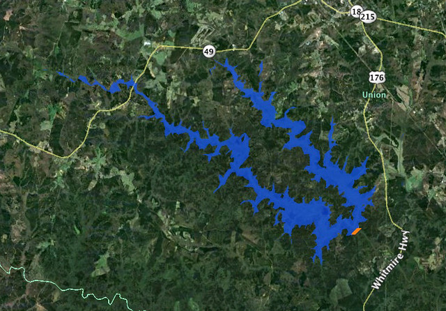
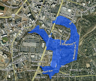
First, I needed a target. Several years ago there was a proposal to dam the Tyger River at Fairforest Creek to create a lake in Union County. The project would have flooded large portions of Sumter National Forest, including part of the Rose Hill State Park lands. So far it looks like the Patriot Lake project, as it would have been called, has been defeated because of cost. Even as late as 2010 the project merits were being debated by legislators. I wouldn’t said the project is dead, but I’m hoping it continues to languish in limbo.
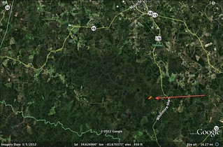
Even though I’m squarely against the Patriot Lake project, I wanted to see what land would be flooded. My hypothetical dam would be built just below the confluence of the Tyger River and Fairforest Creek, as per the proposal.
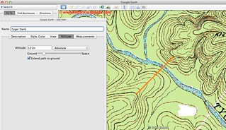
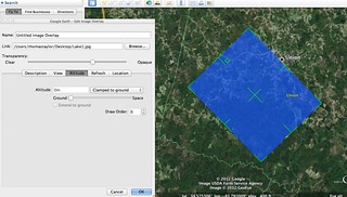
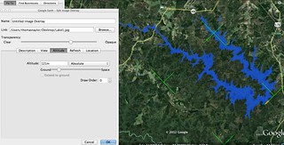
In my first attempt I tried to replicate what we had done in the SC-MAPS project. Using Matt Fox’s USGS topo maps overlay link, I found two contour lines on either side of the lake at 450 feet above sea level. Connecting these two points would create a dam about 100 feet tall from the current river bed. I created a line connecting the two points. Under the Altitude tab I selected “Absolute”, set the height I wanted, then told it to extend the line down to the ground.
Using the polygon tool, I attempted to trace the contour lines at that height so that I could create the outline of the lake. The process was going well, however, it was quite tedious and I was missing some sections. I knew there had to be a better way.
I figured that if I could specify the height of the dam, then I could also specify the height of the polygon, rather than clamping it to the contours of the ground. This way, terrain features that are taller than the height I specified for the lake surface would be visible, but anything lower would be hidden under the polygon.
Rather than trace the contour lines, I created a polygon that should cover all of the lake area.
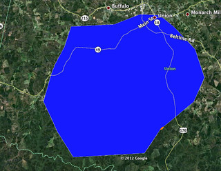
I then set the polygon’s altitude the same way I had set up the dam and at the same height. It worked like a charm. The terrain came through, and the outlines of the proposed lake were visible. But it wasn’t perfect.
When I zoomed out the terrain features in Google Earth became less details, and the lake’s shape became distorted. So I tried another approach. I created a blue rectangle in Photoshop – just a simple JPEG file, then used that image as an overlay. I lined up one edge with the dam, and adjusted the size of the rectangle so that it covered the required area. Then I set the altitude of that rectangle. I also set the opacity to 60% so that part of the ground image would come through. The results were excellent, and even zoomed out the lake retained its shape.
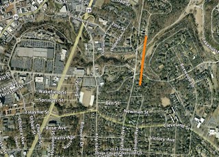
With that success, I decided to try other areas. I wondered what would happen if you built a dam across the Reedy River in Cleveland Park…
The resulting lake would be small…
However, it would inundate several neighborhoods, and Reedy Falls would now be mostly underwater.

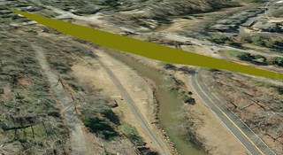
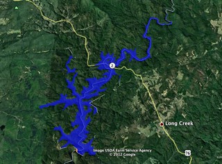
I had one last river to dam. If I was going to commit the blasphemy of damming the Tyger, then why not see what would happen on the Chattooga? Going back to the Deliverance reference, suppose a dam were built there. How much would be flooded? Of course, it depends on the height of the dam.
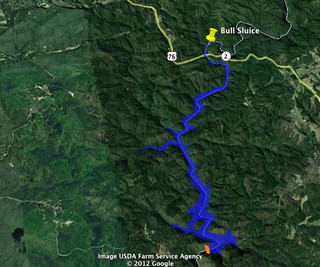
For this last exercise I picked a narrow part of Section IV to build my dam. I also decided to use a polygon rather than my rectangular blue JPEG. I figured I could control the shape better. I set the lake height, and found that I had to tweak the polygon shape quite a bit in order to cover the enter area that would be under water. That tweaking involved moving and extending some of the polygon corner points outward so that it covered more area. The result was a huge lake almost the size of Lake Keowee.
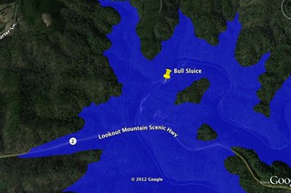
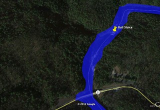
On this lake, Bull Sluice, and any other rapid on most of sections III and IV would only be memories. Two islands would be formed on the prominences along the sluice.
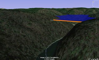
However, I found that I had made a mistake. I’d set the lake altitude much higher than the dam. I spotted it when I tilted the view in Google Earth. I had to lower the lake to match the dam.
The resulting lake was much smaller, but still a catastrophe as far as whitewater is concerned.
Having done this once in an educational setting, I can see lots of potential for this in the classroom, especially given the ease of Google Earth. There are lots of questions for math and geography – How long would the dam have to be? How tall? How much area? What resources would be impacted? Would some landowners benefit over others? Who would lose out? It could be a great lesson.
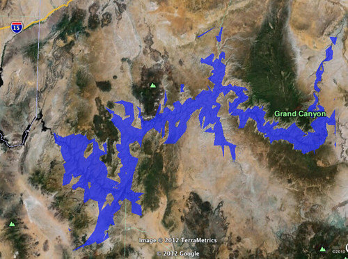
But, for now I’m off. Time to flood a certain canyon in Northwest Arizona.
I would never have forgiven you if you had flooded Burrell’s Ford.
It’s not too late. I could, you know.
Also a good method to illustrate rising sea levels.
I hadn’t thought about that, but you’re absolutely right. I may have to play around with that, Joe.
interesting post. Technology is awesome. Makes me think about how much work went into forming our current upstate lakes without use of Google Earth type technology.