Skip to content

Random Connections

A collection of photography and exploration focusing on Upstate South Carolina and beyond.

  • Home
  • About Us
  • Photos
  • Resources
  • Other Voices
  • Post Archives
  • Podcast
  • Home
  • Geocaching and Maps
  • Page 5

Category: Geocaching and Maps

0

Pointing the Way in Concrete

Posted on January 31, 2014April 8, 2015 By Tom 3 Comments on Pointing the Way in Concrete
Geocaching and Maps, History and Genealogy, Internet

Aerial Beacon-002

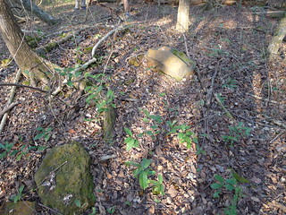
Ghost towns, odd bits of masonry, abandoned towers, derelict schools, old cemeteries, old dirt roads – these are items that speak of a hidden history. These are the things you may pass many times daily and never give any thought. However, if they are brought to your attention, you never look at that area the same way. Just recently my Geocaching friend Larry Easler (aka HockeyHick) made me aware of a whole new genre of interesting historical remnants – Airway Beacon Markers.

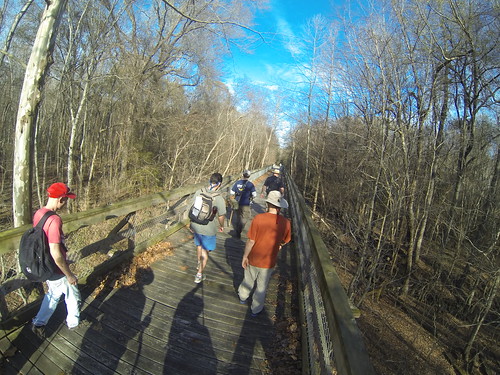
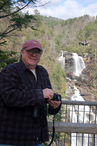
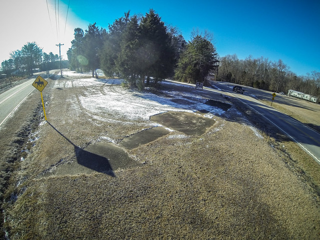
Larry found one of these things fairly close to us and did the initial research and background history. He has since placed a geocache at the location as part of his “Hidden History” series of geocaches. On a cold morning after the recent snowfall, Tommy Thompson and I decided to check it out.

Read More “Pointing the Way in Concrete” »

MaKey MaKey and Google Earth

Posted on January 10, 2014 By Tom 2 Comments on MaKey MaKey and Google Earth
EdTech, Gear, Geocaching and Maps, Science
Makey Makey and Google Earth-001
MaKey MaKey – Front Side

Before Christmas I got an Amazon gift card for my birthday, and I used it to buy a MaKey MaKey. It arrived just before the hectic Christmas rush and our traveling, so I didn’t really get a chance to play with it. These past few very cold days have been the perfect opportunity to see what this thing can do.

So, what is this thing?

A MaKey MaKey is an Arduino-based computer interface that allows any conductive material to be substituted for a key on the computer keyboard. The name is a contraction of “Make Anything a Key,” or “MaKey.”

The kit comes with alligator clips and jumper wires to attach to…just about anything. The board is connected to the computer via USB. You connect the clip to some conductive material such as aluminum foil, liquid, or even a piece of fruit. Another clip is attached to the ground on the board, the held in one hand. Touching the fruit-foil-liquid will complete the circuit through your body and trigger the key, depending on where the first clip is attached on the board.

Read More “MaKey MaKey and Google Earth” »

Florida Geocaching and Caching Recollections

Posted on December 27, 2013December 27, 2013 By Tom No Comments on Florida Geocaching and Caching Recollections
Geocaching and Maps

Recollections I was a pioneer in the geocaching craze. Well, really an early adopter. I got my first GPS in 1998, long before anyone realized how these might revolutionize the world. My plan at the time was to use it to mark locations for genealogy – home places, grave sites, etc. However, I wanted to … Read More “Florida Geocaching and Caching Recollections” »

Google Maps Screws Up

Posted on July 21, 2013July 25, 2013 By Tom 1 Comment on Google Maps Screws Up
Geocaching and Maps, Rants

I’m not one of those people that mounts protests every time Facebook changes their layout, or when GMail makes some slight change. I even like the new updates to Flickr, even though some users are threatening to abandon it for Ipernity. So, when I say that Google Maps has really screwed up with their latest … Read More “Google Maps Screws Up” »

Goodale Geocaching

Posted on March 31, 2013 By Tom 2 Comments on Goodale Geocaching
Geocaching and Maps, Paddling, Photography

N. R. Goodale State Park

On Saturday I attended an event cache put on by the Upstate South Carolina Geocaching Association (USCGA). The plan was to head down to N. R. Goodale State Park and find the Lost in the Swamp III geocache, which requires a bit of paddling to reach. The weather forecast was iffy, as it always is this time of year. When Saturday rolled around, it looked like it was going to be a nice day for paddling, so I loaded up the boat and headed down to Camden.

Traffic was crazy busy on the way down. This is the weekend of the Carolina Cup in Camden, so I wasn’t sure what to expect as far as congestion near the park. Just on the other side of Columbia on I-20 I came across a couple of other vehicles with kayaks on top. I recognized Hockey Hick’s van right away with all of the Geocaching stickers, so I knew there would be company.

We found the park with no problem, and the traffic through Camden wasn’t bad. There were already several people getting ready to launch. I couldn’t tell if they were with our group or not. Soon, though, our group came together, and we were exchanging tales of previous Geocaching adventures.

Goodale State Park Geocaching (7 of 10)
Goodale State Park Geocaching (4 of 10)

Read More “Goodale Geocaching” »

Street View Time Lapse

Posted on February 2, 2013 By Tom No Comments on Street View Time Lapse
Geocaching and Maps, Internet, Photography, Weirdness

Screen Shot 2013-02-02 at 6.42.00 AM

I’ve been enjoying creating time-lapse videos while driving. Unfortunately, I’ve just been driving back and forth to work or rehearsal, so the scenery doesn’t change much.

So while I was looking at Google Earth the other day it occurred to me – I could use the images from Street View to create the same type of time-lapse.

Read More “Street View Time Lapse” »

LCU vs Manchester, Part 3

Posted on January 19, 2013 By Tom No Comments on LCU vs Manchester, Part 3
Geocaching and Maps, History and Genealogy, Photography

Poinsett Park Millrace 2

So far our crew from Lowcountry Unfiltered had breakfast at Battens in Wedgefield, visited the cemetery of a deranged governor, hiked part of the Palmetto trail and discovered an old railroad junction, and we were just getting started.

Manchester and Melrose

We got back to our vehicles and headed to the location of the ghost town of Manchester. The town died out with the demise of the Wilmington and Manchester railroad. All that remains are a few rural houses. We paused briefly, and left in search of a more interesting section of Manchester.

Nearby is a marking indicating the location of Melrose Plantation. Built in the late 1700s, the plantation was owned by Matthew Singleton, whose cemetery we had visited earlier in the day. We stopped at the marker and took a look around. There were a few foundation stones, and the twisted remains of a metal bed. Unfortunately the bed appeared to be more of modern than pre-Civil War origin.

Melrose Plantation Marker
Melrose Plantation Remains

Read More “LCU vs Manchester, Part 3” »

LCU vs Manchester, Part 2

Posted on January 19, 2013 By Tom 2 Comments on LCU vs Manchester, Part 2
Geocaching and Maps, History and Genealogy, Photography, Rambling

LCU Swamp Stomp 2013-026

We had loaded up with breakfast at Battens in Wedgefield, and now it was time to go exploring. There were eleven us, divided over three vehicles. Luckily, I had three FRS radios so we could coordinate our travels. So, we set off.

We got off the main highway, and as we entered Manchester State Forest the pavement just kind of gave out. We road on a fairly fast clip, past forested areas and farmland, most of it with “Posted. No Tresspassing” signs.

LCU Swamp Stomp 2013-047
LCU Swamp Stomp 2013-026

Read More “LCU vs Manchester, Part 2” »

How Many Greenvilles?

Posted on September 10, 2012 By Tom 8 Comments on How Many Greenvilles?
Geocaching and Maps, Miscellaneous

Greenville_Sanborn_Map_Cover

Perhaps it was the fact that I’ve crossed several state lines recently. More likely it was because I’ve spent several late nights wide awake and coughing. Being sick can make you think weird things, but for some reason the following aphorism popped into my head…

There is a town called “Greenville” in every state. However, Tennessee is the only only one that spells it as “Greeneville.”

I don’t even remember where I heard that the first time. My first intent was to take this at face value and create a Google Earth KML file showing the location of each town called Greenville. (Did I mention that I’ve been sick lately?) That turned into a challenge to test the validity of this statement, and learn a bit more about Greenville, where ever it might be found.

Read More “How Many Greenvilles?” »

Jocassee Falls – A Preview

Posted on July 1, 2012 By Tom 2 Comments on Jocassee Falls – A Preview
Gear, Geocaching and Maps, Paddling

Houston at Whitewater Falls

My brother, Houston, recently informed me that he starts feeling anxious when I don’t update this blog often enough. I’m afraid I’ve given him ample reason to be irritated over the last week or so. I just haven’t had much about which to write. The usual excuses apply – work has been nightmarish, Laura’s sister and mother have been visiting, and a massive heat wave have combined to keep me away from any explorations this week. OK, so maybe those aren’t so usual.

Regardless, I’ve still got several projects in the works. So, to allay Houston’s anxiety I’ll provide a sneak preview…

Read More “Jocassee Falls – A Preview” »

Posts pagination

Previous 1 … 4 5 6 … 21 Next

Categories

  • EdTech (197)
  • Entertainment (201)
  • Family (123)
  • Gear (114)
  • General Technology (98)
  • Geocaching and Maps (208)
  • History and Genealogy (275)
  • Internet (142)
  • Local (458)
  • Miscellaneous (559)
  • Music (202)
  • Paddling (267)
  • Photography (781)
  • Podcast (19)
  • Rambling (233)
  • Rants (162)
  • Recipes (37)
  • Religion (48)
  • Restaurants (165)
  • Science (48)
  • Things Overheard (29)
  • Travel (413)
  • Uncategorized (143)
  • Washington Sabbatical (113)
  • Weirdness (60)

Recent Posts

  • Exploring Lake Summit
  • The End of Days
  • Double-Dipping on the Edisto
  • Jerk Chicken a la Farehouse
  • How’s the House, Part 3

Recent Comments

  • Kathleen on A Stonecutter’s Tale
  • Karl Plenge on Exploring Lake Summit
  • Virginia Pepper on Exploring Lake Summit
  • John Guerrant on Carolina Ghost Towns – Merrittsville
  • Laura A Davenport on Brandon Mill Cemetery Clean-up

Tags

blogging cemetery Christmas Columbia Edisto River edtech Entertainment family Flickr Florida Furman Furman University gear Georgia geotagging Ghost Town Ghost Towns Google Earth Google Maps GPS Greenville Greenville Chorale history Instructional Technology kayaking Lake Jocassee LCU Lowcountry Unfiltered maps Music North Carolina Paddling Photography rambling restaurant Restaurants review singing social networking South Carolina time-lapse Travel video Washington Washington State
September 2025
S M T W T F S
 123456
78910111213
14151617181920
21222324252627
282930  
« Aug    

Copyright © 2025 Random Connections.

Theme: Oceanly by ScriptsTown