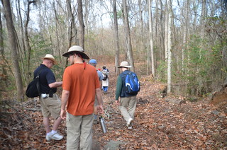
We had loaded up with breakfast at Battens in Wedgefield, and now it was time to go exploring. There were eleven us, divided over three vehicles. Luckily, I had three FRS radios so we could coordinate our travels. So, we set off.
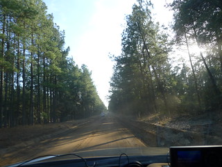
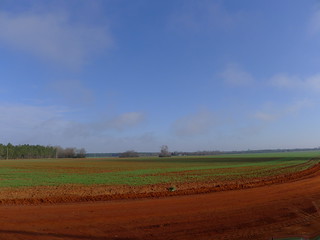
We got off the main highway, and as we entered Manchester State Forest the pavement just kind of gave out. We road on a fairly fast clip, past forested areas and farmland, most of it with “Posted. No Tresspassing” signs.
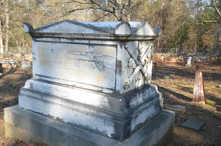
Singleton Cemetery
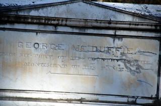
Our first stop was to find the grave of General George McDuffie. McDuffie was governor of South Carolina, then US Senator in the early 1800’s prior to the Civil War. He apparently fought several duels with Colonel William Cumming, and received injuries that eventually led to his death in 1851. One of the stories told about McDuffie was that when his favorite horse died, he was so distraught that he held a Presbyterian minister at gun point, forcing him to hold a funeral for the horse. McDuffie’s profile is emblazoned on the State House in Columbia.

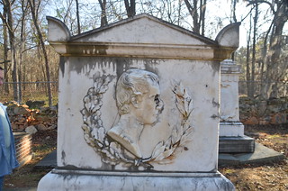
In the photo above, taken by Matt Richardson, McDuffie appears as a Caesar. Apparently that characterization isn’t too far off.
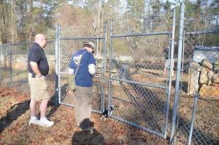
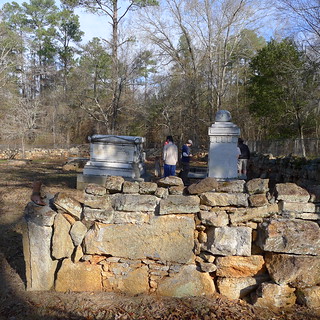
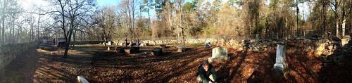
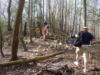
We found the Singleton Cemetery without trouble. Findagrave.com had the wrong coordinates. Fortunately, Wikipedia did. The cemetery is also on the National Register of Historic Places.
The cemetery was down a dirt road with No Trespassing signs on either side of the road. There didn’t be any on the road itself, or at the cemetery. What we did find, though, was a chain-link fence surrounding the cemetery. Apparently vandalism has been a bad problem.

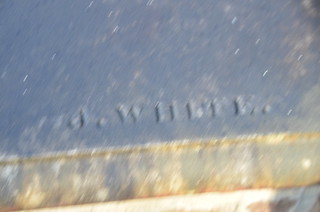
The cemetery itself was interesting. Of course, there were Singletons, but there was also the tomb of the man himself. McDuffie’s tomb had the same Caesar motif as the State House. There was also the crossed, inverted torches. It was an elaborate tomb, and it had a signature.
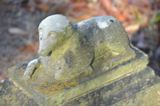
There were several other signature stones, and one lamb with really weird eyes. A cocina stone fence surrounded the cemetery.
There were some cool stones and interesting history, but there was more history to be found. Next stop was the remains of an old Civil War railroad.
Sumter Junction
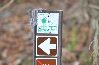
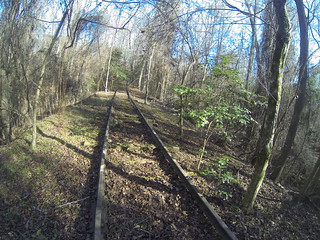
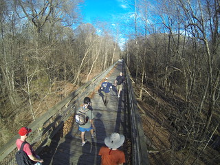
The Wateree Passage of the Palmetto Trail follows the old Wilmington and Manchester Railroad. The trail cross part of the High Hills of the Santee, then follows a very straight portion of the old railroad bed for about 7 miles to the Wateree River.
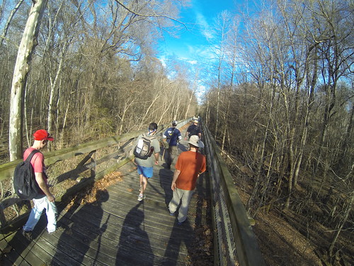
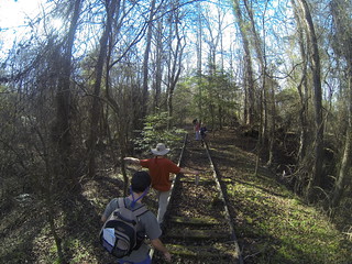
We reached the trailhead where the straight railroad section starts after we had driven on more dirt roads. One other vehicle was parked there. We unloaded, geared up, and headed out.
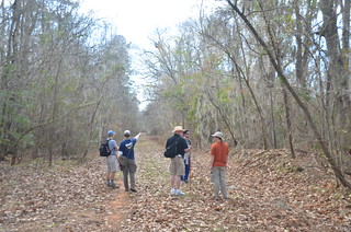
We had four goals for this trek. First, we were looking for evidence of Potter’s Raid. General Edward Potter was part of Sherman’s forces, and marched through the area in 1865 destroying the railroad. The rails were twisted around trees, a practice known as “Sherman’s Neckties.” It was reported that in this area Potter found boxcars of munitions, which he ignited and destroyed.
Our second goal was to find a railroad trestle “Stonehenge” described by two USC professors on a trip in 1997. This spot marked the location of Middleton Depot, which served the now-ghost town of Manchester. The third goal was to find a string of geocaches along the way, and our fourth goal was to reach the Wateree River. We were also looking for possible kayak launch sites for future trips.
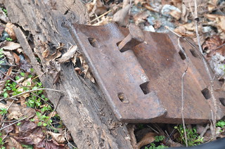
I have referred to our group as the “ADD Paddlers” in the past because they are so easily distracted on the river. As it turns out, that problem is not limited to rivers, but applies to trails, too. Any scrap of metal we came across had the potential to be a Civil War relic, and it was tempting to assign such provenance to it. Various members of our group would spot something off-trail, and several would go to check it out.

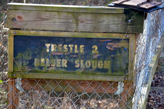
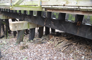
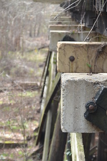
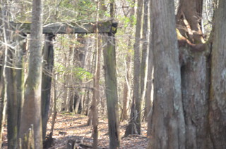
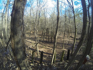
As we hiked we came to several railroad trestles across various sloughs and streams. These provided good views down into the swamp.
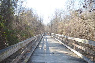
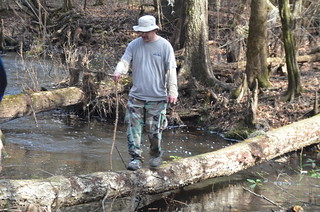
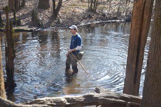
The geocaches tended to be in the swamp areas below the trestles, so we often abandoned the trestles to explore below the trail. The meant crossing the various waterways in unconventional means.
As we continued looking for both geocaches and artifacts, we spotted a bicycle on the trail. It turns out that geocacher Stomperswamp was out doing maintenance on his geocaches. We chatted with him quite a bit and found that we had several mutual friends in the geocaching community.
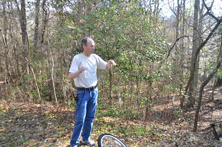
Swamperstomp told us that we were actually on the wrong railroad if we were looking for Civil War artifacts. He said that this was a non-standard spur line, and that Potter’s Raid actually took place further north on the line that runs through Foxville and Wedgefield. I’m still not so sure about that, because we were very close to Sumter Junction. He was kind enough to give us the coordinates of a cache that had been taken offline, and a hint for the one a few feet from where we were standing.
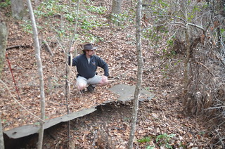
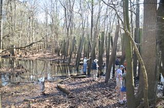
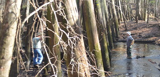
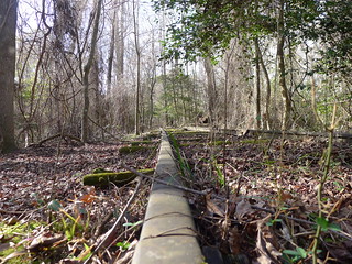
We reached on trestle and looked down to find what appeared to be he remains of a rail line running parallel to the trestle. A series of ordered stumps ran off into the forest. We decided to check it out, so we crossed the trestle and headed down.
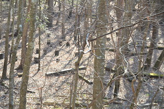
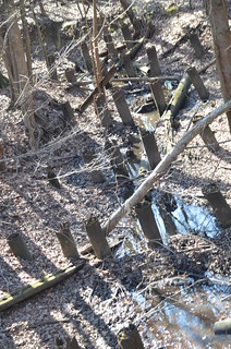
We followed the line of stumps along a creek, and eventually found our “Stonehenge”, or more appropriately, a Woodhenge. The tall remains of the trestle veered south to cross the stream. Ahead, another line of posts crossed the stream to merge with the one we were following. We had reached Sumter Junction.
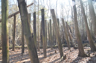
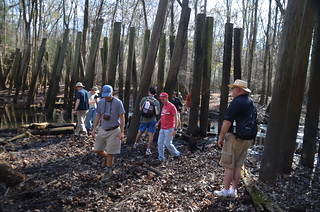
The dramatic posts made a great backdrop for our group photo. Several of us set up cameras to capture exactly the same shot (rather than sharing the photo from one camera.)
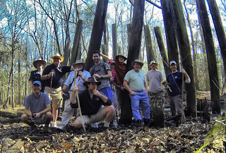
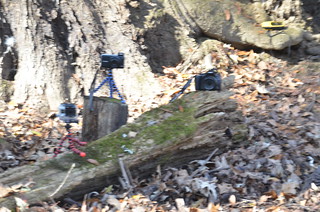
I set up the GoPro and just left it on time lapse, hoping to get a good shot I could crop and use. The unexpected benefit of this approach was that I could create a time-lapse video of our maneuverings.
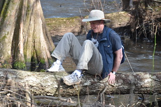
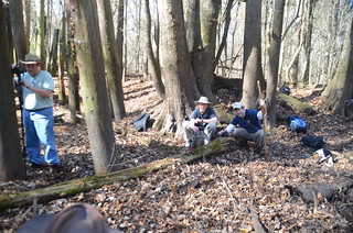
It was a great place to stop for lunch. Of course, since this was a Lowcountry Unfiltered Swamp Stomp, someone had to get wet. Rob obliged by falling into the creek while attempting to cross it. Matt and John didn’t like him being wet by himself, so they followed him across. All three made fun of the rest of us for not wanting to cross. I had lots of expensive camera equipment with me, and didn’t want to risk it.
After lunch we followed the second trestle line we had found. We ascended an embankment at the end of the trestle, and came to a set of abandoned rails that were still in place. We could look back at the trestle remains from this point.
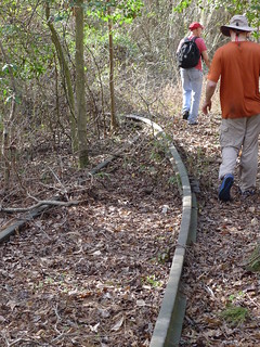
The rails took us back to the main trail, where they ended. We hiked up to the next trestle to find another geocache, then turned back for the return trip. We had accomplished three of the four goals. We found geocaches, we think we did find some old Civil War railroad remains, and we found Sumter Junction.
I used the GoPro camera quite a bit on this hike. As we were discovering the route to Sumter Junction, I had the camera on my head recording video. Here’s the edited video from that part of the hike…
This concludes Part 2 of our trek. Part 3 involves historic plantations and one more historic cemetery. The day was hardly over.
Nice adventure! The property lines in the maps view on Google do hint at the abandoned rairoad junction while the satellite view of the same location shows nothing. Map: https://maps.google.com/maps?q=sumter+junction,+sc&hl=en&ll=33.836041,-80.562079&spn=0.010106,0.015063&sll=33.624497,-80.926614&sspn=5.185779,7.712402&t=m&hnear=Sumter+Junction,+Wedgefield,+South+Carolina+29168&z=16
It was a good one, Mark. I kept thinking this was a place you might like to check out sometime, given your interest in railroads.