I’ve been enjoying creating time-lapse videos while driving. Unfortunately, I’ve just been driving back and forth to work or rehearsal, so the scenery doesn’t change much.
So while I was looking at Google Earth the other day it occurred to me – I could use the images from Street View to create the same type of time-lapse.
Of course, as with most of my brilliant ideas, someone beat me to it…
Address Is Approximate from The Theory on Vimeo.
The title “Address is approximate” comes from the tag on the Street View address box. However, while inspired by Street View, I’m not sure if this is actually Street View imagery in the video. It looks a bit too detailed and smooth in places. I could be wrong, though.
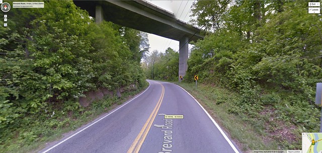
Even though someone else had done a much better job, I decided to give it a shot. My proof-of-concept target was going to be a short section of the Blue Ridge Parkway. I started by using Quicktime to do a short screen capture for an introduction. Once that was done I zoomed into Streetview and started screen captures.
With any time-lapse or stop-motion, image capture is the longest, most tedious part. It was said that in back in pre-CGI days while filmingThe Empire Strikes Back, the battle battle between Luke Skywalker’s snowspeeder and the large AT-AT took three months to complete.

I didn’t have three months for a simple proof-of-concept video. Just an hour or so this morning while enjoying a cup or two of coffee. So I started the tedious process – advance, screen capture, advance, screen capture. My goal was to recreate the trip from Bent Creek on the French Broad River to Mount Pisgah.
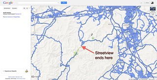
At first I wanted to keep the frame rate approximately the same as what Google did. I would advance just as far as the one arrow length, then capture. It soon came apparent that this would take longer than if I were driving all the way up there. So, I just started advancing randomly and doing a screen capture. Even so, it took quite awhile. Unfortunately, the Google Street View van apparently didn’t drive all the way up to Pisgah, so I could only go part way.
I wound up with 517 shots, each one captured manually – advance, capture, advance. At 30 frames per second, that comes out to about 17 seconds worth of video. That wasn’t going to get me very far.
On the Mac the screen capture produces PNG files, and apparently Adobe Lightroom doesn’t like PNG. I imported them into Picasa, then exported the files as JPG files. THEN I could import the files into Lightroom, crop them as I wanted, then export the files as a time-lapse. Using iMovie, I put my intro file together with the time-lapse and with some short clips from the Blue Man Group for a soundtrack. here was the result…
For a proof-of-concept, I think it turned out pretty good. I liked the way the tunnels turned out.
For my next trick, I may want to do a high speed run down a major city, such as New York London, or Paris. Should be fun.