It was time to plan another Second Saturday trip with Lowcountry Unfiltered. We’ve been trying to expand our trips, visiting places that we haven’t done multiple times. There are lots of waterways in this state, so I don’t think we’ll exhaust our opportunities, but it’s fun to see new stretches of water. This time we decided to paddle part of the Little River Blueway, specifically, a section of Long Cane Creek. Our route would take us through a very remote, historical section of South Carolina, but there would be many, many obstacles before we reached the end of our paddle.
Matt and I both have history in this area. I had family in Calhoun Falls and Abbeville and we used to explore this area when we would come down to visit. The wilds of the western district of the Sumter National Forest that covers parts of Greenwood, Abbeville, and McCormick Counties always seemed like another, more ancient world to me when I was young. This is one of my favorite places to take photo treks, even now. After Matt finished at Erskine he was pastor of Long Cane ARP Church, a historic church Alan and I had explored which became the basis of my one good podcast episode. Matt had also run this section of the creek in a canoe with his future bride, Chris.
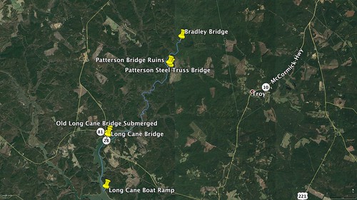
Our route would begin at Bradley Bridge, site of the old Long Cane Covered Bridge and would end at the Long Cane Boat Ramp on Lake Strom Thurmond. It would take us under another historic bridge, past the site of the Cherokee Indian Massacre, and through the heart of Sumter National Forest. It would also involve all sorts paddling conditions, probably more than we have encountered on any other trip.
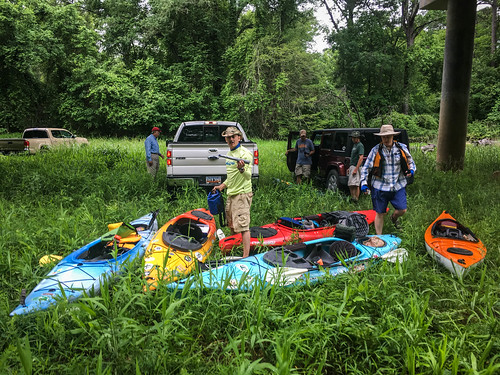
We had a great response for this trip. Six of us would be riding down from the Upstate – Jim Leavell, Alan Russell, Bob Donnan, and I would be in Jim’s truck, and Larry and Albert would be coming over from Spartanburg. Jerry Crisp, John Ring, Sean Jamison, Matt Richardson, and Jimmy Steinmetz would make up the Lowcountry contingent. Weather was a concern as we watched a storm system roll in from the west, but we decided to go for it.
Our crew met early and were all able to fit boats and gear comfortably into Jim’s (actually, his wife Judy’s) truck. After picking up all of our riders we cut across country to Honea Pathology for breakfast. Alan had found the Little Biscuit Barn, and based on its reviews, thought it would be a good place to stop. It was just north of the town on Honea Path’s main street, and lived up to the reviews. It was a tiny place, but service was excellent, and the food was great. And inexpensive – under $5 for eggs, sausage, grits, biscuit, and coffee.
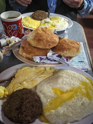
You know a place has to be good when the waitress greets everyone by name when they come up to the drive through.
Suitably filled with calories that would be much needed for the rest of the day, we continued our trek down to Donalds, then Due West, then bypassing Abbeville. A fog was rising, and we couldn’t see the top of the Prysmian Tower, tallest building in South Carolina.
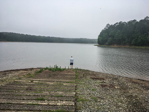
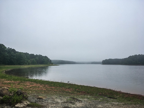
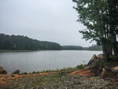
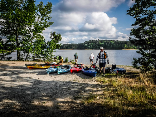
South Carolina Highway 28 took us pretty much straight to our meeting point at the Long Cane Boat Ramp. All along the way I kept an eye on the radar map. We had a small cell approaching, but it look like it would just be rain. When we got to the ramp it was cloudy and foggy, but weather was fine. The ramp was down a long dirt road, and I couldn’t see any way to launch a motor boat there, but the park looked nice. Water levels on the lake were very low, and Matt and I had been concerned about the levels on the creek itself.
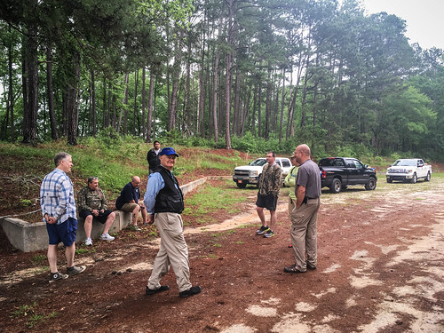
Jerry, John, and Sean were already there waiting for us. Matt and Jimmy had the longest drive, and took a bit longer getting there, but soon joined us.
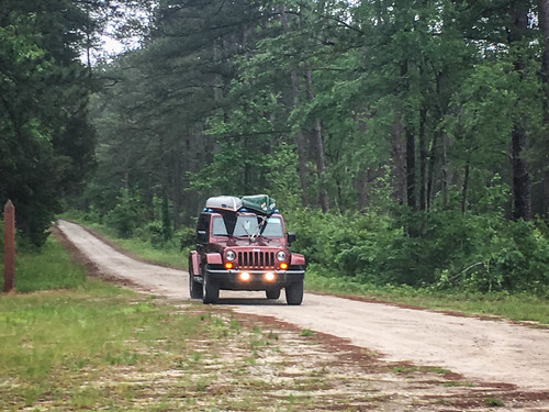
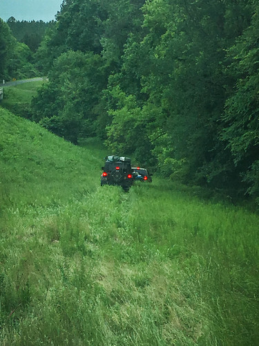
We shifted boats around and left Jerry’s truck at the take out, then drove back up SC 28 to our put-in at Bradley Bridge. There was a rough dirt road on the east side of the creek, but when we got down there the drop to the water was significant. We decided that the other side would make a better launch site, even though it meant four-wheeling over a grassy bank.
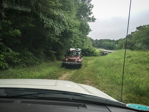
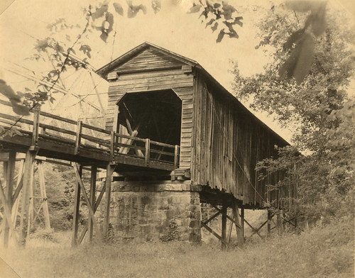
We parked the vehicles under the bridge and got our gear together for launch. Next to us were the old bridge abutments for the Long Cane Creek Covered Bridge, which burned in 1979. I was fortunate enough to see the bridge on one of my visits. Houston photographed it, and the bridge was the subject of a recent photographic mystery. I also just now noticed that in Houston’s photo the “new” bridge is an old steel truss bridge, now replaced by a modern concrete structure.
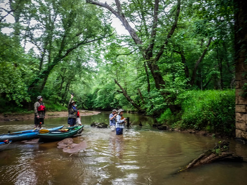
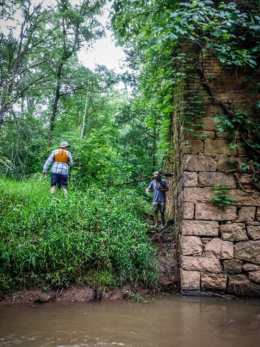
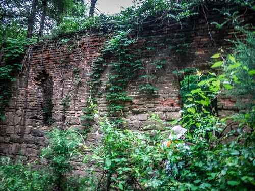
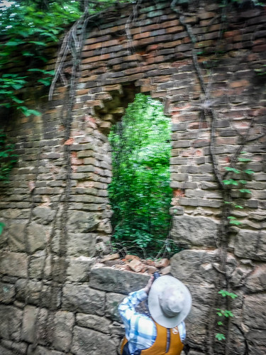
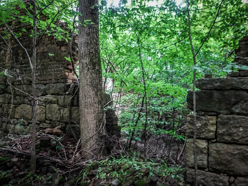
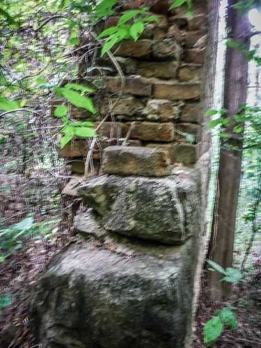
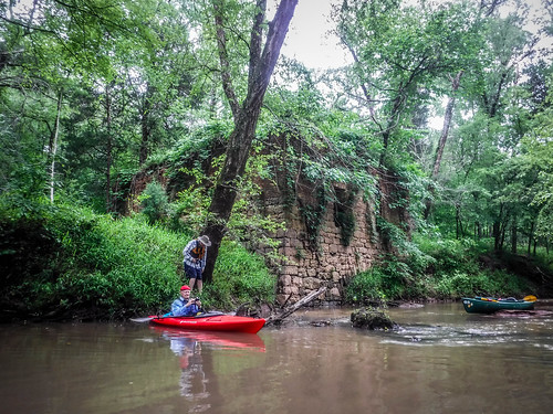
Water was shallow, but navigable. There was a moment’s confusion as Matt started walking upstream without his boat. Several of us paddled along upstream to follow, wondering where he was heading. We found out soon enough. Just upstream from the bridge are the ruins of Bradley Mill.
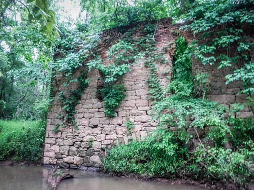
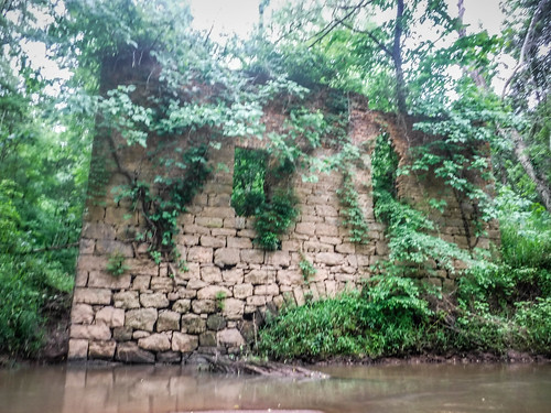
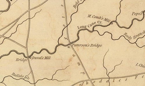
Originally known as Gervais Mill, this mill was operated by Andrew McCombs, and is shown on the Mills 1825 Atlas as “M. Combs’ Mill”. In addition to operating the mill, McCombs was a stone carver who was commissioned by Patrick Calhoun to carve the Indian Massacre Memorial stone, further downstream.
The mill was later acquired by John Bradley, and the covered bridge became known as Bradley Bridge, for the mill.
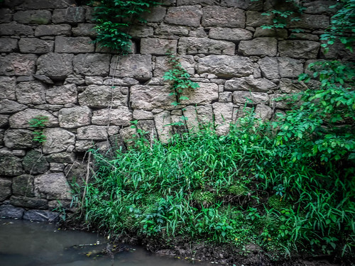
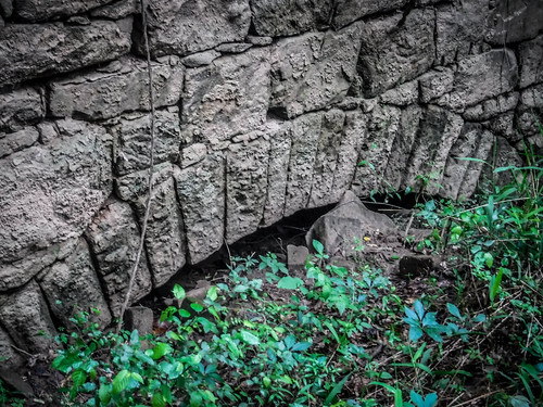
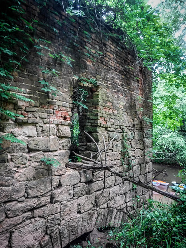
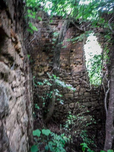
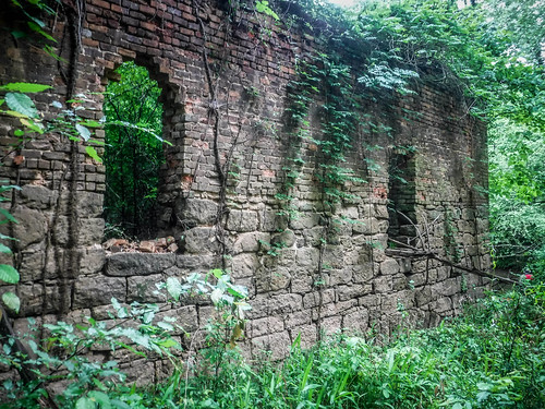
Several of us got out of our boats to explore the old ruins, even though poison ivy was sprouting from the top of the building. All that remains are thick brick walls. Archways along the base were probably where the water flowed over the turbines to turn the mill stones.
It was time to head downstream. We loaded back into the boats and paddled under the new, modern Bradley Bridge. It is interesting to note that the mill shows up on the Mills’ Atlas, but the bridge does not. The only bridge indicated is the Patterson Bridge further downstream, which we would reach later.
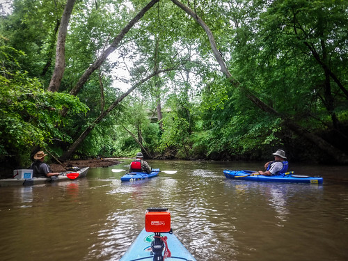
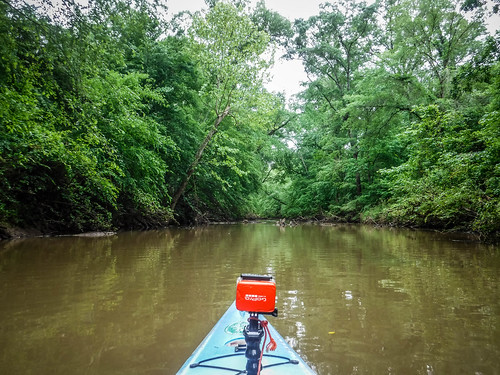
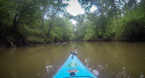
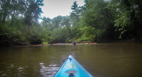
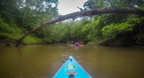
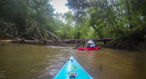
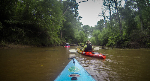
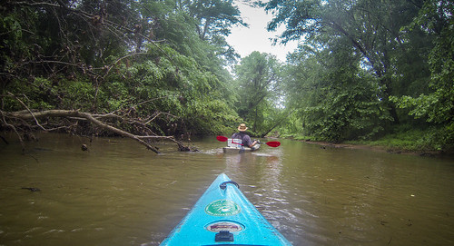
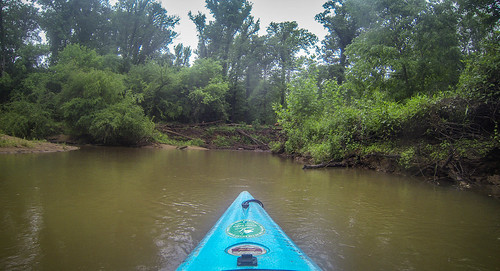
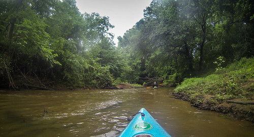
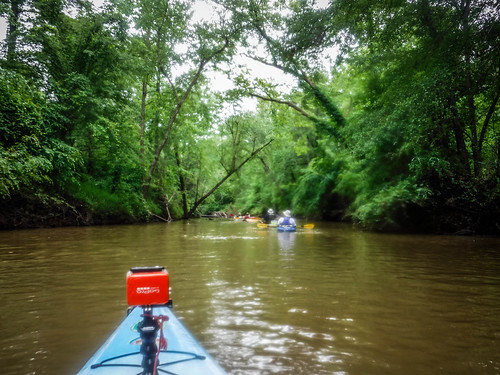
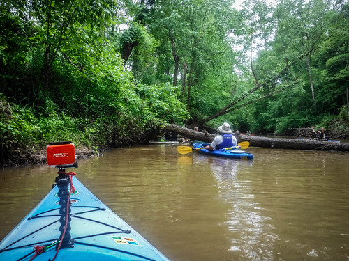
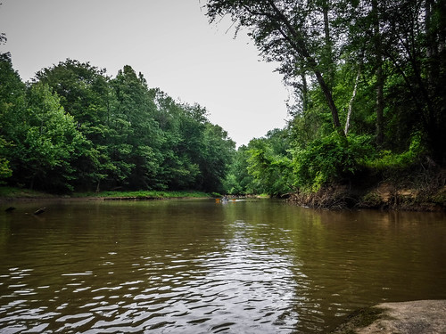
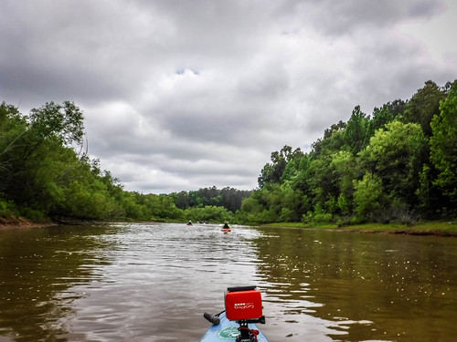
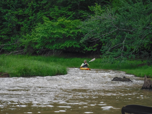
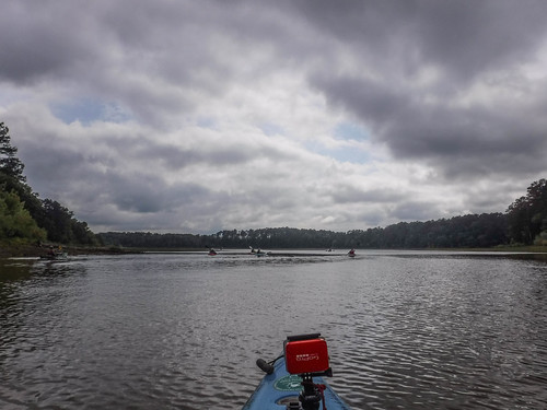
Long Cane at this point is so typical of Upstate creeks and rivers, and reminded me of my early paddling days. Bob and I have explored many rivers with the same characteristics. There were shallow sandbars to dodge, and after awhile you developed a knack for reading the river and understanding where the best paddling might be.
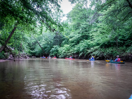
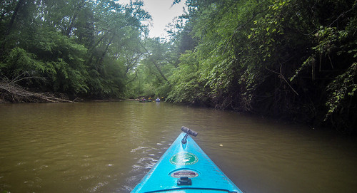
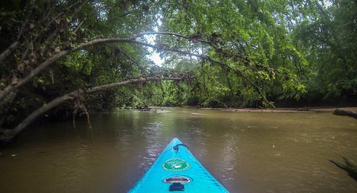
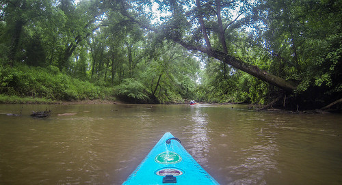
As for the scenery, the lush green and completely undeveloped banks were amazing. Photos can’t capture the peaceful feeling of the creek. That would change soon enough, though.
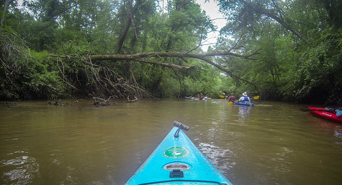
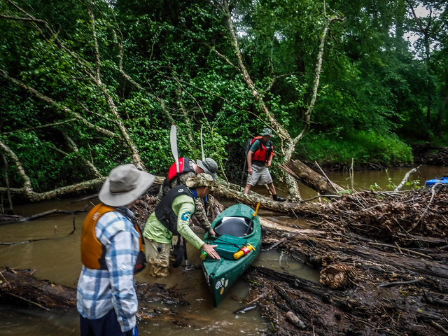
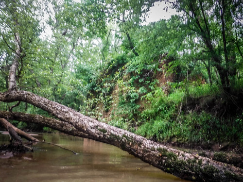
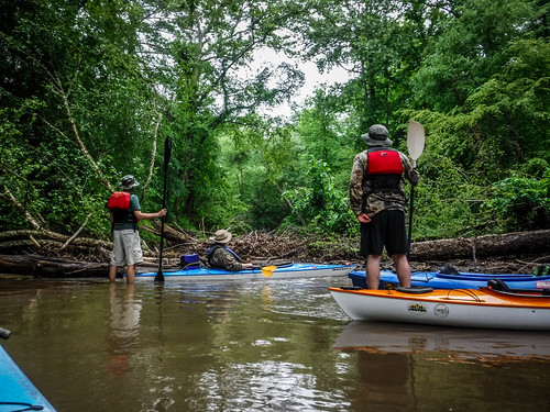
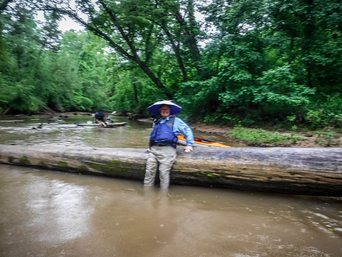
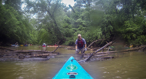
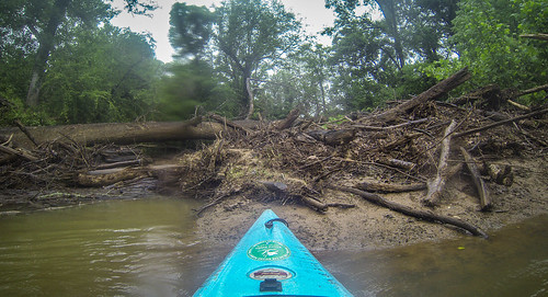
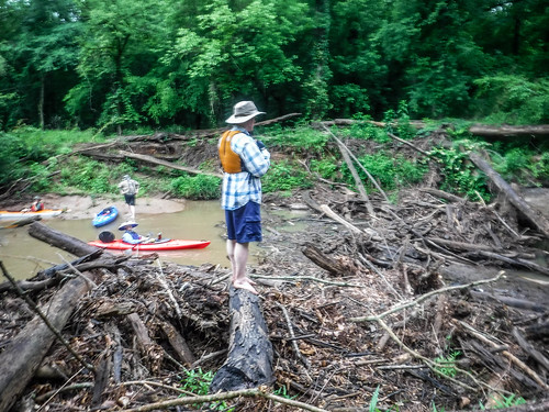
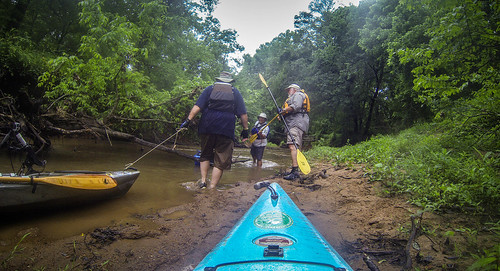
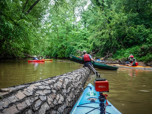
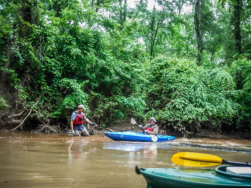
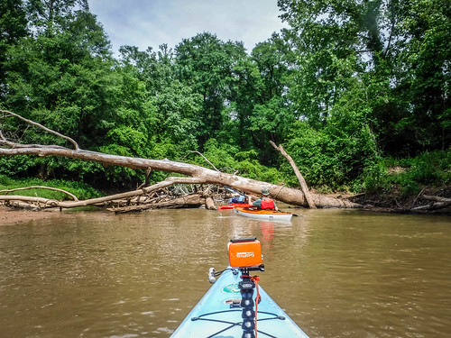
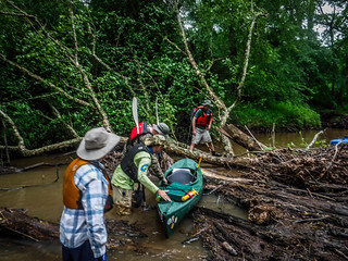
We came upon the first log jam fairly early on in the trip. Several trees had fallen and had washed downstream. We were able to find a way over them by wading and climbing, but getting the boats across was problematic. We set up a “fireman’s brigade” to pass the boats along over the logs. Matt acted as boat wrangler, catching the boats and beaching them on a sidebar as they came over.

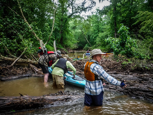
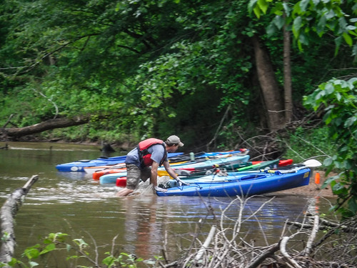
This process would be repeated many times throughout the trip. Yet, before the next portage the weather changed. Shortly after we made it through the first obstacle, the rains started. For us it wasn’t too bad, with a steady, but fairly light rain. I actually enjoy paddling and even hiking through this kind of rain. Back in our younger days Bob and I would don ponchos and do “rain hikes.” We would stand in the rain and it seemed that we would simply merge with the forest. I get that same feeling while paddling through this type of rain. Perception Kayaks used to have the tagline “One with the Water”, and that’s about how I feel paddling through rain.
However, it wasn’t like that everywhere. I got a worried text from Laura asking if we were OK. Ken Cothran sent me a text with a scary weather map image.
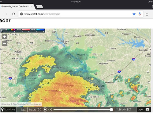
Severe weather was all around us, but somehow managed to pass just north and south of us. We threaded the needle. Since we were so far out in the wilderness, by the time I got Laura’s text I was out of cell range and couldn’t reply. I’m sure that didn’t alleviate her fears. However, all of us were experienced paddlers and we had one deputy sheriff and a search and rescue expert with us. I never felt like I was in danger.
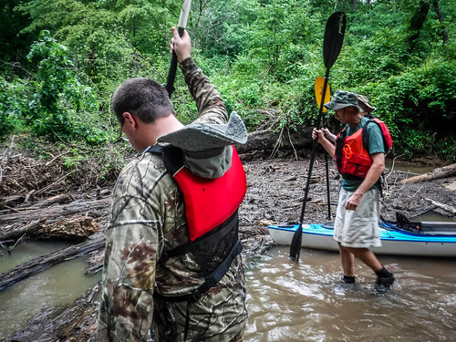
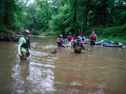
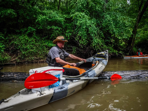
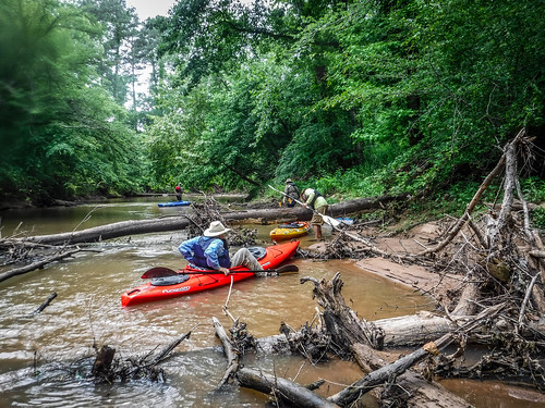
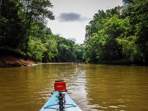
Larry said that this trip consisted of the “three P’s” – paddle, plunge, portage. We would paddle for awhile until we got to a blockage, plunge in, and somehow portage over or around the next jam. Bob said that the river was like a puzzle. You had to figure out the best way to get through it step-by-step. All I know is that I have lots of shots from the GoPro of my rear end dragging my boat. I was also glad I had my machete with me to hack through some of the underbrush and limbs.
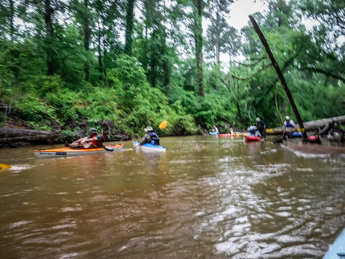
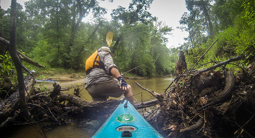
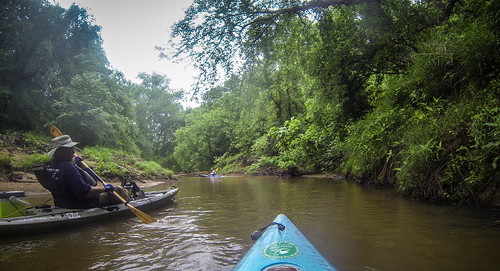
Sometimes we could figure a way around without having to get out of the boat, usually after playing some sort of limbo. There were lots of strainers where we could just get a running start and bounce over the log. Often the first person through would stand and help everyone else drag their boats across the log.
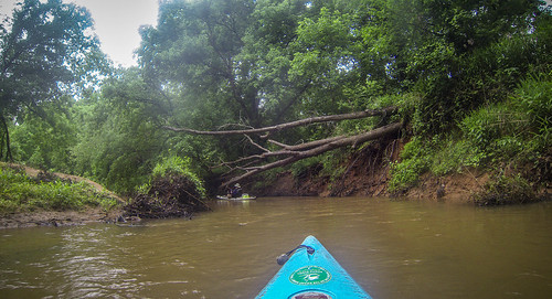
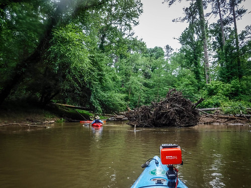
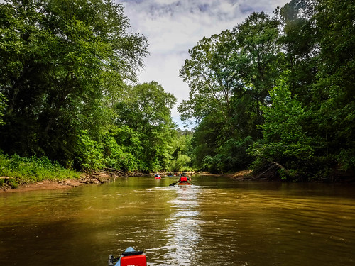
Even with the rain and obstacles, the scenery continued to astound. The wildness and beauty made the hardship worthwhile.
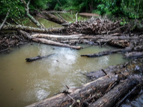
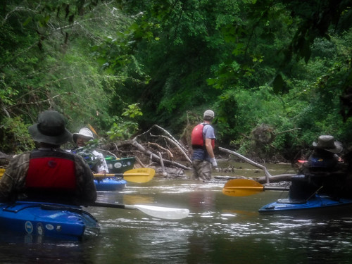
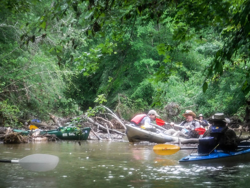
After a particularly tricky bit of paddling and dodging we came to a massive log jam and a quandary. The creek appeared to split. It looked like water was flowing both right and left, and we couldn’t figure out if the main channel went left through a more open channel, or right beyond the log jam. Matt, Alan, Bob, and I got out to explore.
Standing up on the bank I was able to get a minimal cell signal and was able to load Google Maps. From that I was able to determine that we needed to head left. That was a relief because I could see no easy portage around the big jam. Even so, there was a bit of dragging involved, but soon enough we were back on our way.
Downstream a bit further we came to a spot where a channel entered from the right. When I check the map back at home I could see that the big log jam was where an oxbow had been cut, splitting the river around a rather large island. That explained why the water seemed to be running both ways.
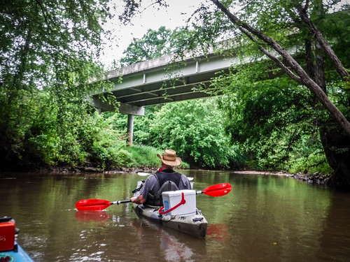
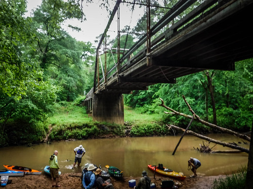
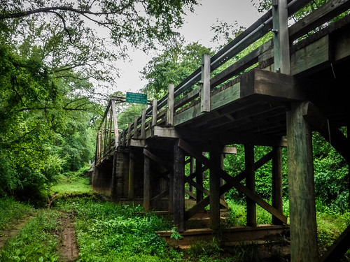
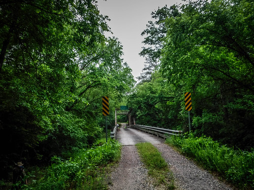
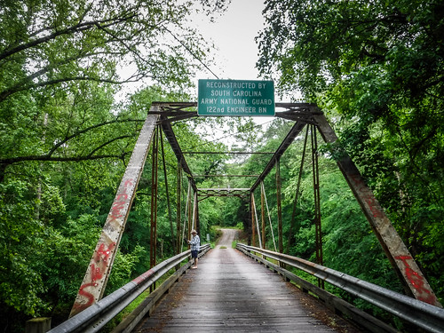
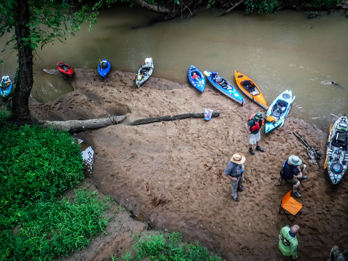
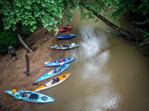
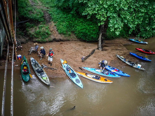
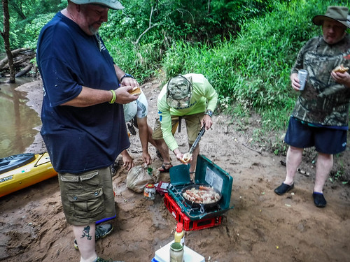
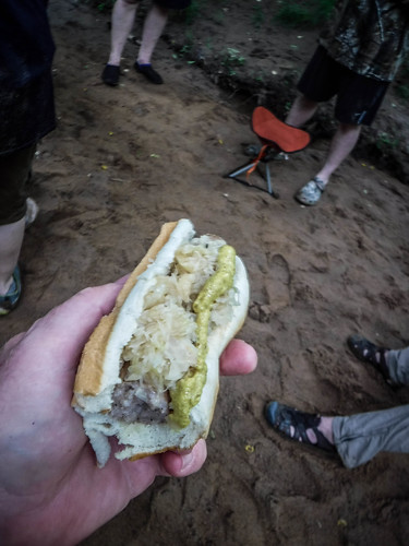
Eventually we reached the old Patterson Bridge. This is an old steel truss bridge on the Old Charleston Road. We were barely a fourth of the way into our trek, but we figured it was as good time as any to stop for lunch. We pulled up onto a beach beneath the bridge, which would shelter our stove should the rain start again.
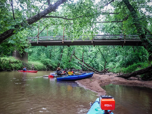
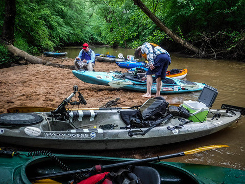
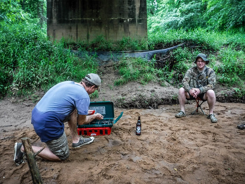
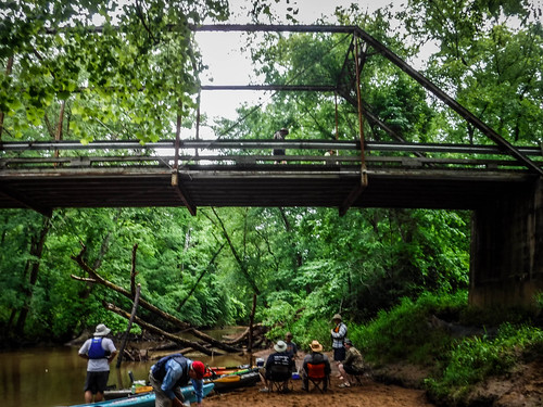
While Matt was grilling up the bratwurst and sauerkraut I decided to explore on foot. I climbed up the bank to the bridge. At this point the Old Charleston Road is just a dirt road. I got good views of the kayak lunch spot below.
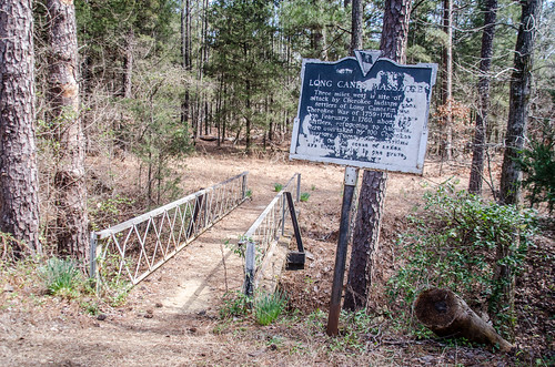
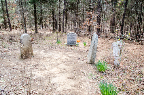
About a half mile from here is the site of the Indian Massacre Memorial. In 1747 the colonial South Carolina government purchased large tracts of land from the Cherokees in the area. This did NOT include the area along Long Cane Creek, but that didn’t stop several families from settling in the area, including the family of Patrick Calhoun from Virginia. They justified the settlement, saying that the treaty had included Little River, and Long Cane was a tributary of that river. The Cherokee petitioned the government in 1758 to have the settlers removed as a violation of treaty terms, but the petition was unsuccessful.
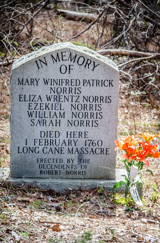
Later that year several Cherokee raids had taken place further inland, and the settlers began to fear for their safety. In February of 1760, while attempting to flee to the safety of a local stockade, the Cherokees intercepted and massacred twenty-three settlers.
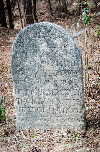
As mentioned previously, Patrick Calhoun commissioned Andrew McCombs to create a monument to remember those killed in the Cherokee raids, including Calhoun’s wife, Cathrine. Patrick and Cathrine Calhoun were the grandparents of John C. Calhoun.
I had visited the site previously with Alan and took these photos.
However, a visit wouldn’t be on today’s agenda. I was still suffering from gout, and a one-mile walk seemed beyond my capabilities. Plus, we still had a long way to go and also had no idea what was happening with the weather. I walked back down from the bridge and savored my lunch and a bit of rest.
Then it was back to more paddle-plunge-portage. I also got very tired from pulling myself over sandbars when I ran aground. Rather than get out and drag the boat (again) I’d pop my paddle apart and use both halves to pole myself through. I don’t have many shots of this section. My GoPro battery had run out and I just didn’t bother to replace it. Plus, I didn’t pull out my other cameras much at all.
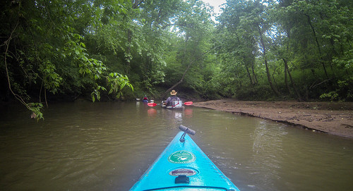
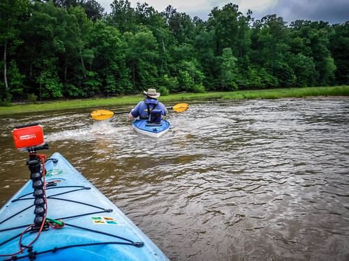
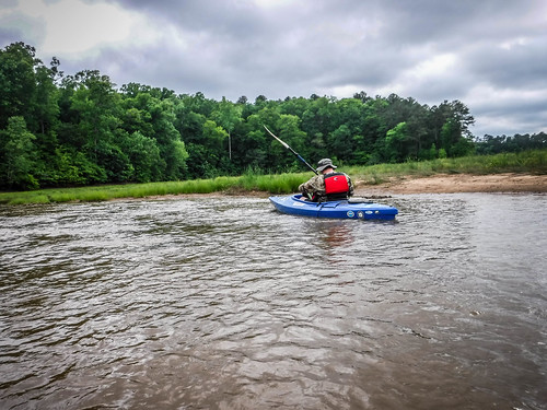
After what seemed like hours of paddle-plunge-portage we came around one bend and the character of the creek changed dramatically. Suddenly it was wider and the banks seemed more open. We had a glimmer of hope that we had reached the backwaters of Lake Strom Thurmond. However, there were still more obstacles, mainly sandbars, and we were still quite a ways upstream. Fortunately, there were fewer downed trees.
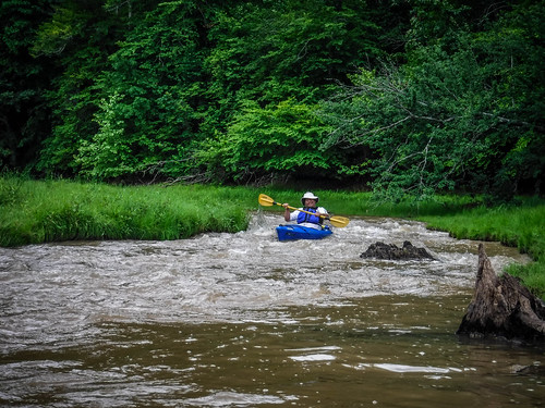
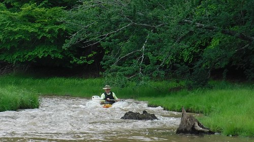
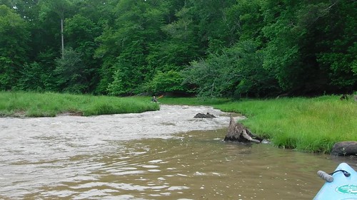
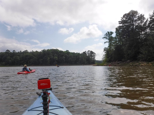
The vistas opened up and we knew we had finally reached the lake. We could see tree lines off in the distance, and grassy open spaces lined the waterway. And still there were obstacles and surprises. There was a fairly significant drop over several hundred feet, but it was over shallow water and thick, thick mud. We started calling it the “mud rapid.” Everyone was getting stuck, and, worse yet, you couldn’t get out to pull yourself without sinking into the mud. I had to resort to my split paddle method of pulling myself through. Larry lost a shoe in the process.
As we reached the end of the mud rapid we could hear the sounds of falling water and had to wonder what could possibly come next. It was a surprising little Class I-II rapid with a clear route dropping about ten feet over a sixty foot course. It was a surprise, and a delight to run after plugging through mud.
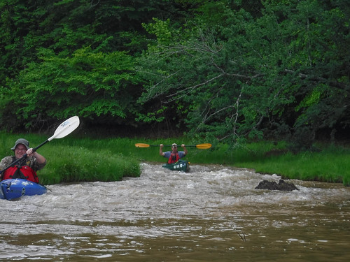
Here are two videos, first of Bob, then of Larry running the rapid.
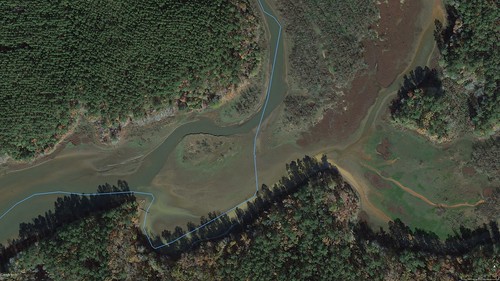
When I looked back at this section in Google Earth it looks like this rapid and the mud rapid are both new. The most recent GE imagery shows the main route going over what is now a grassy area.
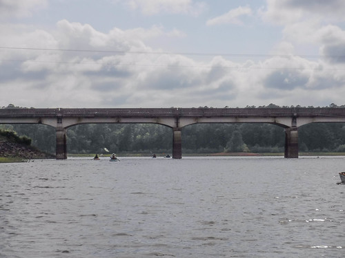
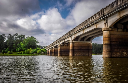
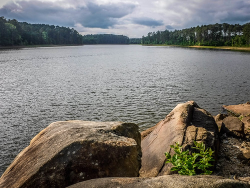
…and STILL we were not done. After the refreshing rapid we had three more miles of flat lake paddling. We plugged along. Fortunately, the skies were starting to clear, but it was also getting late. We paddled under the SC 28 bridge and could see the remains of the old bridge next to it, normally under water.
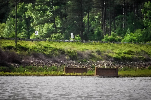
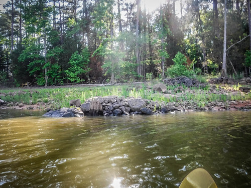
We continued on. Unusual rock formations lined the banks. We wondered if they were natural (which I suspect) or if they had been part of something else. Eventually we reached the Long Cane Boat ramp. We got off the water at about 6:00 pm, 9.24 miles and eight hours from our starting point at Bradley Bridge.
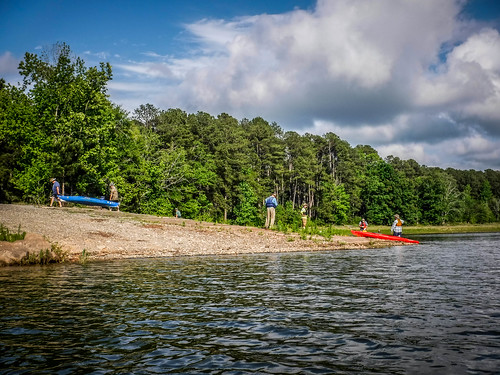
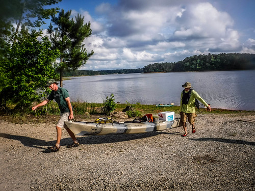
As we waited for the drivers to return with the trucks so we could load up, a truck with a boat trailer showed up. Amazingly he managed to launch, but he used the gravel area next to the ramp.
Soon the drivers were back and we loaded up, said our goodbyes, and dispersed until the next Second Saturday. As tiring as it was, it was still a great trip. After all, how can you call something an adventure unless there are no obstacles or surprises along the way?
Pretty darn cool!
I got tired just reading about all those portages and plunges.
Great read. I’ve always wanted to explore the Long Canes area, though after reading this I’m more inclined to do it on foot than by boat.
Perhaps the new rapid formations on the lakebed stretch were so-called “nick points”, which often form on exposed sections of impoundments during times of extended low lake levels. The stream, meandering through flats of mud/silt/sand, doesn’t necessarily revert to its old channel prior to impoundment. The newly flowing water easily downcuts through unconsolidated lake sediment until it strikes a buried ridge of rock. The damming effect of the newly exposed rock forms a rapid, at least until the lake basin fills back up. Once one starts forming, the kinetic energy of the falling water cuts even faster downward, so they can potentially become big rapids quickly, especially if the lakebed stays exposed for a few years.
Just stumbled across you narrative. Thanks for sharing!
Enjoyed your commentary and beautiful pictures so much. Discovered it while researching the old covered bridge for a presentation at my history club. I first Mett Matt Richardson and his future wife when arriving late one Sunday morning for church services I noticed a young couple in a Volkswagen bug in the parking lot. After talking a bit I invited them in to church. So glad I did because we managed to keep those two through the rest of their college, seminary, and his return as our full time preacher. Have inner tubed/rafted down to Patterson Bridge and had the same experience with the in and outs. Had a similiar experience down Little River from Hiway 72 to old Calhoun Mills. Tell Matt, Wayne and Cyndi Gary said hello.
Wow! I am impressed with your adventure. Yesterday, April 18th, 2022, my friend and I started at Hwy 28 boat ramp and our plans was to check on a beaver lodge that is near the entrance to “long cane creek” which we did not know about, took a left and realized this was all new territory to us. We went as far as time allowed us but plan on returning soon to see how far we can go without getting out of our kayaks. Lake level was 330.66. It was a great paddle.
PS, we saw 2 large metal pylons on the bank that was all rusted, about 10 ‘ high, 2 1/2 feet in diameter and may be 10 ‘ apart and was put together with rivets. What are they?
This was a great experience, and thank you for sharing it with everyone via the Internet. My ancestors, the Patterson and Baskins families settled on Long Cane Creek; I wonder if Patterson Bridge was constructed by them or just named for their presence in the area. These pictures are great, and the commentary makes it so much more interesting. It’s definitely a motivation to visit the area and follow your path down Long Cane Creek.
My ancestors, the Patterson and Baskins families settled on Long Cane Creek; I wonder if Patterson Bridge was constructed by them or just named for their presence in the area. These pictures are great, and the commentary makes it so much more interesting. It’s definitely a motivation to visit the area and follow your path down Long Cane Creek. Thank you!!!
Visited yesterday and now looking for settlement site. I went to John de la howe as a child just across from your pull out spot and just learned about the long cane story from Walter on SC npr.
Visited on ride back from natahala to edgefield