The problem with planning a paddling trip in spring in South Carolina is that the weather can be quite fickle. It was a second Saturday, and time for our monthly Lowcountry Unfiltered excursion. Originally, we had planned to do a new section of the Edisto River. However, recent rains and the threat of more rain in the area had us a bit worried about river levels and currents. The stretch under consideration was long with lots of twists and turns. With a strong current it could turn out like our trip on the South Edisto, which was not the most pleasant paddling trip.
Instead, we turned our attention to Lake Marion and the Santee National Wildlife Refuge. An out-and-back trip would give us greater control over the route should bad weather arise. Our group has paddled several sections of this lake, including Sparkleberry, High Falls, Ferguson, and Persanti Island. However, we hadn’t done the wildlife refuge on the north side of the lake. It was time to check it out.
I had planned to head down early Friday morning and do some photography and exploration of the area. Since it was threatening rain, I just go up early and drove down Saturday. For most of the trip down a light rain fell, and I was glad I had delayed the trip.
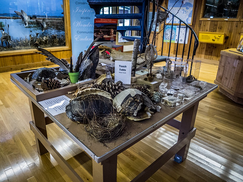
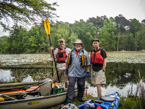
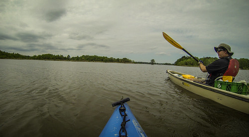
Our rendezvous was at the refuge headquarters, just north of I-95. Only three of us would be making the trip. Matt Richardson and Jimmy Steinmetz made the drive up from Bluffton. We took the opportunity to check out the displays at the visitors center and ask about paddling routes.
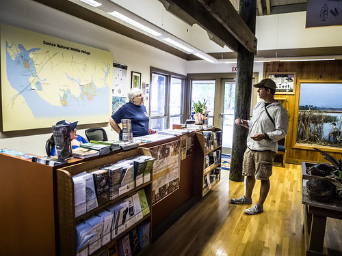

The visitors center is in the “Bluff Unit” of the refuge. This section features the remains of Fort Watson, as well as the Santee Indian Mound. Since all three of us are history buffs this was mighty tempting. However, we had been told that our best paddling options were about 14 miles east in the Cuddo Unit of the refuge.

At least we could see the mound from the deck of the center. There was still a light mist and clouds, but it looked like we would be OK, weather-wise. We mounted up and made the drive through the country over to the Cuddo East section of the refuge.
Multiple dirt roads cross the Cuddo Unit, creating a nice driving tour around the wildlife refuge. One route drops down along the main lake shore, and bears the moniker “Alligator Alley.”
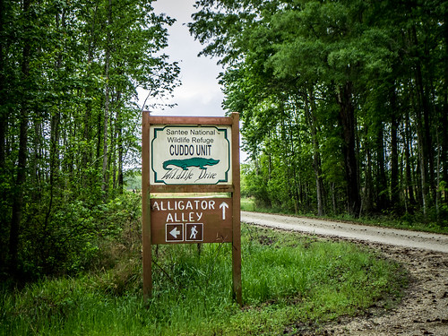
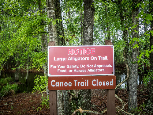
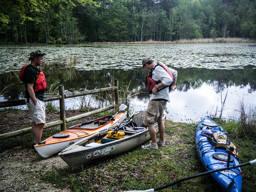
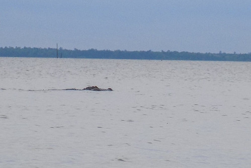
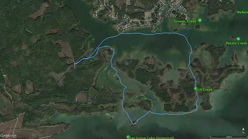
Alligators would definitely come into play in a trip plans today. There is a designated canoe trail in the Cuddo Unit that follows the path of an old canal. The route is fairly short, only about 1.5 miles, but it does open out to the lake. We had been told that the canoe trail was closed because a rather large, territorial alligator was roaming up and down the narrow channel. Our target was the end of that route, where we had access to the lake. It wasn’t easy to spot. We drove right past it the first time and had to circle back around to get to it.
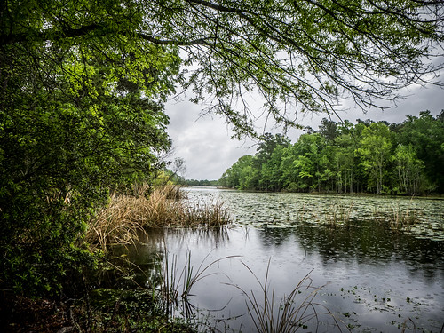
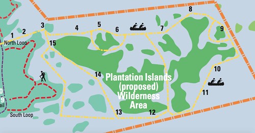
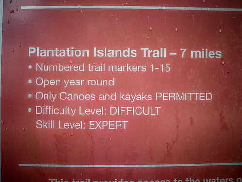
There was a nice dirt access point leading down to the river. A barrier separated the canal from the open water, so it wouldn’t have been possible to paddle back into the channel. That was OK with us. The route we were taking would lead out to the Plantation Islands, a relatively new canoe route established by the refuge. A sign listed this route as “difficult” and recommended it only for “expert” level paddlers. We kind of wondered about that.
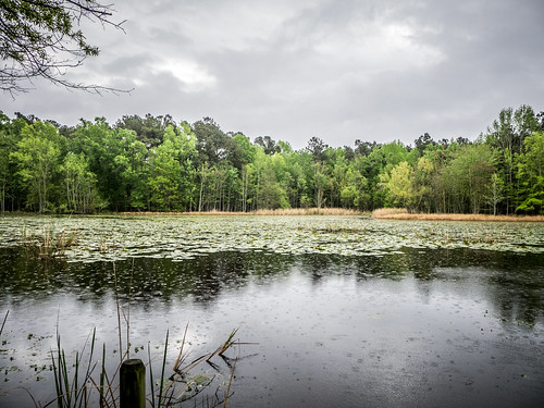
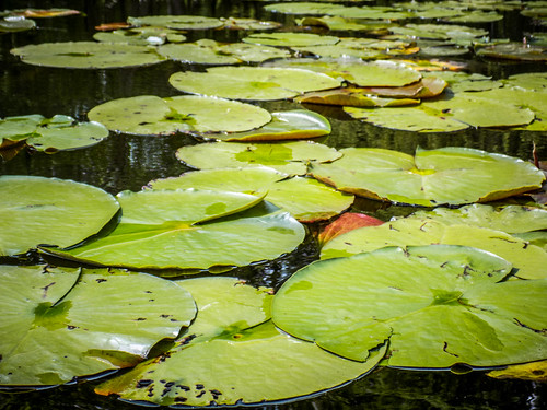
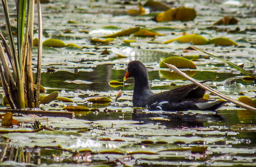
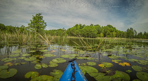
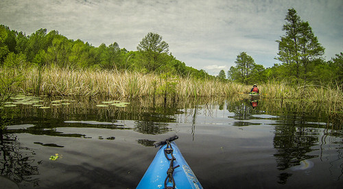
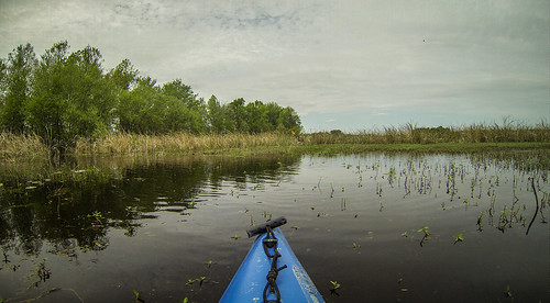
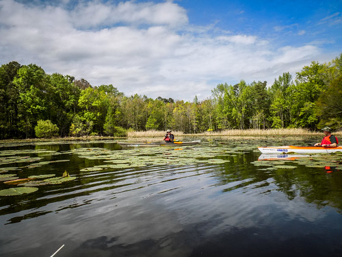
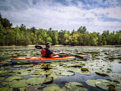
This area was completely covered in lily pads. We would have to paddle through vegetation to get to open water, which isn’t ideal. I could see several Gallineaus out in the water.
All of the sudden we heard thrashing in the water. We began to wonder if the large alligator had decided on a change of venue. Turns out, these were enormous carp, splashing about in the grasses. I wanted to get a video or a photo of one, but these were uncooperative.
The fish were huge, and we had our doubts as to what they really are. Sterile carp have been introduced into the lake to combat the invasive hydrilla. As it happens, the Guinness Record for catfish was caught in this lake…

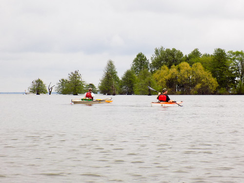
We launched and headed out into the lily pads. After awhile we made it out to clear water and could paddle more easily. Even back in here a couple of fishing boats were trolling along.
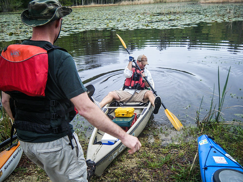

Since it was very much last minute as to where we were paddling, I felt unprepared for this trip from a navigational standpoint. I had my GPS, but only marked the location of out put-in so we could get back. I hadn’t marked any other waypoints. I had my phone with me, but left it powered down most of the time to save battery life. Plus, there wasn’t good cell coverage out on the lake to download maps.
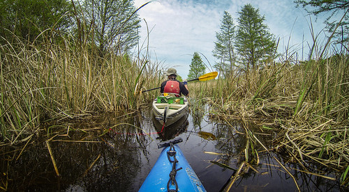
The upshot was that I was completely turned around when we came out of the little bay we were in. I could see houses on the opposite bank, but I had no idea which direction the main lake happened to be. Matt had remembered to bring one of the refuge maps, and that was a good thing. Despite that fact that it felt like we were going the wrong direction, I let him take the lead. It was a good thing we did, because we were on the correct path.
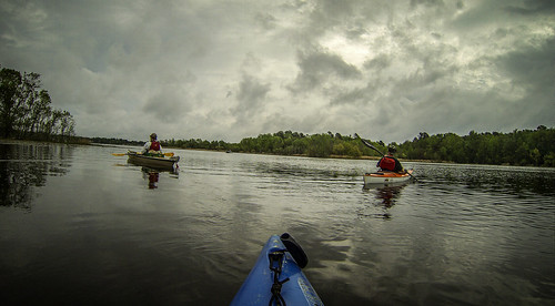
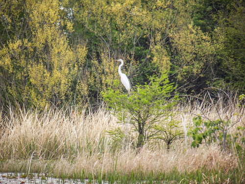
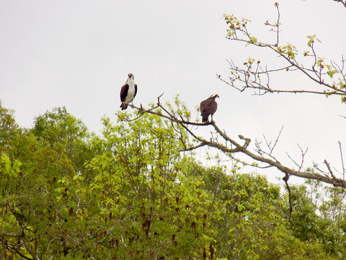
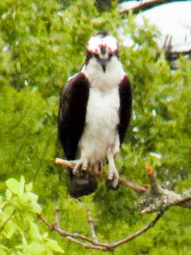
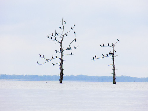
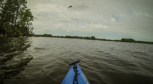
We encountered TONS of wildlife along our route. We did spot an occasional alligator out in the water. There were lots of birds, including herons, egrets, and cormorants.
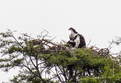
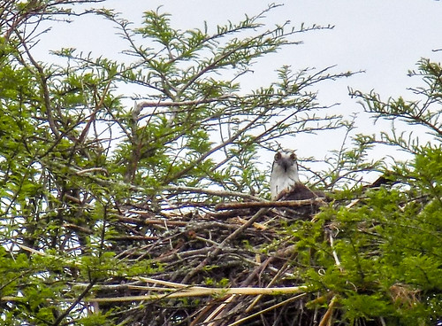
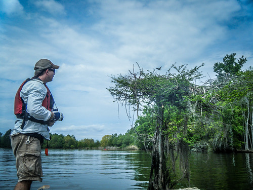
Ho hum…there’s another osprey nest.
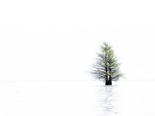
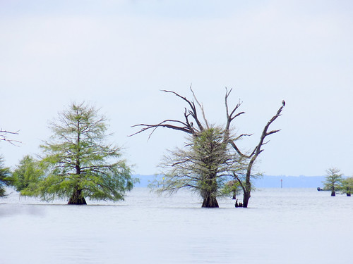
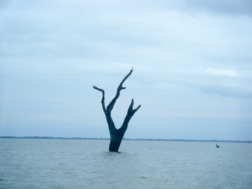
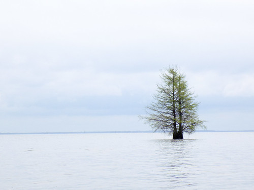
Most striking, though, were the number of osprey nests. If there was a lone cypress tree out in the water, chances were that it had a nest with a mating pair. There were so many that we almost got blase about them. They were everywhere. Here’s just a sampling…
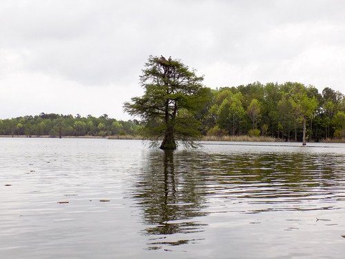
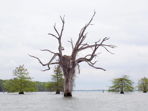
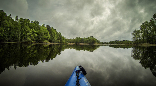
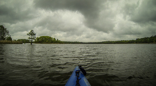
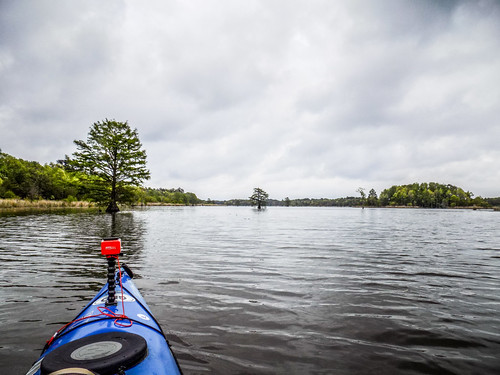
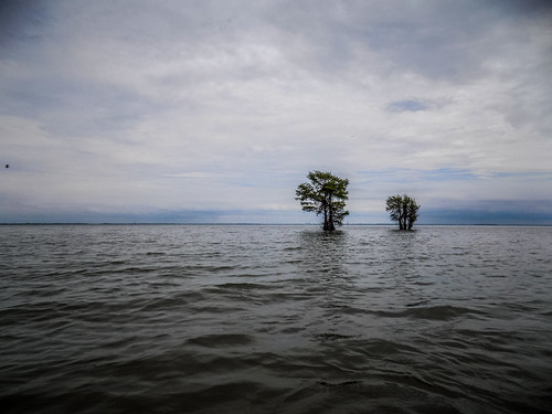
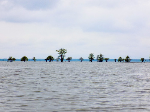
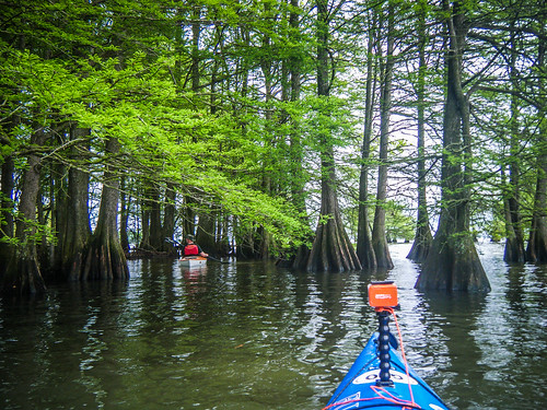
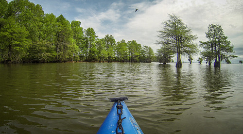
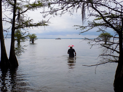
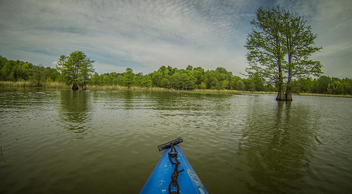
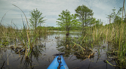
Eventually we reached the open water of the main lake body. At 192 square miles, Lake Marion is the largest in South Carolina. The opposite shore is but a faint blue line in the distance. This creates a striking contrast between the lone cypress trees left during the lake’s construction and the lines of blue and gray.
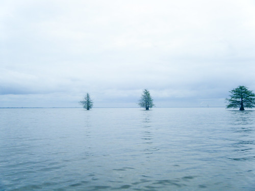
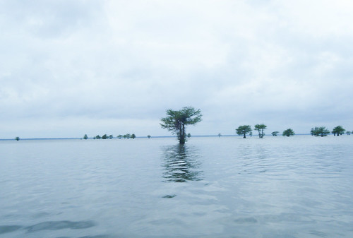
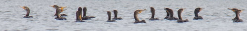
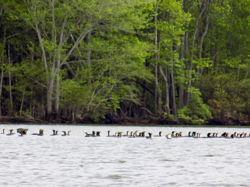
We paddled along the outer island, weaving in and out of the cypress trees. The large carp continued to frolic around any tree or bit of vegetation. Cormorants are much more prevalent out here, too. So much so that they have become a nuisance. These are feasting on the carp that have been imported to take care of the eel grass. (Although, I can’t imagine them eating something five times their size – must be getting the young ones.) DNR has resorted to the controversial practice of hunting cormorants when they start preying on the carp.
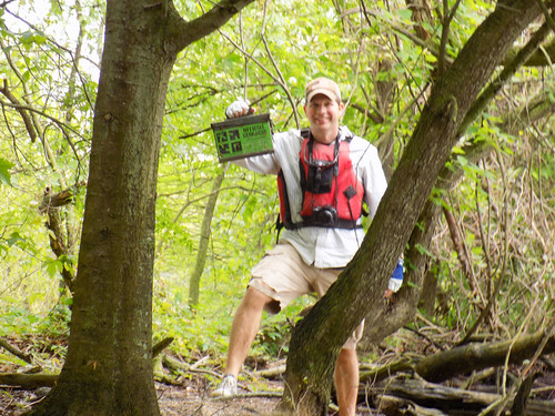
We stopped on one island were Matt had a geocache marked. It was an ammo box that he easily found, and we both logged.
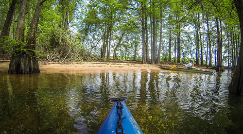
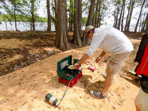
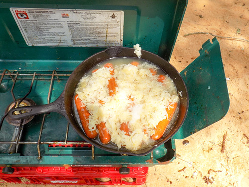
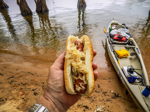
The spot where we found the geocache might have been a good lunch stop if hadn’t been for the poison ivy everywhere. Having battled that last year, I suggested that we continue on. We found a wonderful stretch of beach sheltered behind a stand of cypress on one of the larger Plantation Islands. Here we took our usual communion of bratwurst, sauerkraut, and beer.
The water was incredibly clear. Even though it was a bit chilly, Matt decided that he needed to go for a dip.
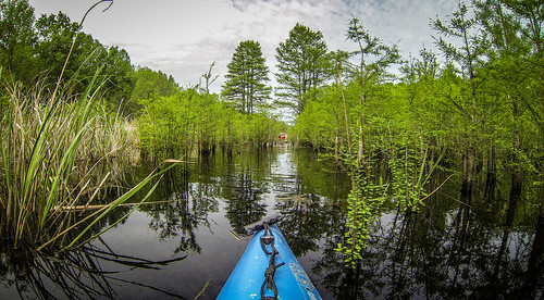
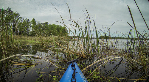
Suitably refreshed we loaded back up and headed on our route. The map indicated a channel between two of the islands, and we thought that might be a nice change from the open water. We turned into the inlet and paddled back in. As we proceeded we started to question whether or not it would actually go through. There were lily pads, which then gave way to tall, thick grasses. It was tight, but Still Creek did provide us a narrow channel all the way through. Fortunately, we didn’t come across any gators.
Here’s a bit of video from that section:
We were now on Potato Creek, the large channel separating the Plantation Islands from the north shore of the lake. There was LOTS of boat traffic, mostly large pontoons, but a few bass and ski boats. The one distressing thing was that these ripped past with no regard to their wake. Lake Marion is a motor boater’s lake. It’s almost better to stay back between the islands and cypress trees if you’re paddling.
Matt had another geocache marked on a small island, so we went in search. We paddled through another narrow grassy channel, and popped out on the other side. When we got to the location of the cache the mosquitoes were so bad that we decided not to pursue it.
We decided that it was time to head back. My GPS indicated that our access point was dead head, so we set off. The north bank of the lake was lined with nice homes – not overly elaborate, but nicely maintained lake getaways. Boat traffic continued at a quick pace through here, and I wondered how bad it would be on a Saturday in summer.
Eventually we reached our little cove and paddled back into the lily pads. We had paddled 6.5 miles – not too bad. Amazingly, we had managed to stick to the main marked routes on the map.
Here’s a time-lapse of most of the trip. I didn’t get to the GoPro to change the battery quick enough, so it ran out a couple of times.
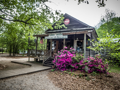
Our other tradition after these trips is to find a local BBQ joint of an after paddle repast. This time we returned to Lone Star Barbeque north of Santee and ate far too much.
Some final thoughts…
The name “Plantation Islands” puzzled me. I wanted to know which plantation, and what was the historical background of this area. Alas, there was not much to be found. Potato Creek connects with Wyboo Swamp. There was a Wyboo Plantation back in the late 1700s, but I haven’t been able to find any more information on it. Any searches bring up links to a golf course community of the same name near Manning, SC. The name would have to have been fairly recent, since the lake was formed in 1939. Historical maps don’t show any significant islands or hammocks in the Santee swampland. I guess it’s just a generic name, referencing all the other plantations that were inundated by the Santee Cooper project.
Lake Marion continues to amaze me as a paddling destination. The scenery is dramatic wherever you go, and you can see a variety of environments in just one short paddling trip. That being said, it does distress me the way boats tend to ignore kayaks and paddlers. Other places I’ve paddled – Florida, Lake Jocassee, etc. – boats usually slow down, or at least swing wide so that the wake doesn’t cause problems. Not here. They zip by fairly close with no regard to their wake. I had to hold my tongue and temper on several occasions. Still, this is a fantastic place to paddle. I want to came back to the Santee Wildlife Refuge and take the driving tour with Laura, next time armed with my big Nikon and long lens.
Here’s a slide show of all the images from the trip, including a couple of church cemeteries I caught on the drive back home while I still had light.
[fsg_gallery id=”62″]
i live on Lake Marion and enjoy reading your posts about it.