By the time the town of Ferguson was swallowed by the waters of Lake Marion, it had already been abandoned. That was not the case with other plantations and residences in the area. The Santee-Cooper project was both hailed as a New Deal marvel, and derided for robbing many of their homes. It’s history has been one of controversy.
As with many things that seem to cause trouble in South Carolina (slavery, Civil War, Mark Sanford, etc), that history had its roots in Charleston. While the peninsula makes an excellent harbor situated between the Ashley and Cooper Rivers, those rivers don’t really go anywhere. They provided adequate access to the low country plantations, but they don’t penetrate very far into the state. By contrast, Savannah was right on the banks of the Savannah River, which provided an easy way to get goods from far inland down to that coastal city. In this state, boats coming down the Santee River had a long stretch along the ocean beset with tides and storms. There seemed to be no good way to get goods from the interior of South Carolina to its largest city.
In the late 1700’s the Santee Canal Company was formed to explore the possibility of connecting the Santee River with the Cooper River, providing a route into Charleston. Construction was begun in 1793 under the direction of Col. Christian Senf. William Moultrie was one of the principal shareholders, and eventually president of the company.
The canal did a great business until droughts of 1817 and 1818 dried up most of the waterway and left boats stranded. Eventually, railroads replaced the canal traffic, and the canal fell into disuse. However, the dream of a complete waterway connecting the Santee and Cooper Rivers persisted.
Fast forward about a hundred years…
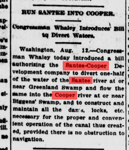
The plight of South Carolinians had not improved. Floods threatened the Congaree-Santee basin on a regular basis, and malaria was prevalent. The whole area was impoverished, and illiteracy was common. As early as 1914 it was reported that the Santee-Cooper project was being planned.
These early discussions of the Santee Cooper project focused on the navigation aspects – the creation of a new canal linking the two rivers. Hydroelectric power was a secondary consideration. The lakes themselves weren’t really considered.
Bills were introduced, but the project lay dormant for another 20 years. According to a retrospective in The State newspaper…
In 1934, state legislation established the S.C. Public Service Authority to construct and operate the Santee Cooper Hydroelectric and Navigation Project and improve “health, welfare and material prosperity.” The lakes and the dams would do just that by providing electricity.
In 1935, a guaranteed federal loan and grant promised a beginning. But court fights with private utility companies delayed the start of work until April 1939.
Soon, blacks and whites, pulled from the relief rolls of every county in the state, were at work. The Works Progress Administration gave 9,672 South Carolinians jobs at the project’s peak, according to the 1944 “Picture Progress Story of the Santee Cooper.” In all, 12,500 workers were employed.
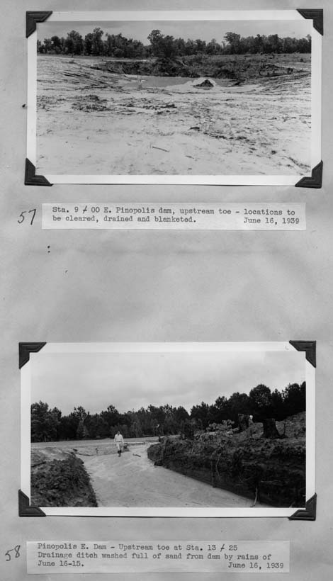
WPA Workers swarmed over the Moultrie basin cutting trees, clearing stumps, and completely clearing the area. Several photographers were instrumental in documenting the work. First up is Harry T. Poe, Senior Engineer for the Santee-Cooper Navigation and Hydro-Electric Project. Poe kept a scrapbook of the project, which has been digitized and is now part of an online exhibit created by Clemson University. The images shows the planning and early construction stages of the Pinopolis Dam and Lock, as well as images of the area from before work began. Unfortunately, the website is not very well organized and is not searchable.
Jack Delano was a WPA photographer who also documented the construction. Many of his photographs of the area can be seen at the Library of Congress’s American Memory website.

Jack Delano, Photographer

Jack Delano, Photographer
Samuel Lord Hyde was placed on the team tasked with documenting cemeteries in the area to be flooded. His photographs can be found on the Lowcountry Digital Library website.
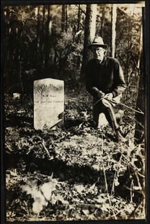
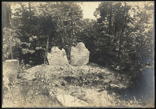
Another photographer named in The State article was C. R. “Dick” Banks. From June 1940 through December 1941, Banks was a WPA photographer, recording the land clearing as well as the plantation houses doomed by the project. He now lives in St. Matthews, SC.
According to the The State article…
While 6,000 graves were moved, many were left to the waters. A 1939 architectural report cited 22 endangered plantation houses, mostly in Berkeley County, mostly demolished, a few moved before lake waters rose. Banks remembers an owner staying in a corner of an historic home as it was dismantled; he remembers another killing himself.
The report was the Waterman Report, and provides a contemporary history and description of the area. The individual described by Banks was one Joseph Simons. Simons lived at Pond Bluff Plantation, which had originally been the home of Francis Marion. According to Douglas Bostick’s book, Sunken Plantations: The Santee Cooper Project, Marion’s original home was long gone, but Simons had built a new home at Pond Bluff. Simons refused to sell to Santee Cooper, which then invoked eminent domain to seize the property. Simons exhausted his legal options, and in 1939 stood on the porch of his home, pulled a gun, and shot himself.
Simons was buried at Rocks Cemetery, one of our paddling destinations for last Saturday. His headstone states that he was killed with a self-inflicted gunshot wound. We looked for his grave, but unfortunately I couldn’t remember Simons’ name when we were out paddling, and there was no signal to look up the information on a smart phone. (CORRECTION/UPDATE: Simons headstone DOES NOTE indicate a cause of death.)
With rumblings in Europe and the threat of war, construction was ramped up. Lake Moultrie was cleared of stumps, graves, plantations, and everything. Lake Marion was done a bit more haphazardly. According to one worker, Bill Fletcher…
Their idea was to cut the trees down, get the stumps, and tops, and everything out. He [the foreman] says, “Forget about that. Cut the trees down or leave them standing. It don’t make any difference.” He says, “We want that lake filled up.” So that was the number one priority at that time. “Get that lake filled up. We need the electricity.”
Transcription from video interview from “Serving Their Country: SC’s Greatest Generation SCETV/ITV, 2002
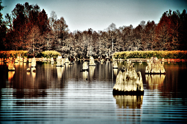
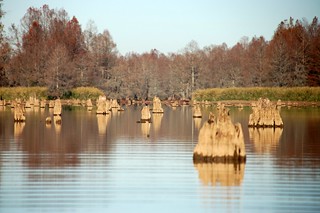
So, cypress trees can be found right out in the lake. Large tracts such as Rimini and Sparkleberry Swamps are still thick with trees. In these places stumps can be seen below the waterline, and can be a hazard for boaters. At lower levels, such as was seen in the shot below from a paddling trip Alan and I took to Low Falls Landing in 2011, the stumps are clearly visible.
…and so we return to Ferguson…
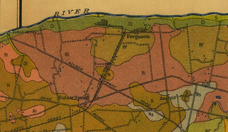
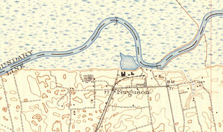
Even though the town was long abandoned prior to flooding of the lakes, it was spared the clearing because of the rush to finish the power plants. I was able to find some early topography and soil survey maps from the SC Memory collection that show Ferguson prior to the waters’ rise.
In the image below, I took the 1942 topo map and overlaid it onto Google Earth. This shows the current Ferguson Island, and where the buildings were originally. I wish I had done this before we took our paddling trip. We might have explored the area a bit more.
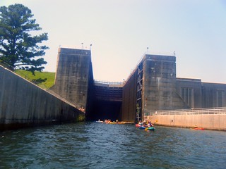
And so the waters rose and the lakes formed. In addition to electricity, the Santee Cooper Project did create the long-sought water route from Columbia to Charleston. A diversion canal links the two lakes, while the Santee River flows eastward from the dam at Lake Marion and bypasses Lake Moultrie. At the Pinopolis Dam on Lake Moultrie, the Pinopolis lock lowers boats 75 feet down to the Tailrace Canal, which then connects to the Cooper River. At the time of its completion, the lock was the largest single-stage lock in the world. The New Deal project was one of the largest WPA projects of that era, and one of the largest land-clearing endeavors undertaken.
However, the controversy continues. As late as the 2000’s a proposal was submitted by Congressman Jim Clyburn to build a bridge across upper Lake Marion from Lone Star, now a ghost town, to Rimini, a wide spot in the road on the other side of the lakes. Clyburn argued that it would bring economic development to an impoverished area, while others derided the plan as a “bridge to nowhere.” In 2007 the S.C. Department of Health and Environmental Control denied the necessary permits for the Department of Transportation to begin work on the bridge. However, the issue isn’t dead, and may still happen.
The series documenting the history of the Santee Cooper area in The State newspaper was actually a multi-part series examining the controversy. The entire series is well worth the read. You can follow the links in the article above, or read the entire article below:
Special section: Bridging Lake Marion by thestate
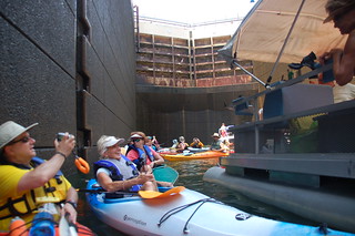
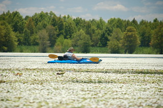
Growing up, the two lakes fascinated me. I was a true map geek as a child, and the incredibly long, straight dam on Lake Marion caught my attention on South Carolina road maps. However, those lakes might as well have been as far away as California. Just recently, I have been able to paddle several sections of the lake. In addition to this most recent trip, I have paddled through the Pinopolis Lock from Lake Moultrie to the Tailrace Canal…
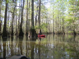
…I have paddled Sparkleberry Swamp on multiple occasions…
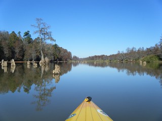
…I have paddled up the Santee River bed from Low Falls Landing…
And I’ve circumnavigated Persanti Island on the north end of Lake Marion.
I must say that I prefer Lake Marion to Moultrie because the trees, stumps, and old buildings were left. I’m glad the government ran out of time. It has a wilder feel to it, and there is so much more to see. Despite the adult entertainment dives in Santee, the setting really is spectacular, and it’s quickly becoming one of my favorite paddling venues.
That opinion is not universally shared, though. When John Lane took his Paddle to the Sea, he completely skipped Lake Marion. This is how Lane saw it…
For me, Lake Marion was an engineering monstrosity and it held no attraction…. A man-made lake is a mere placeholder, a clot in the natural system that over time will clear itself. An impoundment is simply waiting for centuries and gravity to release the flowing water from our utility or recreational needs and return it to the natural river it once was. On the Santee, time will prove more powerful that politics and engineering.
Some paddlers have a much different view. Several years ago I served as a mapping consultant for an SCETV RiverVenture project. Nature photographer Richard Bernabe was taking a similar paddling trip. While John Lane avoided Lake Marion and stuck to the natural route of the Santee River, Bernabe paddled the lake, then went through the diversion canals, Pinopolis Lock, and Tailrace Canal down to Charleston. But, then again, Bernabe’s trip was funded in part by the Santee Cooper Project.
My opinion? I think I would have preferred a wild Santee River. However, this is what we have now. I am willing to enjoy paddling the flooded forests of the lake. The area had already been logged by Ferguson and Beidler, so much of the virgin forests were gone even before the lakes were built. Still there is much wildlife and beauty to be found, and I would not like to see anything else disrupt that view.
More reading…


Thank you for these three write-ups on Ferguson and Church Island. You found the answers to several questions that Doug Bostick’s book left open. I grew up in Sparkleberry swamp where my father had a cabin and we spent a lot of time after cabin was torn down in 1972 in the Ferguson area. Never knew the road bed was the railroad. Especially appreciate you overlaying the old map onto Google Earth. Makes the picture so much clearer. Thanks again for sharing.
Can anyone tell me about a plantation/farm…Quackenbush? My grandmother and her twin brother were born there in 1911..I think it must be one that was flooded but we cant find any information on it. In our old records from family members it just says Quackenbush Plantaton Clarendon County.
thank you for any information or leads for me to follow
sherri mcclendon
Quackenbush is in Summerton, SC 29148 which is in Clarendon County SC.
Google Wyboo Swamp.
Quackenbush is 2 coves over from Wyboo (next to Grimes creek)
One of my Uncles T. Walden Elliott (assumed) drowned (in his early 20’s) at Quackingbush in 1957. He was last seen wading in the water about waste deep and became missing. Later he was found in only about chest deep water. I hope this helps in your search.
thank you so much..forever everyone has looked at me like I am crazy when I ask about Quackenbush…cant wait to forward the info to someof the family.
sherri
You are quite welcome.
I was born in Clarendon County which is rich with history, especially Revolutionary War.
General Francis Marion had many of his excursions here. I fact in a boat, leaving Quackenbush, you would roll out right toward the I-95 bridge, and cross Lake Marion. Pond Bluff Plantation (Marion’s) home place is underwater there not too far from Quackenbush.
I’ll try to do some Quackenbush research for you. I’ve never heard it called a plantation before, but that makes sense, and how the community got its name.
I will be visiting Charleston in January. I am glad I saw this. I was looking into visiting my ancestors place of birth, grave, and many other places. I just started looking into Pond Bluff, and was having a difficult time mapping it. I ended up here when I did some more “googling”. I never new there were so many landmarks on Francis Marion!
Quackenbush in the 1950s was bought by Elliott Lumber Company, Summerton, from C. N. Plowden, a prominent S.C. politician from Summerton who called the large house on the 500- plus-acre farm, Lake Marion Manor. Camp Bob Cooper, if not adjacent to Quackenbush, was just down the road. My father was part owner of the lumber company, and I spent many weekends at the house. I also spent two weeks of my honeymoon there. Next to the honeymoon, some of my best memories of the place are related to fishing and hunting. The quail hunting was superb on the vast broom straw fields that afforded easy shooting unobstructed by trees and brush, and I once counted as many as 18 coveys on a single hunt.
T. Walden Elliott was the brother of DuValle Elliott, Summerton, also one of the owners of Elliott Lumber Company. We referred to T. Walden Elliott as Wally Elliott. I remember when he drowned, and, after this tragedy, visits by adults in the family became more infrequent. The farm was broken up into lots that were auctioned, and the house was eventually sold to the Richardson family of Clarendon County. The rich experiences enjoyed at Quackenbush will be remembered by me as long as I have a memory.
Sherri my father was born in 1912 and I have vague memories of him talking about Quackenbush.You might try to contact Tim Oliver his father owned a lot of property in that area.
Roston..thank you so much..I would love to find some old photos of those days in hopes of finding maybe old family pictures..most of my old pictures are from my ggrandmother..,Onie Babb…her mother was Fannie Abercrombie..its the Grumbles side of the family I am curious about…they were mostly from Laurens. I will try to ask Tim Oliver..thanks again sherri
By the way..how do I reach Tim Oliver..lol
sherri
please feel free to email me ..shermcc4@aol.com
thanks
sherri
I have sure enjoyed this story.told so well I can see,the pictures were so clear.
Thank You for a great piece,I guess I had never really new the story,I will look forward to more,
Thanks
Janne
Thank you so much for this series. I have lots of family around the Eutawville/Santee area and spent much of my childhood with them on and near the lake. I have always heard bits and pieces about the “underwater town” and such, but never so much in one place. Being a bit of a history geek myself, it was particularly interesting. If you make it back to the area, just down from Bell’s marina and Ferguson landing road, you can see the Eutaw Springs battlefield. Might catch that next time. There is/was an old pitcher pump there that has some of the cleanest, freshest water I have ever drank. When I was little (some 30+ years ago) I remember seeing the bubbles as the water bubbled up from the spring in the edge of the lake there.
Love this article!!!!!! During my studies of Lake Marion for the last twenty five years I’m missing bits and pieces of the puzzle.I have seen maps of Francis Marions Plantation at two different locations.If you or you know of someone that has a map older than 1960 please email me(creekrunner77@yahoo.com).The information I’m seaching for may be on older maps.Ok for you Lake Marion trivia folks out there heres a good one.If you are a true Lake Marion history buff you might know this?When Lake Marion was flooded what is now know as Wyboo Creek what name was it called then ?Please email answers.
This was a great series of articles, Tom. I enjoyed reading them.
I’m wondering if Ferguson is an ancestor of mine. Both my father and my brother are named Benny Ferguson. Most of our family is from the south, though.
Can you tell me where exactly Pond Bluff Plantation is located? There is a forgotten cemetery there of about 103 graves. I am interested in pictures of this area to record. The lake at this time is low.
Nice story! I love hearing history of South Carolina since we just moved to Bluffton about two years ago. However, Lake Marion itself is a mess. Who really wants to be restricted to driving a boat between the green and orange? Then, there are places you have to chance it without markers. Well that doesn’t work well. We hit two stumps or trees under the water. Fortunately, I knew it had to happen, and I was going really slow with my engine up. Oh…in the HOT hot sun, until I finally reached one of those markers. This lake is a disaster. Shame on South Carolina for not coming back to clear those trees during the past 75 years. Can you imagine how much better the economies would be around the lake. Instead, there are 70 year old fish camps, and abandoned marinas trying to make it. Wow! I know this will hurt some feelings, and you are right, there is much beauty on the lake. But, for the largest lake in SC, you really only can use about 10-20 percent of it.
I have a place on Quackenbush road and I know Tim Oliver, I can contact him with any questions for you.This area is known as Potato creek. I too love the lake history, and the history and names before the flood. anybody know where the town of Frierson was?
Does anybody have any locations of ghost towns on the Clarendon County side of Lake Marion? This will be used for a class project for my history students.
tommy.hall252@gmail.com
Thanks for the article i always heard that my great grandefathers brother shot himself on the steps of springfield plantation
My father, Charles M Brice, was the Engineer in Charge of clearing for the Santee Cooper Project from 1939-1941. His office was in Holly Hill and my mother was his secretary. He told me many stories about the clearing and the project in general. I had many pictures and layouts of the movable camps, which I donated to the Authority in Moncks Corner. I kept several color photos taken at the beginning of the project and the completion. Thank you for the article, brought back many memories from my youth and the time I spent with my Dad fishing both Lake Moultrie and Marion.
my grandparents have told me many stories of the times back then when the great move occur .. I wonder if you have any information on Trial Plantation or buck/blacks pounds, from my understanding when they first flooded the area you still could take a boat and eventually would have to walk on to these places. They said it was like a beach and that a lot of the remaining stuff from the houses such as cars and etc. was still there and visible they also said that it was connected to church island and even at one point they could go back there and hunt when it first was flooded. Now from my understanding it is restricted area. Not too many information on these areas when you look them up even with Ferguson they really don’t go into details about how the town quickly dismissible right before the start of the Santee Canal project. There’s also a bridge under one of the lakes that was created in 1912 that connected two other towns that is now underwater but regardless it was a great article. I appreciate the history and the knowledge that all these places possessed at one time , thanks for sharing