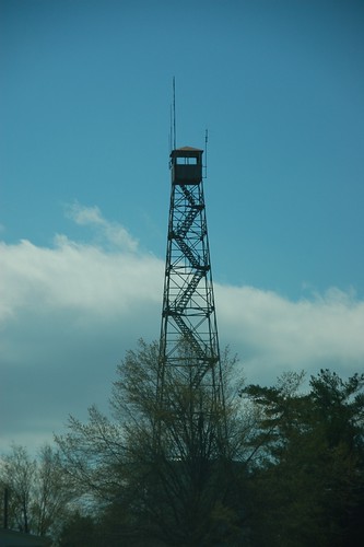
It seems like spring break got away from me without my being about to get out and visit the lookout towers like I wanted. This Friday was one of the best days, as far as weather was concerned, so I was able to visit some of the locations. My target would be those towers located in Northwestern South Carolina, along with any other interested tidbits I might discover along the way. It was a push, but I managed to visit eight tower locations in one day.
Tag: South Carolina
I have always enjoyed looking at the photos of Scott West (South Carolina’s Northern Kingdom). Scott and I seem to cover some of the same territory in Laurens County, and I’ve always admired his gutsy trespassing to get great shots of the interiors of old abandoned houses and interesting places.
Recently, Scott posted a couple of pictures of the old Poole Homestead in the Long Branch Community of Laurens County. I immediately recognized the place as being in one of the old photos my Dad has. After a couple of message exchanges it turns out that we do have some distant family connections (don’t ALL Southerners?) and that some of his family had attended Long Branch Pentecostal Holiness, where my father had pastored years ago.
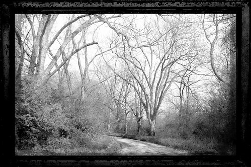
That brings us to this Tuesday. My mother had taken a trip to visit her sisters in North Carolina, so my Dad was on his own for the week. Since I was on spring break, I decided to head down and hang out with him, and see if I could find this photo of the Poole Homestead. I did find it, and we decided to take a tour of some of the old family haunts throughout Newberry and Laurens Counties.
While out driving the rural highways of South Carolina you may have come across a road sign with this symbol… Seeing a road sign like this lets you know that you are on either the South Carolina Discovery Route, or the South Carolina Nature Route, both parts of the South Carolina Heritage Corridor. On the … Read More “South Carolina Heritage Corridor” »
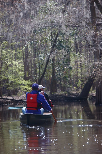
Early Saturday morning a small group of us gathered to paddle Cedar Creek, located in the Congaree Swamp National Park. Instead of kayaks, we decided that would take this trip in canoes. It turned out to be one of the longest paddling trips I’ve taken, covering about 6 miles of swamp, then paddling back.
The issue of which boat to take was only resolved at the last minute. I knew Dwight was bringing his canoe. Whether or not I brought my kayak, or lugged my old battleship 15′ Coleman canoe depended on how many people decided to go. In the end, it was the Coleman, so I loaded it into the back of my pickup with about as much hanging off the tailgate as was actually in the bed of the truck.
Alan Russell and I met James Martin (who had joined us on our last flooded Congaree hike), Dwight Moffitt, and his friend Peter at the put in on South Cedar Creek Road. Dwight and Peter would be in one boat, Alan and I would be in mine, and James had his kayak. The plan was to paddle downstream a bit, then head back. According to Dwight this would take us through some of the more remote parks of the swamp, and away from the crowded boardwalks. Dwight assured us that paddling back upstream wouldn’t be a problem. Yeah, right.
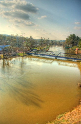
Once, many years ago, I made the statement that while other cities like Austin and New Orleans had cool Riverwalk areas, Columbia had built a penitentiary on it’s riverfront. Fortunately, in the past couple of decades since that statement attitudes have changed, and both Greenville and Columbia have recognized the importance of their waterways and the potential for tourism. While in Columbia this past week I was able to spend an afternoon at the Columbia Riverfront Park, and it was quite a pleasant outing.
The park is located at the site of the Columbia Waterworks, and incorporates historical elements of the waterworks, the Columbia Canal, and the Congaree River. One enters the main portion of the part at the Waterworks entrance, with a path that leads past the portions of the water treatment plant that are still in operation.
Saturday I attended the William Walker Memorial Shape Note Singing at Wofford College in Spartanburg. This was a special occasion, marking the bicentennial of Walker’s birth. An entire weekend of events had been planned for the event. In addition to the singing, there would be an evening showing of the documentary Awake My Soul, and … Read More “William Walker Memorial Singing 2009” »
Thursday evening I met up with several of my Flickr photographer friends for a photo walk. Tracy (Wilhemina Lump Lump), Eric (RestedTraveler), and James (James Wellman) and I gathered at the entrance to Falls Park for a downtown expedition. It turned out to be a great gathering, and we really learned quite a bit from each other about various photographic techniques.
When we first planned this outing we had scheduled it for a couple of weeks ago, right as the snow storm hit. The intent was to go out and try to do some long exposure photography. When we reschedule, we failed to take into account the time change, so we still had more daylight than we had planned. Oops.
As long as I’ve lived in this area I can’t ever remember eating at The Clock on Wade Hampton. Tonight I was on my own for dinner, and I had some ideas for photography in the area, so I decided to give it a try. Background Located at the corner of Wade Hampton and Pleasantburg … Read More “The Clock on Wade Hampton” »
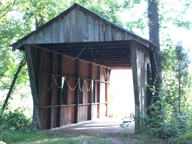
Well, it looks like my exuberance was premature. I was able to find some additional information on the Internet which lists this bridge as being of fairly modern construction.
Dale. J. Travis operates a website devoted to round barns and covered bridges, both fascinating structures. He has a comprehensive listing from across the US, not just of historic structures but of modern construction as well. Travis lists thirteen bridges for South Carolina, including Campbell’s and this one on Mayfield Road. Most of these are decorative, and are found on golf courses and gardens.
According to Travis’ information, the Mayfield Bridge was built in 1991 and is about 25 feet in length. I’m guessing that it hasn’t been kept up since that time, so the tin roof has rusted, making it look older than it is.
Which brings me to the statement the man on the side of the road gave me. The only thing I can think is that he was referring to the actual roadway bridge. Who knows? Then again, maybe Mr. Travis has incorrect information. However, with every reputable reference saying that Campbell’s is “the last”, it’s hard to refute the evidence that this isn’t an authentic structure.
According to South Carolina: A Day at a Time, Campbell’s Covered Bridge is “the only covered bridge still standing in South Carolina.” My friend Duckhunter pointed me toward DiscoverSouthCarolina.com which says that Campbell’s “is South Carolina’s only remaining covered bridge.” Several other websites repeat this sentiment. So, imagine my surprise when I found this just … Read More “The Bridges of Spartanburg County” »