Once, many years ago, I made the statement that while other cities like Austin and New Orleans had cool Riverwalk areas, Columbia had built a penitentiary on it’s riverfront. Fortunately, in the past couple of decades since that statement attitudes have changed, and both Greenville and Columbia have recognized the importance of their waterways and the potential for tourism. While in Columbia this past week I was able to spend an afternoon at the Columbia Riverfront Park, and it was quite a pleasant outing.
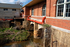
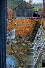
The park is located at the site of the Columbia Waterworks, and incorporates historical elements of the waterworks, the Columbia Canal, and the Congaree River. One enters the main portion of the part at the Waterworks entrance, with a path that leads past the portions of the water treatment plant that are still in operation.
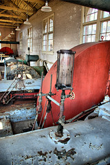
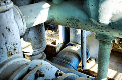
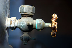
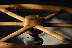
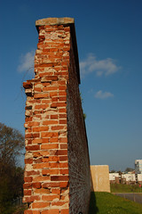
A bridge crosses the Columbia Canal and arrives at historic display for the waterworks. The brick building is full of interesting pipework and valves that make for interesting photography, especially with the afternoon light filtering in.
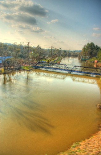
From this point another bridge crosses a canal spillway toward the south, and a path continues between the canal and the Congaree River.
The southbound path ends rather abruptly about a half-mile past the spillway. I retraced my route back to the waterworks building, beyond which is a lovely green space on the banks of the river where several were taking advantage of the warm spring sunshine.
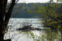
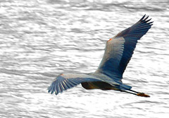
Beyond the waterworks and green space the path continues between the canal and river. At this point the river is quite wide as the Broad River reaches its confluence with the Saluda River on the opposite side to create the Congaree. I watched turtles and wading birds out on the rocks, wishing I could join them in my kayak.

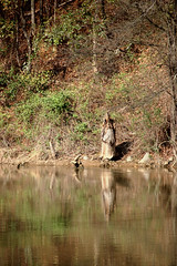
Signs along the canal warned of alligators. I chuckled a bit, as it seemed odd to think of ‘gators this far north. A quick glance across the canal made me think that there was a wooden statue of an Indian maiden. It turned out to be a tree stump that was creating an optical illusion.
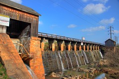
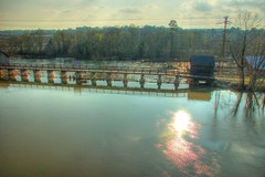
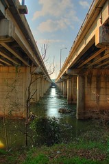
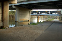
Past the confluence the path and canal go under the I-126 and railroad bridges. I’ve driven over this bridge many, many times, and it’s interesting to see it from this perspective.
I continued past the interstate for a bit, and even wandered down to the banks of the Broad River. However, I didn’t have the attire or footwear for serious exploration, so I returned to the path, then found my way back to the canal bridge.
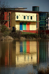
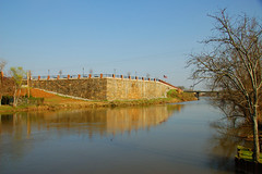
I had mentioned abut the state penitentiary. While the buildings and watchtowers have been demolished, the old stone foundation walls remain. A nice walkway has been developed, and it condos have spring up around the central open area. It looks like more work needs to be done, and I’m not sure what their final plans for it are.
It was a good afternoon out, and I was glad to have finally spent some time in this park.
You showed a lot of interesting views here. Excellent descriptions as well.