Skip to content

Random Connections

A collection of photography and exploration focusing on Upstate South Carolina and beyond.

  • Home
  • About Us
  • Photos
  • Resources
  • Other Voices
  • Post Archives
  • Podcast
  • Home
  • South Carolina
  • Page 25

Tag: South Carolina

Korean BBQ

Posted on July 13, 2010 By Tom 1 Comment on Korean BBQ
Restaurants

Laura had an evening meeting, so I was on my own for dinner. You know what that means – time to explore the local cuisine. In this case, it was hardly local in origin. I decided to try the Korean BBQ place just off of Woodruff Road.  No catchy name here – just “Tasty Korean … Read More “Korean BBQ” »

Loss of a Landmark

Posted on July 12, 2010 By Tom 2 Comments on Loss of a Landmark
Local

Someone who reads this website recently sent me a message via Facebook that was a bit disheartening. It seems that the South Carolina Forestry Commission is selling several of its lookout towers to the highest bidder.  These include the Kelly Tower in Union County, the Silverton Tower near Jackson, SC, the Edgefield Tower, the Riverside … Read More “Loss of a Landmark” »

Lazy Saturday on the Edisto

Posted on July 12, 2010 By Tom 4 Comments on Lazy Saturday on the Edisto
Paddling, Photography

Heading down the Edisto

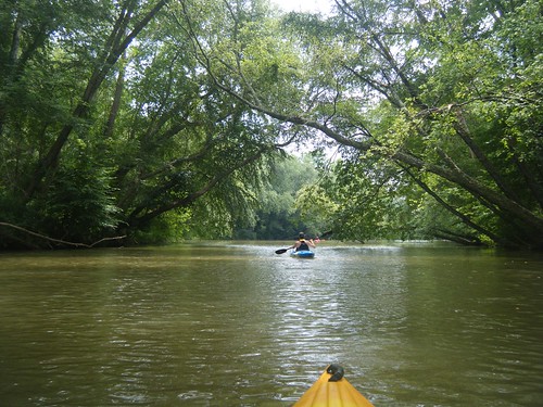
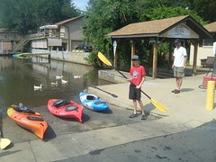
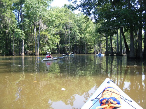
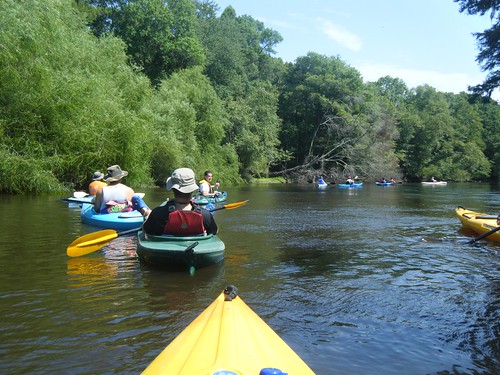
It was a second Saturday, which can only mean one thing – another outing with the guys from Lowcountry Unfiltered. This time our target was once again the Edisto River. This was to be our “beer commercial” float, full of rope swings, mayhem, and general goofing off. And, that pretty much sums up the day.

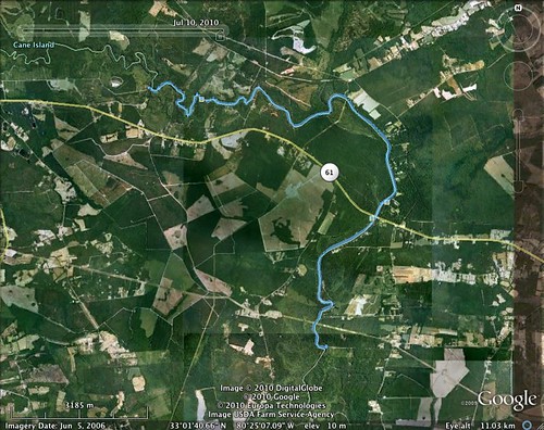
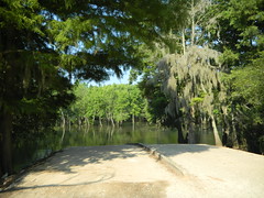
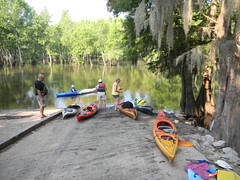
For this trip we were doing a familiar stretch. The plan was to put in at Mars Old Field Landing, but this time we would paddle past Givhens Ferry State Park and take out at Messervy Landing, adding another three miles to our trek.

Edisto River paddling map - July 10, 2010

Read More “Lazy Saturday on the Edisto” »

Archeology and History Resources for South Carolina

Posted on July 7, 2010 By Tom 2 Comments on Archeology and History Resources for South Carolina
History and Genealogy, Internet

Poole Home Textured

Our recent photo trek through Laurens County raised lots of questions for me. I had seen places about which I wanted to learn more. There were the questions about name origins – Ghost Creek Road and Dead Man’s Curve in particular. I wanted to know if there were documented incidents that led to these names. I also wanted to know more about the spring we found on Bramlett Road – what rallies were held here, etc.

Of course, I first turned to online resources to see what I could find. A simple Google search didn’t reveal much initially. In fact, I was getting a bit discouraged. I even turned to Facebook, and was able to get some anecdotal answers, but nothing documented.

I still haven’t found the answers to these questions, but I did find some great reference materials. First up are the ones I’ve mentioned here before – SC DISCUS (requires login), SCIWAY.net, and the new South Carolina Digital Archive. All of these have excellent primary source materials, or links to those materials.

Read More “Archeology and History Resources for South Carolina” »

Laurens County Photo Trek

Posted on July 7, 2010 By Tom 2 Comments on Laurens County Photo Trek
Local, Photography

I had Monday off as part of the 4th of July weekend. My brother, Houston, and my sister, Glynda, also had the day available, so we decided to go on another photo exploration. This time our target was our old stomping grounds around Laurens, South Carolina.

Houston had some specific locations he wanted to see if we could find. Most of these were in the old Long Branch area, but we knew we would get sidetracked in route. I picked up Glynda and Houston at the family home in Gray Court. Armed with GPS, maps, and more cameras than we had passengers, we set out.

We actually didn’t get very far. At the south end of Gray Court is the historic farm area that the Gray Court-Owings Historical Society has put together. Glynda and Houston weren’t aware of this place, so we spent a good bit of time looking at the old cabins and farm implements and taking pictures of these.

Read More “Laurens County Photo Trek” »

Saluda Lake, Take Two

Posted on July 4, 2010 By Tom 1 Comment on Saluda Lake, Take Two
Local, Paddling, Photography

Saluda River

When Alan and I came out to Lake Saluda last week, I wasn’t feeling so hot. Well, actually, I was too hot – heat exhaustion plus a fever of over 100. Couple that with the fact that we missed the channel we were supposed to be taking, and it wasn’t an ideal trip. So, when Dave Freeland called and wanted a close paddling venue that would be good for his 13 year old son, Zach, I suggest heading back to Saluda.

We made our way back down Motor Boat Club Road to Saluda Landing. Personally, I would love to find some other access point. These guys charge per boat, so to launch our three kayaks was $15. I don’t mind paying a parking fee, but the per boat fee is a bit steep. However, they have a monopoly on lake access, and they know it.

Zach and DaveZach Launches

We paddled out, then southward to avoid the silted spit, then turned upstream. This time we hugged the right channel toward the river, rather than being tempted by the more open water of the west arm of the lake.

Read More “Saluda Lake, Take Two” »

Chasing the Swamp Rabbit – Illegally

Posted on July 4, 2010 By Tom 8 Comments on Chasing the Swamp Rabbit – Illegally
Local, Photography

20100702-DSCN5935

It’s pretty bad with 85 degrees feels like a cooling trend. However, the humidity was down, and it didn’t feel as sweltering as the past several weeks have been. Laura and I had taken advantage of the nice weather to do some yard work in the morning, and in the afternoon we decided to take the bikes up to Furman and ride part of the Swamp Rabbit Trail.

We parked at the south end of the Furman section of the trail and headed north. This was the first time Laura had ridden the trail since it had been paved. However, the combination of earlier yard work and lack of recent cycling got to her. We made it about 2.5 miles before she decided it was time to head back.

I wasn’t done, though. I wanted to continue on down the trail toward Greenville. I particularly wanted to see parts of the trail I hadn’t traveled yet. I knew that the trail had been closed at the CSX railroad crossing, so I couldn’t make it all the way into town. My intent was to ride down to the barricades, turn around, and head back. Turns out I did two things I hadn’t intended – I made it all the way to Greenville, and I did it illegally.

Read More “Chasing the Swamp Rabbit – Illegally” »

One Night in Santee

Posted on June 28, 2010 By Tom 2 Comments on One Night in Santee
Travel, Weirdness

Seems like I’ve spent more nights in motel rooms since January than I have all of the past couple of years. There have been kayaking trips, conferences, and the rare vacation get-away. Some of the rooms have been spectacular, such as my recent stay at Charleston Place Hotel, or our trip to Washington, D. C. Some have been routine, such as the Quality Inn in St. George, SC, that seems to be where we seem to have stayed lots recently.

Of these, the most unusual has been the Whitten Inn in Santee, South Carolina. I think I hinted recently that I would write about the experience once I’d had enough therapy. A slow, restful weekend seems to have been enough therapy, so, here goes…

It had been a long day of paddling. We had battled heat and crazy motor boats both on Lake Moultrie and on the Tailrace Canal. One of our fellow paddlers had said she felt like she had been riding a moped on I-85. Some of our group had planned to camp out, then paddle Sparkleberry Swamp the next day. I was in no mood to camp, so I decided to find a relatively cheap place in Santee so I could get some rest before the next day’s trip. The requirements were simple. I just needed a good clean room, and preferred a place that had a restaurant on the premises. I would be happy with a sandwich and not having to drive somewhere once I got settled.

Read More “One Night in Santee” »

Paddling Lake Saluda

Posted on June 26, 2010 By Tom 5 Comments on Paddling Lake Saluda
Paddling, Photography

Saluda Lake Siltation

When I mention Saluda Lake to my acquaintances, many don’t even know it exists. They usually reply, “Don’t you mean the Saluda River?” Or, they try to correct me by naming one of the many other lakes fed by the Saluda. Most don’t seem to be aware that there is a rather large lake on the west side of Greenville with that name.

I can see why Saluda Lake is overlooked. While it’s a nice lake, the banks are almost completely built up, and there is very little public access. There is limited access right at the dam, but no place where one could easily launch a boat. The only boat ramp is on the north end of the lake on Motor Boat Club Road. It’s privately owned, and the signs make you think the owners are somewhat less that friendly.

And we mean it!

Despite the limited access, Alan and I decided to give it a shot. The lake is relatively close, and I’d never been on it. The plan was to put in at the one boat ramp then paddle north up the Saluda River to at least Farr’s Bridge on Highway 183. For a variety of reasons, we didn’t quite make it that far.

Read More “Paddling Lake Saluda” »

Sparkleberry Swamp

Posted on June 15, 2010 By Tom 1 Comment on Sparkleberry Swamp
Paddling, Photography

Sparkleberry Channel

I had been wanting to paddle Sparkleberry Swamp for quite awhile, but always seemed to miss opportunities. I had a solo trip planned for a couple of months ago, but had to cancel when my cat suddenly got ill. I did Jocassee instead. Another trip was planned for a month later, but we canceled because one of our paddlers got ill (we did Jocassee instead.) Several of the Greenville group were staying over after the Pinopolis Lock paddle and heading up on Sunday to paddle Sparkleberry, and this time it didn’t look like anyone was going to get ill, and we were nowhere near Jocassee, so I finally got my chance.

Sparkleberry Swamp, also known as Rimini Swamp, isn’t a natural swamp. It was formed when Lake Marion was created and the forests of the upper Santee River were flooded. Its boundaries are nebulous, depending on water levels and who you ask. Even though it’s not a natural swamp, it has all the characteristics of one. If you picture in your mind what a southern swamp is supposed to be, it probably looks a lot like Sparkleberry.

I spent the night in the town of Santee in a dumpy little motel that deserves its own blog post. Maybe, after therapy, I’ll write that one up. Our group met at the local Bojangles for breakfast, then crossed Lake Marion on I-95, then headed north along the east shore.

This part of the state is about as desolate as it gets. It’s on the lower edge of the Carolina sand hill region, so pine forests and sandy soil are the norm until you reach the actual swamp. We passed through the towns of Summerton and Rimini, which I didn’t even know existed.

When we got to Sparkleberry Landing it was already sweltering. The water was high, and even at the landing the scenery was fantastic. We unloaded the boats and were soon underway.

One of our group of seven had been to the swamp several times before, and served as our guide. It was a good thing. I would have followed the more open channels either north or south, and would have missed the real path through a narrow stand of trees. I was glad I had a functioning GPS and spare batteries.

Read More “Sparkleberry Swamp” »

Posts pagination

Previous 1 … 24 25 26 … 35 Next

Categories

  • EdTech (197)
  • Entertainment (202)
  • Family (123)
  • Gear (114)
  • General Technology (98)
  • Geocaching and Maps (208)
  • History and Genealogy (275)
  • Internet (142)
  • Local (459)
  • Miscellaneous (560)
  • Music (202)
  • Paddling (268)
  • Photography (781)
  • Podcast (19)
  • Rambling (233)
  • Rants (162)
  • Recipes (37)
  • Religion (48)
  • Restaurants (165)
  • Science (48)
  • Things Overheard (29)
  • Travel (413)
  • Uncategorized (143)
  • Washington Sabbatical (113)
  • Weirdness (61)

Recent Posts

  • Helene One Year Later
  • Once Again, Up the Long Nose
  • Upstate Renaissance Faire
  • Exploring Lake Summit
  • The End of Days

Recent Comments

  • Gay on In Search of the Road Builder
  • Virgil Howell on The Ghost Towns of Lake Marion
  • Virgil Howell on Return to Ferguson
  • Mary Copeland Myers on Renno and Stomp Springs
  • Virginia Pepper on Helene One Year Later

Tags

blogging cemetery Christmas Columbia Edisto River edtech Entertainment family Flickr Florida Furman Furman University gear Georgia geotagging Ghost Town Ghost Towns Google Earth Google Maps GPS Greenville Greenville Chorale history Instructional Technology kayaking Lake Jocassee LCU Lowcountry Unfiltered maps Music North Carolina Paddling Photography rambling restaurant Restaurants review singing social networking South Carolina time-lapse Travel video Washington Washington State
October 2025
S M T W T F S
 1234
567891011
12131415161718
19202122232425
262728293031  
« Sep    

Copyright © 2025 Random Connections.

Theme: Oceanly by ScriptsTown