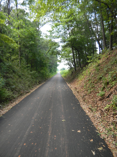
It’s pretty bad with 85 degrees feels like a cooling trend. However, the humidity was down, and it didn’t feel as sweltering as the past several weeks have been. Laura and I had taken advantage of the nice weather to do some yard work in the morning, and in the afternoon we decided to take the bikes up to Furman and ride part of the Swamp Rabbit Trail.
We parked at the south end of the Furman section of the trail and headed north. This was the first time Laura had ridden the trail since it had been paved. However, the combination of earlier yard work and lack of recent cycling got to her. We made it about 2.5 miles before she decided it was time to head back.
I wasn’t done, though. I wanted to continue on down the trail toward Greenville. I particularly wanted to see parts of the trail I hadn’t traveled yet. I knew that the trail had been closed at the CSX railroad crossing, so I couldn’t make it all the way into town. My intent was to ride down to the barricades, turn around, and head back. Turns out I did two things I hadn’t intended – I made it all the way to Greenville, and I did it illegally.
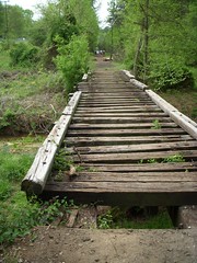
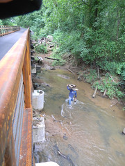
The trip along the part of the trail I had ridden before went quickly. On the south side of Watkins Bridge Road there had been some rickety railroad bridges across a couple of streams. This is what they looked like the last time I road this stretch…
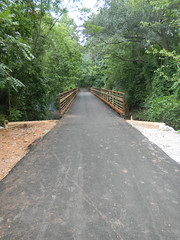
…and while this isn’t the exact same bridge, this is what those bridges look like now…
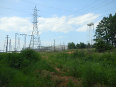
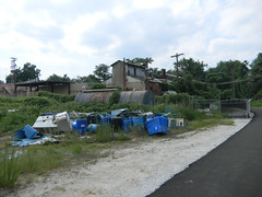
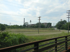
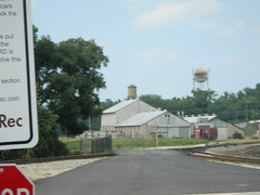
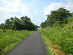
The area between Sulpher Springs Road and Highway 252 starts out with light industrial. A large electrical station hums due east of the trail.
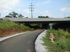
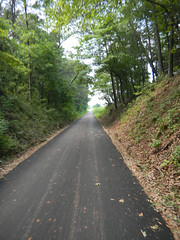
On my last ride I made it as far as Highway 252. This time I crossed on over and continued toward town. The trail continues through a nice wooded area, and eventually reaches a longer bridge over the Reedy River. I heard the drone of chain saws, and saw workers underneath the bridge taking out old railroad timber. It looked like they were stacking it to the side.
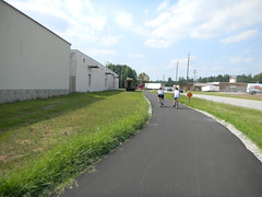
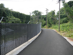
Th nature of the trail changed back to industrial. I passed barbed wire fencing and lots of warehouse looking things. Around a bend, and the old Woodside Mills loomed into view before the trail passed under Cedar Lane Road.
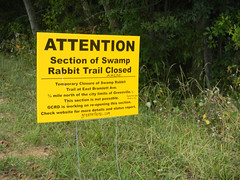
At this point I began to wonder when and where the trail would end. All along the trail, even as far up as Furman, yellow signs warned of the closure.
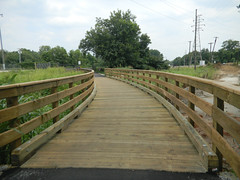
However, there were no other indications of closure. I continued on my trek. There was a very nice wooden bridge that crossed the river, and before I knew it, I was on top of railroad tracks. There were no barricades, and I didn’t remember seeing any signs. I was over the tracks in seconds.
On the other side of the bridge there was an orange barricade, but it was turned sideways. I hesitated, but I knew that the path beyond wasn’t the path that was blocked. I made a decision, and continued on. The trail paralleled the Reedy River, and had tracks on the left, but never crossed any other tracks.
At this point I was on familiar territory. I rode on into town past River Place and on down to Falls Park, just to say I’d done it. I paused to catch my breath in the park, then headed back toward Furman.
As for that railroad crossing, this time I felt like I knew where it was, so I couldn’t exactly claim ignorance. However, to the casual traveler it wasn’t clear where the problem actually was. I was more vigilant this time, and I spotted the following sign:
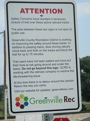
Here’s the problem area:
If they really want people to stop, there really does need to be clear barricades. The sign is too wordy. Someone riding past on a speeding bicycle isn’t going to read this, or, like me, is going to miss it completely the first time. Furthermore, the admonition that there is no detour, and that riders should just go back the way they came is unreasonable. There’s got to be a detour somehow.
I wasn’t alone in my violation. Trail traffic from Greenville to Furman was high, and I don’t think any of them avoided the problem tracks. I could see how these could be hazardous. The tracks weren’t active on this trip, but I would certainly feel uneasy if they were. I can’t imagine the stupidity of someone pulling their bike between train cars (well, actually, I can.)
Let me be clear – I am not advocating ignoring the signs. Now that I know where it is, I don’t plan to go back that way until the situation is resolved. However, with no viable detour I was stuck, and had to go back that way to get back to Furman.
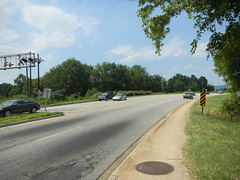
Fact is, there are several much more hazardous areas on the trail than the CSX crossing. Crossing Highway 252 seemed almost suicidal. Sulphur Springs was only marginally better.
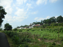
Controversy about safety aside, I find the Swamp Rabbit Trail intriguing because of its changing nature. There are some beautiful scenic parts of the trail, but there are some not-so-scenic parts through industrial areas. Stands to reason – this was, after all, an active railway, and did service those industrial areas. These not-so-scenic areas were just as important to Greenville’s growth.
I finally made it back to Furman. The whole trek, including the part I rode with Laura, came to a little over 18 miles. It’s about 7 miles one way from Greenville to Furman. I used to ride 18 miles on my bike every other day, but it’s been awhile. However, I felt good about my ride, and the only real complaint was that my seat no longer seems to have enough padding.
I want to ride this trail sometime. I have a road bike that is great on pavement.
I’d love to see the area down near Monteghan Mill now that the trail is paved. I was down there in February, and found the old industrial stuff fascinating. Apparently the mill has been converted to housing.
My seat has too much padding. Maybe if I bike more….
I was, of course, referring to the bicycle seat.
Its Hwy 253 not 252.
Thanks for the correction. I have a hard time keeping those numbers straight.
I enjoyed reading your story but I especially enjoyed seeing the pictures. We’ve only walked some of the trail so far but plan to walk the whole trail eventually.
There’s a fairly easy detour (except for the steep hill up the bridge) around the closure, I don’t know why they don’t suggest it temporarily my wife and go this route every time we ride it. If your coming from Furman turn left on to W Washington St. up over the bridge then right at the light on Bramlett Rd. and get back on the the trail at CSX.
I came back to read this post after walking the trail yesterday. I saw the two white signs (one on either side of the tracks), and a orange barricade at each end. The barricade was positioned to only block about half of the trail and NOBODY I saw turned back. It was a busy Saturday. We decided that the barricades and signs are designed to clear the city / county of liability. If something happens to someone this is their, “We told you not to be there.” If they really didn’t want people back there it wouldn’t be hard to block the entire trail.