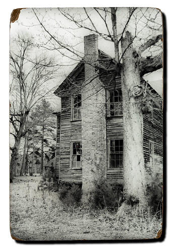
Our recent photo trek through Laurens County raised lots of questions for me. I had seen places about which I wanted to learn more. There were the questions about name origins – Ghost Creek Road and Dead Man’s Curve in particular. I wanted to know if there were documented incidents that led to these names. I also wanted to know more about the spring we found on Bramlett Road – what rallies were held here, etc.
Of course, I first turned to online resources to see what I could find. A simple Google search didn’t reveal much initially. In fact, I was getting a bit discouraged. I even turned to Facebook, and was able to get some anecdotal answers, but nothing documented.
I still haven’t found the answers to these questions, but I did find some great reference materials. First up are the ones I’ve mentioned here before – SC DISCUS (requires login), SCIWAY.net, and the new South Carolina Digital Archive. All of these have excellent primary source materials, or links to those materials.One of my favorite resources is the National Register of Historic Places. However, navigating their warren of websites can be confusing. The NRHP is administered by the National Park service, which maintains the official website. The site is searchable, and details and photographs of the locations are supposed to be available in PDF format. However, when I go to click on any of these I get an error message stating that the particular record hasn’t been digitized yet.
Confusing the issue is the site www.nationalregisterofhistoricplaces.com . The site is searchable and has mostly the same information as the official site. However, at the bottom of the main page it clearly states the following:
nationalregisterofhistoricalplaces.com is not affiliated in any way with the U.S. Dept. of Interior, the National Park Service, or the National Register of Historic Places
I’m thinking this is a commercial endeavor playing upon the prestige of being listed on the National Register. I wouldn’t count on it having the latest info.
Much more useful are the National Register websites for South Carolina. These can also be confusing, though. It looks like there were several attempts to create listings for the state over these. Each of these has a different style and slightly different domain, but they contain essentially the same information. Each is also an official state government website.
The main point of entry is the State Historic Preservation Office website at shpo.sc.gov. That site contains a wealth of resources for historical research, and I’ll get back to it in a minute. The actual National Register listings are at nationalregister.sc.gov. Stylistically this looks like a website from the 1990s, but it has extensive information about all of the registered websites, including nomination forms, historical background, and lots of photographs. This is the site I link to most often when referencing a location.
Not to be outdone, the state’s Department of Archives has also gotten in on the act with their site at archivesindex.sc.gov . Not only can you search NRHP sites, but also will transcriptions, census records, military records, land grants, and several other databases.
All three of the state websites link to each other, and each presents a slightly different view of the info. The main Preservation Office has some additional info that is excellent. There is an extensive list of archeological and historical surveys organized by county. These include not only the NRHP sites, but those nominated for inclusion. The survey covering western Laurens County (PDF) was an interesting read, especially after our recent photo trek.
The University of South Carolina website has long been a great resource for GIS and mapping materials. One portion of their website, ArchSite, allows users to zoom into a map that shows sites of historic interest. NRHP sites are marked with blue triangles, eligible sites are marked with purple triangles, and all other nominated sites are marked with purple circles. It’s a great way of cross-checking locations, or possible scouting locations for future treks.
I lived on the Ranch Road just up the hill from ‘Dead Mans Curve’ until leaving home for the Marine Corps and later work. We were the closest house to the bridge during that time. It was named so because people used to take a dare and try and make the curve a 100 mph in some of the hot cars during the fifties and sixties. They would start meeting and doing some drinking at the Ranch Drive-In and by mid-night some one would take the dare and head for the ‘Curve’. As a child I remember sitting in our living room hearing a loud boom and feeling the house shake. Only once did Dad allowed us to walk down after he called the sheriff to see what had happened and we saw one person laying face down in the water and others in the destroyed car that did not make the curve with the heavy wooden rails of the bridge inbedded in the front of the car. I remember many of the these accidents at ‘Dead Mans Curve’.
Now ‘Ghost Creek Road’ is another story that crossed the same ‘Little River’.
Thanks, Gerald. I knew there had to be more hard evidence for “Dead Man’s Curve.” I hadn’t heard about the 100 mph dares before.
I’d still to find out about Ghost Creek, though.