Skip to content

Random Connections

A collection of photography and exploration focusing on Upstate South Carolina and beyond.

  • Home
  • About Us
  • Photos
  • Resources
  • Other Voices
  • Post Archives
  • Podcast
  • Home
  • kayaking
  • Page 11

Tag: kayaking

Paddling Around Samish Bay

Posted on July 6, 2011 By Tom No Comments on Paddling Around Samish Bay
Paddling, Photography, Travel

It looked like I wasn’t going to get to go paddling this trip.  I had thought about just buying a kayak and leaving it up here for future trips, but couldn’t find anything reasonable.  I thought about booking another tour, but by that time most had filled up with holiday  travelers.

Fortunately, the neighbor Duff came to my rescue.  He had several homemade Fiberglas boats that we had used before, but they weren’t easy to reach.  They were at the bottom of the cliff on the south side of the island.  We managed to haul them up the cliff, but by that time it was late in the evening, and we were a bit tired from the haul to go paddling.

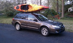
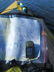
After discussing options we decided to take the boats up the Valley and run a section of the Skagit River.  This was something I’ve been wanting to do for a long time, so I was psyched.  We loaded the boats onto our rental, since it had roof racks.

The next morning Duff and I headed out in two vehicles.  We had barely gotten off the island when one of the boats came loose and slid off of my car.    Fortunately there was no damage to car or boat, and we were able to get it loaded back on an limp home.  However, we needed to regroup.

Read More “Paddling Around Samish Bay” »

Kayaking and Phones

Posted on July 3, 2011 By Tom 1 Comment on Kayaking and Phones
Paddling

Took this photo of the neighbor Duff while out paddling this morning… …and it occurred to me that I’m spotting a trend on my paddling trips. As Alan (second photo) said, “When nature calls…”

Geocaching on Lake Marion

Posted on June 13, 2011 By Tom No Comments on Geocaching on Lake Marion
Geocaching and Maps, Paddling, Photography

Lake Marion Paddling

Another second Saturday, and it was time for another epic paddling trip with Lowcountry Unfiltered. This one was truly epic. This time our explorations took us to the eastern part of Lake Marion to do some geocaching around Persanti Island.

Our launching point was Carolina King Landing, just north of the Santee National Wildlife Refuge. It’s a private landing with cabins for rent, and was quite the happening place when I arrived. It turns out that this was the day for the Sparkleberry Poker Run up at the north end of the lake. Lots of camouflaged boats were getting ready for departure.

Lake Marion Geocaching-2Lake Marion Geocaching-1Lake Marion Geocaching-4

Alan arrived, and we entertained ourselves with Cokes, Moon Pies, and conversation with the proprietors of the local shop. These turned out to be very nice folks, and were very helpful suggesting parking and launch spots for the boats. They also had some interesting taxidermy.

Read More “Geocaching on Lake Marion” »

From Buzzards Roost to Chappells

Posted on May 31, 2011 By Tom 14 Comments on From Buzzards Roost to Chappells
Paddling

Saluda River Paddle-24

With the long weekend I felt the need to hit the water. The challenge was to find a paddling venue that was relatively close, doable without killing the entire day, and not over-run by Memorial Day crowds. We found the perfect location on the Saluda River, below the Lake Greenwood Dam.

Our plans were for an 8-mile stretch of the river from Buzzards Roost at Highway 34 to the Highway 39 bridge at Chappells. I was a bit concerned about river access. I knew there was parking and river access at Buzzard’s Roost, but I couldn’t find any info about Chappells. All my resources indicated that it would be a throw-in, at best. Fortunately, Dave was able to do some advanced scouting, and concluded that it would be a challenge, but doable. We decided to go for it.

Dave, Alan, and I rendezvoused at Alan’s house early Monday morning and we headed on down. Our first stop was at the take-out at Chappells. A steep, rutted dirt road lead down to the river, and it looked like there was adequate parking, assuming one had four-wheel drive and could get down the initial hill. The bank down to the river did look steep, but not insurmountable. We decided to put all of the kayaks in my truck and leave Dave’s Land Rover at the take-out.

The shuttle for the trip was only about 3 miles. While the road goes east-west, the river takes a deep dip southward. Before we knew it we had arrived at the Highway 34 bridge and the area known as Buzzards Roost. The dam forming Lake Greenwood was completed in 1940 and was referred to as the Buzzards Roost Project. The name has been around much longer than the lake, but I haven’t been able to find any history on it.

Read More “From Buzzards Roost to Chappells” »

Paddling Lake Greenwood from Souls Harbor

Posted on May 8, 2011 By Tom 4 Comments on Paddling Lake Greenwood from Souls Harbor
Paddling

Saluda River Paddle-7

My father’s history with boats has been…interesting. Despite having served in the Navy during WWII, the boats he seemed to wind up with during later adulthood were quirky, at best. There was the time we went fishing and I wound up with battery acid eating through all of the life vests, as well as the jeans I was wearing. We didn’t catch anything. There was the time the passenger seat snapped loose, at speed. We didn’t catch anything that trip, either.

But what would life be like without these adventures, and the tall tales that they inspire? Some of my fondest memories are of exploring the north end of Lake Greenwood and the rivers that feed it. We took one boat far up the Reedy River, and another boat far up the Saluda. On one of these trips we watched a bobcat jump into the river and swim alongside the boat, terrified that it might take a notion to jump into the boat.

Saturday I was able to replicate one of those trips, this time from the relative safety of a kayak. I joined the Greenville Canoe and Kayak Meetup for a trip from Souls Harbor on Lake Greenwood up the Saluda River. Although there were no bobcats this time, it was still a 14 mile adventure.

Read More “Paddling Lake Greenwood from Souls Harbor” »

Lowcountry Unfiltered Does Ebenezer Creek

Posted on April 11, 2011 By Tom No Comments on Lowcountry Unfiltered Does Ebenezer Creek
Paddling

LCU on Ebenezer Creek

For our April Second Saturday Lowcountry Unfiltered trip, the group decided to head back to Ebenezer Creek. The last time our group had paddled this tributary of the Savannah River was a snowy February in 2010. I had planned to go on that trip, but a rare snowstorm prevented my joining them. I heard tales and saw photos of a cold snow-covered paddle through beautiful cypress cathedrals. I hated missing the first trip, and was really looking forward to this one.

Ebenezer Creek flows into the Savannah River at Ebenezer Landing, about 10 miles above where I-95 crosses the Savannah. The area is overflowing with history, as the site of one of the earliest settlements in Georgia, and the location of one of the worst betrayals of the Civil War.

Ebenezer Creek GPS Track

Our plan was to put in at Log Landing and paddle down to Ebenezer Landing for a 10.4 mile trip. This added about 3 miles to the group’s previous trip.

Read More “Lowcountry Unfiltered Does Ebenezer Creek” »

A Tuesday Sparklberry Paddle

Posted on March 31, 2011 By Tom 3 Comments on A Tuesday Sparklberry Paddle
Paddling


This week is my spring break, and despite the fact that I still needed to go into the office and work a couple of days, and despite the fact that two days of my break would be taken up with dental surgery, I was determined to do some paddling. Dwight was in the same frame of mind, so we had arranged to meet Tuesday morning and take a trip down to Sparkleberry Swamp and test our navigation skills. It turned out to be a fantastic trip, with lots of wildlife and some a amazing wilderness isolation.

Sunday and Monday had been rainy and stormy, and it looked like Tuesday was going to tbe the only day with decent weather.  It was cloudy in Greenville when I started out, but when I picked up Dwight in Columbia, and when we got on down toward the swamp, it looked like it the weather gods were going to smile on us.  Although it was chilly, we had perfect weather the entire day.

Read More “A Tuesday Sparklberry Paddle” »

A Paddle and a Pow Wow on the Savannah River

Posted on March 13, 2011January 28, 2024 By Tom No Comments on A Paddle and a Pow Wow on the Savannah River
History and Genealogy, Paddling, Travel

Lowcountry Unfiltered on the Savannah River

It was the second Saturday of the month, and time for another Lowcountry Unfiltered outing. For this excursion we were headed to the heart of some Civil War history along the Savannah River. The plan was to paddle a 5 mile stretch from Beck’s Ford Landing to Millstone Landing. It turned out to be a momentous trip for a variety of reasons.

I drove down right after work Friday evening and crashed at Matt’s place in Bluffton. The next morning we loaded up the boats at met the rest of the LCU guys at their usual meeting place, Grace Coastal Church. It was a small group – five of us met at the church, and James Martin came down from Columbia to meet us at the landing.

As we drove through the town of Hardeeville, small signs with the word “Pow Wow” and arrows pointing in the general direction we were going. When we got to the turn off for the take-out at Millstone Landing, we saw the following sign…

Apparently there was a big Pow Wow at the landing. We were starting to wonder if this was a good idea.

When we got to the landing there were tents set up everywhere and things were just getting started. Parking was just starting to get scarce, but we found places for two of our cars. We loaded up our boats into the remaining trucks and drove on up to our put-in at Beck’s Ferry Landing.

Read More “A Paddle and a Pow Wow on the Savannah River” »

Sparkleberry Unfiltered

Posted on February 13, 2011 By Tom No Comments on Sparkleberry Unfiltered
Paddling

The Gang - 14

It’s the second Saturday of the month, and that means another trip with my friends from Lowcountry Unfiltered. For this trip we decided to tackle Sparkleberry Swamp, at the north end of Lake Marion. I had paddled it before, but we only did a short trip that day. I was eager to see more, and I was curious how the swamp would look in winter.

Preparations:

Matt and I went back and forth on this trip. What we wanted to do was to hit the heart of the swamp, and paddle from Sparkleberry Landing to Risers Lake. However, there were lots of variables that had to be in place before we could take the trip – weather, water levels, etc. We had several alternatives, such as launching from Low Falls Landing, or doing something different all together.

The Palmetto Paddlers were also planning a trip to Sparkleberry for the same weekend, but they were going Sunday instead of Saturday. I contacted Kate Whitmire, the trip’s organizer, to see if she had any insight into water levels. She pointed me to the USGS water levels website for Pineville on Lake Marion. According to Kate, a reading of 72.09 was necessary for a paddle without portages.

I took my GPS track from my last trip, trip reports from several other paddlers, and placed all the data I could find on the Lowcountry Unfiltered wiki site. Based on this data, I created a GPS file that included waypoints and routes, as well as a Google Earth file with image and map overlays.

John Nelson also shared a great map of the swamp. It didn’t have the detail of the Google Earth data, but it had the “bones” of the swamp, and would prove useful to make sure we were on a major channel. It also provided names for the various creeks and guts that weren’t available in Google Earth.

I printed out copies of John’s map, my Google Earth maps, and a map of the 7.5 minute USGS topo map of the area. I had also purchased a fishing map of Lake Marion. I put all of these in a waterproof map case I had just purchased, and also programmed all of the waypoints into my GPS. I felt like I was ready.

Read More “Sparkleberry Unfiltered” »

2010 €“ Paddling Year in Review

Posted on December 31, 2010 By Tom 1 Comment on 2010 €“ Paddling Year in Review
Paddling

Paddling 2010

2010 certainly had its ups and downs for our extended family. We lost a family member to cancer, several of my family and friends had other health issues, and the lingering financial cloud presented challenges at work as well at home. Laura and I weren’t exactly able to take a vacation, but we were able to take advantage of conferences and family visits to do some traveling.

The one thing we were able to do in abundance this year was kayak – and we did A LOT of it. Apart from quick run-outs to Lake Cunningham or our local lake in the backyard, we participated in over 20 paddling expeditions this year. We explored some new areas, and I was able to make new friends and set up new paddling associations with folks. Here’s just a quick run-down of some of the trips:

  • Indian River in Florida at Christmas
  • Lake Jocasee (multiple trips)
  • French Broad River
  • Lake Hartwell-Little River to Newry
  • Lake Cunningham (multiple trips)
  • Lake Robinson (multiple trips)
  • Saluda Lake (multiple trips)
  • Saluda River
  • Edisto River – Greenpond Church to Cannadys
  • Edisto River – Stokes Bridge to Mars Old Field
  • Edisto River – Mars Old Field to Messervy Landing
  • Burrows Bay, Washington State
  • Sparkleberry Swamp
  • From Lake Moultrie through the Pinopolis Lock to the Tailrace Canal
  • Intracoastal Waterway from Lady Island near Beaufort
  • Lake Oolenoy
  • Tugaloo River

Read More “2010 €“ Paddling Year in Review” »

Posts pagination

Previous 1 … 10 11 12 … 15 Next

Categories

  • EdTech (197)
  • Entertainment (202)
  • Family (123)
  • Gear (114)
  • General Technology (98)
  • Geocaching and Maps (208)
  • History and Genealogy (275)
  • Internet (142)
  • Local (459)
  • Miscellaneous (560)
  • Music (202)
  • Paddling (268)
  • Photography (781)
  • Podcast (19)
  • Rambling (233)
  • Rants (162)
  • Recipes (37)
  • Religion (48)
  • Restaurants (165)
  • Science (48)
  • Things Overheard (29)
  • Travel (413)
  • Uncategorized (143)
  • Washington Sabbatical (113)
  • Weirdness (61)

Recent Posts

  • Helene One Year Later
  • Once Again, Up the Long Nose
  • Upstate Renaissance Faire
  • Exploring Lake Summit
  • The End of Days

Recent Comments

  • Gay on In Search of the Road Builder
  • Virgil Howell on The Ghost Towns of Lake Marion
  • Virgil Howell on Return to Ferguson
  • Mary Copeland Myers on Renno and Stomp Springs
  • Virginia Pepper on Helene One Year Later

Tags

blogging cemetery Christmas Columbia Edisto River edtech Entertainment family Flickr Florida Furman Furman University gear Georgia geotagging Ghost Town Ghost Towns Google Earth Google Maps GPS Greenville Greenville Chorale history Instructional Technology kayaking Lake Jocassee LCU Lowcountry Unfiltered maps Music North Carolina Paddling Photography rambling restaurant Restaurants review singing social networking South Carolina time-lapse Travel video Washington Washington State
October 2025
S M T W T F S
 1234
567891011
12131415161718
19202122232425
262728293031  
« Sep    

Copyright © 2025 Random Connections.

Theme: Oceanly by ScriptsTown