For our April Second Saturday Lowcountry Unfiltered trip, the group decided to head back to Ebenezer Creek. The last time our group had paddled this tributary of the Savannah River was a snowy February in 2010. I had planned to go on that trip, but a rare snowstorm prevented my joining them. I heard tales and saw photos of a cold snow-covered paddle through beautiful cypress cathedrals. I hated missing the first trip, and was really looking forward to this one.
Ebenezer Creek flows into the Savannah River at Ebenezer Landing, about 10 miles above where I-95 crosses the Savannah. The area is overflowing with history, as the site of one of the earliest settlements in Georgia, and the location of one of the worst betrayals of the Civil War.
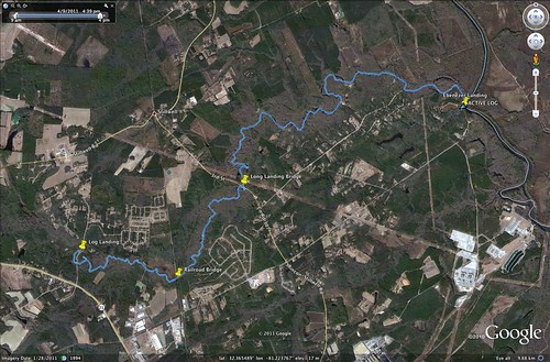
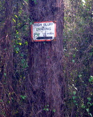
Our plan was to put in at Log Landing and paddle down to Ebenezer Landing for a 10.4 mile trip. This added about 3 miles to the group’s previous trip.
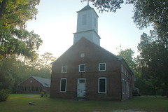
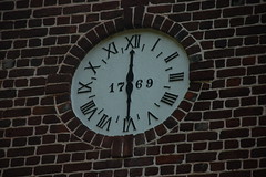
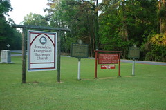
The entire trip is quite a ways from home, so I drove down Friday evening and stayed overnight at the closest exit on I-95. Early the next morning I drove on up through Rincon GA, to our take-out on Ebenezer Landing to meet the rest of the guys. I was there early, so I took a couple of minutes to get some photos of the historic Jerusalem Lutheran Church, at the site of “New Ebenezer” township. The church and surrounding area are on the National Register of Historic Places.
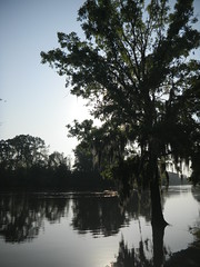
I also caught a few early morning sun rays peeking through the Spanish Moss over the Savannah River.
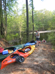
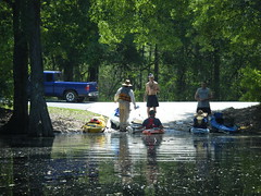
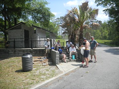
Eventually the rest of the group showed up, and we left my car at the take out while carrying the boats and rest of the gear to our put-in. The shuttle itself didn’t take very long at all. However, when we got to the put-in there were No Trespassing signs everywhere.
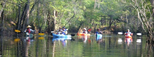
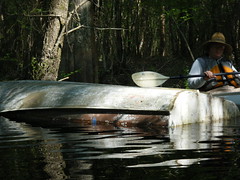
We trespassed anyway. We pulled the truck and trailer in long enough to unload the boats, then parked them on the highway right-of-way so that they technically weren’t trespassing. We paused long enough for a group photo (which I didn’t get, this time), then launched so as to be no longer illegal.
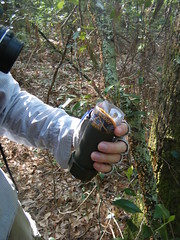
We knew we had a long way to go, and this group is notoriously ADD when it comes to paddling. Therefore, when we set out we resolved to get on down the river so we wouldn’t be all day at it. So, it only makes sense that one of the first things we did was to stop and find a geocache. Matt and I hopped out and tracked down one that wasn’t too far from our launch site. We promised to be better about the ADD thing after that.
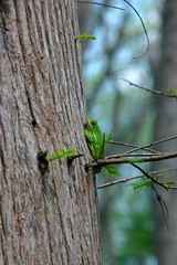
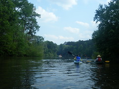
Back on the river we continued downstream. There was no current to speak of, and it was hot. There were a few large cypress along the banks, but mostly it was hardwood along some higher banks, almost like an upstate stream.
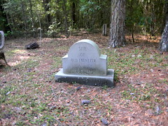
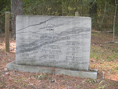
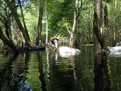
Of course, our ADD resolutions were for naught. We had not gotten far from the geocache when we spotted something interesting on the southern bank, so we got out to investigate. Turns out that this was the location of the original township of Ebenezer, settled in 1734 by settlers from Salzburg, Austria. However, the area proved to be unsuitable for crops, and many of the Salzburg immigrants died. In 1736 the Salzburgers petitioned General Oglethorpe to let them move a short distance to the more fertile banks of the Savannah, where they formed New Ebenezer.
A stone marker indicates the location of the old settlement, and another monument lists the names of the Salzburgers who died those first two years. They were buried nearby in now unmarked graves.
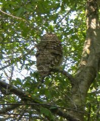
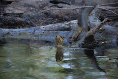
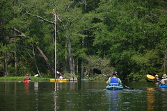
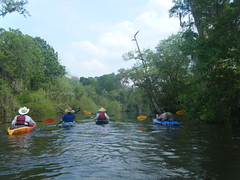
Now it really was time to paddle. We saw a barred owl and one snake. There seemed to be lots of trash in the creek, and we tried picking up what we could. One of our group got a very nice cooler along the way, and we even found an overturned boat. Matt tried to retrieve it, but it was chained to a cypress knee.
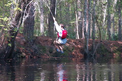
On down the river we found one a water moccasin, and Matt found a rope swing to distract is even further.
We had rounded a bend in the creek, and the northern bank was much more open. In 2008 this area was clear cut, with 1,000 year-old cypress falling to chain saws. There was only one positive note here – as we paddled we were hearing an airplane overhead. There was an air show in Charleston over the weekend, and this small Cessna was practicing maneuvers. The clearer openings allowed us to watch loops and other aerial acrobats.
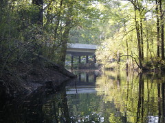
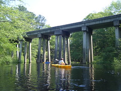
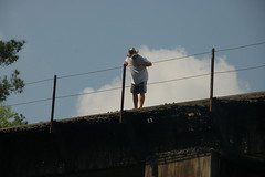
By 11:30 we reached one of our landmarks – a railroad trestle over the creek. We were only 1/4 of the way into our trip, and it was almost lunch time. Our proposed lunch stop was still miles off, and we would still have 7 miles from that point. This was not going well. However, we didn’t let that stop us from admiring the bridge. Jason even decided to climb on up for a better view.
Now we really were pushing hard. There was still no current, and the river was taking on more of the cypress swamp feel. One of our group lagged behind, and I paddled back to make sure he was OK. I found myself in a tricky spot – not wanting to leave him behind, but not wanting to get left, myself. Eventually, though, we did catch up with the rest of the group, and soon we were pulling up to our lunch stop at Long Bridge Landing.
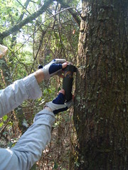
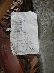
While we took our lunch break I found the second geocache of the day – sort of. The cache had been muggled, and all that was left was the log sheet lying on the ground. Matt found a green pill box that would work as a container, and we replaced the cache as best we could.
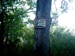
Suitably refreshed, we set out with 7 miles to cover and not much daylight left to do it. Along this stretch of Ebenezer Creek there are signs indicating location and the number of miles remaining until the confluence with the Savannah River. Our first landmark was Alligator Gardens.
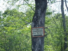
Unfortunately, while the arrow on the sign was pointing generally in the direction of the river, it was the exact opposite from the way we needed to go. We spent several fruitless minutes trying to punch a path through dense undergrowth. Finally, we did find a way around.
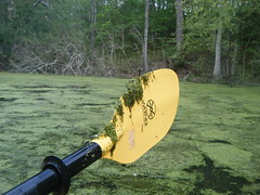
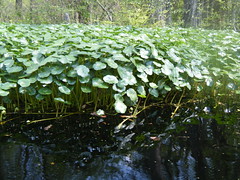
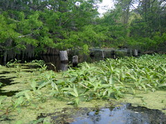
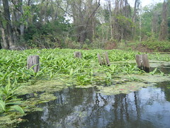
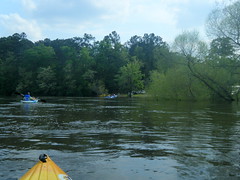
This last 7 miles was very challenging. We had no current to help us. It was hot. And, to make matters worse, there were lots of obstructions. We first came upon dense sections of water lily-like weeds and duck weed that clogged the main channels.
Our group negotiated those as best we could. We also came to areas with dense flotsom that was even harder to punch through. These were logs and other swamp detritus just floating along on the surface of the water.
We tried to punch through this as best we could and as quickly as we could. This continued on for several miles. All along we would pass a landing with another sign showing our progress. I was surprised when the group passed an excellent rope swing made out of a fire hose at one of the landings. They must REALLY want to get on back to the take out!
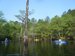
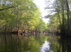
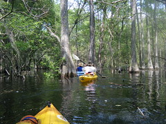
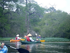
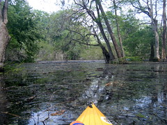
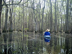
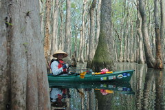
Eventually we came to a bend in the river, and the much-vaunted cypress cathedral. This area did have a large stand of cypress with passageways in between. Several of the group paddled on around on the main channel, completely missing the stand of trees, but some of us hung back.
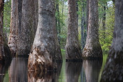
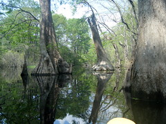
Half of our group of eight stayed back in the cypress. Probably appropriately enough, it was the four of us with Apostles’ names that remained in the cathedral – Matthew, James, John, and Thomas. We admired the large trees and even spotted a bit of wildlife.
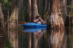
We weaved in and out of the cypress stand, preferring it to the harsher open skies of the main creek channel. Unfortunately, we got to a point where we were forced into one channel, and the channel became increasingly clogged.
We came to a place where some old pilings marched across the creek.
This marked the location of “The Betrayal of Ebenezer Creek.” On December 8, 1864, Union General Jefferson C. Davis (similar name, but not related to the Confederate president) built a pontoon bridge across the creek. As part of Sherman’s March to the Sea, a large contingent of slaves had followed Davis. Davis’ men held nearly 670 black men, women, and children on the northern bank of the river while his brigade crossed. Once across, Davis had the pontoon bridge removed, stranding the slaves on the other side, at the mercy of Major General Joseph Wheeler’s Confederate Calvary. Some slaves tried to cross the river and were drowned. Many were shot and killed by Wheeler’s men. It was a terrible tragedy with plenty of blame for both sides.
We had one more challenge ahead of us, and the resulting problems were completely my fault. We came to an oxbow that was clearly marked on my map, and I had the waypoint on my GPS. The main route went north, and this was born out by the fact that a large boat was coming around that way. I suggested taking the shorter southern route. Unfortunately, this took us into dense thickets of underbrush. At one point my GPS got knocked off the boat, and I was nearly at panic level. Alan E. was behind me and was able to pick it up.
We eventually punched through to the main channel, and shortly thereafter reached the Savannah River, and the first current we had felt all day. Ebenezer Landing was a welcome sight. We had been on the river for eight hours, and we were exhausted.
When we got to the landing, the place was hopping. Lynnyrd Skynnyrd was blaring from a boom box, and every picnic table was occupied. A state ranger was there to keep some order, and he asked us about our trip. Two hydrofoils were parked at the landing, and they cranked up and raced off as we were pulling our boats out of the water.

It was a good trip, but strenuous. I always enjoy exploring new waterways, but I’m not sure this is going to make it to my list of favorites. There were some spectacularly beautiful areas, but none that outshone closer venues like Sparkleberry Swamp. Perhaps if we had done the shorter segment, and if I’d had the original experience of seeing this in the snow like my friends, I might have been more impressed, but it was still nice.
I did take many more photos than are shown here. Below is a slide show of the 162 photos I posted online.