Here’s an interesting activity you can do with students using Google Earth. It helps if you use the actual program (or the satellite view in Google Maps) instead of a static image so that students can zoom in and out…
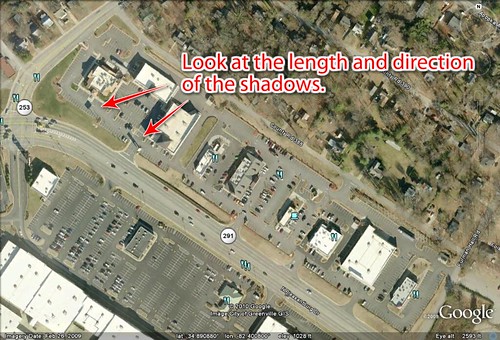
The above Google Earth image is of the Cherrydale Shopping Center in Greenville. Using only clues from the image, can you tell me the following:
- About what time of day was the image captured?
- What month was the image captured?
Good luck!Here are some hints, in case your students (or you) have trouble…
First, look at the shadows. The length and direction should act like a sundial. You know which direction is north. In this case it looks like the shadows are quite long and are running from southeast to northwest. That means it’s got to be sometime in the morning.
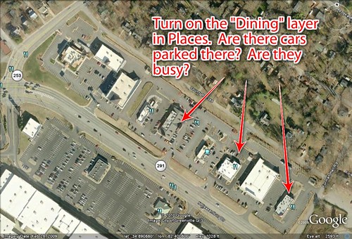
What about the parking lots? Do they provide any clues as to the time of day? Turn on the “Dining” layer and find the restaurants. If they are busy, it might indicate this was taken around some meal time. What about other businesses in the area? How about a school or church parking lot?
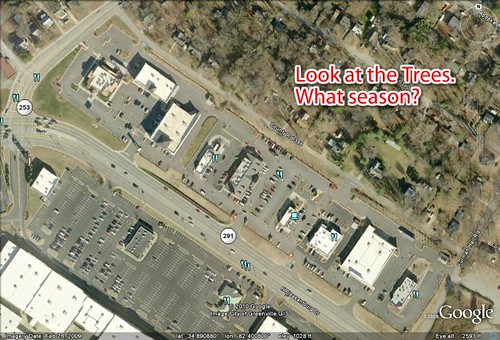
What about the month? In some Google Earth imagery the image date is given in the lower left corner of the screen. In this case, we know that this image was acquired on February 26, 2009. But even if we didn’t have that information, could we make a guess? Also, how would knowing the date help you figure out the time? Would the shadows have something to do with it?
You could have your students work in teams and come up with their justifications. You could also provide images from different locations and see what they come up with.
Sometimes it’s ideas like this that make me wish I were back in the classroom.


Great idea. I think things like this are interesting. I may show this to my kids and look at various places in the world.
what about the other way around? can we locate the place (or nerrow down the area) the image was taken if we know the time it was taken?