Skip to content

Random Connections

A collection of photography and exploration focusing on Upstate South Carolina and beyond.

  • Home
  • About Us
  • Photos
  • Resources
  • Other Voices
  • Post Archives
  • Podcast
  • Home
  • Travel
  • Page 18

Category: Travel

0

From Long Beach to Samish Island

Posted on August 4, 2014September 1, 2014 By Tom No Comments on From Long Beach to Samish Island
Photography, Travel
Skagit Valley and Samish Island-38
Samish Island Sunset

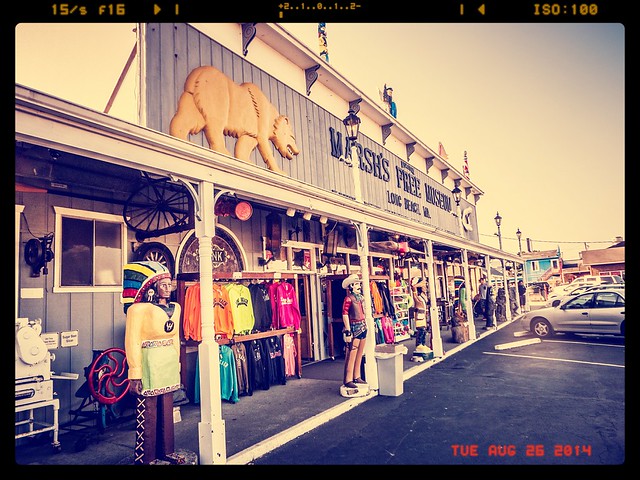
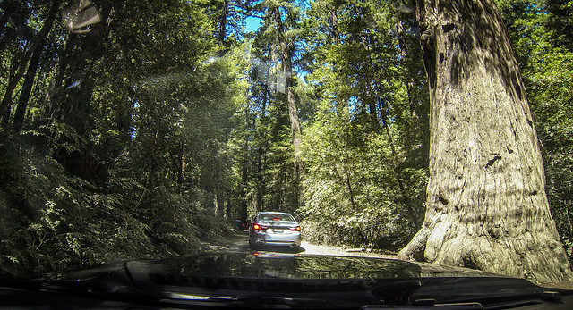
Monday, August 4, 2014

We got a good night’s sleep in our quaint little hotel, but it was time to move on. We were very close to the end of our journey, but we still had some exploring to do. We got up and had a large breakfast at a local joint, where I demonstrated my prowess with one of the triangular peg puzzles.

Read More “From Long Beach to Samish Island” »

Portland, Oregon to Long Beach, Washington

Posted on August 3, 2014August 26, 2014 By Tom No Comments on Portland, Oregon to Long Beach, Washington
Photography, Travel
Marsh's Free Museum at Long Beach
Marsh’s Free Museum at Long Beach

Saturday, August 3, 2014

It had been a long day already. We had seen some amazing waterfalls, some incredible vistas, and some enormous crowds along the Columbia Gorge. It was time to move on. I didn’t want a repeat of Friday’s scramble to find a place to stay in Portland, so Laura dove into the task of finding us a place for tonight. Our only requirement was that it needed to get us further on our way, preferably somewhere on the Washington State coastline, but not too far of a drive. Laura was successful, but I didn’t know anything about the town or location. Regardless, I set the GPS and we set off.

I-84 took us through downtown Portland and over the Willamette River on another spectacular bridge. We didn’t linger for sightseeing, or even for a photo of the bridge and skyline, but kept going. We left the interstate for the coastal highway, which mimicked our Friday trip over from the coast. We passed through rural lands, then ascended over the coastal range, dropping back down at the appropriately named community of Seaside.

We began seeing signs pointing to historical locations for Lewis and Clark. Seemed fitting. Our last two week road trip was ten years ago, when we followed the Lewis and Clark route across country in another convertible.

The highway followed only a short span of the Oregon Coast before turning back eastward. Most of this was through developed seaside communities. Soon, though, we were crossing the Young’s Bay Bridge toward Astoria. We didn’t linger, though, because we immediately drove onto the Astoria Bridge across the Columbia River.

Astoria Bridge over Columbia River

Read More “Portland, Oregon to Long Beach, Washington” »

Waterfalls of Columbia Gorge

Posted on August 3, 2014August 26, 2014 By Tom No Comments on Waterfalls of Columbia Gorge
Photography, Travel
Columbia Gorge from Vista House
Columbia River Gorge

Sunday, August 3, 2014

We wanted to get an early start. However, gas and more coffee were calling. We found a Starbucks in the little planned community of Wilsonville, then headed on our way. We circled past Portland on I-205 until we came to an overlook of the Willamette River. We had a good view of the Willamette River Locks.

Willamette River Locks

Soon we found ourselves headed east on I-205, and entering the Columbia River Gorge. The gorge was much wider than I had imagined. I don’t know what I was expecting – perhaps a narrow river gorge like the Green in North Carolina?

Tom Driving along Columbia River Gorge

Read More “Waterfalls of Columbia Gorge” »

Coos Bay to Portland

Posted on August 2, 2014August 24, 2014 By Tom No Comments on Coos Bay to Portland
Photography, Travel
Heceta Head Lighthouse from Sea Lion Cave

Saturday, August 2, 2014

It was time to continue our trek up the west coast. We weren’t really sure where we would end up today, but from Aunt Ellen we had gotten suggestions about a couple of place we wanted to stop along the way.

We retraced our steps northward from yesterday’s trip, driving along miles and miles of dunes. It would have been tempting to stop at several of the locations with dune overlooks, but with Dunefest in full swing that wasn’t very appealing.

Soon we came to the town of Florence on the Siuslaw River. As we crossed the river we made note of the fascinating architecture of the bridge. It turns out that this is one of the historic bridges along this road designed by Conde McCullough, an architect active during the 1920s and 30s. McCullough had a penchant for adding art deco elements to his designs, such as unusual obelisks at the entrances to the bridge. We had already crossed several of his bridges, including the ones at Coos Bay, Umpqua River, and Gold Beach. This wouldn’t be the last one we crossed today.

The town of Florence looked like it would be a great place to explore, with an interesting waterfront along the Siuslaw. However, we kept going. The dunes also continued, ending abruptly at Cox Rock, near Sea Lion Point. The dunes stretch for over 35 miles of the Oregon Coast, and it was interesting seeing the massive piles of sand right up against the highway in some areas. I had to wonder about the shifting nature of the sands, and how hard it must be to keep the highway clear. I was also glad it wasn’t exceptionally windy in an open top car.

Read More “Coos Bay to Portland” »

Coos Bay and Lighthouses

Posted on August 1, 2014August 21, 2014 By Tom No Comments on Coos Bay and Lighthouses
Family, Photography, Travel

Friday, August 1, 2014 Where did July go? Normally this date would cause major consternation as I panic about the start of school. This is the second time around that I haven’t had to worry about it, and it shouldn’t bother me. Occasionally, though, it does. That’s why it’s nice to be traveling this week. … Read More “Coos Bay and Lighthouses” »

Coos Bay Sunset

Posted on July 31, 2014August 21, 2014 By Tom No Comments on Coos Bay Sunset
Family, Photography, Travel
Sunset at Bastendorf Beach

Thursday, July 31, 2014

We had arrived in Coos Bay, Oregon and checked in at our hotel. Now it was time to visit Laura’s Aunt Ellen.  Ellen is Laura’s mother’s younger sister.  Upon retirement, Aunt Ellen and Uncle Larry sold their home in the desert in California, bought a large RV and spent several years traveling around the country.  We were privileged to have them stay with us for awhile.  When it was time to settle down from that adventure, they chose Coos Bay.  Uncle Larry passed away two years ago, and this was the first chance we’d had to visit Aunt Ellen.

We found the house with no trouble and spent a good bit of time catching up.  We had an early-ish dinner at a local Mexican restaurant, then set out to see what we could find.  It was still early evening, but since it was now clear I asked if there was a spot we could watch the sun set over the beach.  Ellen had the perfect location.

The town of Coos Bay is on the eastern (inland) side of the peninsula along the bay. Like a mutant amoeba, it expanded and swallowed up the surrounding communities into its city limits, including North Bend and Empire. Aunt Ellen lives near the Empire area, which is closer to the coast. This put us in a good position to reach the beach before sundown.

Read More “Coos Bay Sunset” »

Crescent City to Coos Bay

Posted on July 31, 2014August 21, 2014 By Tom No Comments on Crescent City to Coos Bay
Photography, Travel
Oregon Coast near Bandon

Thursday, July 31, 2014

East Coast, West Coast – doesn’t matter. I still get up early regardless of the time zone. This morning was no different. I went to bed last night to the sounds of a fog horn in the distance and sea lions, and I awoke to the same this morning. I decided to get up and go for a walk.

Our hotel was on a small prominence that connects to a series of sea rocks by a small jetty. There were piers that jutted off to the north, and a beach to the south. An RV park was right behind the hotel, and a small cafe and a couple of fish places occupied the rest of the jetty.

Tom at Crescent City
Crab Shack

Of course, it was foggy. So far it’s been foggy most of the time we’ve been on the coast. However, I’d take cool fog over the sunny heat of the interior just about any day. So, while I may complain about the lost views, I’ll delight in the cool comfort.

Read More “Crescent City to Coos Bay” »

Elk and Redwoods

Posted on July 30, 2014August 21, 2014 By Tom 1 Comment on Elk and Redwoods
Photography, Travel
Redwoods and Elk-039
Redwoods National Park

Wednesday, July 30, 2014

Looking back over our maps, brochures, and travel plans, Laura was in a bit of a panic, or, at least, in a state of disappointment. By turning off of Highway 101 early we had missed the “Avenue of the Giants” redwoods corridor. I looked at the maps a bit more, and it looked like all we had missed was a highly commercialized stretch of redwoods. This included another drive-through-tree (been there, done that) and the “Trees of Mystery,” a strange fun house sort of place. There was the Humboldt Redwood State Park, but there was also a gauntlet of campgrounds, old style motels and gift shops.

Our target was further on. Highway 101 bears the designation “Redwood Highway,” and the stretch north of Eureka runs through Redwoods National Park. That seemed much more appealing. First, however, we wanted to check out Eureka, and we wanted some breakfast.

Eureka is the largest town we had visited since leaving San Francisco. As we drove in last night we had noticed some neat architecture, similar to what we had seen in Ferndale. There were a couple of local maps and brochures in the hotel, and we had spotted that there was an “Old Town” district with shops and things, and a driving tour highlighting unique architecture.

Our first target was the Old Town section. There was certainly some unique architecture, and it looked like there were some cool shops that would open later in the morning. However, everything had a seedy quality to it that made Laura uneasy. Perhaps when there was more activity things would improve, but not right now.

Read More “Elk and Redwoods” »

The Lost Coast

Posted on July 29, 2014August 21, 2014 By Tom 1 Comment on The Lost Coast
Photography, Travel
Coastal Redwoods and Fog-101
Fog Rolling In on the Lost Coast

Tuesday, July 29, 2014

It was hot. Driving along Highway 101 the thermometer read over 100º. We had left the top up on the convertible, hoping to cool the car down a bit.

From San Francisco Highway 101 takes a more inland route than Highway 1 until it gets to Eureka. Highway 1 ends at Leggett, so it looked like our coastal road had ended. However…

We had seen several smaller roads that got back over to the coast, so we decided to check those out. From Garberville we took a very small twisting and turning road up over the coastal range. The road ran for many miles, winding through more redwoods over some amazing switchbacks.

Coastal Redwoods and Fog-061
Coastal Redwoods and Fog-062

One thing we noticed was that the temperature was dropping drastically. As we topped the range and headed down toward the coast the temps reached the low 60s. By the time we reached the little town of Shelter Cove, it was down to 58º, a far cry from the 100º temps just an hour or so earlier.

Read More “The Lost Coast” »

Tide Pools and Redwods

Posted on July 29, 2014August 21, 2014 By Tom No Comments on Tide Pools and Redwods
Photography, Travel

Coastal Redwoods and Fog-032

Tuesday, July 29, 2014

After my morning walk it was time to get on the road again. Yesterday’s drive had turned into a mad dash through late night coastal fog in order to get to our hotel. I was hoping to avoid that this time. Little did I know we had an even more extreme adventure ahead.

We drove through the coastal town of Fort Bragg, stopping briefly for more coffee. There is something about these coastal climes that calls out for caffeine. I can see how Starbucks got its start in Seattle, and why there is an espresso stand on every corner.

As for the town itself, Laura admitted to some confusion. She thought there was a large military base around here. I told her I didn’t think so, that there was one in Fort Bragg, NC, and that this one was a historical fort. Turns out I was correct.

Read More “Tide Pools and Redwods” »

Posts pagination

Previous 1 … 17 18 19 … 50 Next

Categories

  • EdTech (197)
  • Entertainment (202)
  • Family (123)
  • Gear (114)
  • General Technology (98)
  • Geocaching and Maps (208)
  • History and Genealogy (275)
  • Internet (142)
  • Local (459)
  • Miscellaneous (560)
  • Music (202)
  • Paddling (268)
  • Photography (781)
  • Podcast (19)
  • Rambling (233)
  • Rants (162)
  • Recipes (37)
  • Religion (48)
  • Restaurants (165)
  • Science (48)
  • Things Overheard (29)
  • Travel (413)
  • Uncategorized (143)
  • Washington Sabbatical (113)
  • Weirdness (61)

Recent Posts

  • Helene One Year Later
  • Once Again, Up the Long Nose
  • Upstate Renaissance Faire
  • Exploring Lake Summit
  • The End of Days

Recent Comments

  • Kristi on From Buzzards Roost to Chappells
  • Gay on In Search of the Road Builder
  • Virgil Howell on The Ghost Towns of Lake Marion
  • Virgil Howell on Return to Ferguson
  • Mary Copeland Myers on Renno and Stomp Springs

Tags

blogging cemetery Christmas Columbia Edisto River edtech Entertainment family Flickr Florida Furman Furman University gear Georgia geotagging Ghost Town Ghost Towns Google Earth Google Maps GPS Greenville Greenville Chorale history Instructional Technology kayaking Lake Jocassee LCU Lowcountry Unfiltered maps Music North Carolina Paddling Photography rambling restaurant Restaurants review singing social networking South Carolina time-lapse Travel video Washington Washington State
October 2025
S M T W T F S
 1234
567891011
12131415161718
19202122232425
262728293031  
« Sep    

Copyright © 2025 Random Connections.

Theme: Oceanly by ScriptsTown