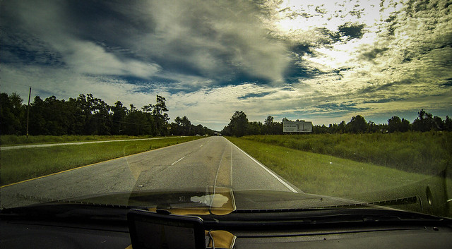
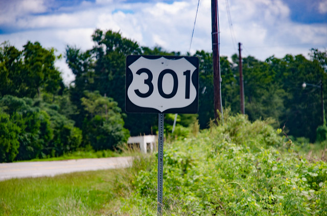
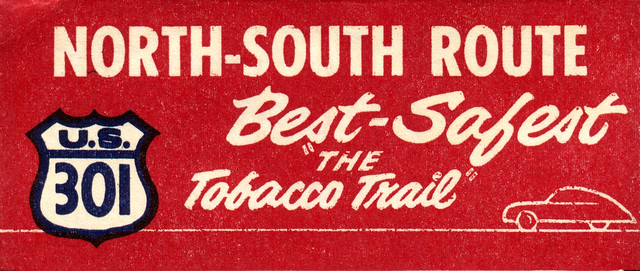
For some reason the town of Santee intrigues me. It’s something of an anomaly compared to the other cities on the Tobacco Trail. There is no main street or central business district. Those features make me think that the town as, say, Orangeburg, Allendale or Bamberg. I decided to find out more about it. In the process of that research I discovered a new ghost town.
Category: History and Genealogy
I was out exploring the Tobacco Trail through South Carolina. So far I had started at the SC-GA border on the Savannah River and had crossed Allendale, Bamberg, and a good portion of Orangeburg Counties. Orangeburg is a large county, and is bordered by Lake Marion on the east. I was ready to check out the rest of the county, and see how far I could go on this day’s exploration.
Read More “The Tobacco Trail through Orangeburg County, Part 2” »
So far I had traveled across two South Carolina counties on The Tobacco Trail, aka US Highway 301. I still had a long way to go, though. I was able to get through about a third of Orangeburg when we had a death in the family. Yesterday I was able to go knock out another huge chunk of the highway.
Read More “The Tobacco Trail through Orangeburg County, Part One” »
I’d made it through Allendale County, my GPS beeping every time I reached the location of an old tourist spot that I had marked. I was following the Tobacco Trail through South Carolina on Highway 301. Now I had just crossed the Salkehatchie River into Bamberg County.
I was out exploring Highway 301, the Tobacco Trail. I had driven down early in the morning, trying to resist distractions along the way. Once I finally reached my starting point I visited two old welcome centers, one still in operation, and one finding new life. Now it was time to continue eastward. However, my day was running out, and the trip was much quicker than I would have liked.
It was time to explore Highway 301. I had done the preliminary research and discovered the importance of The Tobacco Trail as a major route through South Carolina. I was ready to get out and actually take photos of some of these locations. However, I still had a bit of research to do.
The first thing I did was begin collecting old postcards and images from eBay and other sources. This would give me a comparison of what had been with what I would find. The next step was to mark potential locations in Google Earth. I traced the route of 301 through the state, marking motel and other locations as I spotted them. I also added any National Register or other interesting sites I found along the way. These were then uploaded to my GPS so I’d have them for ready reference.
On our last Lowcountry Unfiltered kayaking trip on the Savannah River Larry Easler and I drove back along Highway 301. We were amazed at the number of old motels and abandoned tourist spots along the way. I knew it had to have once been a major thoroughfare, now bypassed by I-95, but I wanted to know more about it. What was its history? How did this highway through one of the most desolate parts of South Carolina become such a major route? The answer turned out to be much more interesting than I could have possibly imagined.
In a previous post I wrote about the old auto trails that predated the US Highway System, and the business associations that promoted these routes and the tourist amenities along them. Here’s the story about how Highway 301 became known as The Tobacco Trail, one of the most important north-south routes along the Eastern Seaboard.
You have died of dysentery.
That was the sad fate that awaited many who played the 1980s game “The Oregon Trail.” It was a frustrating game, and I used to enjoy torturing my students with it back in the day. The game was supposed to be a representation of the perils of pioneer life on the early cross-country routes like the Santa Fe, Cumberland, Oregon, Mormon, and Chisholm Trails.
Flash forward 75 to a hundred years or so. Railroads crossed the country, but routes for automobiles were still a challenge. Neither the roads nor the cars themselves were suited for long cross-country road trips. While one probably wasn’t going to succumb to dysentery, flat tires, steep hills, winding treacherous roads, and all manner of other problems awaited.
On our recent trip down to paddle the Savannah River I lamented the fact that we couldn’t stop and all of the cool photo ops along the way. We had a schedule to meet and we were running late. Tuesday of this week I decided to take a break from house remodeling to get and explore a bit with my camera, and I was determined to catch some of those photo ops that we had missed.
Actually, this post is just a taste of a much larger project, one that I hope to complete over the next couple of weeks. Even on this outing I had a tighter time crunch than I might have liked, and I still missed lots of things I’d like to have explored further. I would be exploring the land between the rivers – the basins between the North and South Edisto, and the Savannah River.
Read More “Rambling between the Rivers – The Edisto and Savannah” »
Earlier this summer my cousin Brent Baker contacted me about some family history sites. His mother, Judy Oliver Baker, is my first cousin, and they were wanting to visit home sites and graves for the Ellenberg-Oliver family.
I sent Brent a map of locations I knew about, and he and his mom set off. I would have loved to have tagged along, but that was during the time that Laura and I were in Florida. Brent was kind enough to send me his write-up of the trip and share some photos on his Amazon Cloud Drive. I told him I’d be happy to post his information here, even though I wasn’t able to go with them.


