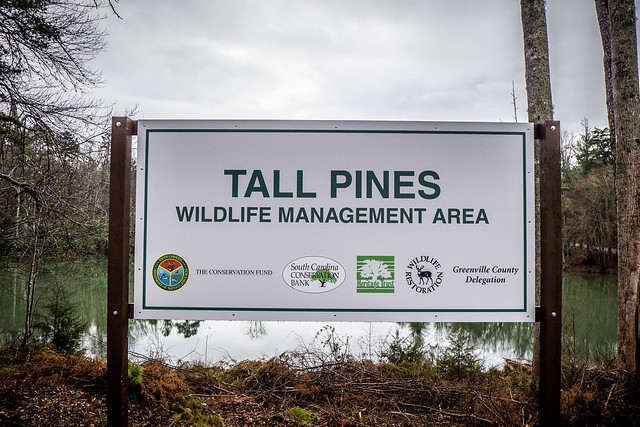
Last week it was announced that a new preserve has been established under control of SC Department of Natural Resources. The new public space, called the Tall Pines Wildlife Management Area, will be open to hunting, fishing, and hiking. Located in Northern Greenville County along the banks of of the South Saluda River, the property includes several lakes, nearly 1800 acres, and…the site of an old church and cemetery. Fellow explorer Mark Elbrecht and I decided to see what remained.
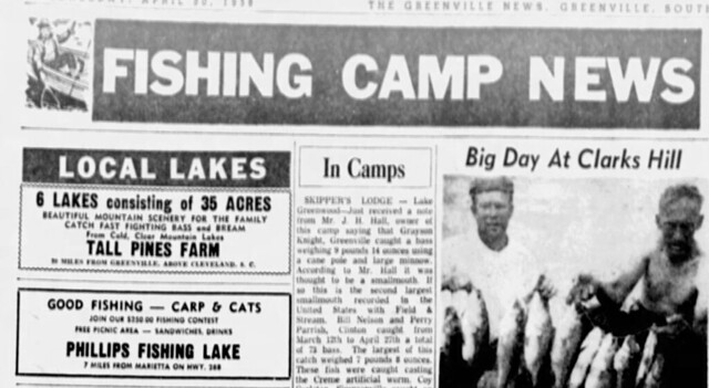
As much as I’ve rambled over this part of Greenville County, somehow I’d missed the Tall Pines property. To others, though, it was well-known as a fishing spot, as seen in this 1958 clipping from the Greenville News.
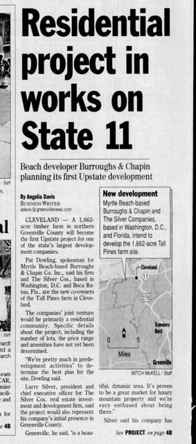
I remember passing a For Sale sign at the corner of Highway 276/11 and Moody Bridge Road showing that the property was for sale. I was afraid that someone would snatch up the property for development, and in 2007, someone did.
Burroughs and Chapin Co. from Myrtle Beach planned a huge development, initially with 1200 homes and a public market. It looked obscenely elaborate, and would change the name from “Tall Pines” to “Copper Lakes” for some reason. Fortunately, they scaled back their plans, whether from public outcry or financial uncertainty I don’t know.
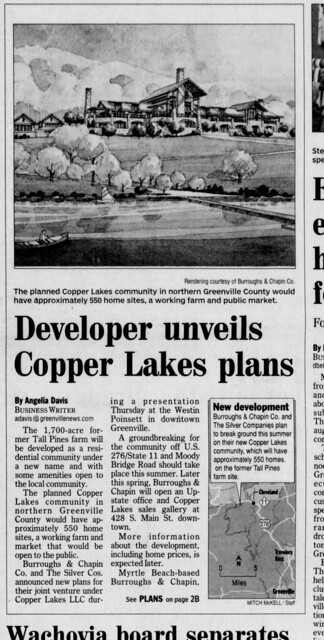
Even more fortunately, the plans never came to fruition. Eventually, with the help of the Conservation Fund from Virginia, SCDNR was able to purchase the entire tract and incorporate it into their WMA program.
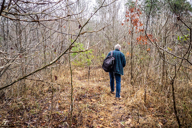
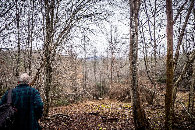
Earlier this week Mark had posted a link to another upstate blogger, writing about her trip to Tall Pines. He made plans to visit this past Wednesday, and I decided to tag along. When Wednesday rolled around it was dumping rain in Greenville and I thought the trip might be a bust. However, the skies cleared. It was muddy, but wasn’t raining when we arrived at the parking lot overlooking the largest of the lakes.
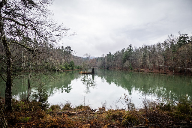
In the middle of the lake is an island with an unusual brick structure with a tower of sorts. We had no idea as to its purpose. Mark and I both wished that we had our kayaks to explore.


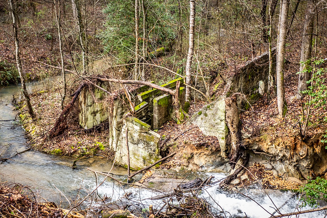
With the rain the outflow from the lake was quite dramatic. On the other side of the road was another structure. We couldn’t tell if it was part of an old bridge or something else.

On the lake side of the road there was lake access which would be perfect for launching.

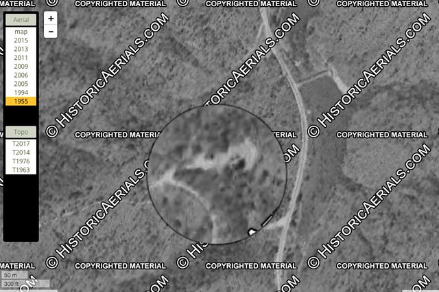
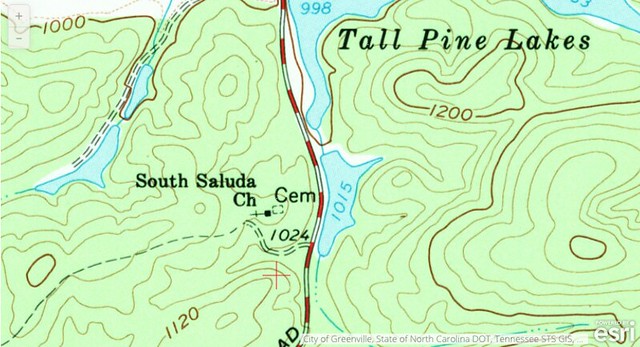
This was cool, but we had a destination. Mark had the coordinates for an old church and cemetery nearby. GNIS showed this to be South Saluda Church. The church shows up in aerial imagery from 1955 and it appears on a 1967 USGS topo map.
Google Earth historical imagery shows that the area was logged in the early 2000s. The namesake pines were taken, but a stand of old oaks remain in the proximate location of the church. That would be one of the landmarks for us.

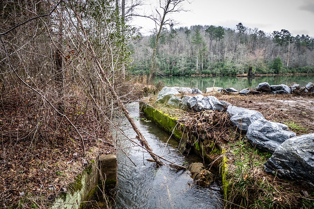
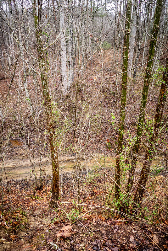
At first we thought about bushwhacking over the hill, but decided to walk along Moody Bridge Road until we got to the dirt road leading to the top of the ridge. Along the way we checked out the dam separating two of the lakes. At least, that’s the way it appears on maps. In actuality it’s a broken dam between a lake and a wetlands area. At the bottom of the broken dam a stream flowed through.

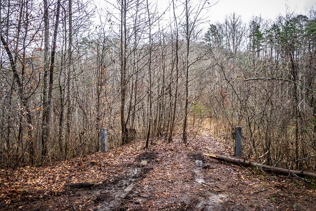
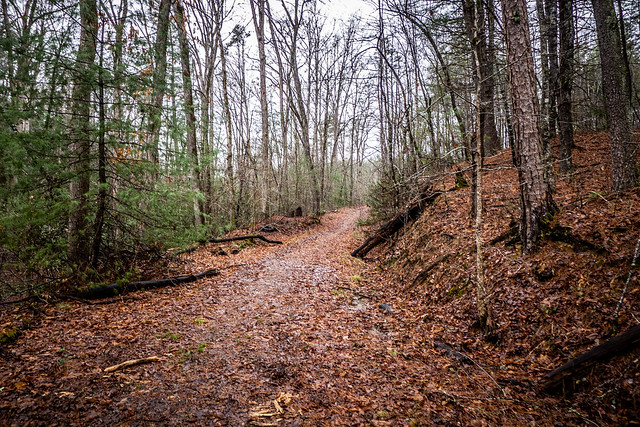
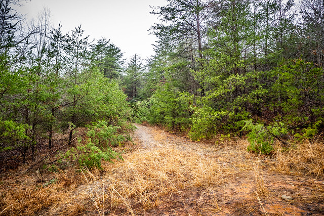
The dirt road leading up to the church and was very clearly marked. It was an easy, albeit muddy climb to the top of the ridge.


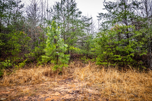
At the top of the ridge we found a clearing. It looked like this had been a regular campground. There was a bit of trash, but it wasn’t too bad. Another dirt road led south, but our target was to the north.

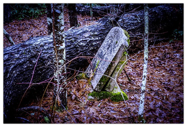
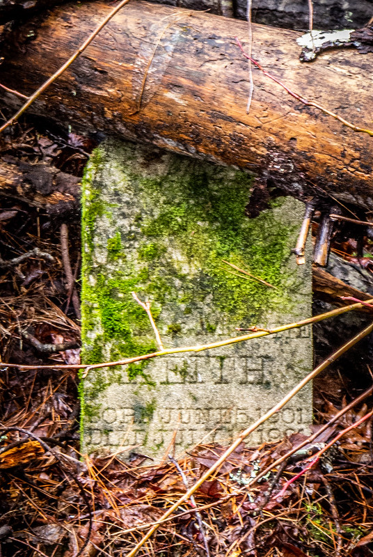
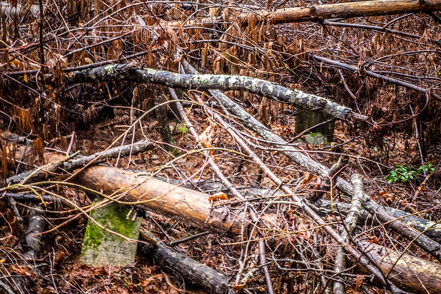
Some yards north of the clearing I spotted what looked like field stones.


But that wasn’t all there was to the cemetery. Mark spotted some headstones under the branches of several fallen pine trees.


Click on the page turn buttons below to continue…
This is the most interesting article I have read in a very long time. Certainly makes a person do some hard thinking about the place we will reside in the afterlife will look like after so many years. I truly the read. Thank you for taking your time and effort to print an article such as this.
Great article! I love finding old cemeteries and sharing the pictures and info for others to find. Awesome job!
Excellent post, Tom! I was not aware of any of this. The “lighthouse” in the middle of the lake makes me want to take a ride out there. Thank you for the great info on this area and the interesting characters who once lived here.
Thank you for the information here. I have walked part of the property, and can’t wait to get back and do more exploring on foot, or by kayak. Very interesting history of this place, and I am glad that DNR now has this property, and it will be protected for future generations to enjoy. My only concern is that the public will take care of this land and water as if it were their own. It is up to us, the hikers, fishermen, hunters and nature lovers to protect this place, and it’s history, as well. Thanks.
Amazing finds!! Just wanted to say that the white glass is a milk glass vase. I own one, so I recognized the pattern. ♡
I’m curious… Are you posting these graves and memories on findagrave.com?
I have not, yet, mainly because I wasn’t sure that I had enough information and the number of graves was rather sparse. I’d like to see what SCDNR does with clean up so that the site can be documented properly.
Tom I lived across Moody Bridge when the WIlkinsons still owned it and their daughter lived in the old farm house. We had a meager 75 acres and decided to get out of Dodge when the Wilkinson kids sold the place to the developers. That was just about the time things went south in the market and I’m pretty sure that’s what saved Tall Pines from being another cheesy golfing development. I truly wonder if the WIlinsons even knew about the cemetery! Great article!
This was very interesting. My ancestors cam from Glassy Mountain, and I love finding more about the area. Thanks for what you do.
Thank you for sending this article to me. It’s a very interesting blog post. As a society we have certainly quit thinking that the dead are sacred. Cemeteries across the state are falling to ruin. But I’m so glad this wild land is protected.
Very interesting article! I love old history and old cemetery’s! Interested in hearing more of your research on Tall Pines, South Saluda Baptist Church, the lakes, the cemetery, and the property!
What an amazing and interesting story! The details made it come alive. My ancestors settled in northern Greenville and Pickens counties in the late 1700s and I love reading stories about that area. Thanks!
Great article and welcome to the “I love old stuff” club…could be graves, houses, roads, books, and of course cemeteries/graves and now old people…good job!
Hi Tom, great post, and thanks for coming along! I finally completed my own post yesterday:
https://markemark4.blogspot.com/2019/03/at-tall-pines-and-what-we-found-there.html
Amazing story and photos. Thank you so much for perking my interest in learning more. My great great grandparents also settled around Greenville and Pickens Counties. Really has me curious now to see if family members are buried there in the cemetery. But, regardless, great research and photos. My hat off to you and Mark.
My family is from Pickens and Cleveland where I grew up and my Dad worked for Ga Pacific Lumber Mill in Cleveland and My Grandfather worked as a Blacksmith .
The Graves of William and Mattie Keith’s daughter Vienna were Black folk . don’t know if the South Saluda Church was a Black Congregation but back in those days I know for a fact Black and White folk attended the same church.These were poor farmers and farm laborers. Poshields @ yahoo .com
We have a friend who is 80 and remembers going to this church as a child. Mary Carr, the headstone picture you took is his great great grandmother. He has been looking for this cemetery for several years. We would love to take him up there. Can you please give me some detailed directions how to get to the cemetery. Thank you for posting this. We told him about your post and showed him the pictures, He is very excited!!
Thank you for your post. My friend and I explored that area the other day. Sadly, we did not see the gravestone for William Blythe and I hope, that family came and took the stone or perhaps it is being protected under a tree. From your photos, we encountered different trees that had fallen in the area. We were able to find 10 gravestones, although Mack Boyd’s was pretty well worn off. Hoping to go back and get some rubbings to help identify, if possible, others.
I have been able to find the death records of some of the deceased through familysearch.org
Would you be okay if I added the link to your blog as a source for the articles on Mack Carr and the other findings?
Thank you for your post; it’s a good way to honor these blessed souls.
Wendee, you are welcome to add a link.