I really despise the term “Black Friday” in reference to the day after Thanksgiving. The thought of battling crowds just to save a few bucks seems silly to me, so I like just about ANYTHING other than shopping. A paddling trip seemed in order, so Alan agreed to meet me at Low Falls Landing on Lake Marion. So, while others were getting up at 4:30 to head to Walmart, I was getting up at the same time for the 3 hour drive down to Calhoun County.
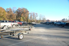
When I arrived at Low Falls I found a parking lot just about as crowded as one at any mall. Every boat trailer place was taken, and boat trailers lined the approach road to the landing. I managed to find a “car only” slot. The boat ramps themselves were in constant motion with duck hunters arriving from their daybreak hunt, and fishermen heading out for the day.

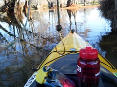
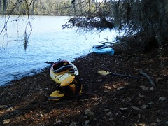
Alan arrived shortly and was able to find another car only space. We unloaded the boats and opted to launch from a beach area next to the boat ramps, rather than try to compete with the boat traffic.
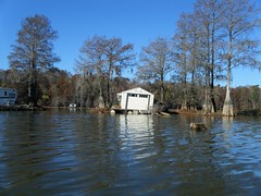
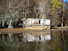
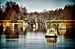
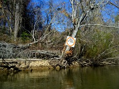
The first thing one spots upon heading out from the landing are the infamous river shanties. These are floating barges cobbled together from old pontoons, 55 gallon drums, or just about another other material. Atop the barge are placed campers, sheds, or anything that might serve as a shelter. Hunters and fisherman use these as squatters cabins all up and down the lake. Unfortunately, these are often just abandoned as they fall into decay, and there are sanitary issues with them as well as navigation and pollution hazards.
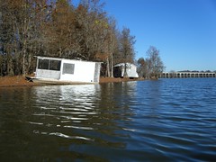
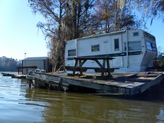
I had thought DNR was going to remove most of these over the summer. Apparently that didn’t happen. Some of the shanties in better condition had DNR permits in the windows. Others had boat licensing numbers affixed to deck rails or other parts of the structure, as if these were a licensed water craft.
The water levels were extremely low. Some of these cabins were left high and dry. That may also have impeded DNR from removing the offending structures.
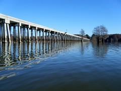
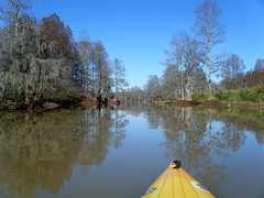
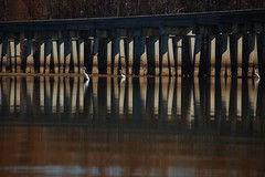
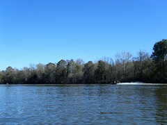
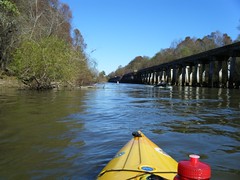
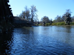
Instead of following the boats and paddling out to the big water, we headed north into a shallow arm of the lake. We first passed under a long railroad trestle.
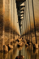

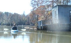
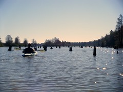
On the other side of the trestle there were no more shanties, and absolutely no boat traffic. I’m guessing the shanty barges would be difficult to fit between the trestle pylons. Even with good water levels, motor boat navigation here would be difficult because of the cypress stumps everywhere. Today it was impossible, and the only way back here was by kayak.

We had paddled up to one clump of cypress to explore, and I was hit with another reminder of human impact on the area. An abandoned fishing hook snagged my sweater as I paddled past. Fortunately, it didn’t make it through my sweater or my PFD, but it was a bit scary.
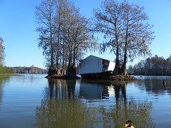
One the things Alan and I love to do is to explore various side channels. This time the low water made that impossible. All around we could see places that we might be able to get back into at higher water levels, but not today. We might even have been able to connect to the Santee River channel from here.
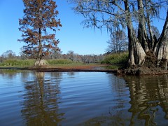
Even in a kayak navigation was tricky. We frequently ran aground and had to backtrack. Hidden cypress stumps were also a problem. We would run up on these unexpectedly, momentarily losing balance. We learned to paddle with a wary eye toward snags.
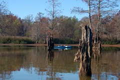
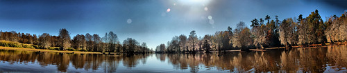
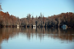
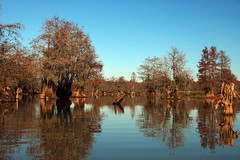
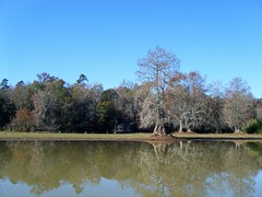
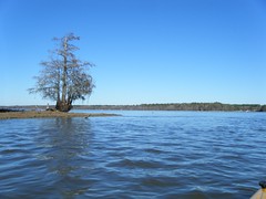
The brown leaves on the cypress and the stumps left us with an impression of stark beauty. I really want to come back in the spring when this area is green, and the water levels are a bit higher.
Alan and I kept paddling back in this cover until we reach a point where we could go no further, about a mile and a half past the trestle. We then headed on back, cautiously.
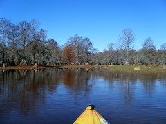
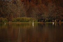
All along this path we heard sporadic gunfire from the hunters. Even so, there was quite a bit of wildlife in our little cove. Especially as we approached the trestle again we saw lots of herons and egrets.
When we got back to the landing we decided to explore the river channel a bit. Lake Marion is unusual in that the Santee River maintains a completely separate channel between two bits of high ground for quite a ways. There are several inlets into the river channel, and at higher water the river flows into the back coves, but for the most part it maintains a separate existence from the main body of the lake for quite awhile.
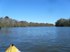
When we crossed over to the river channel we hit current, but not so much that we couldn’t continue upstream. This body of water was distinctively river, as opposed to the open lake. The one problem we did encounter was more boat traffic.
We stopped for lunch along the river, and watched as a camp was forming up on the other bank. Several tarps were spread, and at least three duck boats were tied up there. Our lunch spot obviously had served as a camp at some point, because we found a good bit of trash.
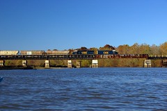
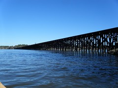
I had maps with me, but I didn’t have a good feel for distances. I wanted at least to reach the trestle as it crossed the Santee, so we continued upstream. We could see boats on either bank next to the trestle, and just as we reached it, a train crossed over.
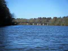
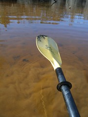
Just on the other side of the trestle a narrow channel leads off to the east, paralleling the trestle. This was a cut over to the main body of the lake. On the map it looked like a good distance, but I wanted to get to the big water just to take a look. As we entered the channel, the current picked up significantly. Not only did we have to battle boat wakes, but there were actually small standing waves and slight rapids in the strong current.
We continued in the channel for just under a mile until it empties into Lake Marion. The trestle continued on, and we could see Rimini Landing across the lake. While more open than the river channel, the body of water had large stretches of exposed sand as well as lots of exposed stumps. I’m not sure how anyone could navigate a motor boat here, but several were attempting to do just that.
At this point we had two choices. We could paddle the mile or so against the strong current in the channel back to the Santee, or we could continue south and hope to find a cut back to Low Falls. Since we were unfamiliar with the area and the water levels were so low, the latter option wasn’t very appealing. So, we headed back into the channel, slowly making our way against the current.
Back down the river more camps were forming. I’m guessing these were hunters getting in position for an early morning outing. There was more gunfire as the campers were taking pot shots at cans (I hope.) Even so, I was glad we were heading back to the landing.
We had put on the water around 9:00, and got back around 3:00. The parking area was every bit as crowded as when we had started out. As I was loading up my boat someone asked if they could have my spot.
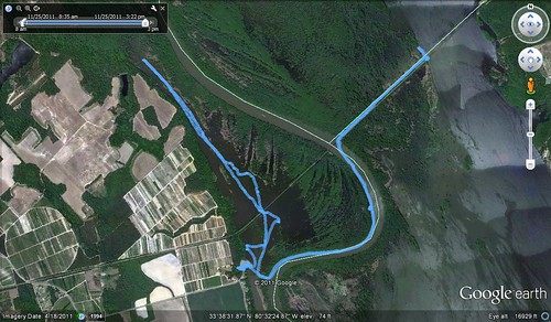
In all, we paddled a little over 10 miles on this trip. I do want to come back in the spring when the warblers are out, and I think I might have an idea of a better paddle route. We’ll have to see. Until then, though, here is the route we paddled on this trip…
Here are all of the photos I uploaded as a slide show:
One last comment: I just finished reading John Lane’s book “My Paddle to the Sea“. On his journey he completely skipped Lake Marion. There were weather and time factors involved, but Lane spent a good bit of time decrying man-made impoundments, as opposed to free-flowing rivers. He indicated that even if time and weather had been conducive, he would have shunned the lake. I, however, think he missed an opportunity. While free flowing rivers are better, there is quite a bit to see and enjoy on Lake Marion. I get irritated at the human element with their shanties, trash, and shooting, but the lake somehow seems to rebound, and there are some truly spectacular places to visit here. Between Sparkleberry Swamp, Low Falls, Persanti Island, and other places we’ve visited, this is quickly becoming one of my favorite paddling destinations.
UPDATE: Alan added his photos to Flickr. Here’s his set…