Skip to content

Random Connections

A collection of photography and exploration focusing on Upstate South Carolina and beyond.

  • Home
  • About Us
  • Photos
  • Resources
  • Other Voices
  • Post Archives
  • Podcast
  • Home
  • Photography
  • Page 20

Tag: Photography

The Wilds of Vancouver Island

Posted on August 6, 2010 By Tom No Comments on The Wilds of Vancouver Island
Travel

Wednesday, August 4, 2010

We had kind of overdone it the day before. We were exhausted, and on top of that we hadn’t gotten much sleep because it was hot and most of these BC hotels have no AC. So, it was a late start to the day with a leisurely breakfast in the hotel restaurant.

We figured we had until 4:00 before we had to line up for the return ferry to Anacortes. That gave us several hours to explore. Eventually, we decided to head up along the coast to see if we could get to where we could see the Pacific Ocean, and not just the Puget Sound. Our target was Port Renfrew, which was barely where one might see the ocean, and about at the limit of our range for the day.

We headed northwest(ish), outside of Victoria, and toward the town of Sooke. From Sooke we took Highway 14 toware the coast.

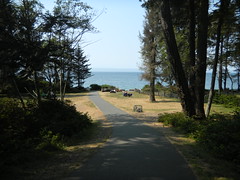
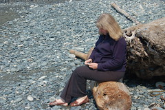
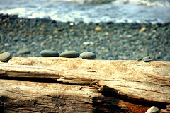
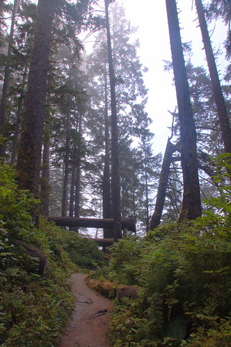
Our first stop was French Beach, a BC Provencial Park along the coast. The sun was shining, but it was still very cool and foggy off of the coast. The ranger said that a couple of pods of whales lived nearby, so we grabbed binoculars and sat for a bit.

Read More “The Wilds of Vancouver Island” »

Anacortes Ferry, Butchart Garden, and Victoria

Posted on August 5, 2010 By Tom 2 Comments on Anacortes Ferry, Butchart Garden, and Victoria
Travel

Tuesday, August 3, 2010

Laura and I got up early this morning. We had reservations for the ferry from Anacortes to Sydney, BC, and knew we had to get there early to board. We drove off of the island while the sun tried to break through the ubiquitous fog.

The Ferry

The ferry wasn’t very crowded this time. Only the lower car deck had vehicles, and the seating area was largely empty. We took our usual positions at the front of the boat, despite the chilly, damp wind.

Pretty soon, though, it got too foggy, and they even closed off the outer decks for safety. Visibility was nil, and the ship slowed and blew its horn regularly.

Read More “Anacortes Ferry, Butchart Garden, and Victoria” »

Kayaking around Burrows Bay

Posted on August 5, 2010 By Tom 1 Comment on Kayaking around Burrows Bay
Paddling, Travel

Monday, August 2, 2010

One thing I love about this is the abundance of paddling opportunities. There are flatwater lakes, swift moving rivers, and challenging open water courses. I never get to do as much kayaking as I would like when I’m up here, so this time I decided to make sure I got to paddle at least a little bit. I booked a five-hour tour with Anacortes Kayak Tours before we left South Carolina.

I set out early, planning to catch breakfast in one of my favorite joints in Anacortes before starting the tour. The bay between Samish and Fidalgo Islands was completely fogged in, but it looked like skies would be clearing. When I drove onto Fidalgo, the fog really set in. I found my way to my restaurant and had a fantastic breakfast while also putting out fires at work over the phone. So much for vacation.

I headed on over to the kayak place. I had been another another tour around Hat Island several years ago, but it turns out that it was a different group. This place not only had kayak tours, but also offered whale watching tours.

I was early, and got my instructions to meet the rest of the group on the other side of Fidalgo. Since I had some time, I stopped by Washington Park, which is just past the Anacortes Ferry Terminal. This early the road around the park was closed to auto traffic, so I walked around and took a few shots.

Pretty soon it was time to meet my group, so I headed to the Skyline Marina on Burrows Bay. In addition to myself and the guide, Ken, there were three others – Robbie from Tasmania, and sisters Sue and Carolyn. Robbie and I got single 17 foot Necky Looksha sea kayaks, and the two sisters got a tandem kayak. All of us were experienced kayakers, so Ken gave us some obligatory brief instructions, and we set out across the foggy water.

Our route would take us out around Burrows Island, with a stop at the lighthouse there. We would paddle on around Allan Island, then out to Williamson Rocks if we had time.

Read More “Kayaking around Burrows Bay” »

Upriver on the Skagit

Posted on August 5, 2010 By Tom No Comments on Upriver on the Skagit
Travel

Diablo Lake Panorama

NOTE: Just catching up with blogging after traveling around the islands. Things are a bit post-dated right now.

Sunday, August 1, 2010

Yesterday we followed the Skagit River through Mount Vernon and out to its confluence with the bay. Today we decided to head the opposite direction and follow the river upstream. Our route would takes up into the North Cascades National Park.

Old Skagit Railroad Trestle

We started on the Skagit River Road along the south side of the river, away from the more crowded Highway 20. The road twists through farms, runs through large stands of trees, and crosses many tributary streams. The last time we were up this way we found several access points that let us get down to the river for a better view. This time we couldn’t find the same access points, so we kept driving.

Near the town of Concrete we crossed the river and picked up Highway 20. The road crossed the Baker River, where we found a nice dirt road leading down to where The Baker and Skagit Meet.

Read More “Upriver on the Skagit” »

Onion Photography

Posted on July 28, 2010 By Tom No Comments on Onion Photography
Photography

Onion Texture

SHREK: For your information, there’s a lot more to ogres than people think.

DONKEY: Example?

SHREK: Example? Okay. Uh… ogres are like onions.

DONKEY: They stink?

SHREK: Yes. No!

DONKEY: Oh, they make you cry?

SHREK: No!

DONKEY: Oh, you leave them out in the sun, they get all brown and start sprouting little white hairs.

SHREK: No! Layers! Onions have layers. Ogres have layers. Onions have layers. You get it? We both have layers.

DONKEY: Oh… you both have layers… You know, not everybody like onions. Cakes! Everybody likes cakes. Cakes have layers.

SHREK: I don’t care what everyone likes. Ogres are not like cakes… You dunce, irritating, miniature beast of burden. Ogres are like onions. End of story. Bye bye. See ya later…

OK, you may be wondering what Shrek has to do with photography. Actually, it’s more about layers – specifically, layers in Photoshop.

I had been working with layers ever since my friend Duck Hunter showed me the technique. The process can add interest, texture, and even change the mood of a photograph. The process is simple enough…

1. Open a photograph in Photoshop or your image editor of choice.

Calhoun Creek Bridge HDR 2

2. Find an interesting texture, such as the ever-popular “Pollution” texture from Jerry Jones, , AKA Ghostbones, AKA SkeletalMess

Pollution

3. Resize the texture to match the base photograph, then copy it into a layer on top of the base. Change the blend mode of the texture layer from “normal” to “overlay”…

Calhoun Creek Bridge HDR with Texture

…and the result is an image that combines aspects of both layers. You can change the opacity of the upper texture layer to increase or decrease the effect.

Read More “Onion Photography” »

Weekend Update

Posted on July 25, 2010 By Tom 1 Comment on Weekend Update
Miscellaneous

Been a crazy, crazy week, both at work and at home. There hasn’t been much time to paddle, take photos, or chase down fire towers or old schools. Here’s a brief rundown… Work Our computer shipments have started to arrive. We’ve ordered far less than we usually do, but there were still pains. Our normally … Read More “Weekend Update” »

Old School Charm

Posted on July 18, 2010 By Tom 9 Comments on Old School Charm
Geocaching and Maps, History and Genealogy, Local

Old Shiloh School Textured

Perhaps it’s that I’m the son of a school principal, and had run of the various schools that I attended growing up. Perhaps it was the many reunions and covered dish suppers our family attended in various country community centers. Perhaps it was even because I spent college summers working maintenance – painting and waxing all of the schools in our district. It might, in some small part, have something to do with my own long career as an educator. Whatever the reason, I’ve always had a fascination with school architecture. Just about any school can be interesting, but what catches my attention most are the old wooden framed country schools.

Driving through the country these are easy to spot. The architecture is distinctive. The buildings tend to be squarish with hipped roofs. If it’s got an old bell tower, all the better.

Wheeland SchoolFish SchoolGowensville School HDR

Well, OK, they don’t all have to be white frame. There are some cool old brick schools, too.

Recently I was doing some research on the South Carolina State Archives website. There is a marvelous collection of photographs of old schools taken between 1935-1950 for insurance purposes.

Browsing this collection got me thinking about these old schools. They are great subjects for photography, and an excellent symbol of a bygone time. I wanted to see if I could find more of these old schools, and that meant making a list of potential targets using Google Earth.

Read More “Old School Charm” »

More Saluda Lake

Posted on July 17, 2010 By Tom 1 Comment on More Saluda Lake
Paddling

Saluda Lake Dam Panorama

Having never been on Saluda Lake before this summer, I’ve now paddled it three times in four weeks.  I’m actually surprised at how it’s become a nice quick paddling destination for when we want to get out on the water.

Friday Alan and I headed out and launched from Saluda Landing at the end of Motor Boat Club Road.  Once again we paid the steep access fee for our two little kayaks.  The more I think about this, the more I realize what a rip-off this is for kayakers.  Motor boats can launch for $8, but kayaks and canoes are $5 each.  A motor boat usually can carry more than one person, so it works out to be a better deal.

Again, we had the annoyance of having to paddle south to avoid the silted-in portion of the lake.  This time, though, we kept paddling south, out toward the main portion of the lake.  This would be new territory for us.

Read More “More Saluda Lake” »

Lazy Saturday on the Edisto

Posted on July 12, 2010 By Tom 4 Comments on Lazy Saturday on the Edisto
Paddling, Photography

Heading down the Edisto

It was a second Saturday, which can only mean one thing – another outing with the guys from Lowcountry Unfiltered. This time our target was once again the Edisto River. This was to be our “beer commercial” float, full of rope swings, mayhem, and general goofing off. And, that pretty much sums up the day.

For this trip we were doing a familiar stretch. The plan was to put in at Mars Old Field Landing, but this time we would paddle past Givhens Ferry State Park and take out at Messervy Landing, adding another three miles to our trek.

Edisto River paddling map - July 10, 2010

Read More “Lazy Saturday on the Edisto” »

Laurens County Photo Trek

Posted on July 7, 2010 By Tom 2 Comments on Laurens County Photo Trek
Local, Photography

I had Monday off as part of the 4th of July weekend. My brother, Houston, and my sister, Glynda, also had the day available, so we decided to go on another photo exploration. This time our target was our old stomping grounds around Laurens, South Carolina.

Houston had some specific locations he wanted to see if we could find. Most of these were in the old Long Branch area, but we knew we would get sidetracked in route. I picked up Glynda and Houston at the family home in Gray Court. Armed with GPS, maps, and more cameras than we had passengers, we set out.

We actually didn’t get very far. At the south end of Gray Court is the historic farm area that the Gray Court-Owings Historical Society has put together. Glynda and Houston weren’t aware of this place, so we spent a good bit of time looking at the old cabins and farm implements and taking pictures of these.

Read More “Laurens County Photo Trek” »

Posts pagination

Previous 1 … 19 20 21 … 29 Next

Categories

  • EdTech (197)
  • Entertainment (202)
  • Family (123)
  • Gear (114)
  • General Technology (98)
  • Geocaching and Maps (208)
  • History and Genealogy (275)
  • Internet (142)
  • Local (459)
  • Miscellaneous (560)
  • Music (202)
  • Paddling (268)
  • Photography (781)
  • Podcast (19)
  • Rambling (233)
  • Rants (162)
  • Recipes (37)
  • Religion (48)
  • Restaurants (165)
  • Science (48)
  • Things Overheard (29)
  • Travel (413)
  • Uncategorized (143)
  • Washington Sabbatical (113)
  • Weirdness (61)

Recent Posts

  • Helene One Year Later
  • Once Again, Up the Long Nose
  • Upstate Renaissance Faire
  • Exploring Lake Summit
  • The End of Days

Recent Comments

  • Gay on In Search of the Road Builder
  • Virgil Howell on The Ghost Towns of Lake Marion
  • Virgil Howell on Return to Ferguson
  • Mary Copeland Myers on Renno and Stomp Springs
  • Virginia Pepper on Helene One Year Later

Tags

blogging cemetery Christmas Columbia Edisto River edtech Entertainment family Flickr Florida Furman Furman University gear Georgia geotagging Ghost Town Ghost Towns Google Earth Google Maps GPS Greenville Greenville Chorale history Instructional Technology kayaking Lake Jocassee LCU Lowcountry Unfiltered maps Music North Carolina Paddling Photography rambling restaurant Restaurants review singing social networking South Carolina time-lapse Travel video Washington Washington State
October 2025
S M T W T F S
 1234
567891011
12131415161718
19202122232425
262728293031  
« Sep    

Copyright © 2025 Random Connections.

Theme: Oceanly by ScriptsTown