Skip to content

Random Connections

A collection of photography and exploration focusing on Upstate South Carolina and beyond.

  • Home
  • About Us
  • Photos
  • Resources
  • Other Voices
  • Post Archives
  • Podcast
  • Home
  • Google Earth
  • Page 4

Tag: Google Earth

The Travels of JH, Junior

Posted on May 30, 2008 By Tom 4 Comments on The Travels of JH, Junior
Geocaching and Maps

In the summer of 2006 we made a trip to London and visited the Royal Observatory in Greenwich. While there I picked up a fuzzy little souvenir I intended to use as a Travel Bug for geocaching. Thus was born “JH, Junior.” JH, Junior. was named for John Harrison (1693-1776). Harrison was an English clockmaker … Read More “The Travels of JH, Junior” »

Embeddable Google Earth

Posted on May 29, 2008 By Tom No Comments on Embeddable Google Earth
Geocaching and Maps

The functionality of Google Earth is showing up in more and more places outside of the actual Google Earth software. Much of what you could do in GE is now available in Google Maps. Maps has had the ability to read KML/KMZ files for awhile now, and for the most part the imagery is the same for both systems. Well the folks at Google have blurred the line even more with the recent release of the Google Earth COM API.

The new API allows developers to create interfaces to the Google Earth data. Probably one of the best examples of this has been done by the folks at TakItWithMe.com. They have created a version of Google Earth than can be embedded into blog posts, web pages, etc.

In order to take advantage of this three things have got to be in place:

  1. Google Earth 4.x or higher must be installed on your computer.
  2. You have to install the Google Earth 3D plugin for the browser you plan to use.
  3. The KML/KMZ file you plan to use must be available online, either on hosted webspace or on the user’s My Maps folder in Google Maps.

If you have at least the first two of these already in place on your computer, you can click the link below to read more, and you’ll see a demonstration…

Read More “Embeddable Google Earth” »

Creating Media-Rich Lessons with Google Earth

Posted on May 20, 2008 By Tom 3 Comments on Creating Media-Rich Lessons with Google Earth
EdTech, Geocaching and Maps

Sometimes it just clicks. As many workshops as I have done on Google Earth, I hadn’t really, truly understood its implications for the classroom. In most of my workshops, I had been focusing on the mechanics – basically how to navigate and create interactive placemarks. Now I’m going to emphasize using Google Earth as a … Read More “Creating Media-Rich Lessons with Google Earth” »

Hey! What’s That?

Posted on April 29, 2008 By Tom No Comments on Hey! What’s That?
Geocaching and Maps

Via the blog Free Geography Tools, I’ve learned about one of the coolest new applications to take advantage of the Google Maps/Earth interface. The service is called “Hey! What’s That?” and it allows users to create panoramas from any point on Earth. Think of it this way… You’re up on the Blue Ridge Parkway and … Read More “Hey! What’s That?” »

Super Geotagged

Posted on April 28, 2008 By Tom No Comments on Super Geotagged
Geocaching and Maps, Photography

One of the problems with native KML support in Flickr is that it only displays the last 20 geotagged images from the specified search criteria. If you want a more inclusive display of Flickr geotagged images, you need to use something like Metaltoad, Flyr or Loc.alize.us. Flyr gives you better granularity of control for searches … Read More “Super Geotagged” »

SCETV Day 3 – Reflections on Censorship

Posted on April 25, 2008 By Tom No Comments on SCETV Day 3 – Reflections on Censorship
EdTech

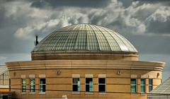
South Carolina State House

Today was a jam-packed day. I had three sessions back to back, then it was time to drive home. There was one last session on basic Google Earth, then two on Geotagging. Yesterday during the late afternoon I had drive around Columbia snapping pictures so that I would have some shots for tagging.

Thurmond DomeWar Protesters 2Varsity BilliardsETV Satellite FarmETV Building

The first session went well, then it was a mad dash to the other ETV building for geotagging. It was a small room, so we had a rather information demonstration/discussion. Both sessions went very well, and my photos showed up in Google Earth exactly like they were supposed to.

Read More “SCETV Day 3 – Reflections on Censorship” »

SCETV Day 2

Posted on April 23, 2008 By Tom No Comments on SCETV Day 2
EdTech, Geocaching and Maps

Today’s workshops went very well. As with yesterday, I did a basic Google Earth workshop then an advanced session. Both sessions were well-received, and I got some good positive feedback. By sheer happenstance these workshops are following a logical progression. The basic session focuses on just getting used to the program. First, there is simple … Read More “SCETV Day 2” »

(Google) Earth Day

Posted on April 22, 2008 By Tom No Comments on (Google) Earth Day
EdTech, Geocaching and Maps

Since this is Earth Day, it seems only fitting that I spent the day doing workshops for SCETV on Google Earth. I did one basic session, which covered getting use the the controls, searching, basic placemarks, and learning how to manage layers and folders. The second session was an advanced session where we started embedding … Read More “(Google) Earth Day” »

New Imagery and Version for Google Earth

Posted on April 16, 2008 By Tom No Comments on New Imagery and Version for Google Earth
EdTech, Geocaching and Maps

Last week I was going to write a post about the new imagery for the city of Greenville in Google Earth. Things got busy over the weekend, and I had to delay writing about it. In the meantime, I learned that Google Earth was releasing version 4.3 this week, so I decided to hold off … Read More “New Imagery and Version for Google Earth” »

Sky, Moon, and Mars

Posted on March 14, 2008 By Tom No Comments on Sky, Moon, and Mars
Geocaching and Maps, Science

Google has taken its Google Sky functions and made them available on Google Maps as well as Google Earth. Google Sky for Maps features much of the same space imagery as its Google Earth counterpart. You can zoom in (out?) for a closer view of deep space objects and stars. There are also links that … Read More “Sky, Moon, and Mars” »

Posts pagination

Previous 1 … 3 4 5 Next

Categories

  • EdTech (197)
  • Entertainment (202)
  • Family (123)
  • Gear (114)
  • General Technology (98)
  • Geocaching and Maps (208)
  • History and Genealogy (275)
  • Internet (142)
  • Local (459)
  • Miscellaneous (560)
  • Music (202)
  • Paddling (268)
  • Photography (781)
  • Podcast (19)
  • Rambling (233)
  • Rants (162)
  • Recipes (37)
  • Religion (48)
  • Restaurants (165)
  • Science (48)
  • Things Overheard (29)
  • Travel (413)
  • Uncategorized (143)
  • Washington Sabbatical (113)
  • Weirdness (61)

Recent Posts

  • Helene One Year Later
  • Once Again, Up the Long Nose
  • Upstate Renaissance Faire
  • Exploring Lake Summit
  • The End of Days

Recent Comments

  • Kristi on From Buzzards Roost to Chappells
  • Gay on In Search of the Road Builder
  • Virgil Howell on The Ghost Towns of Lake Marion
  • Virgil Howell on Return to Ferguson
  • Mary Copeland Myers on Renno and Stomp Springs

Tags

blogging cemetery Christmas Columbia Edisto River edtech Entertainment family Flickr Florida Furman Furman University gear Georgia geotagging Ghost Town Ghost Towns Google Earth Google Maps GPS Greenville Greenville Chorale history Instructional Technology kayaking Lake Jocassee LCU Lowcountry Unfiltered maps Music North Carolina Paddling Photography rambling restaurant Restaurants review singing social networking South Carolina time-lapse Travel video Washington Washington State
October 2025
S M T W T F S
 1234
567891011
12131415161718
19202122232425
262728293031  
« Sep    

Copyright © 2025 Random Connections.

Theme: Oceanly by ScriptsTown