Sometimes it just clicks. As many workshops as I have done on Google Earth, I hadn’t really, truly understood its implications for the classroom. In most of my workshops, I had been focusing on the mechanics – basically how to navigate and create interactive placemarks. Now I’m going to emphasize using Google Earth as a total presentation tool.
The other evening Laura was looking for videos to use with her chemistry class. They were discussing nuclear power, and she wanted to show something on Chernobyl. We found three videos on YouTube from the History Channel on the subject. She wasn’t sure she would remember how to find them again, so I had her register for an account then mark these as favorites. We began to wonder how else Laura might incorporate these into her lesson. We had explored embedding them into PowerPoint, but she wasn’t interested. There had to be a good way to make sense of all these materials.
Meanwhile, I had taken an interest in the subject matter itself. Out of curiosity I had located the Chernobyl plant in Google Earth. I created a placemark for it and for the neighboring town of Prypiat. I turned on the Wikipedia layer, and learned about something called the “Zone of Alienation” – a twenty mile circle around the plant from which all residents were evacuated. I used the online KML Circle Generator to recreate the Zone’s circle in Google Earth. Finally, I created placemarks and embedded the three video clips from YouTube in each of them. I then put all of these in a folder in My Places called Chernobyl and saved it to a KMZ file. Below is a screen capture…
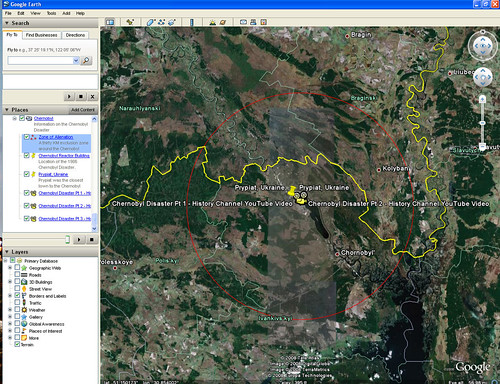
And here’s the KMZ file as rendered in Google Maps…
If I had wanted to, I could have copied those Wikipedia placemarks into my Chernobyl folder, as well as any of the images that came in Panoramio, or data from any other layer, for that matter. This gives me a ton of information, and it’s all related to its correct location on the map. Talk about a powerful way to start discussions and explorations!
As a general rule, if a service such as YouTube provides embeddable code, you can copy that code into a Google Earth placemark. Not only does this include other video services such as Vimeo and TeacherTube, but other presentation tools such as SlideShare, SlideFlickr, and VoiceThread.
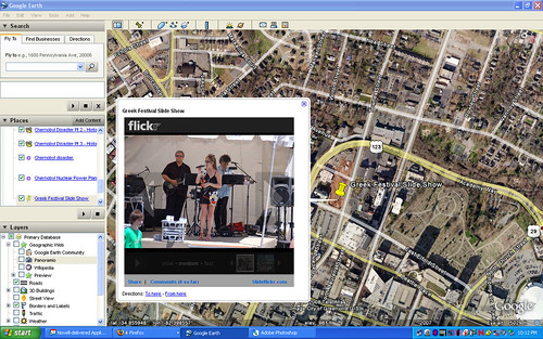
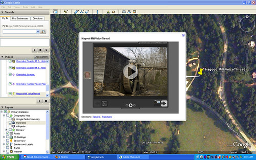
Now imagine the possibilities. In addition to the other Chernobyl materials, you could add a VoiceThread and solicit discussion about the disaster, all within the context of Google Earth. Sounds pretty amazing to me.
3 thoughts on “Creating Media-Rich Lessons with Google Earth”