Skip to content

Random Connections

A collection of photography and exploration focusing on Upstate South Carolina and beyond.

  • Home
  • About Us
  • Photos
  • Resources
  • Other Voices
  • Post Archives
  • Podcast
  • Home
  • Broad River

Tag: Broad River

Paddling Parr Shoals

Posted on June 25, 2012 By Tom 1 Comment on Paddling Parr Shoals
Paddling

Parr Shoals

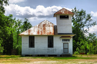
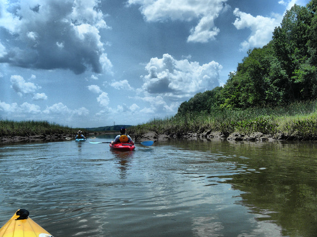
Saturday Laura had to meet with new advisees at Furman, so Alan and I decided to do some paddling. We wanted to find a place that was fairly close to Greenville, and that we hadn’t paddled before. I’ve had my eye on Parr Shoals, just east of Prosperity, for some time now and that’s where we decided to go.

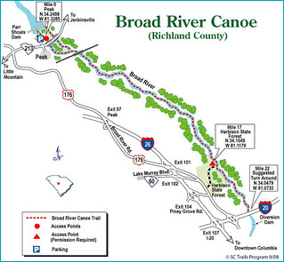
Parr Shoals is on the Broad River, and is just north of where we put in on our marathon paddle from Peak to Harbison State Forest. Parr Shoals, along with its sister reservoir, Monticello, are often overlooked. While Parr Shoals is fed by the Broad River, water is pumped from the river into Monticello, then returned to Parr Shoals via tailrace. Both reservoirs serve as impoundments for the V. C. Summer nuclear power plant, one of the first nuclear power plants in the Southeast. Construction is currently underway for additional reactors.

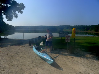
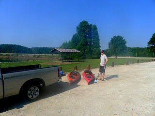
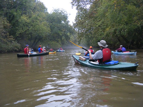
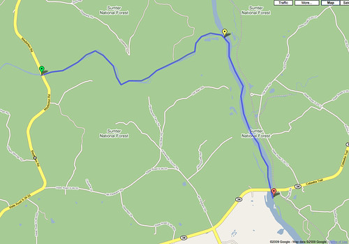
We were joined by Alan’s son, Joshua, a recent Furman graduate himself. We met early Saturday and Alan and Josh followed me down I-26 to the Pomaria exit, then on across country to the Cannon Creek Landing on Parr Shoals.

Alan with kayakJosh with Boats

Read More “Paddling Parr Shoals” »

Paddling to Columbia

Posted on May 27, 2012 By Tom 3 Comments on Paddling to Columbia
Local, Paddling, Photography

Alan at Shoals

I’ve always been intrigued by the Broad River, especially the stretch starting at the Peak trestle. It looks like it would be a great paddling venue, but unfortunately public access points are few and far between. The next access point downstream from Peak is Harbison State Forest, near Columbia. Alan wanted to do a trip for Memorial Day weekend, and it looked like the perfect opportunity to hit this stretch. It turned out to be the longest single-day trip I’ve every attempted, but it was another great day on the water.

The SC Trails website describes the Peak to Harbison stretch as a 22-mile paddle. This site lists the put-in about a mile upstream at the Highway 213 bridge. The route also describes paddling down to the I-20 bridge, then back up for some reason. I had been down to the 213 put-in, and it was a very rough drive down, and a difficult launch. The new access point at the trestle seemed much better, and would shorten the trip a bit.

Untitled

Even so, I knew it would be a challenge. However, I was hoping that a strong current would make it easier than if we were doing a flatwater trip of the same distance. All the same, I wanted to get an early start. In addition to Alan, my brother Houston and his two friends Steve and Jeannie Boyette would be joining us. The plan was to meet at the put-in at 8:30 am, run the shuttle, and get on the water by 10:00.

Read More “Paddling to Columbia” »

Trestles to Trails

Posted on April 26, 2012 By Tom 3 Comments on Trestles to Trails
Local, Photography, Travel

Peak Trestle 4

Tuesday I had one of my quarterly meetings in Columbia with the South Carolina Association of School Administrators (SCASA) Tech Leaders’ Roundtable. I normally try to drop in to visit my mom on the way back from these trips, but this time she was out and about. So, instead, I decided to see if I could find a few spots to try out the new camera. There are a couple of neat places just off the interstate – just a quick detour away – that are full of history and scenery.

My first stop was to the west of I-26 between the towns of Little Mountain and Prosperity. I first spotted the old Wheeland School in the photo layer of Google Earth several years ago, and have made regular visits to it since then. I figured it would be a good test subject.

Wheeland School 1

Wheeland School 2

Read More “Trestles to Trails” »

Two Rivers for the Price of One

Posted on October 11, 2009 By Tom No Comments on Two Rivers for the Price of One
Paddling

Starting Out on the Enoree

This time our Lowcountry Unfiltered group got two rivers for the price of one, plus a few ghosts and goblins thrown in for good measure. On Saturday we paddled a portion of the Enoree River to its confluence with the Broad River, then down to our take-out at Strother’s Landing.

Planning this trip proved to be a challenge. The group wanted to paddle an Upstate river, but didn’t have the boats for whitewater. There was also the matter of distance. These guys would be driving for 3-4 hours just to get here, so the paddling trip couldn’t be too long. If they’re driving that far, then the trip needs to be worthwhile, and not a drag through the mud.

My first plan was to paddle a stretch of the Tyger River. It had all the elements I needed – it was remote, full of history, and even a ghost story. Unfortunately, there wasn’t much water when Bob and I paddled it last month. It was more of a muddy hike while dragging boats.

Fortunately, I was able to find a suitable route. We would put in at Keitt’s Bridge on the Enoree near Maybinton and float to its confluence with the Broad River, then paddle down to Strother’s Landing at the Highway 34 Bridge. According to Google Earth, the route would be about 7 miles. This route takes us through Sumter National Forest, so it’s suitable remote, and there’s even a ghost story – The Hound of Goshen.

Enore_Broad_River_Map

Read More “Two Rivers for the Price of One” »

Categories

  • EdTech (197)
  • Entertainment (201)
  • Family (123)
  • Gear (114)
  • General Technology (98)
  • Geocaching and Maps (208)
  • History and Genealogy (275)
  • Internet (141)
  • Local (458)
  • Miscellaneous (557)
  • Music (202)
  • Paddling (264)
  • Photography (781)
  • Podcast (15)
  • Rambling (233)
  • Rants (161)
  • Recipes (36)
  • Religion (48)
  • Restaurants (165)
  • Science (48)
  • Things Overheard (29)
  • Travel (413)
  • Uncategorized (142)
  • Washington Sabbatical (113)
  • Weirdness (59)

Recent Posts

  • Six Layer Bourbon Grits Bowl
  • How’s the House? Part 2
  • Carolina Ghost Towns – Merrittsville
  • Gimme Shelter
  • From Kingsbury to Stoneboro – Rambling in Lancaster County

Recent Comments

  • Curtis V Fink on Chasing the Swamp Rabbit – Part 3, Sievern and Edisto Academy
  • Bobby Stan Gillespie on Exploring Jacks Township
  • Richard Thornton on Paddling Up the Long Nose
  • John Guerrant on From Kingsbury to Stoneboro – Rambling in Lancaster County
  • John Guerrant on Gimme Shelter

Tags

blogging cemetery Christmas Columbia Edisto River edtech Entertainment family Flickr Florida Furman Furman University gear Georgia geotagging Ghost Town Ghost Towns Google Earth Google Maps GPS Greenville Greenville Chorale history Instructional Technology kayaking Lake Jocassee LCU Lowcountry Unfiltered maps Music North Carolina Paddling Photography rambling restaurant Restaurants review singing social networking South Carolina time-lapse Travel video Washington Washington State
May 2025
S M T W T F S
 123
45678910
11121314151617
18192021222324
25262728293031
« Apr    

Copyright © 2025 Random Connections.

Theme: Oceanly by ScriptsTown