
I’ve always been intrigued by the Broad River, especially the stretch starting at the Peak trestle. It looks like it would be a great paddling venue, but unfortunately public access points are few and far between. The next access point downstream from Peak is Harbison State Forest, near Columbia. Alan wanted to do a trip for Memorial Day weekend, and it looked like the perfect opportunity to hit this stretch. It turned out to be the longest single-day trip I’ve every attempted, but it was another great day on the water.
The SC Trails website describes the Peak to Harbison stretch as a 22-mile paddle. This site lists the put-in about a mile upstream at the Highway 213 bridge. The route also describes paddling down to the I-20 bridge, then back up for some reason. I had been down to the 213 put-in, and it was a very rough drive down, and a difficult launch. The new access point at the trestle seemed much better, and would shorten the trip a bit.
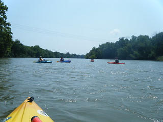
Even so, I knew it would be a challenge. However, I was hoping that a strong current would make it easier than if we were doing a flatwater trip of the same distance. All the same, I wanted to get an early start. In addition to Alan, my brother Houston and his two friends Steve and Jeannie Boyette would be joining us. The plan was to meet at the put-in at 8:30 am, run the shuttle, and get on the water by 10:00.
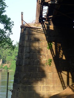
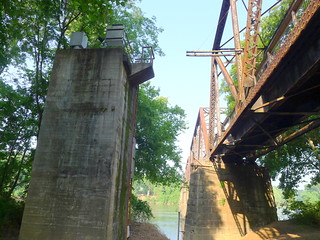
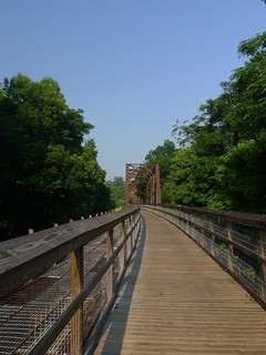
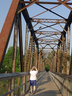
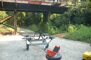
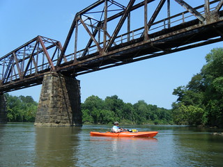
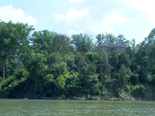
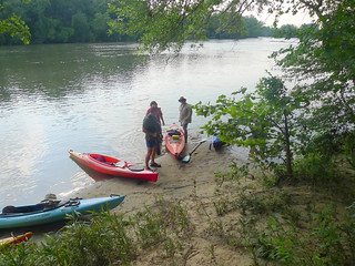
Alan and I got there first and checked out the launch site. The trestle in the morning light presented loads of interesting angles and shadows.
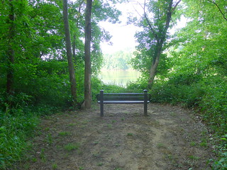
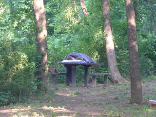
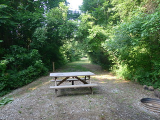
There were several nice benches overlooking the river, as well as several picnic tables, one of which was occupied by a camping couple.
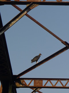
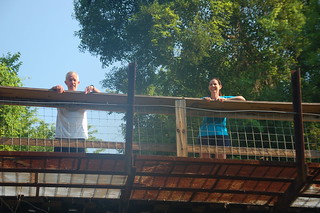
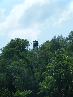
Alan and I walked up to the trestle and wandered out on it a bit. A vulture had perched on the steel girders.
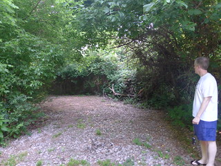
We also checked out the designated camping area. The original railroad had a junction here. The camping area is down one branch of this junction.
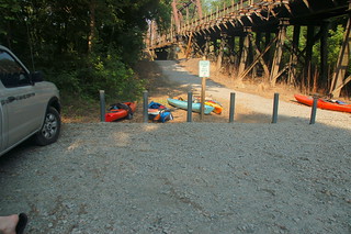
Soon enough the Georgia contingent arrived. As we were unloading the boats, a couple jogging across the trestle accosted us, wanting to know where we were headed, etc. The Georgia plates attracted their attention. Houston and I mentioned that we have family in Prosperity and Newberry. In a typical “small world” scenario, it turns out that they sing in my sister Ann’s choir in Newberry.
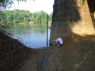
Steve and I left to run the shuttle, and that’s where we started to run into trouble. I hadn’t really scouted the take-out, and wasn’t sure what to expect. All I had was a set of coordinates from Google Earth. The GPS on my phone took me down the wrong road initially, but soon we were back on the right track.
We stopped at the main office to find out where the canoe launch was. Before they would give us directions or let us pay the parking fee, we first had to fill out a float plan with details of everyone on the trip. The route to the river access was down a VERY long dirt road, but we finally found it and parked Steve’s truck.
We had hoped to be on the river. However, with all of the paperwork and miscues, we would be lucky to be on the water by 11:00. We were getting a late started, and the later it got, the more worried I became that we wouldn’t be able to make it.
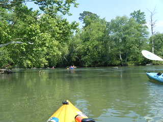
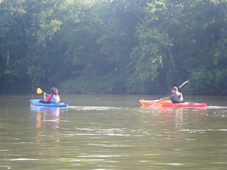
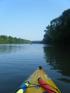
We launched with a decent current at the bridge, and the gauge indicating 4 feet – lower than it had been, but not too low.
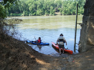
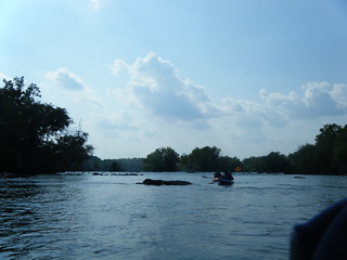
The Broad River certainly lives up to its name at this point. Unfortunately the current we found at the launch site quickly flattened out. A brisk headwind countered the bit of current that we did have. It looked like we would be paddling more than floating with the current.

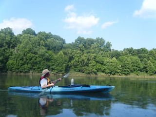
To prepare for the trip I had put lots of landmarks into my GPS – powerlines, tributary streams, islands, and shoals. I had also printed out the entire route from Google Earth, with the landmarks indicated. That took twelve sheets of paper. As the miles rolled on, we used both the landmarks and the pages to mark the passage.
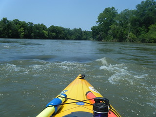
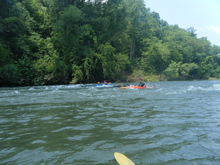
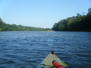
In addition to the length of the trip, the other unknown was how many shoals and rapids we might encounter. At this water level, there were lots of exposed rocks, and we had to be careful maneuvering around them. There were also several ledges, but nothing I’d really call a rapid. Still, getting hung up on a rock wasn’t pleasant, and none of us wanted to spill in these rec boats. If we had about two feet more water, most of the ledges, rocks, and ripples would have completely disappeared.
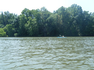
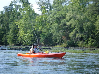
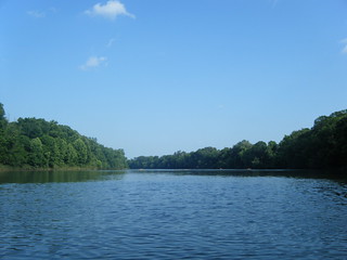
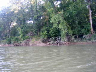
All of the descriptions I’ve read about this stretch describe the remoteness and multitude of wildlife. The Broad River lived up to this description in both respects. We saw only a very few people during the whole route. We DID see loads of wildlife – river otters, deer, snakes, turtles, herons, kingfishers, garfish, nutria, and no less than three bald eagles. The eagles tended to hang out at the shoals, so I was usually paying more attention to paddling than to photography. Subsequently, I have not shots of them. The other wildlife was equally elusive, at least as far as photography is concerned.
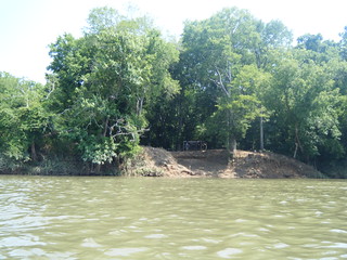
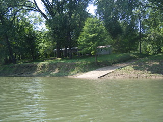
There were very few houses along the route. Most places looked like little get-aways, with nothing more than a boat ramp and a picnic table. I guess folks pulled their campers up for a weekend away. However, there were a couple of nice places.
At one point we looked up and saw a fire tower at a bend in the river. We figured it had to have been moved there from its original location. It seemed out of place. Plus, there was an American flag near the top. It was too well-tended. As we paddled past I looked at it with jealousy.
The miles passed very slowly, and my traveling companions complained that I wasn’t turning the pages on my map fast enough. We stopped for lunch briefly, but didn’t linger.
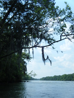
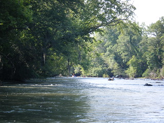
Right about page four on our map we hit two changes in the river. First, we approached the first of several islands Haltiwanger Island is the largest in this stretch. We ran the narrower channel to the west, as it seemed like it would have fewer rocks and rapids. The second thing we noticed was that the trees now had Spanish moss. It seemed weird to be hitting minor rapids with the moss hanging overhead.
We also passed Huffman Island to the West, hitting a few more minor rapids along the way. After that there were several more miles of flat paddling. I didn’t mind the rapids because it meant that the current was a bit stronger there.
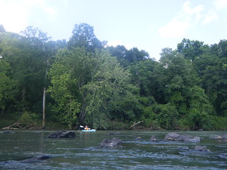
A small island marked the beginning of the Hickory Island/Bookman Island chain. The obvious and wider route was to the west, but we opted for the smaller, braided channels to the east in the hope that there would be fewer rocks. We had to weave our way through some rocky areas to reach our route, but our choice paid off, with nothing but a few ripples and some nice overhanging limbs. We also knew that this route would eventually open up.
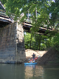
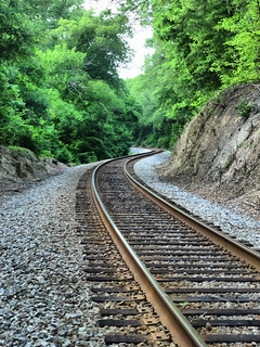
Once past the islands and shoals we stopped for another quick break, and I climbed the bank to explore. I was surprised how close we were to the railroad tracks, but I shouldn’t have been. The railroad parallels the river for most of its route.
By now it was 5:00 pm. We had been on the river for six hours and had been paddling that entire time. We still had a long way to go before we reached the take-out, and we were tired and sunburned. We’d had a few close encounters with rocks, but no one had flipped. We paddled on, with conversation kept to a minimum. We kept to the west bank, taking advantage of the late afternoon shadows.

Finally our take-out point started to show up on my GPS. I think I let out an audible yelp. After nearly two more hours of paddling since our break I spotted another crucial landmark. A rocky outcrop marked the beginning of another set of shoals just beyond our take-out. The end was in sight.
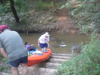
Of course, it wasn’t the end of our trials. The take-out was either up a steep bank straight from the river, or we could paddle up a hidden shallow creek to another steep take-out. At least this second one had steps and was closer to Steve’s truck. Regardless, it was quite a haul, especially after a long paddling trip.
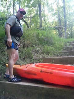
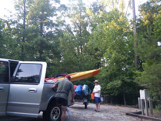
It was after 7:00 and we were finally off of the water. We loaded up the boats and got ready for departure.
But, the ordeal STILL wasn’t over. We were well past the time when all of the gates were locked at Harbison. Fortunately, the ranger had provided us the combination lock. Unfortunately, that meant that we had to stop and five different gates and wait while I hopped out, unlocked the gate, opened them, let the truck and trailer pass through, then close and relock the gates. It took us longer to get through Harbison than it did to drive from Harbison back to Peak.
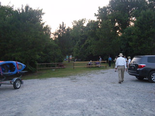
When we finally got back to the put-in to retrieve my truck we had yet another surprise. The Palmetto Conservation Foundation was sponsoring Art on the Trail. There was some sort of art installation opening on the trestle. I didn’t go see it, but there were lots of cars and visitors.
All in all it was a great, albeit long trip. I think this is a trip that might be best spread over two days, with an overnight stop at Haltiwanger Island. I would also love to find an alternate take-out. The paperwork hoops and locked gates at Harbison were a nightmare, and delayed both our launching and our leaving.
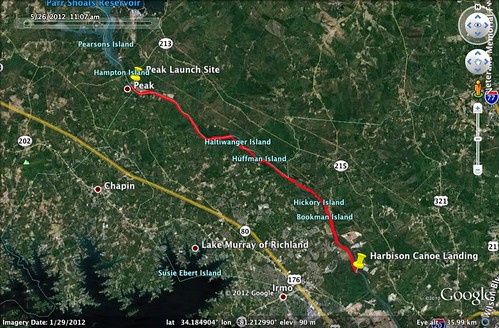
According to the GPS, we had paddled 17.1 miles. Just crossing the river from one side to the other added length to the trip. Here’s the map from Google Earth…
…and here’s a slideshow of all of the photos that I took along the way…
Jeannie has also uploaded her photos from the trip to Flickr. Here’s that slide show…
…and lastly, Alan has uploaded his photos to Flickr…
Thanks for being our river guide. It was a great trip. I believe this was the longest single day paddle for all of us. I think we did a terrific job!
Jeannie
I have some pictures of a short float I took a couple of days ago on the Little Pee Dee from Potato Bed landing to Punchbowl. I use your “paddling South Carolina” kmz file a lot to plan trips. Just got down here full time and am looking forward to many more. Black Mingo is next and then perhaps the Black quite a ways upstream/upstate. Do you want photos of the route? If so, where would you like them and what format?
Dean
Dean – I’m glad you’re finding the files useful. I’ve been wanting to get down to the Black River and Black Mingo myself. I would love to see those photos. My best suggestion would be to pop them onto either Flickr or Picasa and send me a link. You can get a basic free account on both of those, and that way you retain control of the images and can use them as you see fit for other purposes. I’ll be able to link to them from the KMZ file if they are already online.