Skip to content

Random Connections

A collection of photography and exploration focusing on Upstate South Carolina and beyond.

  • Home
  • About Us
  • Photos
  • Resources
  • Other Voices
  • Post Archives
  • Home
  • Travel
  • Returning from Samish Island
  • Page 2

Returning from Samish Island

Posted on August 8, 2019August 8, 2019 By Tom No Comments on Returning from Samish Island
Travel

Coos Bay OR to Burns OR

Day 2 Route
381 miles across Oregon

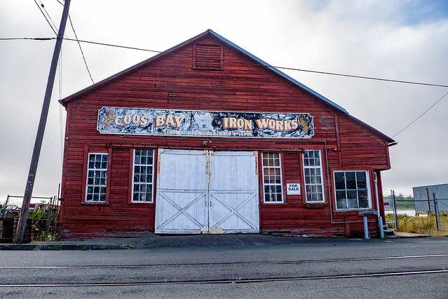
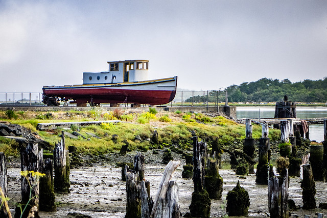
The plan for Day 2 of our travel was to have a leisurely breakfast with Aunt Ellen then drive deeper into Oregon. We were a bit early for a rendezvous, so we enjoyed watching tug boats pulling barges along the bay. I didn’t get photos of those, but I did try to capture the local atmosphere.

Coos Bay to Burns-3
Coos Bay to Burns-4
Coos Bay to Burns-5

Our breakfast stop was The Pancake Mill, and it was crazy. We had to wait quite awhile. Not only was it a busy Sunday morning, but Dunefest was happening just north of here at the Oregon Dunes Recreation Area. There would be tons of ATVs and off-road vehicles coming through town.

As we waited I was a bit confused by a few of the postcards.

Coos Bay to Burns-1

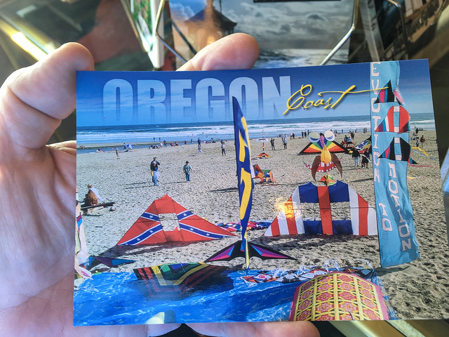
Despite the long wait, though, the apple waffles and buckwheat pancakes were worth it.

Coos Bay to Burns-2

After breakfast we said our goodbyes and continued on our journey home. We retraced our steps back to Reedsport, then eastward along the Umpqua. Just south of Eugene we leave the interstate and take Highway 58 which followed the Willamette River for much of its route.

This stretch was beautiful, but I didn’t stop to take photos. One thing I noticed were TONS of big box store kayaks. They seemed to be strapped to just about every other vehicle we passed. I had also noticed them stacked to the rafters in the stores in Washington. There must have been a big push on them this season.

Samish Island to Coos Bay-2
Samish Island to Coos Bay-3

I try my best not to be a “kayak snob.” These boats are a great, inexpensive introduction to the sport, but people should really know their limitations and not get into situations that these boats just can’t handle. But, I digress from the trip…

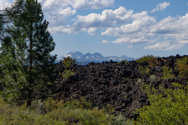
Our route led us through a pass in the Cascade Range, then at the Crescent/Gilchrist area we headed north on Highway 97. We had passed unmistakeable lava fields on Highway 58. As we traveled north we could see larger volcanic cones in the distance to the west.

Coos Bay to Burns-8
Coos Bay to Burns-7

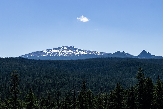
Near the city of bend we started to see signs for the Newberry Volcanic Monument. We decided to stop for a bit. There was a large cinder cone and miles of what I know as a’a lava (from the Hawaiian word, pronounced “ah-ah.”)

Coos Bay to Burns-20
Coos Bay to Burns-19
Coos Bay to Burns-18
Coos Bay to Burns-13
Coos Bay to Burns-9
Coos Bay to Burns-27
Coos Bay to Burns-16
Coos Bay to Burns-26

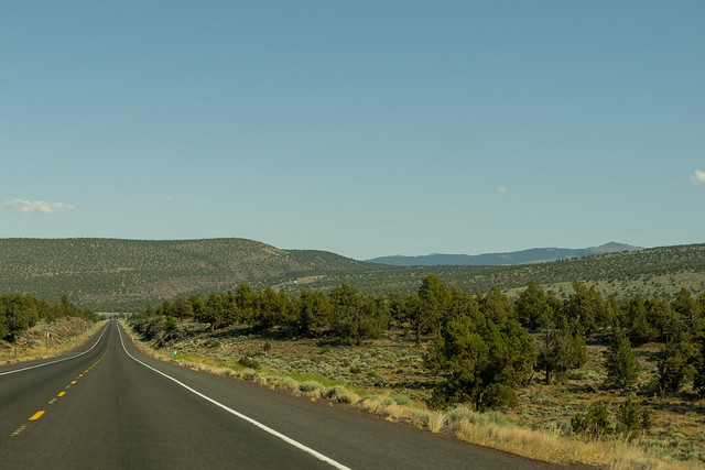
At Bend we headed east on US 20 across wide open stretches of land. This was some seriously remote terrain. Laura and I both thought that this would make excellent dark sky viewing.

Coos Bay to Burns-29
Coos Bay to Burns-28

I saw signs for Bureau of Land Management and we passed a large office for the BLM. As we pulled into Burns something at the back of my neck began to tingle. I had some nagging suspicions I’d have to check out when we got to the motel.

The community of Hines is just southwest of Burns. As we drove in we counted several taxidermy shops. Apparently hunting and stuffing is a big business in this area.

The motel we had booked for the night was…creepy. The Days Inn at Burns was a worker’s motel, not a vacationers place. There were vans and strange types lounging everywhere. Our room was filthy, but at this point we were tired and nothing else was available. I got a pretty good pizza from a place next door and we locked the doors to settle in for the night.

Coos Bay to Burns-22

Continued on page 3…

Pages: 1 2 3 4 5 6

Post navigation

❮ Previous Post: On the Ferry with a $20 Camera
Next Post: Paddling to Capers Island ❯

Leave a Reply Cancel reply

Your email address will not be published. Required fields are marked *

This site uses Akismet to reduce spam. Learn how your comment data is processed.

Categories

  • EdTech (200)
  • Entertainment (201)
  • Family (120)
  • Gear (115)
  • General Technology (99)
  • Geocaching and Maps (208)
  • History and Genealogy (260)
  • Internet (144)
  • Local (449)
  • Miscellaneous (544)
  • Music (195)
  • Paddling (245)
  • Photography (779)
  • Podcast (6)
  • Rambling (226)
  • Rants (160)
  • Recipes (34)
  • Religion (48)
  • Restaurants (165)
  • Science (48)
  • Things Overheard (29)
  • Travel (410)
  • Uncategorized (129)
  • Washington Sabbatical (113)
  • Weirdness (60)

Recent Posts

  • To Anacreon, on Samish Island
  • Wilkinsville and a Mystery Church
  • A Farewell to the Greenville Chorale
  • Edisto River from Good Hope to Sullivan’s Landing
  • Paddling Lake Monticello

Recent Comments

  • Patricia Taylor on Taylor Invasion of Ireland
  • Rewriting Urban Legends (Goatman's Bridge Series) - Buried Secrets Podcast - Paranormal, Occult, Weird and Forgotten History on Paranormal Activity
  • Russell Timmerman Owings on A Feud, a Mule, a Senator, a Potter, and a Ghost Town or Two – Part One
  • James Corley on A Feud, a Mule, a Senator, a Potter, and a Ghost Town or Two – Part One
  • Tom on A Feud, a Mule, a Senator, a Potter, and a Ghost Town or Two – Part One

Tags

blogging cemetery Christmas Columbia Edisto River edtech Entertainment family Flickr Florida Furman Furman University gear Georgia geotagging Ghost Town Ghost Towns Google Earth Google Maps GPS Greenville Greenville Chorale history Instructional Technology kayaking Lake Jocassee LCU Lowcountry Unfiltered maps Music North Carolina Paddling Photography rambling restaurant Restaurants review singing social networking South Carolina time-lapse Travel video Washington Washington State
August 2022
S M T W T F S
 123456
78910111213
14151617181920
21222324252627
28293031  
« Jul    

Copyright © 2022 Random Connections.

Theme: Oceanly by ScriptsTown