Dwight Moffitt and I were out exploring parts of the Cowasee Basin area. This area encompasses the river basins of the Congaree and Wateree Rivers where they come together to form the Santee. The basin name is an amalgam of the names of three rivers.
The area is rich in history and nature, and includes several plantations, ghost towns, and forgotten communities in Lower Richland, Western Sumter, and Southern Kershaw Counties. I’ve spent a fair amount of time kayaking its waters and hiking trails through here, but this time we were after ghost towns.
Earlier in the morning Dwight and I had explored the areas around the Eastover and Hopkins communities. We had already covered a LOT of territory, but our day was just getting started. The morning’s rambles had been confined to Lower Richland, but now we would be crossing the Wateree to explore the High Hills of the Santee area.
We had just wrapped up at Saint Thomas Episcopal Church, and it was lunch time. We were hungry. Unfortunately there wasn’t anything really close by without driving into Sumter or Columbia. We decided to try Mr. Bunky’s out on Garner’s Ferry Road.
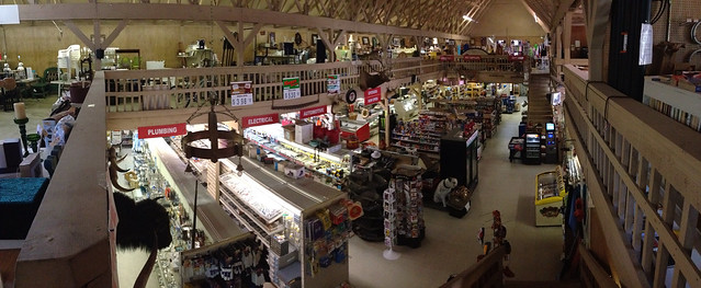
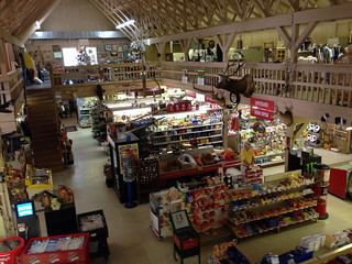
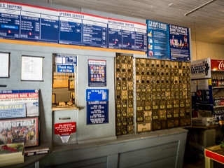
I had stopped here before, usually on my way down to Sparkleberry Swamp. Mr. Bunky’s is a landmark on the route from Columbia to Sumter, an old-school general store with just about anything you could imagine, from plumbing supplies to fishing supplies to a first-class butcher shop that even stocks alligator. And, yes, there is even a small cafe.
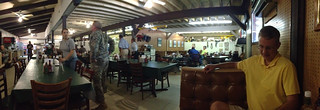
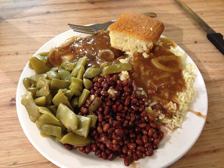
When we arrived the place was filled with military types, either from McIntire or from Shaw AFB, both nearby. I ordered from the hot bar, which was basically a meat-n-three, and Dwight got a hamburger. Both were excellent.
On my last trip I had noticed that their restroom had awkwardly placed two commodes side-by-side. Now at least there was a wicker divider, but it was no less awkward. I was glad for a lock on the door.
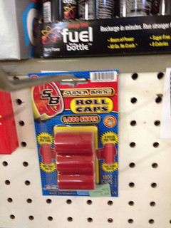
We spent a few minutes exploring. The general store area is downstairs. There were live chicks, and even roll caps, which I hadn’t seen in ages.

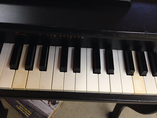
Upstairs is an indoor flea market with lots of consignment goods. I spotted a rather large toy piano, and couldn’t resist the pull of a keyboard. However, when I went to play it I discovered this particular keyboard had a problem.
We paid for our lunches and Dwight bought a roll of caps, and we continued on our adventure.
High Hills of the Santee
We crossed the Wateree River then turned north into the High Hills of the Santee. This is the location of the ghost town of Stateburg. Myth has it that it was under consideration as capital of the state, but that has been somewhat disproved by historians.
Since I had visited this area several times, we resisted the urge to stop at the Church of the Holy Cross, but continue on. I had Thomas Sumter’s tomb marked in my GPS and that was our next target. The only time I’d been there was with my two brothers, and I was sick as a dog. I was running a fever and didn’t even get out of the car.
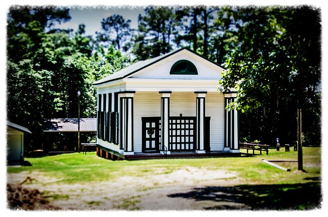
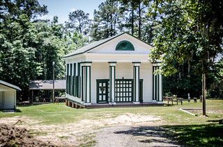
Our route took as past another one of my GPS waypoints – High Hills of the Santee Baptist Church. This historic church was pastored by none other than Richard Furman, and it was here that Furman University had its humble beginnings in 1826. This building was constructed in 1803.
When I was here with my brothers we had the good fortune of finding someone working inside, so we got a tour of the facility. No such luck this time. Dwight and I wandered around the exterior of the church.
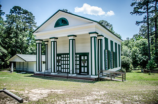
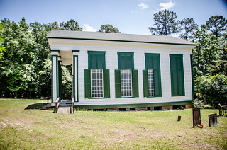
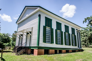
The striking green accents have always caught my eye. However, having just come from Saint Thomas Episcopal which had similar green accents, it looks like it was probably the style from that time period. Might be worth checking at some later date.
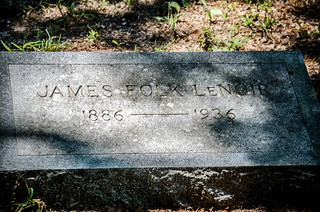
As we wandered through the cemetery I spotted a familiar set of names – Lenoir. I’m sure that these are relatives of the Lenoirs that run the Lenoir Store up in Horatio.
Not surprisingly, I did find one W. T. White signature stone.
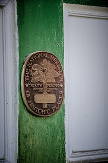
One thing baffles me, though. The church clearly had a National Register seal on the front facade. However, I don’t see it listed on the state records, and it isn’t on the delisted site. I’m now unsure of its status.
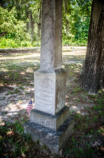
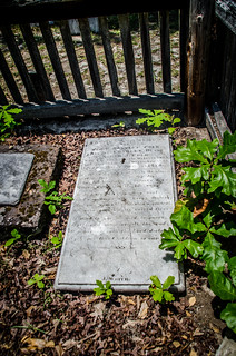
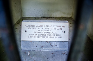
We left the church and continued on our way. General Thomas Sumter’s grave is located in a park-like setting. The most imposing structure is a brick mausoleum with a memorial to the wife of Sumter’s son, Thomas Sumter, Jr.:
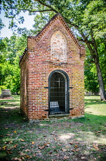
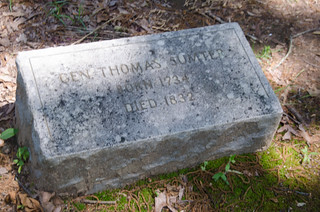
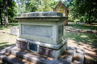
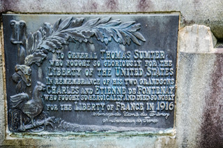
General Sumter’s grave is behind the mausoleum. A large marker has been placed as a memorial behind the grave.
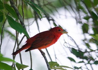
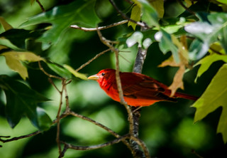
The area was peaceful, with birds flitting among the trees. Dwight spotted a flash of red, and identified it as a summer tanager. I’d never seen one before. I rushed back to the car and grabbed the long lens. I managed to get a couple of good shots.
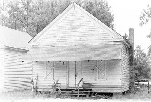
From the Sumter Grave we retraced our steps to 263 and headed to our next destination. Along the way we passed another historic school. I spotted the building and recognized it for what it was. However, we didn’t stop for photographs. I’ll have to content myself with a Street View capture.
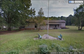
Now I’m kind of wishing we had stopped, though. The school is listed as “High Hills #1 Colored” on the School Insurance Photos site. It’s also listed as a Rosenwald School on the database for Sumter County. The current building looks like it has had an addition since the original insurance photograph was taken.

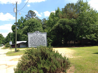
Lenoir Store and Horatio
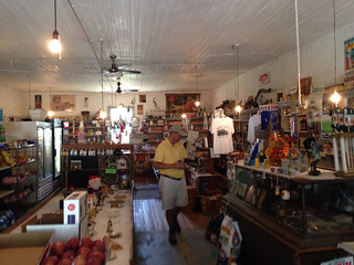
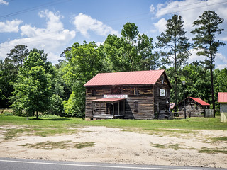
Lenoir Store is located in the farming community of Horatio. This is an amazing place. The store has been in continuous operation, owned by the same family, for over 200 years. The store was first mentioned in an 1808 will for Isaac Lenoir. The present building was constructed in 1878. Obviously, the place is on the National Register of Historic Places.
The store’s former proprietor, Carrie Lenoir, should have been on the National Register herself. When we last visited seven years ago Carrie was 87 and still actively running the place. She obtained a law degree back when women didn’t do such things. She had authored several legal texts, and there were photos of her with various presidents and celebrities on the walls of the store.
I believe the woman who was minding the store when we arrived is Carrie’s daughter, whom we had met on our previous visit. I asked about Carrie, and was told that she is now 94 and living in assisted living with advanced Alzheimer’s. Otherwise, she is still in good health for a 94 year old.
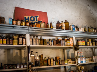
Other than missing Carrie, the store looked the same as it had the last time we were here. Old pharmaceuticals lined the shelves and the various moments of the store’s long history were tucked here and there. The store’s post office is still active – barely. There has been a plan to consolidate and close the post office at this location (link goes to video report.)
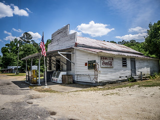
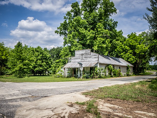
Dwight and I bought a couple of snacks and continued on our way. Not far from Horatio is the community of Hagood. There we found another country store similar to Lenoir. However, fate had not been as kind to this one.
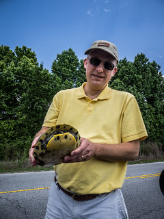
We drove on up to the community of Rembert to check it out. It was a small town typical of the many that we had already explored. I didn’t have any GPS locations marked for the town, and while it had some interesting old homes, nothing leaped out that begged for photography. We continued on our trek, which included having to stop so that Dwight could rescue a turtle from the middle of the road.
Boykin Mill Pond Community
Our route took us through more rural farm land. At one point the pavement changed abruptly and we knew we were in a different county. The pavement wasn’t any better or worse, just…different. We were now in Kershaw County and heading toward Boykin Mill Pond.
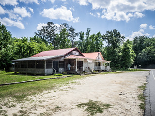
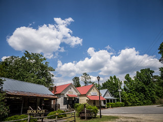
I had spotted this area in Google Earth and had seen a couple of photos that made me think it might be a potential for my ghost town list. Those thoughts evaporated as we approached the community and I spotted a black stretch limo parked out in front of the row of stores.
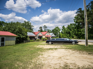
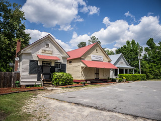
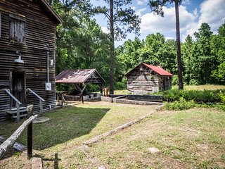
The buildings themselves were quite interesting. On one side of the street were two conjoined buildings, one serving as a barbecue joint and the other as a gift shop. On the other side of the street was the old mill itself. Next to that was another gift shop and more conjoined buildings which together form the Mill Pond Steak House. Alas, since this was a Monday, all of the stores were closed.
The mill was constructed in 1790, with the buildings added over time later. Boykin Mill was the site of the last battle of the Civil War in South Carolina on April 18, 1865. It was also the site where the last Union officer was killed in the war.
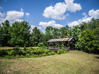
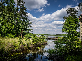
As we were looking at the buildings a V of storks flew overhead and caught our attention. Even though we couldn’t get onto the property, we walked over to the side of the mill where we had a bit of a view of the mill pond. There we saw many birds, and wanted to get a closer look. We walked to the other side of the steak house where there had been an old road, but there was no way to get closer with the buildings closed up.
The place reminded me of Lone Star Barbecue, where the old store buildings were moved from their original locations in the town of Lone Star down to Santee, then combined to create the restaurant. If these buildings had been moved, then this site should no longer be listed on the National Register. However, the community is listed as a conplex. Not exactly sure how that is possible with the alterations to the buildings. At least, in the Register photos the buildings appear to be in place, but were connected later.
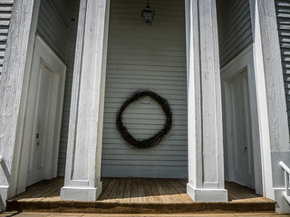
We moved the car on down to Swift Creek Baptist Church. This old Greek Revival styled church looked to be in excellent condition. It was a single-gable meeting house church, with no additional rooms as far as I could tell. I was able to get some photos of the interior with the GoPro.
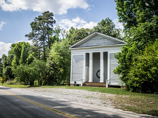
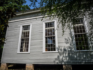
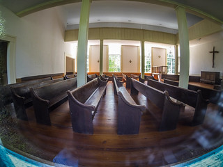
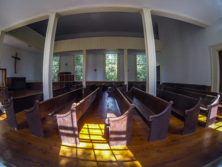
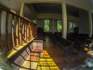
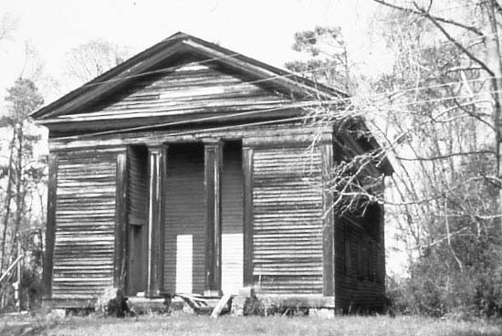
The church was built in 1827, and has been restored extensively. The photo on the National Register site shows a building in a state of decline. I’m glad someone has been able to preserve this building.
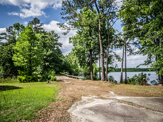
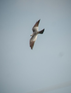
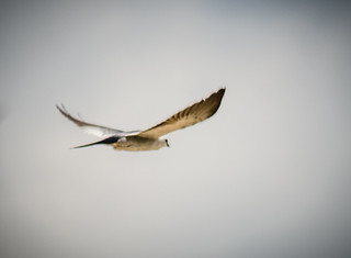
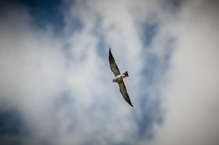
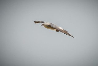
We had parked the car on the edge of the road next to an open field. On the way into the town Dwight had pointed out a large swarm of vultures over this field. As we walked back to the car, we were able to see that these were not vultures, but hawks. Specifically, kites. We watched them dive and swoop as I tried to catch a photo or two with the long lens.


As commercial as Boykin has become, I’m glad that it has been preserved. It’s still a cool place, and I’d like to come back when things are open. I definitely want to spend more time here bird watching.
By this time the day was getting away from us. We drove up to I-20 and headed back to Columbia.
Here’s a map of all of the locations we visited…
…and here’s a slide show of all of the shots from the day’s adventures…
[fsg_gallery id=”47″]
What a great day of exploring!