Keith had the day off, and wanted to visit the Cataloochee Valley in North Carolina. The weather looked like it was going to be spectacular, so Wednesday we collected Ken from Clemson and set off toward the Great Smokey Mountains.
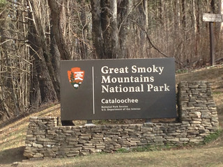
Cataloochee Valley is a remote settlement on the eastern side of the Great Smokey Mountains National Park. Originally a Cherokee hunting area, the valley was settled by the Colwell (later Caldwell) and Palmer families in the early 1800s. Livestock roamed the valleys, and hunting brought in more commerce. By the early 1900s nearly 800 people lived in the valley. Tourism increased in the valley for hunting, fishing, and the spectacular scenery. In 1922 the Great Smokey Mountains National Park was established, which included the Cataloochee Valley. Residents were granted lifetime leases on their properties, but many decided to leave.
Today, Cataloochee is almost as remote as when the park was established. The only way into the valley is over one of two twisting dirt roads. In the 1970s there was a plan to pave a way in, but by the 1980s that was abandoned. The valley is very much like Cades Cove on the western part of the national park, but without the constant crowds. In 2005 a herd of elk were introduced to the valley, and those, along with the scenery and trout fishing serve as the main draw for tourists today.
We drove pretty much directly up to the valley, following Highway 25, then I-26 to I-40 in Asheville. We took the Highway 276 exit at Maggie Valley, and followed the signs for Cataloochee.
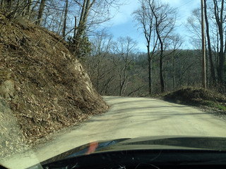
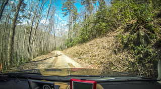
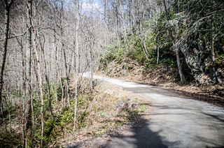
The twisting road was everything described. It was hard-packed, and had some bumps and potholes. It really needed another scraping and layer of gravel. As the road ascended over the past it became even more narrow and twisting. I would hate to encounter another car coming the other way, and I couldn’t imagine this road with the types of traffic Cades Cove gets.
After miles of single-lane twisting madness, abruptly we came to a well-developed two lane road. A sign right past this abrupt change indicated that we were entering national park lands.
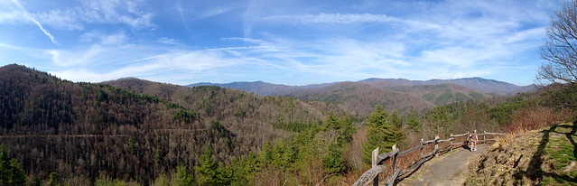
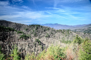
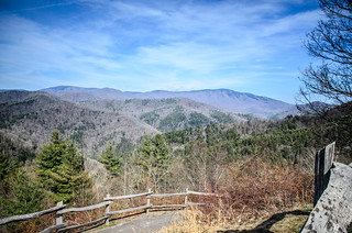
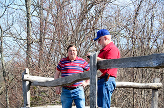
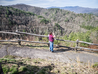
Soon we came to a valley overlook, so we pulled over. A couple was just coming down from the overlook, and another car pulled up next to us. The newcomers asked the couple if the elk were out and about. They replied that one or two might still be out, but that we had probably missed them. I hadn’t even considered that there might be an optimal time of day for viewing elk, but it stands to reason that early morning and evening would be better. Oh well, we would see what we could find.
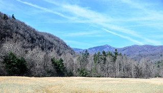
On top of the overlook we did have spectacular views of the valley.
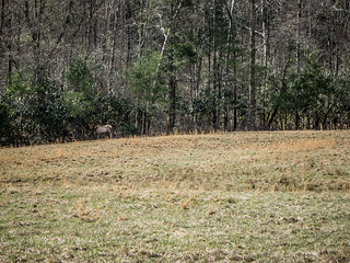
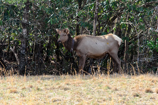
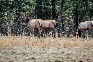
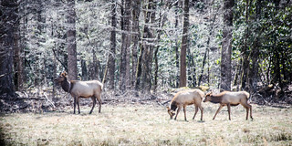
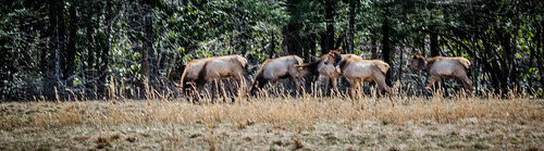
Descending into the valley proper, we came to the ranger station housed in an old farmstead, then continued along the road. There was an open field, and we saw cars paused – indicators that there might be elk. Sure enough, a lone cow was right at the tree line. I took a few photos, and managed to get my long lens out to get some close-ups.
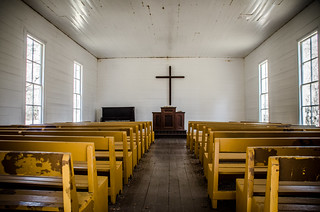
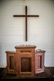
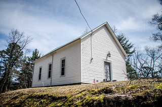
There was another tree line, and nestled into a grove next to the banks of Cataloochee Creek was Palmer Chapel Methodist Church. We definitely had to explore.
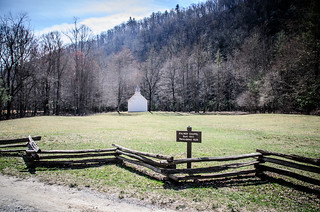
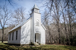
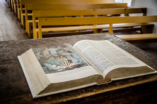
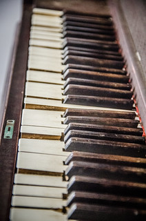
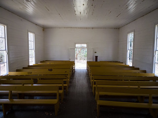
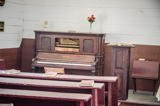
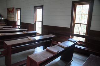
The chapel was built in 1898, and is a simple white wood-frame meeting-house construction with a small steeple. The doors were open, so we went in to explore. The interior was about as simple as the exterior – hard wooden pews, an old (unplayable) piano, and a pulpit with an open Bible.
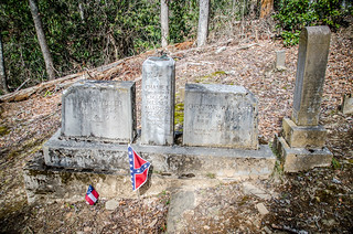
On the other side of the road we saw a sign for the Palmer Cemetery. Keith and I went to check it out. It was up a very steep hill, and we had a challenge getting up there. The cemetery itself was on a steep slope.
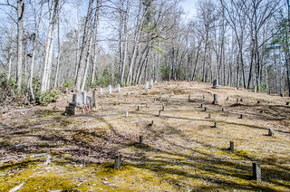
There were lots of simple field stones, with a few more elaborate headstones. Keith pointed out that most of these were cast concrete and not marble or other solid stone. Even so, these would have been a challenge to haul up that steep hill, along with a casket.
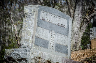
We did see the predominant names of the valley – Messer, Caldwell, and Palmer. The Caldwell name was spelled “Colwell” on some stones.
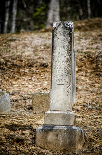
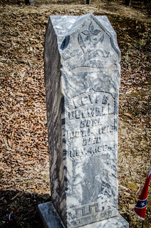
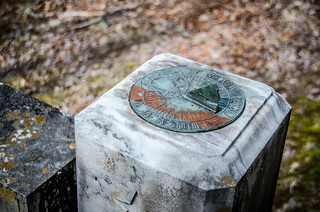
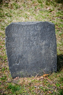
I didn’t even bother to look for signature stones. These were simple folk, and the remoteness of the location probably precluded high-end stonemasons. Even so, one elaborate stone caught our eye. The Messer Family stone was a composite piece that even had a sundial.
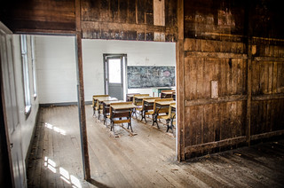
The next stop on our journey was the old Beech Grove School. This was another meeting-house style building – simple, white wood frame. It was located at the fork of Cataloochee Creek and Rough Branch, on the side of another wide field.
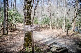
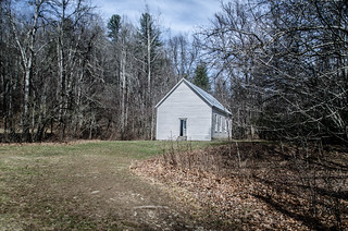
The story goes that the population had outgrown the old school house. Officials in Waynesville rejected a request for a new one, so the residents burned down the old one. Citing mandatory attendance laws, the residents forced the officials to pay for construction of a new school, which was build in 1902.
As with Palmer Chapel, Beech Grove School was open and we could go inside. There were a few rows of desks and a simple chalk-board. The desks looked very similar to the ones I had in my first grade classroom, except mine didn’t have a place for an inkwell. Unfortunately, there seemed to be lots of vandalism inside, too.
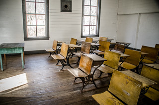
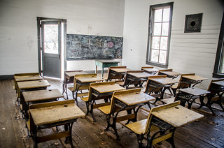
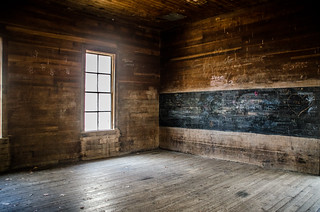
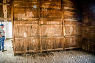
The building is divided into two rooms. The second room was either unfinished, or just had not been repainted in a very long time. It looked like there was still a blackboard there. Large panels separated the rooms, and it looked like these could be removed to make one large space.
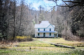
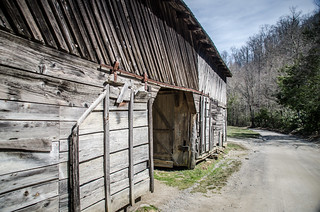
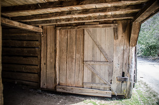
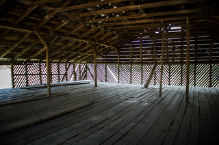
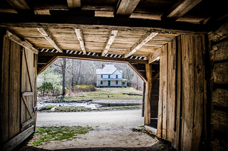
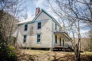
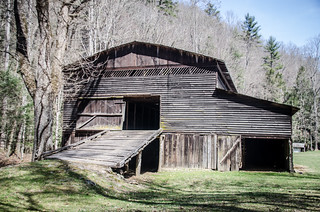
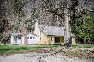
The pavement had given out right at Cataloochee Creek before reaching the school. A dirt road continued on past the school and past a couple more open fields. Soon we reached the Caldwell Homestead. There was a large two-story barn on the right side of the road, and a rough footbridge crossed Rough Branch (appropriately enough) to the main farmhouse. The two-story farm house was white, and had “haint blue” accents surrounding all the windows and doors.
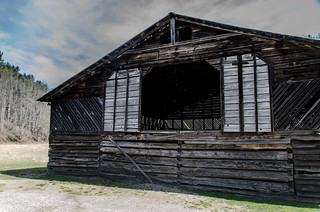
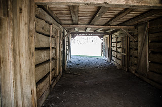
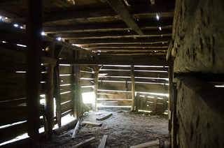
We explored the barn first. The lower area was divided into stalls, and there was a single open space upstairs, probably for storing grains and hay.
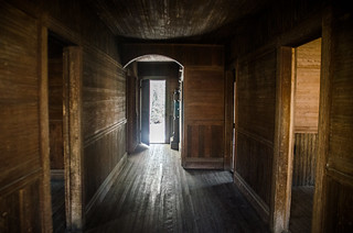
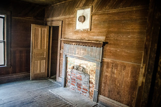
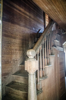
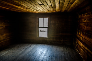
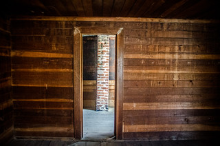
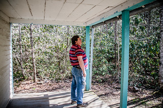
We crossed the precarious bridge to the other side of the stream, which was quite deep right here. As with other buildings in the valley, this one was open for exploration. There were five rooms downstairs arranged on either side of a long hallway, two with fire places, and one a smaller room that looked like a kitchen. There was natural wood paneling with a chair rail and wainscoting.
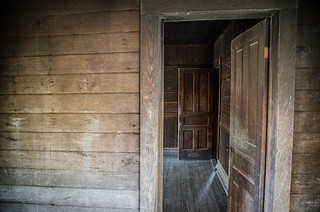
Upstairs there were two rooms on one side of the hall, and a single large room on the other. A large closet that could almost be a room of its own mirrored the kitchen space below.
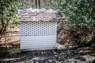
There was a good sized back porch. Next to the house along a tributary was the spring house. I guess this was for drawing water.
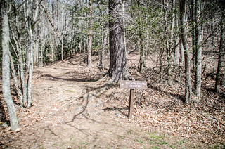
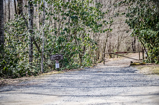
We crossed the stream and returned to the car, then continued on up into the valley. Sooner than we expected we reached the end of the road. A trail continued on up, with a parking area at the trail head. It was already past lunch time and we were nowhere near food, so we decided not to hike, but drive on out.
On the way out, right where we had seen our first elk we spotted a herd of about nine of them lingering at the treeline. We paused to take more photos.
At one point we reached a turn-off. It was about 10 miles over the mountain back the way we came, or 14 miles up to Crosby, TN along the Little Cataloochee Valley. Against our better judgement we turned north along new territory.
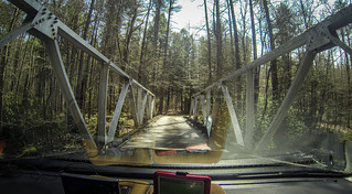
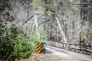
The road crossed Cataloochee Creek on an old steel girder bridge, then came to the old Palmer homestead. There was a large barn similar to the Caldwell barn, but with a ramp to the second floor. The home was much older than the Caldwell place. It was a “dogtrot” design, meaning that there were two sections connected by a covered breezeway, or “dogtrot”. One second held kitchen and dining areas, and the other living and sleeping quarters. This way any fires would be contained to one section. In traditional dogtrots both sections are roughly equal. However, in the Palmer home the living and sleeping areas had been expanded. We did not pause or go inside this time.
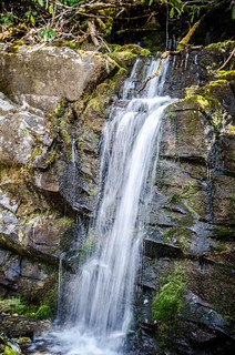
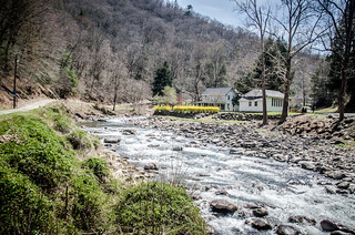
Soon road took on the same characteristics as the road on the way in. It was yet another twisting turning dirt road, albeit a bit wider. The road tended to follow the creek, and there were some tributaries with interesting waterfalls.
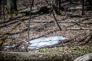
The road crossed the creek a couple more times on single-lane bridges with steel girders, but then started a steep upward climb, eventually reaching 3700 feet at the Mount Sterling Pass. Here there were still patches of snow on the grown.
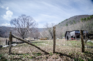
On the other side of the pass we started the downward descent, and we left national park lands. Now we began to see signs of habitation. However, it was far past lunch, and none of these places looked like somewhere that you would stop for a bite to eat.
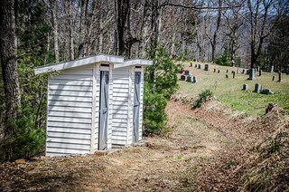
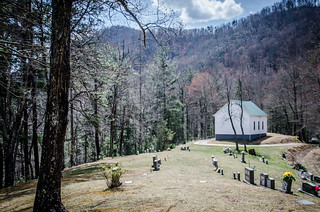
On the descent we spotted one more little white frame church just off the road. Mount Sterling Baptist Church looked very similar to Palmer Chapel, but with the addition of a couple of outhouses.
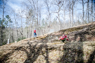
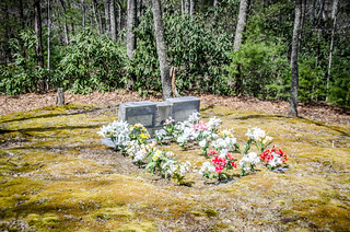
A small cemetery sits behind the church. We wander on out through the graveyard. Many of these looked fairly recent, including one that was ringed by flowers, as if a burial had just taken place.
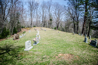
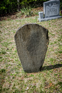
However, there were some older stones, including these two hand-carved soapstone graves.
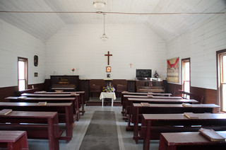
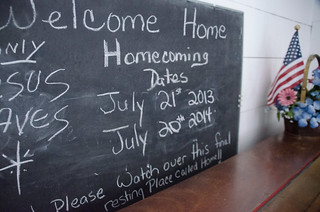
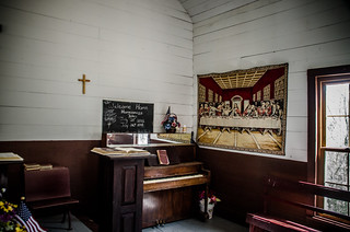
The church door was open, so we went inside. As opposed to Palmer Chapel, it looked like this one saw more frequent use. There were wooden pews and a set of old hymnals. There was some artwork up on the walls, and a playable piano. A chalkboard advertised the next homecoming service.
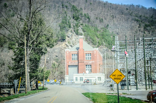
By this time we were REALLY getting hungry. We came to an intersection and followed a sign pointing toward the interstate. This brought us to the power plant at Waterville on the Pigeon River.
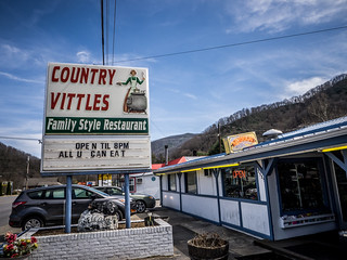
We took I-40 back toward Maggie Valley, where we found an interesting little place serving overly tough chicken and an overly touch chick as a waitress who kept wanting to flirt with Keith. At least we got food.
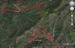
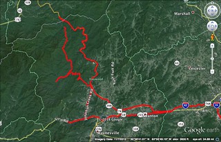
Here’s a map of our travels through Cataloochee…
…and here’s a slideshow…
[fsg_gallery id=”40″]
I would like to return sometime. I think the best thing is to stay overnight in the area so that you can be here either early in the morning or later in the evening so that you can see more elk.
UPDATE: I found a great video that describes life in the Cataloochee Valley. This was produced by the National Park Service in 1993: