For the second Saturday in a row I got up very early to head out on a photo trek, this time with the Lowcountry Unfiltered group to the Congaree National Park. Instead of paddling, this would be a hiking trek. I think we would have stayed drier if we had been in kayaks.
I left a foggy Greenville at 6:00 AM, with the plan to meet the rest of the group at the park between 8:00 and 8:30. It was a cold mid-30’s, but I was appropriately dressed. The forecast called for rain later in the day, so even though it was cold, I was glad we were getting an early start.
As I drove south, and especially as I crossed the large rivers around Columbia, the rising fog made for some spectacular photo opportunities. Crossing the Congaree River a filtered sun was casting rays through the trees and fog. Unfortunately I came across these views while driving on the interstate, so I wasn’t able to take advantage of the shots.
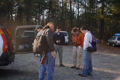
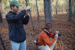
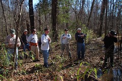
I pulled into a crowded parking lot at the exact time that my GPS had predicted, and just as Matt called to say that the Bluffton group would be running late. I got out to explore, and listened to the sounds of shouting kids at the nearby campground. A large group of boys, probably Scouts, came down the path and began loading up into their vehicles. Another slightly smaller group in their early twenties had apparently been participating in a drum circle, and were carry (and playing) their drums along with camping gear. With such a ruckus I doubted that we would see any wildlife around here.
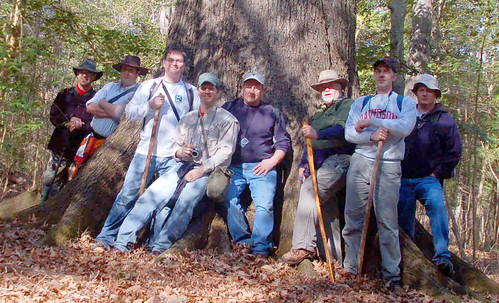
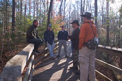
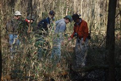
Shortly I was joined by James Martin from Irmo. Around 8:50 the Bluffton group arrive with Matt, James B, Robb, Sean, Joe, and John. Our group was now complete, and we were ready to head out.
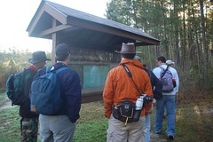
We had parked at the outer lot, outside the main gates, so there was a short walk to get to the visitors center. As we approached the boardwalk one of the rangers informed us that most of the lower boardwalks and river trails were flooded because of the recent rains. However, he encouraged us to get lost, because he had just bought a new boat and was itching to try it out on a search and rescue mission.
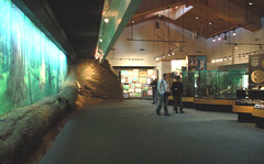
We popped into the visitors center for a bit and got similar information about flooded trails. The lady behind the counter also spotted all of our camera gear and asked if we were wildlife photographers. We responded that if wildlife were present we would photograph it, but that also applied to pretty much anything else that interested us. It turns out that she was trying to drum up business for a series of wildlife seminars they were conducting through the spring.
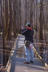
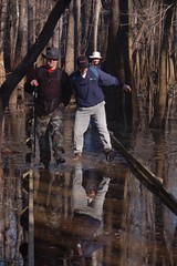
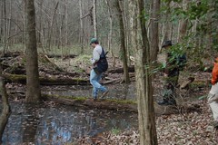
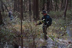
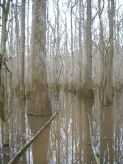
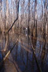
Finally we got out on the trail proper. The upper boardwalk was fine, but, as predicted, we hit high water levels very quickly. At first it wasn’t too bad. We were able to walk keep our feet relatively dry, even with a bit of water on the boards. We stepped gingerly to keep the water out of our shoes.
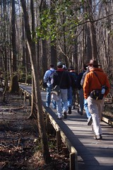
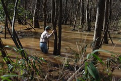
Soon, though, it became apparent that any attempt to walk gingerly was futile, as we went deeper into the swamp. The water over the boards got too deep, and my hiking shoes filled with water. By this time it had warmed up to the 40s, but even so, it didn’t feel too terribly cold.
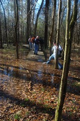
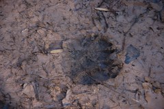
We left the boardwalks at the Weston Lake trail. We managed to keep our feet out of the water most of the time, even though there was water on parts of the trails. We had also left most of the other park visitors who didn’t venture past the flooded parts, so we started hearing owls, woodpeckers, and other wildlife. We encountered several large animal tracks, as well.
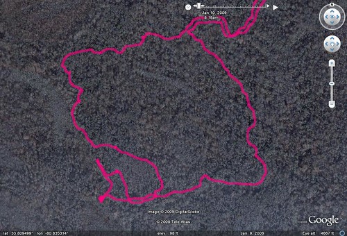
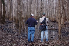
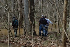
With the trails flooded, our plan was to hike toward the Congaree River, sticking to a high ridge that should be free from floods. The problem was that we would have to thread a series of waterways called “guts” that might block our path. We had a detailed map provided to us by John Nelson, a member of our group who couldn’t make it, my GPS, and three compasses I had brought. We didn’t want to give the ranger an excuse to use his boat.
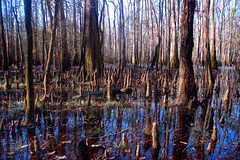
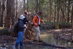
The wild scenery of the swamp was spectacular, but avoiding the flooded guts proved more difficult than we thought. We found ourselves crossing lots of log bridges.

However, it soon got to the point where I would preferred getting wet on my own terms. Wading into cold knee-deep water was one thing. Slipping off of a log into a stream, and in the process getting soaked and ruining equipment was somthing entirely different. Most of us gave up and started wading where necessary.
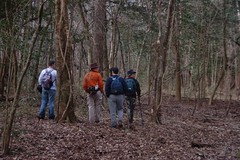
At various times Matt would consult the compass, GPS, and John N’s map to make sure we were on the right track. It seemed that we had been zig-zagging quite a bit. Matt stopped at one point and declared that we were lost, at which point John Ring grabbed the map and compass to figure out where we were. We were about ten feet from the trail, with trail blazes clearly visible, but we continued to feign being lost for John, who became more and more frustrated. All in good fun.
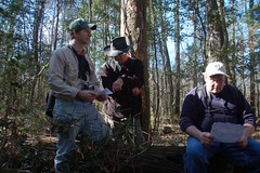
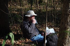
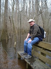
Finally, though, we did come to the end of the line – an impassably deep stream with a strong current. Matt tried to find a way across, but it was just too deep. We decided that it was as good a place as any to stop for lunch.
Thus replenished, we walked along the waterway trying to find a way across. We made several attempts, but nothing was working
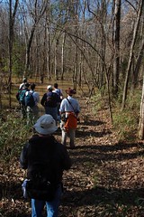
Eventually we gave up and headed back toward the river trail, but away from the river.
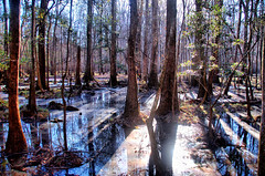
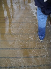
Clouds were starting to build, I was getting very tired by this point. Several wanted to find some of the “champion trees” in the park, but James Martin and I opted to hike on out, leaving the Bluffton group to their own devices. As we hiked out we discoverd that the water had risen even higher. Boardwalks that had been only slightly underwater were now completely submerged and we were constantly walking through ankle-deep cold water. Even though the temperatures were now in the mid-60s, it somehow seemed colder, and our feet ached.
Here’s the boardwalk in the morning…
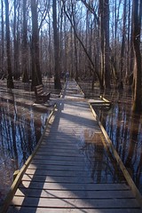
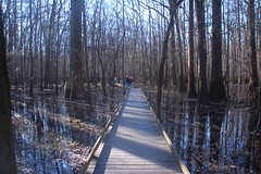
…and here’s the same stretch on the return trip…
Finally, though, we made it back to the warmth of our cars. I at least had dry socks and shoes into which to change. It was a good hike, but an exhausing one.
Here is the GPS track of our wanderings overlaid on the National Park map for the swamp…
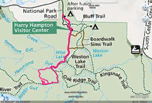
Here’s a more detailed look at our wanderings on and off of the trail…