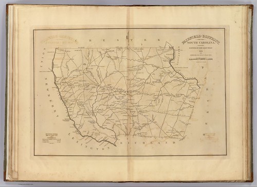
I have been enjoying going through the old maps in the Robert Mills 1825 Atlas of South Carolina. However, last weekend’s photo trek to Old Pickens Court House brought out some problems with relying solely on Mills’ maps to find ghost towns. The maps are too early to catch many towns that developed after 1825, only to fade away by the time of the Great Depression. Never fear, though. There are other online resources that can cover later time periods.

The University of South Carolina’s online digital library has an extensive collection of historic topographic maps of the state. The maps cover from 1888 to 1975, but not all quadrangles are available for this time period. For example, the collection contains three maps for the Abbeville quadrangle – 1900, 1918, 1943. The 236 maps in the collection include a mix of 30 minute, 15 minute, and 7.5 minute projections. I haven’t checked to see how extensive the state coverage is, but I’m sure there are parts of the state that are not covered.