I’ve gotten behind on my blogging. It seems that living life is taking more time that the documentation thereof. It’s an ironic consequence of having available time. When I do sit down to write, I tend to fall asleep. So, here goes a bit of catch-up…
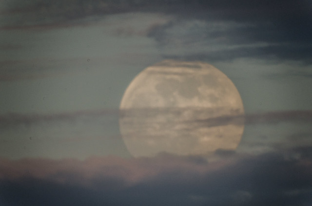
Saturday Evening – Super Moon
Saturday’s full moon was a “super moon”. That’s a relatively recent term, meant to generate more interest in astronomy. A super moon occurs when the moon reaches perigee at full moon. Since it’s at its closest point to Earth, it is supposed to appear larger. Of course, this only works if the moon can be placed in context, near the horizon. The lensing effect of the atmosphere automatically makes the moon appear larger.
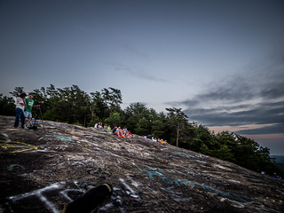
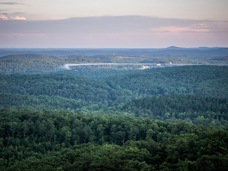
The trick is to find a good place to take a photo with a clear view of the horizon. I decided to try Bald Rock. I’d had success up there with sunrise shots, why not a moon rise?
I got to the location well before sunset. There were a few other around, but it wasn’t crowded. As I set up my camera and gear a woman nearby asked if I was there for the super moon. I said that I was. Another photographer set up nearby. Soon, others were joining us on the rock.
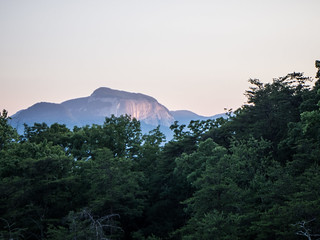
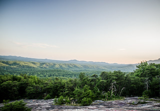
The sun was setting behind us, so there wasn’t a good shot of the actual sunset. I did take a few photos of the Piedmont through the evening light.
As we waited for the moon to make its appearance, a cloud bank blew over. I was afraid we wouldn’t be able to see anything.
Eventually we looked up, and the moon was emerging from a bank of clouds. By that time it was too late. There was no context. Size on an image doesn’t matter, especially when shot with a 1000mm lens. Oh well, maybe next time.
Swamp Rabbit Trail
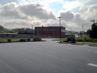
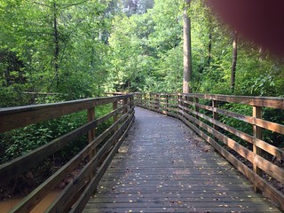
Monday morning I got up and explored a new section of the Swamp Rabbit Trail. Alan had said that he had ridden the new section through the Lake Connestee Nature Park, so I decided to check it out. I loaded up my bike and drove over to the Connestee Mill area, where the trail begins. I mounted the GoPro to the handlebars.
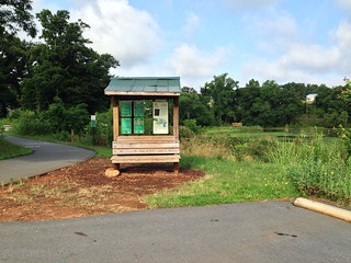

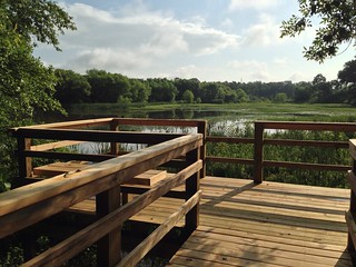
The trail passes over several boardwalks, with one lake overlook.

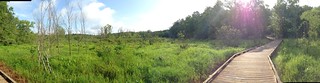
There were a few hills, but not to many. I road the path until I got to the terminus on Fork Shoals Road. This passage has yet to be connected to the rest of the trail system.
Lake Robinson
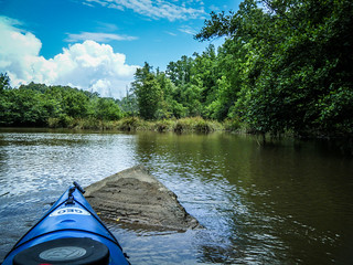
Monday was biking, so Tuesday was kayaking. I was out for a “quick” paddle on Lake Robinson, more for exercise than anything else. Lake Robinson isn’t a particularly interesting lake, but it’s good for building up some distance. This was to be a simple trip without GoPro, GPS, or any other fancy gadgets. I had my iPhone as a matter of safety, and at the last minute I picked up my waterproof camera.
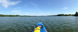
This time I did something I’ve never done before while paddling. I put in ear buds, turned on my iPod, and treated more as an exercise routine than an excursion. That didn’t last long, though. I passed Fews Bridge Road, and decided to keep going. I was now on parts of the lake I had not explored before.
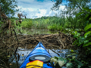
The lake narrowed considerably, then started getting very shallow. I began to see more wildlife out on the lake. In the shallows large “somethings’ would scurry away from the boat, kicking up silt in their wake. They could have been turtles or perhaps catfish – it was hard to tell.
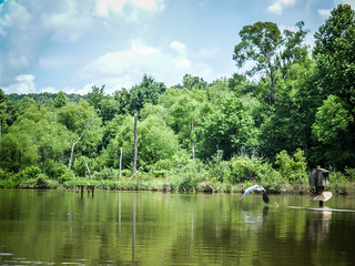
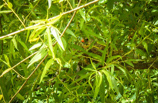
As things got more interesting I pulled out cameras. There were lots of herons out and about. As I paddled under one low branch I spotted a bird on a nest. I couldn’t get close enough to identify it, but it had a very red beak.
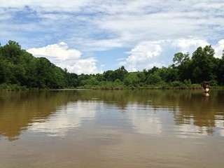
As the path narrowed the current picked up. I had to watch for the deeper areas that were navigable, otherwise I ran aground. Eventually I reached another bridge – Bright Road.
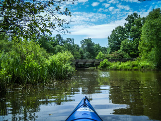
By this time I was getting very hot. I had gone much, much further than I had planned. The bridge provided no respite, though, as it was very muggy under the bridge. I still wasn’t done, though. The urge to explore around the next corner was overwhelming, so I continued up the South Tyger River. Several times I came upon what I thought was the end of the road, but I found ways around, usually by backtracking and finding another path, but often by just pushing through.
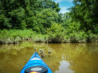
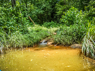
The more open area was just a decoy and eventually ended. The actual river route was the narrower path, so I headed up that way to see how far I could get. Not far. Just a few yards up deadfalls blocked the path.

It was time to head back. As I paddled back under the bridge I started to hear thunder. It was time to begin paddling in earnest. I made it past Few’s Bridge, pausing occasionally to rest in the little bits of shade I found. I put my earbuds back in and started paddling to the beat of rowdy music. At one point I made the mistake of looking back. A large thunderhead loomed over Glassy Mountain, and it looked like rain was already falling on Tigerville. I started paddling faster.

The last stretch across Lake Robinson always seems to take forever, and this day was no exception. Eventually I did make it, and the clouds looked no less threatening. As I loaded up one other paddler with more stickers on his boat than I have got ready to launch. I’m not sure that was such a wise move.
My “quick” trip had turned into a 10+ mile paddle. At least, that’s what Google Earth says, since I didn’t have a GPS with me.
Sulfur Springs Trail
Monday was biking, Tuesday was paddling, so Wednesday had to be hiking. I met John Kaup up at Paris Mountain State Park early in the morning, and we headed out along the Sulfur Springs Trail. It had been a long time since I had hiked the trail. We took it at a fairly brisk pace. After one particularly steep stretch I found myself quite winded. It was so humid that I had a hard time catching my breath.
John needed to key back to get the kids on their way, so we hiked on back down without completing the trail. Still, it was a good morning’s workout, given everything else I’d done this week.
So, we get to Thursday. I didn’t do quite as much – accompanied Laura to doctor appointments, went out for breakfast, then joined some friends for lunch. I might get the hang of this retirement thing.