I had come to a roadblock on the Tobacco Trail, quite literally. The Highway 301 bridge across Lake Marion still exists, and still connects across the lake. However, in 1987 it was closed to automotive traffic, and now serves as a fishing bridge. If I were going to cross from Orangeburg into Clarendon County, I was going to have to do some backtracking.
I drove back into Santee and turned onto SC Highway 6 for about a mile, then hopped onto northbound I-95. As soon as I hit the bridge I was in Clarendon County. My intent was to get off of the interstate as soon as possible and continue on Highway 301.
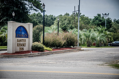
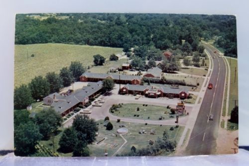
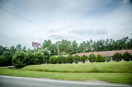
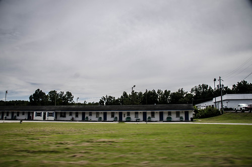
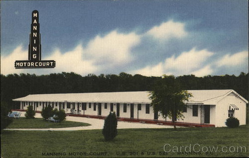
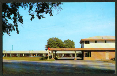
Highways 301 and 15 exit I-95 just on the other side of the bridge, then run concurrently until they reach Summerton. Right at the exit was a motel. Part of it appeared to be closed, but part looked like it was still in operation as the Santee Resort Inn. This motel looked much more modern, a product of I-95 traffic rather than the Tobacco Trail.
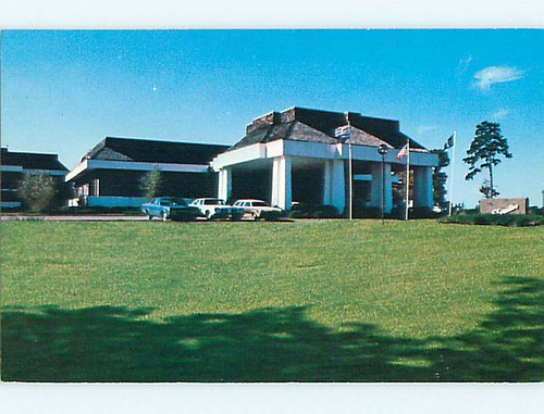
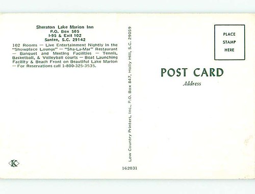
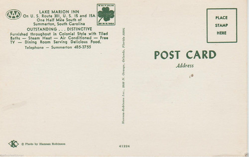
From the shape of the building I can tell that this was once the Sheraton Lake Marion Inn. The reverse of the postcard confirms the location.
From Google Earth I had marked a location on the other side of I-95 closer to the lake, but I didn’t turn that way and missed it. On up, though, I took another detour to check out inhabitants that predated the Tobacco Trail by hundreds of years.
The turnoff for the Santee Wildlife Refuge is just east of the interchange. I’ve used this as the starting point for a couple of kayaking expeditions. The refuge is also the site of the Santee Mound and Fort Watson.
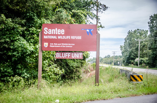
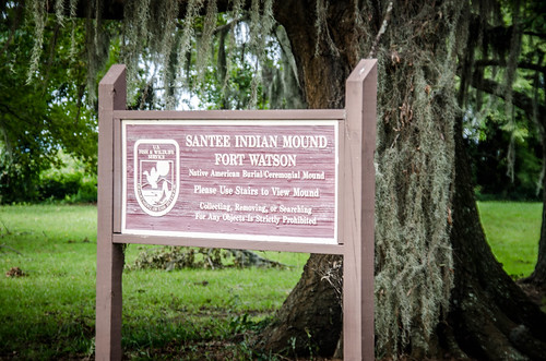
The mound was part of a Santee village, built sometime between 1200-1500. It’s purpose is unknown, but it is thought to be either burial or ceremonial.
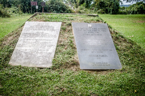
With the Santee long gone, the British used the mound as high ground for the construction of Fort Watson in 1780, adding more earthworks and barricades to the site. The fort was attacked by Francis Marion in that year, and taken during the Siege of Fort Watson.

It was the first fort captured during the British occupation. As you can imagine, there are plenty of historical markers.
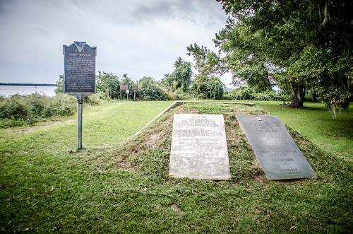
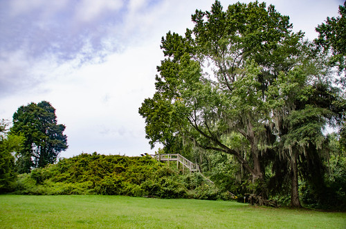
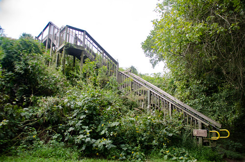
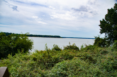
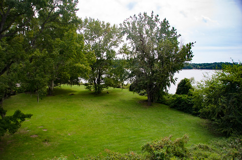
Now there are no remains of the fort. However, the mound is still there. A set of stairs leads to an observation deck with views out over the lake named for General Marion.
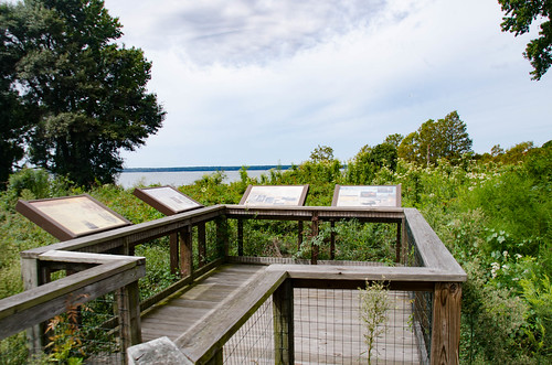
The site is now on the National Register of Historic Places.
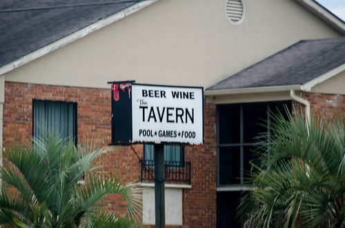
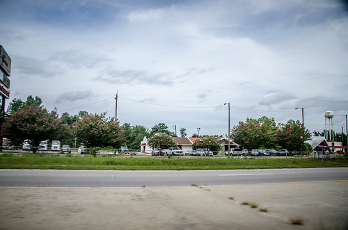
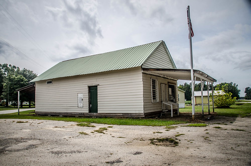
It was time to get back to the Tobacco Trail. I continued on east toward Summerton. At the St. Paul’s Crossroads I came across a few more remnants, hanging on with secondary businesses.
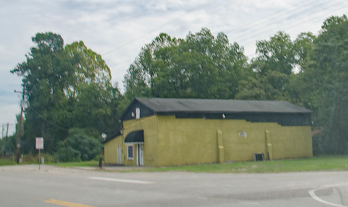
The town of Summerton, as well as Clarendon County in general are enigmas to me. I could deduce a bit just from the name. In Arizona and Florida there are towns I’ve visited named “Summerhaven” and “Winterhaven.” South Carolina itself has Summerville in addition to Summerton. As the names suggest, these towns were refuges from various seasonal problems for those with the means for mobility. Summerton was no different. It started as a retreat from the mosquitoes, heat, and humidity of plantations along the Santee River during the early to mid 1800s. By the late 1800s a center of commerce had sprung up, and the town was chartered in 1889.
Most recently, though, Summerton has become known as the genesis of the landmark Brown vs Board of Education Supreme Court case that ended segregation. The case was Briggs vs Elliott, and was filed by the NAACP on behalf of the black students who had to walk nine miles in order to attend school. The lead names on the petition were Summerton residents Harry and Eliza Briggs.
As for my experience with Summerton, I’d only been through this way once before. I had spent the night in Santee and had driven through on my first excursion to Sparkleberry Swamp. Other than that, I didn’t know what to expect. From the number of vintage postcards available for motels along this stretch, you would think it was a tourist Mecca. The question was, would I be able to find any remains of those motels?
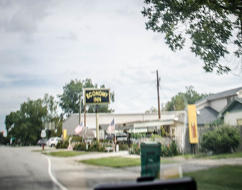
Just south of town there were two motels side by side. The first was still in operation as a Economy Inn.
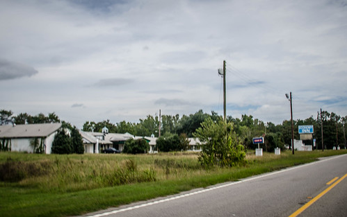
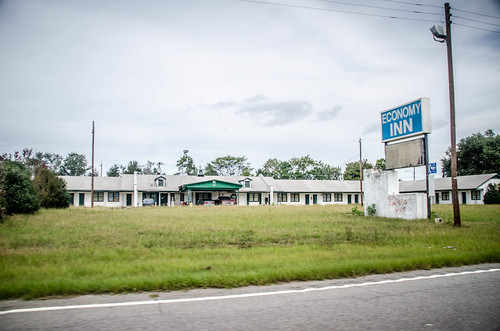
At least, I though it might still be in business. There were cars present, but the grass growing on the drive and the hand-drawn sign advertising rooms for $20 cast doubts on the motel’s viability.
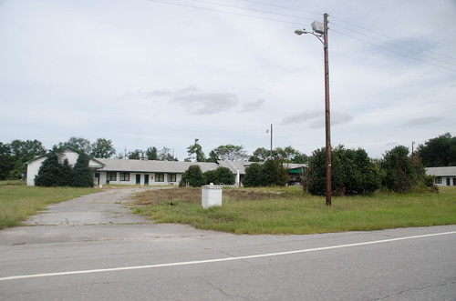
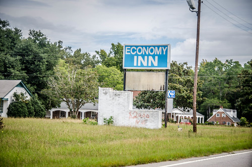
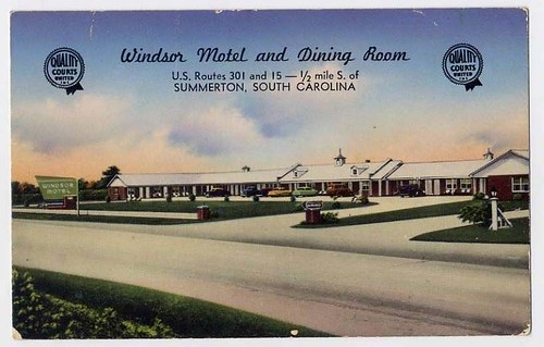
It looks like this was once the Windsor Motel. I found a couple of postcards showing a much livelier place. It’s the same brick sign base as the one with the hand written room rate, but I miss the figure of the diver with a bathing cap.
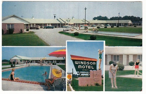
Unfortunately the diver was missing by the time this postcard was made.
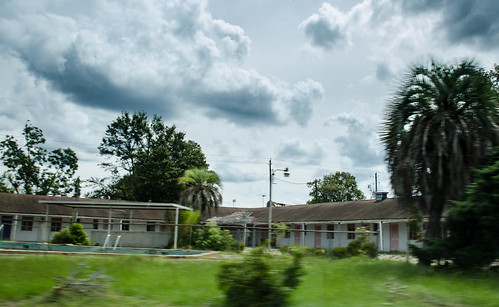
The next one up was a Traveler’s Inn, and it looked like it was in a little better condition.
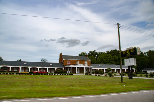
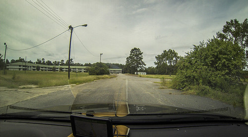
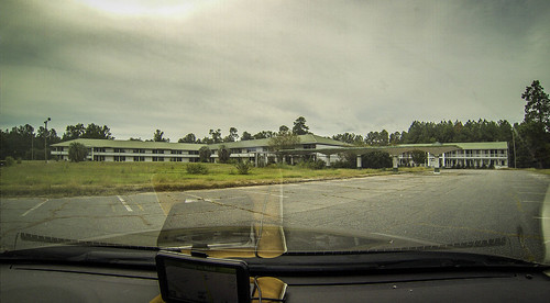
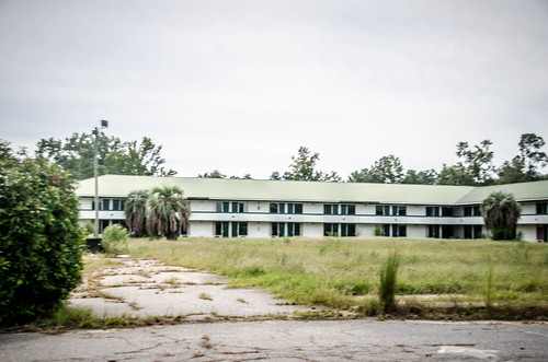
The motel has undergone several cosmetic changes, but I’m sure this was the Lake Marion Inn. The central office is the same shape, minus the cupola and columns. The half-moon dormers and the central driveway match.
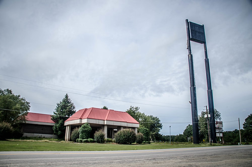
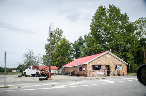
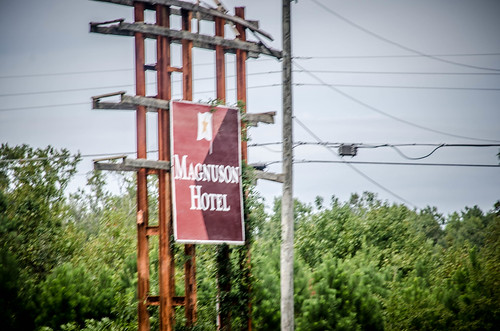
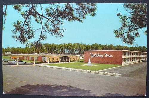
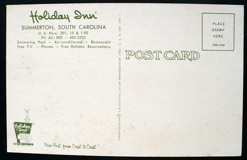
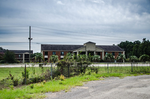
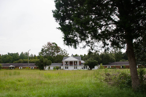
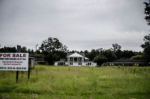
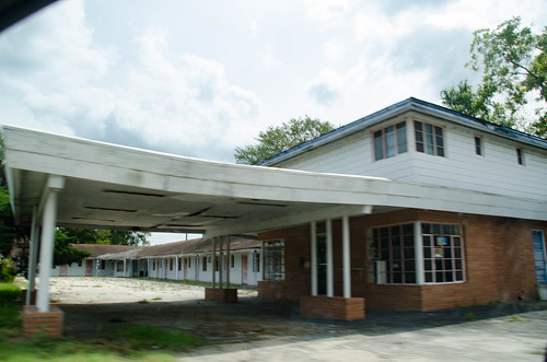
The intersection of Bluff Road and Highway 301 is a big one south of Summerton, and there I found two motels. The one on the south side is larger, and is definitely abandoned. The facility is for sale. A sign advertised it as the Magnuson Hotel.
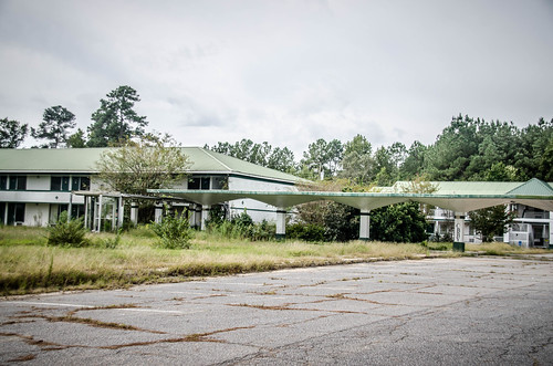
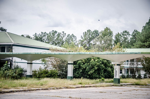
The canopy in front of the office matches a postcard I have for the Holiday Inn.
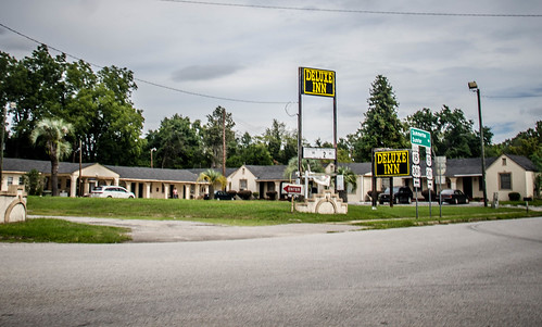
Across the street is a Deluxe Inn that’s still in business. I only got this one shot.
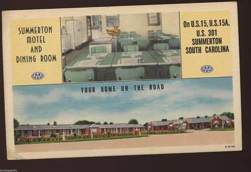
However, the postcards were easy to match up, especially when I compared the aerial photo in the postcard with Google Earth. This was once the Summerton Motel and Dining Room.
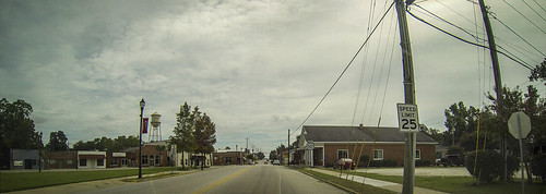
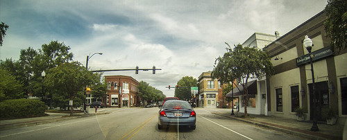
In the town of Summerton proper US 15 continues on straight, and US 301 takes a sharp right turn onto Main Street. It is a typical southern town, and as is the case with so many of these towns, most of the store fronts were boarded up.
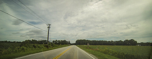
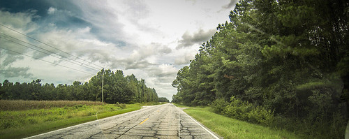
Outside of town the road turns to the northeast, paralleling I-95. Here the road goes through farmland.
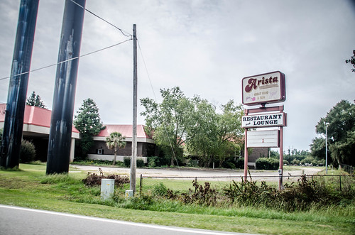
Five miles outside of town 301 crosses I-95. Here there are a couple of old motels and a restaurant. This being an interstate interchange, the location is logical. The two motels on the south side of the road were definitely closed.
Across the road was a sign for Georgio’s Restaurant and the Sunset Motel.

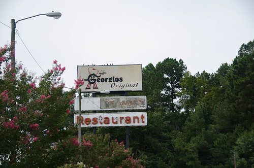
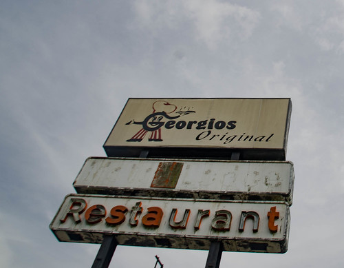
Despite the decrepit sign, Georgio’s was a hopping place, especially since it was just about lunch time. I was tempted to stop for a bite. Lots of locals means that it’s probably good. However, I wasn’t in the mood for Italian, if that’s what it was.
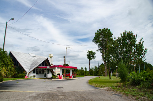
As for the motel, the architecture of the office was a dead giveaway that this was a former Howard Johnson’s Motel. It was still in business with its new identity.
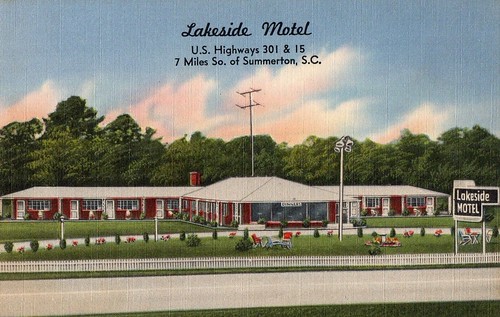
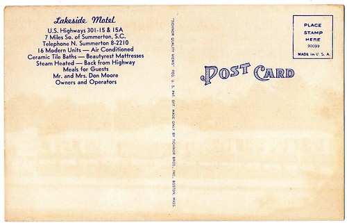
I crossed under I-95 and continued on my way. At this point I was leaving the environs of Summerton and headed toward Manning. There were a couple of postcards with Summerton addresses that I just didn’t find. One was the Lakeside Motel. From the Clarendon County Tax maps I think I found this one. When I left I-95 after crossing the lake it would have been back toward the old bridge, which makes since, given the name.
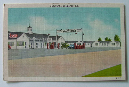
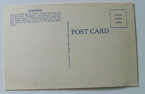
The other was Godwin’s Motel and Esso Station. I didn’t spot that one anywhere.
Moving on toward Manning…
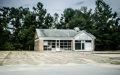
There were a couple of old service stations along the way.
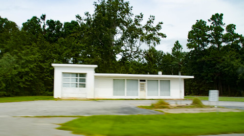
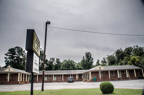
Then I came across yet another one of those motels with a two-story central office and wings right and left. I wonder if the same company built these along the Tobacco Trail. This one was definitely closed, and the property was for sale.
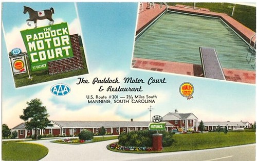
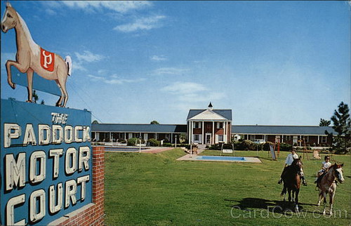
The tax map shows that it had been a senior residential facility. I found a postcard that identified this as The Paddock Motel. Given the name, it’s not surprising that the postcards features horses.
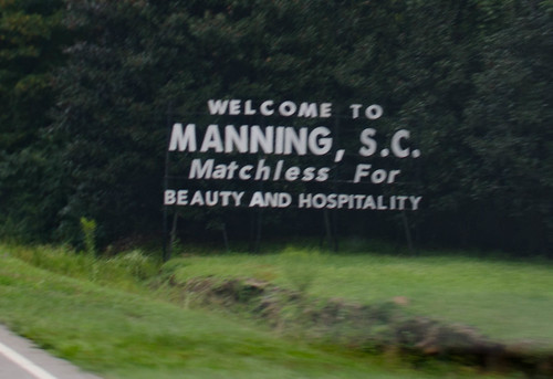
I passed another abandoned motel and a sign that declared Manning as “Matchless for Beauty and Hospitality.”
There was another small motel, another Budget Inn, barely hanging on just as I entered Manning.
That got me thinking about these motels that are barely hanging on. Maybe I’ve watched too many episodes of The Blacklist or Breaking Bad, but it seems to me that if I wanted to disappear, there are plenty of these little hole-in-a-wall places to do it.
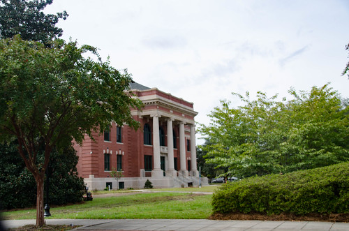
Manning itself seems like a nice little town. It’s the county seat, incorporated in 1855. Highway 301 merges with US 521 and these run concurrently through the town. The town itself is based on a square with a courthouse in the middle. Perhaps it’s because it’s the county seat, or perhaps because it’s larger than the other towns I’d encountered, but there was much more business and activity.
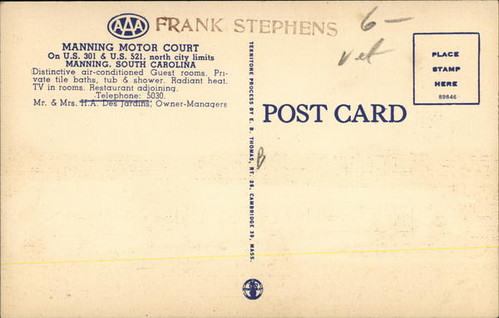
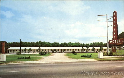
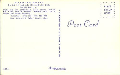
On the way out of town to the north there was another small motel, the Manning Motel. It, too, was still hanging on.
The vintage postcards I found show that it didn’t change names, as so many have.
US 521 veers off, heading toward Alcolu, and US 301 continues to the northeast. I continued on 301, passing through lots of farmland.
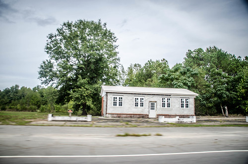
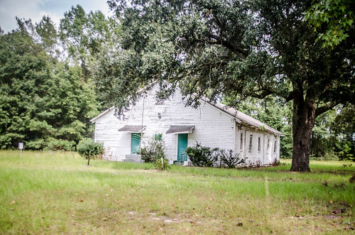
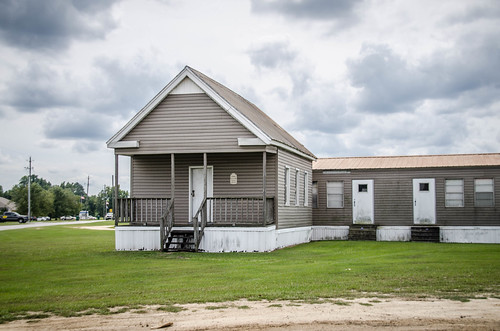
Soon I reached the Pleasant Grove community. Next to Pleasant Grove Baptist Church was the Pleasant Grove Community Center, once an old school.
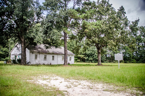
I was able to find the school in the School Insurance Archives. Here it is in its…prime? I’m not sure that’s exactly the word I’d use.

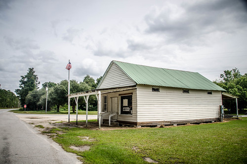
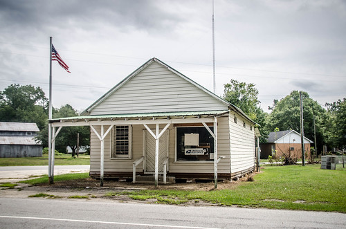
The miles rolled by. I passed through more farmland and through several crossroads with country stores. I passed through the community of Gable, with a 1960s era post office that seemed to be active. Ten miles on from Pleasant Grove I reached the community of Sardinia. There was an old wood frame country store that still had official US Postal Service signs on it, even though it didn’t appear to be open.
Next to the post office was a Murray Gin, but I didn’t get a photo of it.
Eventually I reached the town of Turbeville. The Turbevilles were prominent landowners in the area, and soon the town of Puddin’ Swamp built up nearby. The town was renamed for the Turbeville family, and became known as a railroad stop and for its turpentine still.
On the south side of town I came upon yet another barely-there motel. This one was an Economy Inn. It was notable because of all of the flowers and hanging plants everywhere.
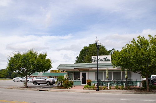
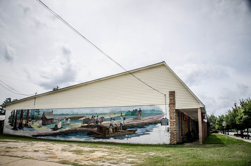
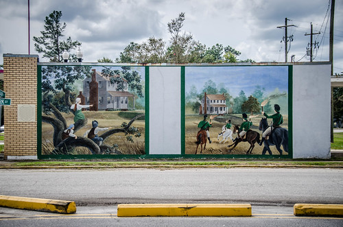
The town itself was small. There was a classic cafe that caught my eye – the Chat and Chew. I’m going to delve more into that in my next post. There were some beautiful murals depicting the town’s history.
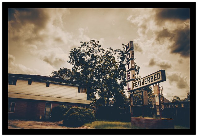
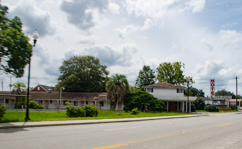
North of the town I found the Featherbed Motel. It was closed.
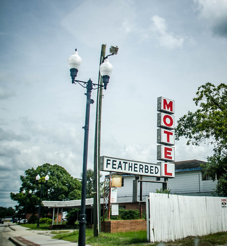
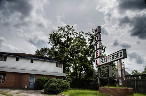
I was able to find a postcard for this one.
I was also found a news article about a murder that was committed in room #15 of the motel in 2013. I’m sure this place is now haunted.
Further out of town, right next to East Clarendon High School I spotted another old School. I think this was the Pine Grove School, which was moved to this location on the grounds of the current high school.
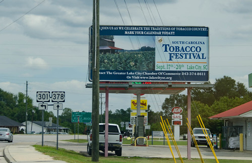
As I headed out of town on Highway 301 I FINALLY saw some signs that we were in tobacco country. A billboard advertised a Tobacco Festival in the town of Lake City. Too bad I wouldn’t be around for it.
I only had three more miles of Clarendon County left to go. At first I didn’t realize I had entered another county, but there was a distinct change in the road pavement. I’d have to wait until the next adventure, though, to cover the rest of the Tobacco Trail through South Carolina.
Next up, Lunch in Turbeville, and The Journey Home.
My late mother, who grew up in Manning, once told me of a boarding house in Manning that was very popular with the Yankees heading to Florida to “winter”, as they would stop to spend the night before resuming their journey. Served some of the best “home-cooked” meals around. Many evenings, during “supper” (that’s the evening meal in SC… everywhere else it’s called dinner), two small black boys would come to the dining room windows, which were open (no air conditioning back then) and SING… Mama said those little boys made a “ton of money” off the Yankees every night…
Regretfully, I can’t remember who owned the boarding house or where it was. But I’m sure some older Manning resident, somewhere, would remember.
Manning also had an interesting diner, White’s Streamliner. I wish I had taken a photo of it years ago, before it fell into decline. It’s long gone now.
Wow – this is so awesome and brings back lots of memories. My grandmother worked at the Windsor Motel in the late 1960’s/early 1970’s. I actually remember 95 opening but I was probably 5-6. Thanks for the great research.
Tom, you might be interested in my US 301 photo albums on FB. I have over 700 images in seven albums. Hoping to do a self-published book one day. Feel free to friend me!
Brian Patton, Longboat Key FL
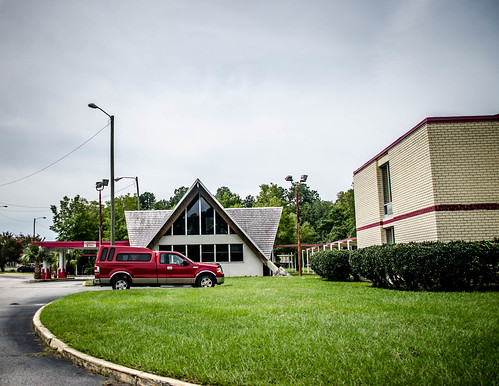
A very enjoyable read, Tom. This section of 301 is one of the many sections of the ghost highway I traverse whenever possible. North of Manning, across from the ex-Howard Johnson, is what was a Ramada Inn, currently “I-95 Extended Stay”. Even as early as 1975, Ramada had dropped it and it was operating as the “Armada Inn”. Late in the 90’s I stayed at the Summerton ex-Holiday Inn while it was a Knights Inn. Apparently, being just a quarter mile away from the I-95 exit was still too far to survive, and the Inn spiraled downward. Thanks for posting.