So, I was intrigued by this random name on a map. I had to find out more about it, so I had done some initial research. Now it was time to see if there was anything left of the old Temple of Health.
Tuesday, October 11, 2016
Antreville and the Temple of Health are small communities. I knew it wouldn’t take long to cover those areas, so I added a few more targets to my list to justify the trek down to Abbeville County. My plan was to head down to drive pretty much straight down to Antreville, check out a few sites I had tagged, then meander back through Anderson County by way of Lowndesville and a few other spots north of there. As usual, there would be discoveries along the way.
I did drive pretty much straight down to my target area. I passed through places that would normally catch my attention – Craytonville, Saylors Crossroads, etc. I did let myself get distracted once when I was just a couple of miles from my first target. A dirt road by the name of Asa Hall Road caught my attention.
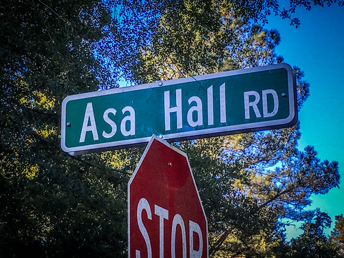
I had just focused on the “Hall” part of the name, and Asa is also a good old Biblical name. So I imagined a large, stately house with an old Biblical name. I hadn’t imagined that Asa Hall might be a person’s name. I posted this to Facebook in the heat of the moment and was…corrected. Actually, they provided some great info. Asa Hall was a state legislator in the early 20th Century. The information my friend Meredith Daniel provided stated “that he was “a bill-killer, not a lawmaker.” The dirt road wound through some pretty farmland, but there was no “hall”, Asa or otherwise.
I had visited Antreville a couple of times before and photographed the area. Back then, Antreville wasn’t my primary target. This time I paid more attention.
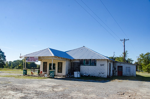
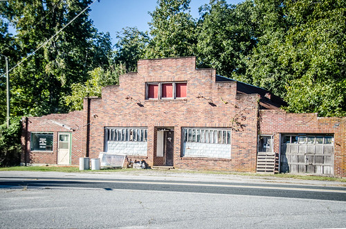
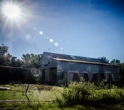
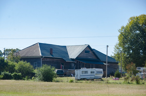
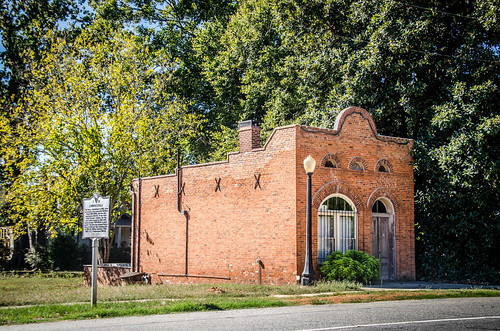
There is a large modern convenience store, but there are a couple of other older commercial buildings.
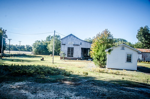
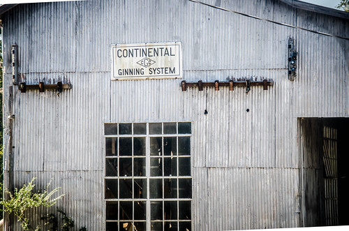
There was also a cotton gin.
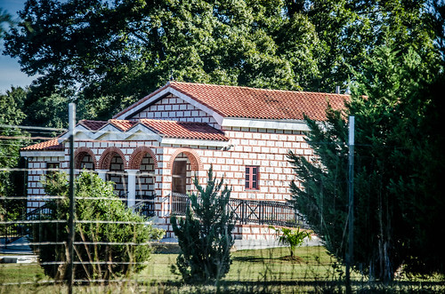
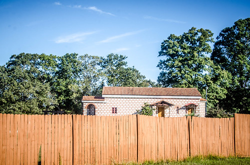
Driving on past the gin I came around a corner and found the Paracletos Greek Orthodox Monastery. Even though I’d seen a small sign for it, it caught me by surprise. The architecture is about what I’d expect for Greek Orthodox, but NOT what I would expect for Antreville.
That wasn’t the last surprise Antreville had in store for me. There was a very photogenic cotton field with a modern looking house back behind.

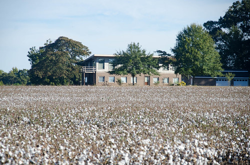
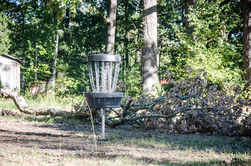
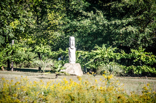
Ringing the property was a private disc golf course. A large Rapa Nui statue adorned the grounds. Seems like the occupants were somewhat whimsical.
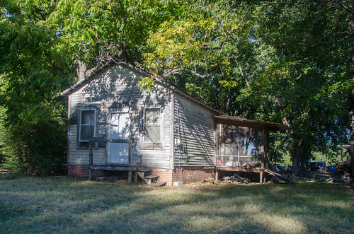
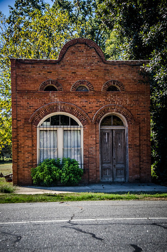
Back in Antreville, proper, I searched for something that might look like the site of an old inn. I found another old, rather small building that might have been another store or a farm out-building, but nothing obvious. At this point I really didn’t know where the inn might have been, so I was searching blindly.
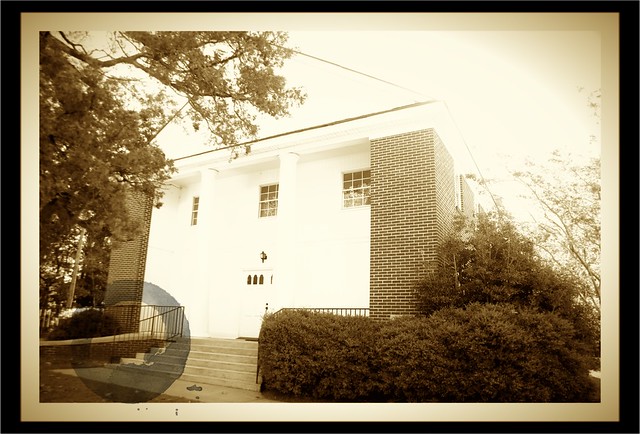
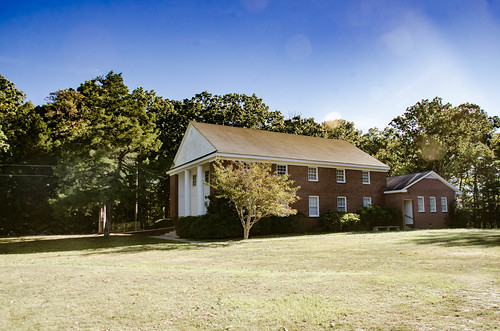
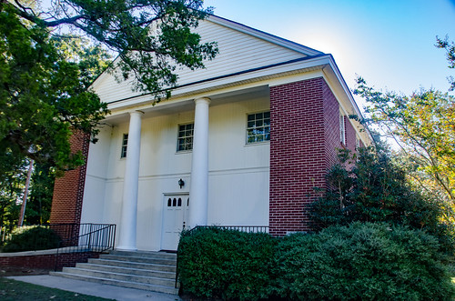
The history of the Brownlee Family had figured prominently in one of the histories of Temple of Health. Shiloh Methodist Church (yeah, yeah…ANOTHER Shiloh) was mentioned in the Brownlee genealogy, and is a bit of a mystery. Even though it’s a historic church, there are no historical markers and it’s not on the National Register of Historic Places. I couldn’t even find it on SCIWAY.net, or any other online reference, for that matter.
In fact, the only history I could find, short of digging through the library, was in the Brownlee history I found online. This history states that John A. Brownlee designed the slave balcony at Shiloh in 1858 and was one of the congregation’s founding members. So 1858 is the only date I have to go one. There were no other signs or markers at the church itself, either.
The church is a brick Greek Revival structure and has the general shape and form of others I’ve seen that have slave galleries.
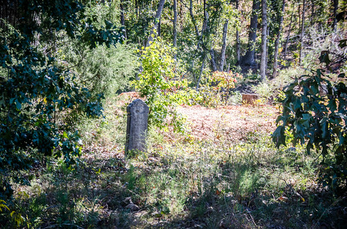
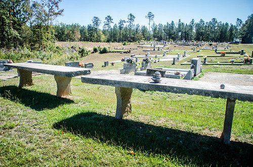
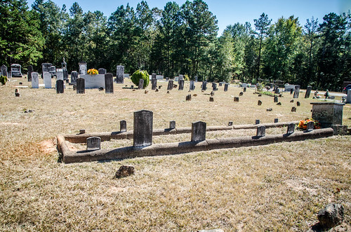
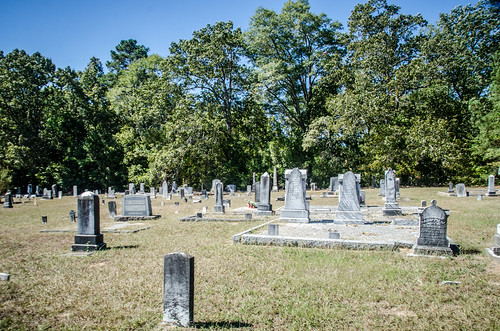
Behind the church was an open field with a gate. This appeared to be an overflow cemetery, where newer graves were being added.
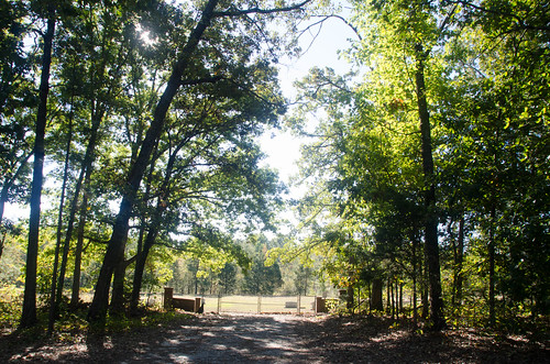
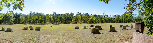
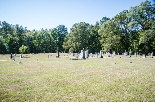
The older cemetery was across the street.
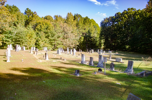
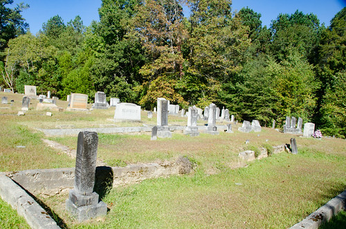
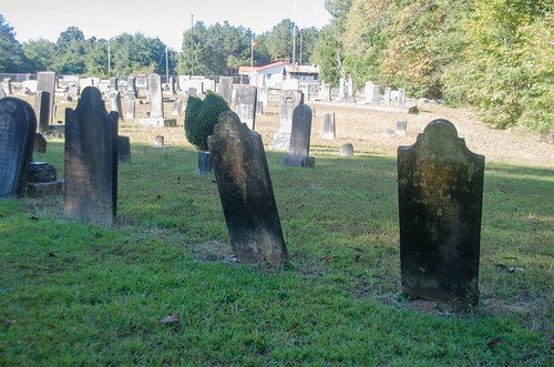
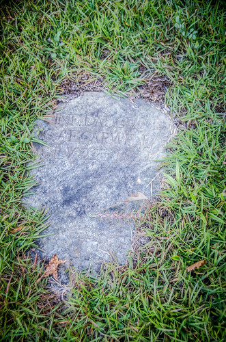
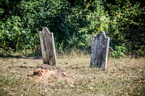
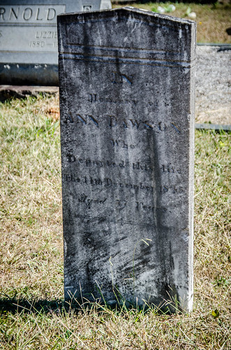
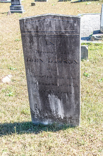
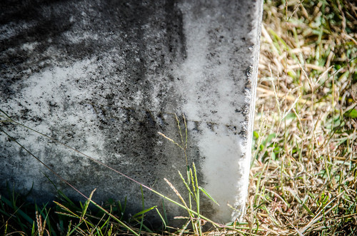
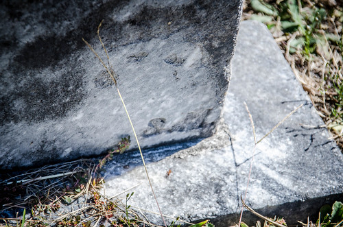
There were some older slab stones. Most of these looked like they were from the late 1800’s, as would be expected given the date of the church.
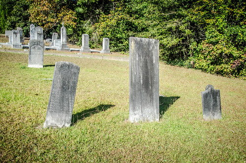
However, some of these caught me off-guard. A couple of members of the Clinkscales family predate the church by many years, with burials in the late 1820s, early 1830s. This throws into question the age of the congregation as listed on the Brownlee site.
Of course, it’s possible that these stones were added later as a memorial, or that the graves were moved from a family plot.
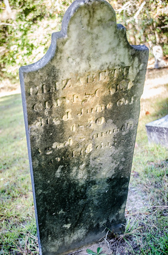
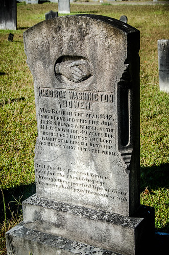
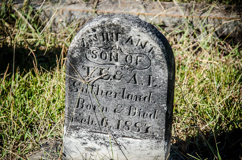
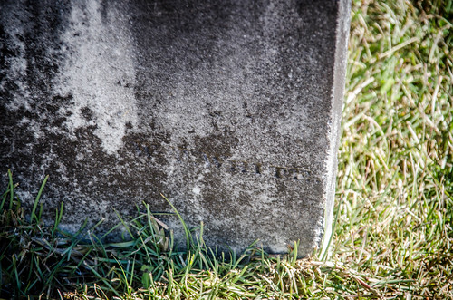
There were several hand-carved headstones. These dated to the late 1800s. The same surname seemed to be on several of these, as if the family couldn’t afford the services of a stone carver.
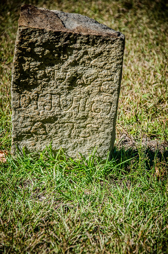
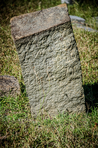
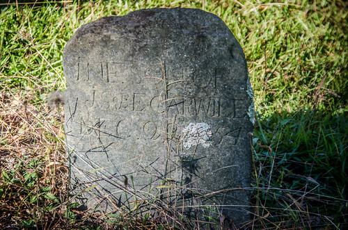
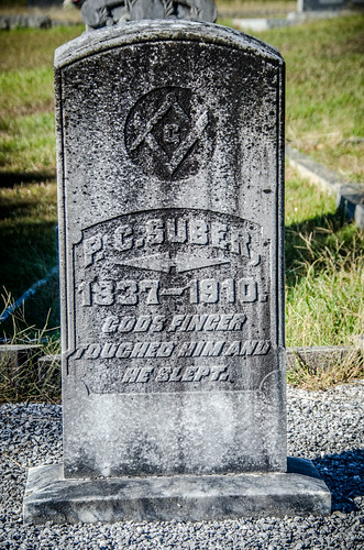
Other stones were typical for the late 1800s and early 1900s.
I checked the Find-a-Grave listing for the cemetery, and it confirmed the existence of stones with dates earlier than 1858. There was no mention of the graves being moved. The oldest of these, the Clinkscales, were related to the Brownlees. As for the Brownlees themselves, the only ones listed were fairly modern.
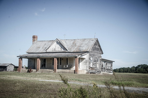
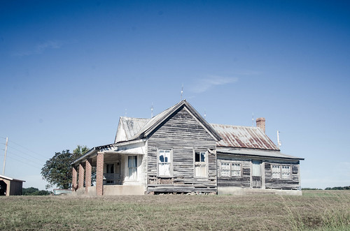
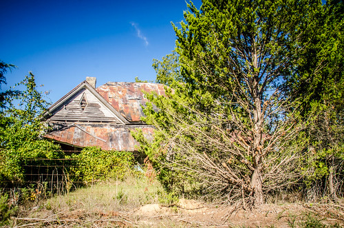
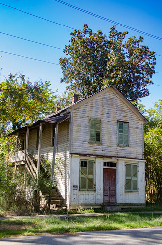
As I had thought, exploring Antreville and environs didn’t take much time at all. As I left Shiloh, I still had plenty of morning left, and was unsure which direction to wander. I continued I headed southwest, where I found one of the coolest old farm houses. I’d photographed this one before, but couldn’t resist this time.
From there it was back east to reach Brownlee Crossroads, also mentioned in the Temple of Health references. As I suspected, it was quite a ways from Antreville, relatively speaking, and there was nothing there. I dismissed it as a location of interest, at least as far as this subject was concerned.
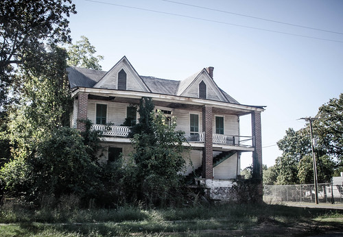
From Brownlee Crossroads I drove west to Bell’s Crossroads, then headed south on SR 284 toward Lowndesville. Along the route a couple more old houses and the old Campbell School, now a private residence.

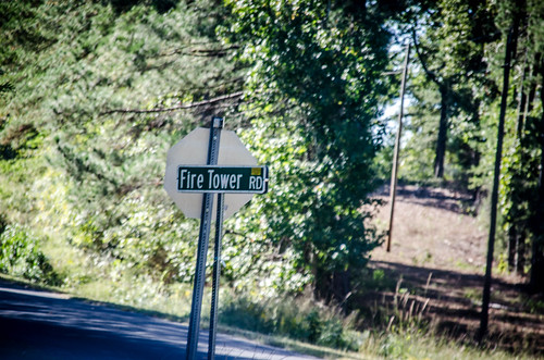
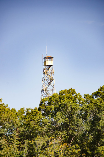
South of the old school was the Lowndesville Fire Tower.
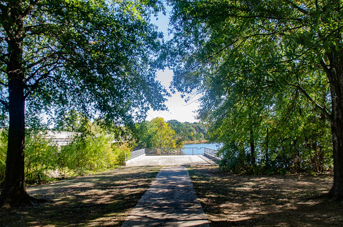
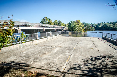
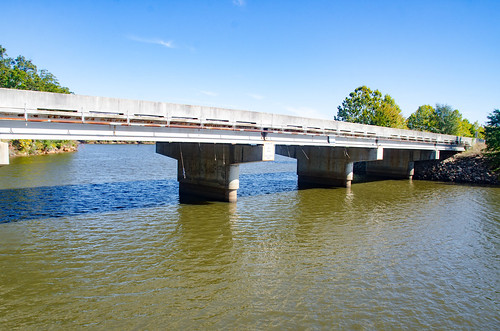
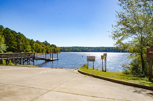
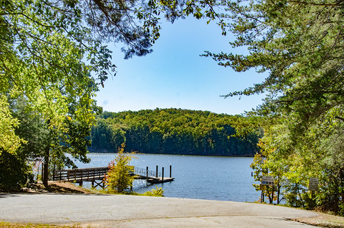
I turned west on state road 71 heading Lowndesville. I crossed over the Rocky River branch of Lake Russell. On the west side of the bridge there was a park with fishing access and a boat ramp. The fishing platform seems to be part of an old bridge. I may have to bring a kayak down here sometime.
In Lowndesville, proper, I paused to take a few photos of some of the old homes and commercial buildings along the main street.
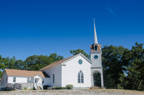
Providence ARP Church dominates the street. I didn’t pause to take as many photos as I have in the past.
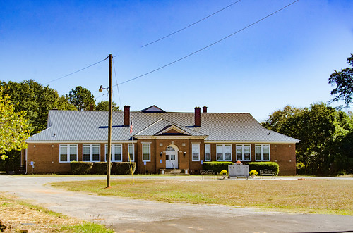
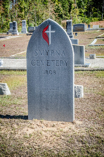
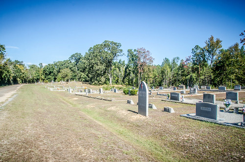
I took a couple of photos of Smyrna Methodist Church and the old Lowndesville School across the street. The school is now used for town offices.
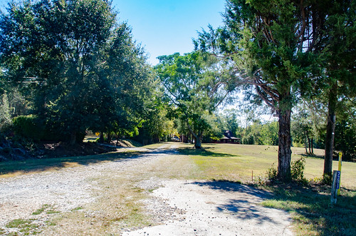
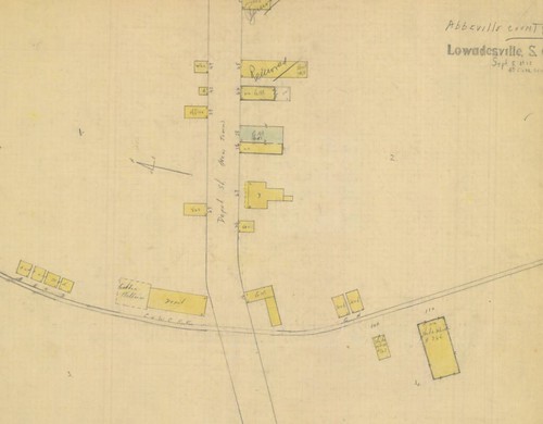
The street that ran next to Smyrna Church intrigued me. Depot Street would imply that there was a railroad somewhere around here, and I had not seen one. I drove along the street and found a private home with railroad signs and memorabilia, but nothing that looked like a depot. There were folks out in the yard, so I didn’t stop for photos. There was also a cleared path that looked like it could have been a right of way.
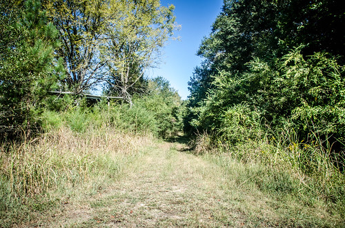
An unpublished 1915 Sanborn map shows that this was the route of the old railroad, an abandoned branch line of the Port Royal and Western Carolina Railroad that ran from McCormick to Belton.
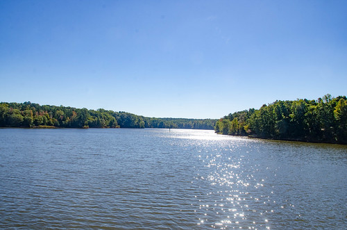
I continued several miles on this street as it turned into a country road. Eventually I reached another branch of Lake Russell and another boat ramp.
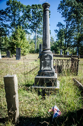
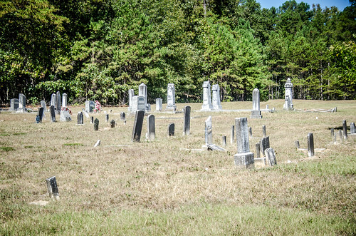
I drove back to Lowndesville then headed north out of town. I turned off of Highway 81 onto Barnes Station Road. About a mile out of town I spotted another interesting cemetery. Apparently this was the cemetery for Smyrna Methodist Church which I had photographed earlier. This turned out to be quite interesting, with some old headstones mixed with new. It was obviously still in use.
I eventually reached the community of Barnes Station. I took no photos, and in reviewing my route in Google Earth later I now wish I’d spent more time there. There was a large Baptist church with an old cemetery, and the name implies that it was probably on the aforementioned railroad line. It might have been interesting to look at the old railroad aspects of the community.
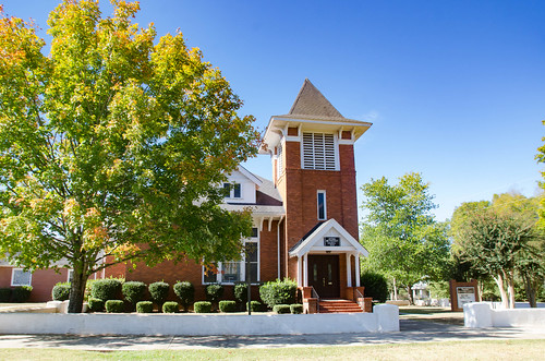
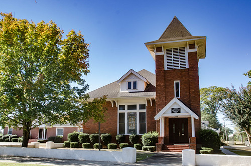
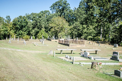
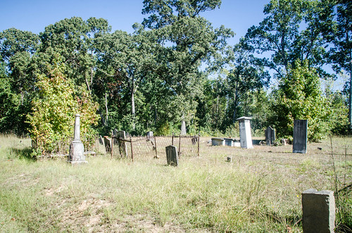
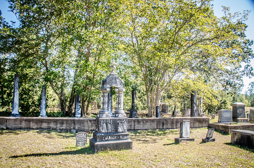
I turned onto Manning Road, then onto Sam Turner Road. Where this road crosses Highway 184 is the location of Moffitsville, one of my ghost towns. I continued on Parker Brown Road and came to Generostee ARP Church.
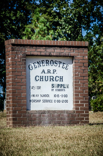
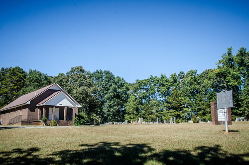
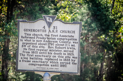
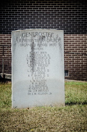
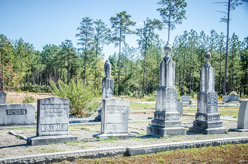
The congregation was formed in 1790, and the first church on this location was built in 1828. As you might expect, there is a correspondingly old cemetery.
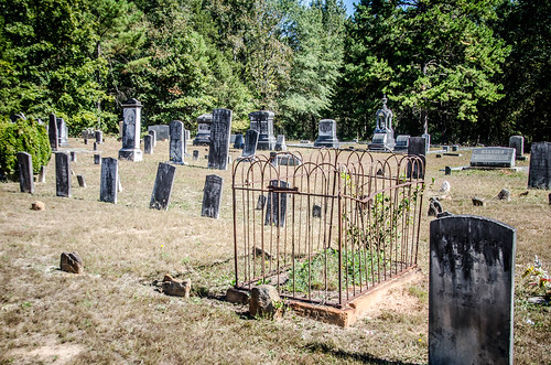
This was the first of the cemeteries I’d explored this day that had signature stones. I found one by E. R. White, a couple by W. T. White, and a couple of unknowns.
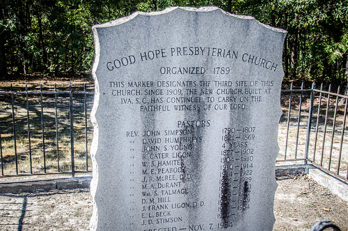
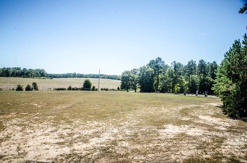
Not far from Generostee I found the cemetery for Good Hope Presbyterian Church. The cemetery was in a large open field. I explored a bit, but I had just about reached cemetery saturation and didn’t pay as much attention to details.
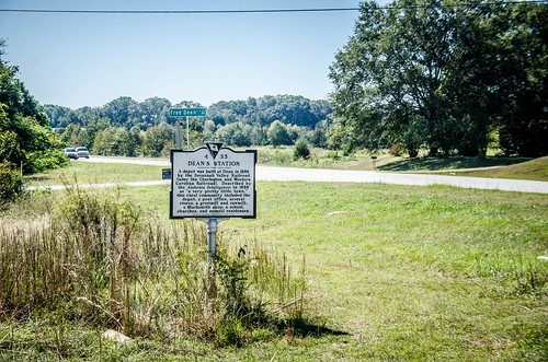
I had one more historical spot to visit. Dean’s Station was probably along this same railroad route I’d discovered in Lowndesville. I had it marked in my GPS because it qualifies as one of my ghost towns. I didn’t linger long, though, because the quick shop that provided the best access to historical marker and area was surrounded by deputy sheriff cars with blue lights flashing. I think I’ll have to come back and explore this railroad route later.
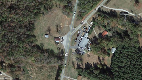
I wrapped up my morning of exploration with lunch in Anderson. I hadn’t found any remnants of the Temple of Health, or really anything pertaining to it. I later found that my location was all wrong. Reader John Blythe sent me some information that the actual location was a bit north of Antreville, very close to where I had found Asa Hall Road. It was at the intersection of Highways 284 and 28. This view from Google Earth shows the spot as it is now.
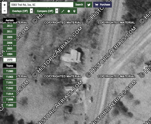
Historical Aerial Photos has a shot from 1970 that shows the purported inn still there. Yeah, it’s a screen capture with the watermarks in place, but it gets the point across.
That might explain why there were two post offices – one for Antreville as well as one for Temple of Health. A couple of miles in the 1800s was a significant distance. If I get back down this way to check out that old railroad, I’ll have to revisit this location.
The structure in the googleEarth pic is considerably S of the structure in the HistoricalAerial compared to the road intersection.
I see now, the HA structure is not there in the GE pic.
nevermind!
Dec. 19, 2019- looked at the two serial photos above. 1st is taken after house was moved, shows the old Gable store by where house was. Car repair across the road. 2nd shows house in place by Gables store. Car place not built. The Gable house was the old Temple of Health/Stagecoach Inn. Someone had covered it with clapboard by the time I lived near Antreville.
I am born and raised in Antreville. I could gives you tons to go along with this, and I’m actually blood related to Most prominent black families there, Brownlee’s included. I also have the names of the churches centered in Antreville as well. I’d love to chat with you!!
I work at Trembly Bald. The StageCoach Inn is one of my favorite cabins. Please contact me ASAP! Im trying to gather as much information as I can. Thanks
Can you tell me about the Brownlees. I am a descendent. I am very interested. We are doing our family tree.
Yes, my great-great grandfather is/was John Brownlee. If you would like more info. concerning the Brownlee family history, please feel free to email me, elizabethswearingenlogan@gmail.com
Sincerely,
Elizabeth Logan